Hello everyone, and welcome to another Tinto Maps! We’re back after celebrating the most important victories over Germany and France since the 30 Years War a hard week of work, and we’re ready to share with you the region of the Syrian Levant & Egypt (actually, we’re revealing a bit more of what those regions would be, to cover the complete extension of the Mamlūk Sultanate). Let’s go!
Countries:

The Mamlūk Sultanate is the main power of the region, a situation achieved after the defeat of the Mongols at the Battles of Ain Jalut and Marj al-Saffar, and the fall of Acre, the last stronghold of the Crusader states in Outremer. The latter's legacy is still handled by the Kingdom of Cyprus, ruled by Hugues IV of Lusignan. Apart from that, we can see the realm of Candia, a subject governed by the Serene Republic of Venice, and some Arabic tribes, such as the Hutaym and the Anizah. Oh, and also, to the south-west, you might have noticed some oases ruled by either the Mamluks, or Fezzan; I opted for not coloring the wastelands, as usual, but also the corridors, a type of terrain present in other GSGs, that we have in Project Caesar. I’ll talk more about them under the ‘Locations’ section of the DD, but I just want to note one more thing: the connection down the Nile is a regular one, with a border existing between the Mamluks and Makuria (the country that controls the small chunk of land at the very south of the image).
Dynasties:

The Bahri Mamluks have ruled the Sultanate since they deposed the Ayyubids, almost a century before the start of the game. It could maybe be a bit more accurate to depict Sultan al-Nasir Muhammad as an ibn Qalawun (‘of the lineage of Qalawun’), but the dynastical dynamics of the Mamluk rulers are not so easy to portray, so we opted for the moment to better use Bahriyya. Apart from that, you may also see the neighboring dynasties, such as the already-mentioned House of Lusignan, or the Hethumian of Cilicia.
Locations:


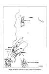
 Here you can see the locations of the entire region, and also closer chunks behind the ‘Spoiler’ button. The most interesting feature to talk about is that of the corridors, something that some of you might remember from ‘Imperator: Rome’, but also something new to the rest. The corridors are empty locations, with no population or resources, but that allows connection between the locations at their sides, for some mechanics that we’ve already mentioned (market access, control), and some others that we haven’t (army movement). This is the way that we’ve chosen to portray the Saharan corridors, that allow for a connection between the Maghreb and the Mashreq, and Western and Central Africa. There are also some regular locations over those corridors, with population, resources, etc., that can be controlled by countries, which portray the desert oases that made for important outposts in the different Saharan routes. Not all the connections are throughout corridors, though; outside of the image, the Nile River valley allows for regular locations all the way down from Egypt to Nubia, the last location held by the Mamluks being that of Aswan, while the first held by Makuria, not shown in the screenshot, being Qasr Ibrim. We will talk more about Nubia and Ethiopia in a future Tinto Maps.
Provinces:

Usual provinces mapmode; please let us know of any spelling or naming suggestions that come to your mind.
Areas:

A new mapmode that has been requested in previous Tinto Maps, and that we’re now incorporating.
Terrain:


The climate is dominated by a mix of Mediterranean, Arid, and Cold Arid. The topography of the region is quite flat, with some hills and mountains on Mount Lebanon and Anti-Lebanon, Mount Sinai, and the verge of the Arabian plateau; and some marshland over the Nile Delta, of course. Regarding the vegetation, desert and sparse vegetation dominate most of the region, with some woods and forests over Levant, and the Nile fertile farmlands, the bread basket of the Eastern Mediterranean.
Cultures:

Here starts the fun… Those countries ruling over the Middle East will face the challenge of managing several different cultural minorities. Libyan, Egyptian, Sa'idi, Bedouin, Ḥijāzī, Najidi (the green one to their right), Levantine, and Iraqi (the light blue at the top right of the picture) are all different regional cultures of Arabic-speaking people. Something interesting is that most of Bedouin pops are tribesmen, instead of peasants, portraying their traditional social organization. Coming to important minority groups, Coptic people are quite important in Egypt, accounting for about 10% of the population of the Mamlūk Sultanate. The other important minority are the Syriacs, as they also account for another 10% of the population, and are a cultural majority in a few locations. Apart from those, there are also Armenians, Kurds, and Turkomans on the divide between Anatolia, Syria, and Jazira, Alawites Shiites in Syria, Mizrahi Jews all over the region, Samaritans in Palestine, and Greeks in Crete, Cyprus, and some in Alexandria. Oh, also the Saharan cultures of the Eastern Berbers and the Toubou over some of the Saharan oases.
Religions:

More fun. In this region, we have:
Relating these religions to the previous cultures, we can tell you most of the Arabic-speaking cultures are Sunni Muslims, with some Shia Muslims in Syria and Lebanon. Most of the Coptic are Miaphysite, adhering to the Patriarchate of Alexandria, although some of there still follow the Orthodoxy of Constantinople. The Syriacs are also religiously divided, with some being Nestorians (the current name we have to cover the confessions related to the Church of the East), some Miaphysites, some Orthodox, and even some Catholics in Lebanon. And then we have some cultural-religious minorities, such as the Alawite Shiites, the Druzes (which are of Levantine culture), the Mizrahi Jews, the Samaritans, and the Yazidi (which are of Kurd culture).
Raw Materials:

There are some materials that are more unique to this region, such as the Dates in the arid fringes. The Nile Valley and Delta are incredibly fertile, having plenty of different crops: Wheat, Rice, Legumes, Sugar, Cotton, Fiber Crops (=Linen), etc. Livestock, Wool, and Horses are also important resources for the people across the region. There are also some metals present in the region, such as Copper in Cyprus and around the Red Sea, Iron, Tin, some Lead, and some interesting sources of Alum.
Markets:

The main market centers of the region are Alexandria (yeah, it’s there! I’ve already reported its weird name-wrapping and one of our programmers is going to take a look at it) for the Mashreq, Damascus for the Syrian Levant and Mecca for the Hejaz.
Country and Location Population:


 The population of the region points to Egypt being its powerhouse, with several million people being supported being the Nile Valley and Delta. Apart from that, the Syrian Levant has a very decent population, making the Mamlūk Sultanate a dreadful rival to have in 1337. The arid fringes make for a way more difficult food production and population sustainability, making them more of strategic value, by their position, resources, etc.
And that’s all for today! Next week @Johan will show you Scandinavia, the very first map that was crafted for Project Caesar! Cheers!
Countries:
The Mamlūk Sultanate is the main power of the region, a situation achieved after the defeat of the Mongols at the Battles of Ain Jalut and Marj al-Saffar, and the fall of Acre, the last stronghold of the Crusader states in Outremer. The latter's legacy is still handled by the Kingdom of Cyprus, ruled by Hugues IV of Lusignan. Apart from that, we can see the realm of Candia, a subject governed by the Serene Republic of Venice, and some Arabic tribes, such as the Hutaym and the Anizah. Oh, and also, to the south-west, you might have noticed some oases ruled by either the Mamluks, or Fezzan; I opted for not coloring the wastelands, as usual, but also the corridors, a type of terrain present in other GSGs, that we have in Project Caesar. I’ll talk more about them under the ‘Locations’ section of the DD, but I just want to note one more thing: the connection down the Nile is a regular one, with a border existing between the Mamluks and Makuria (the country that controls the small chunk of land at the very south of the image).
Dynasties:
The Bahri Mamluks have ruled the Sultanate since they deposed the Ayyubids, almost a century before the start of the game. It could maybe be a bit more accurate to depict Sultan al-Nasir Muhammad as an ibn Qalawun (‘of the lineage of Qalawun’), but the dynastical dynamics of the Mamluk rulers are not so easy to portray, so we opted for the moment to better use Bahriyya. Apart from that, you may also see the neighboring dynasties, such as the already-mentioned House of Lusignan, or the Hethumian of Cilicia.
Locations:
Provinces:
Usual provinces mapmode; please let us know of any spelling or naming suggestions that come to your mind.
Areas:
A new mapmode that has been requested in previous Tinto Maps, and that we’re now incorporating.
Terrain:
The climate is dominated by a mix of Mediterranean, Arid, and Cold Arid. The topography of the region is quite flat, with some hills and mountains on Mount Lebanon and Anti-Lebanon, Mount Sinai, and the verge of the Arabian plateau; and some marshland over the Nile Delta, of course. Regarding the vegetation, desert and sparse vegetation dominate most of the region, with some woods and forests over Levant, and the Nile fertile farmlands, the bread basket of the Eastern Mediterranean.
Cultures:
Here starts the fun… Those countries ruling over the Middle East will face the challenge of managing several different cultural minorities. Libyan, Egyptian, Sa'idi, Bedouin, Ḥijāzī, Najidi (the green one to their right), Levantine, and Iraqi (the light blue at the top right of the picture) are all different regional cultures of Arabic-speaking people. Something interesting is that most of Bedouin pops are tribesmen, instead of peasants, portraying their traditional social organization. Coming to important minority groups, Coptic people are quite important in Egypt, accounting for about 10% of the population of the Mamlūk Sultanate. The other important minority are the Syriacs, as they also account for another 10% of the population, and are a cultural majority in a few locations. Apart from those, there are also Armenians, Kurds, and Turkomans on the divide between Anatolia, Syria, and Jazira, Alawites Shiites in Syria, Mizrahi Jews all over the region, Samaritans in Palestine, and Greeks in Crete, Cyprus, and some in Alexandria. Oh, also the Saharan cultures of the Eastern Berbers and the Toubou over some of the Saharan oases.
Religions:
More fun. In this region, we have:
- Sunni Muslims
- Miaphysite Christians
- Orthodox Christians
- Shia Muslims
- Catholic Christians
- Druzes
- Jews
- Nestorian Christians (the ‘label’ we’re using to depict the Church of the East)
- Samaritans
- Yazidi
Relating these religions to the previous cultures, we can tell you most of the Arabic-speaking cultures are Sunni Muslims, with some Shia Muslims in Syria and Lebanon. Most of the Coptic are Miaphysite, adhering to the Patriarchate of Alexandria, although some of there still follow the Orthodoxy of Constantinople. The Syriacs are also religiously divided, with some being Nestorians (the current name we have to cover the confessions related to the Church of the East), some Miaphysites, some Orthodox, and even some Catholics in Lebanon. And then we have some cultural-religious minorities, such as the Alawite Shiites, the Druzes (which are of Levantine culture), the Mizrahi Jews, the Samaritans, and the Yazidi (which are of Kurd culture).
Raw Materials:
There are some materials that are more unique to this region, such as the Dates in the arid fringes. The Nile Valley and Delta are incredibly fertile, having plenty of different crops: Wheat, Rice, Legumes, Sugar, Cotton, Fiber Crops (=Linen), etc. Livestock, Wool, and Horses are also important resources for the people across the region. There are also some metals present in the region, such as Copper in Cyprus and around the Red Sea, Iron, Tin, some Lead, and some interesting sources of Alum.
Markets:
The main market centers of the region are Alexandria (yeah, it’s there! I’ve already reported its weird name-wrapping and one of our programmers is going to take a look at it) for the Mashreq, Damascus for the Syrian Levant and Mecca for the Hejaz.
Country and Location Population:
And that’s all for today! Next week @Johan will show you Scandinavia, the very first map that was crafted for Project Caesar! Cheers!


_-_Geographicus_-_Turkey...jpg "1870_Johnson_Map_of_Turkey,_Persia,_Arabia_(_Iran,_Iraq,_Afghanistan_)_-_Geographicus_-_Turkey...jpg")