• We have updated our Community Code of Conduct. Please read through the new rules for the forum that are an integral part of Paradox Interactive’s User Agreement.

Tinto Maps #20 - 27th of September 2024 - The Steppes

Hello, and welcome one more week to the weekly encounter for map lovers! This week it’s also directed at horse lovers because we will be looking at the Eurasian Steppes, plus the Urals! So let’s start with the maps without further ado.

Countries:
Countries.jpg

Colored Wastelands.jpg

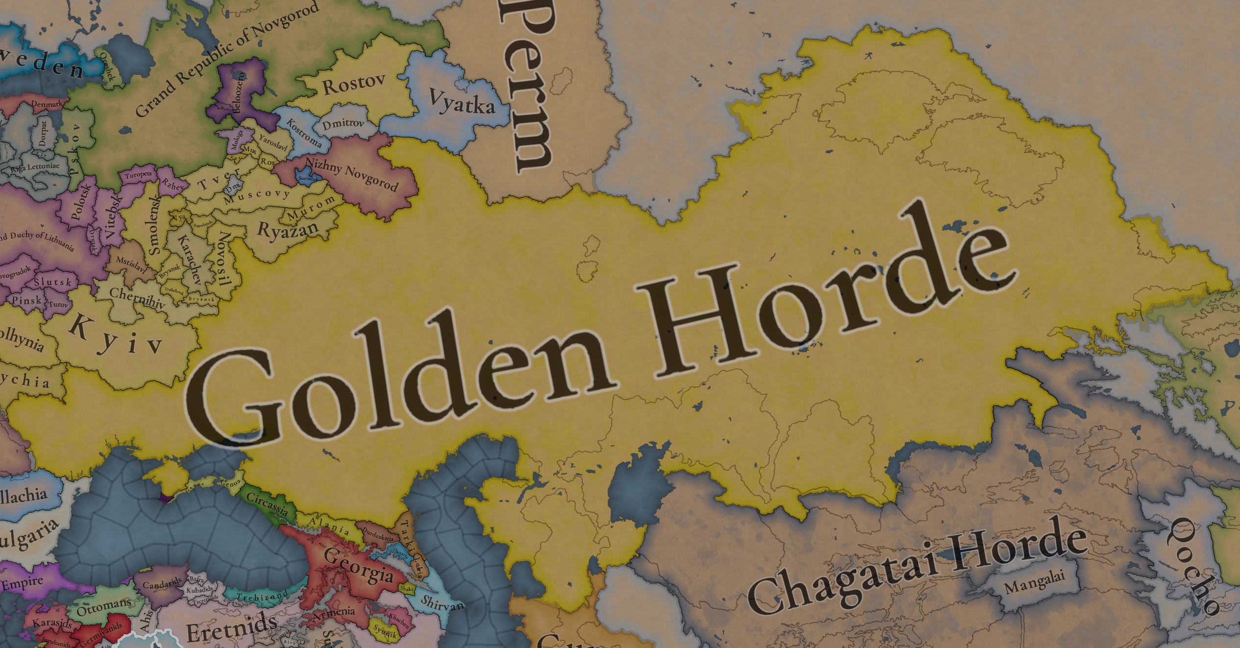
A glorious, Golden Horde! It is at its power peak, under the reign of Uzbeg Khan, so it's a much more menacing presence for its neighbors. However, it has its some internal issues that need to be managed, as you’ll notice in some of the maps, and in the future when we talk about the content for Hordes. The Golden Horde also heads its own IO, the Tatar Yoke, as shown in a previous Tinto Maps:

Tatar Yoke.jpg

We have already corrected the Ruthenian countries that are under the Horde’s Yoke, although we still have to correct the Russian principalities, which will be done in the corresponding Tinto Maps review. We’re also aware that we need to improve a bit the coloring of the IO, to mark not only the Golden Horde as the overlord of these countries, but also that Muscovy holds the title of the Grand Principality of Vladimir, which makes it the ‘enforcer’ of the Yoke. These fixes are also planned to be done in a few weeks.

Societies of Pops:
Societies of Pops.jpg

Societies of Pops 2.jpg .jpg

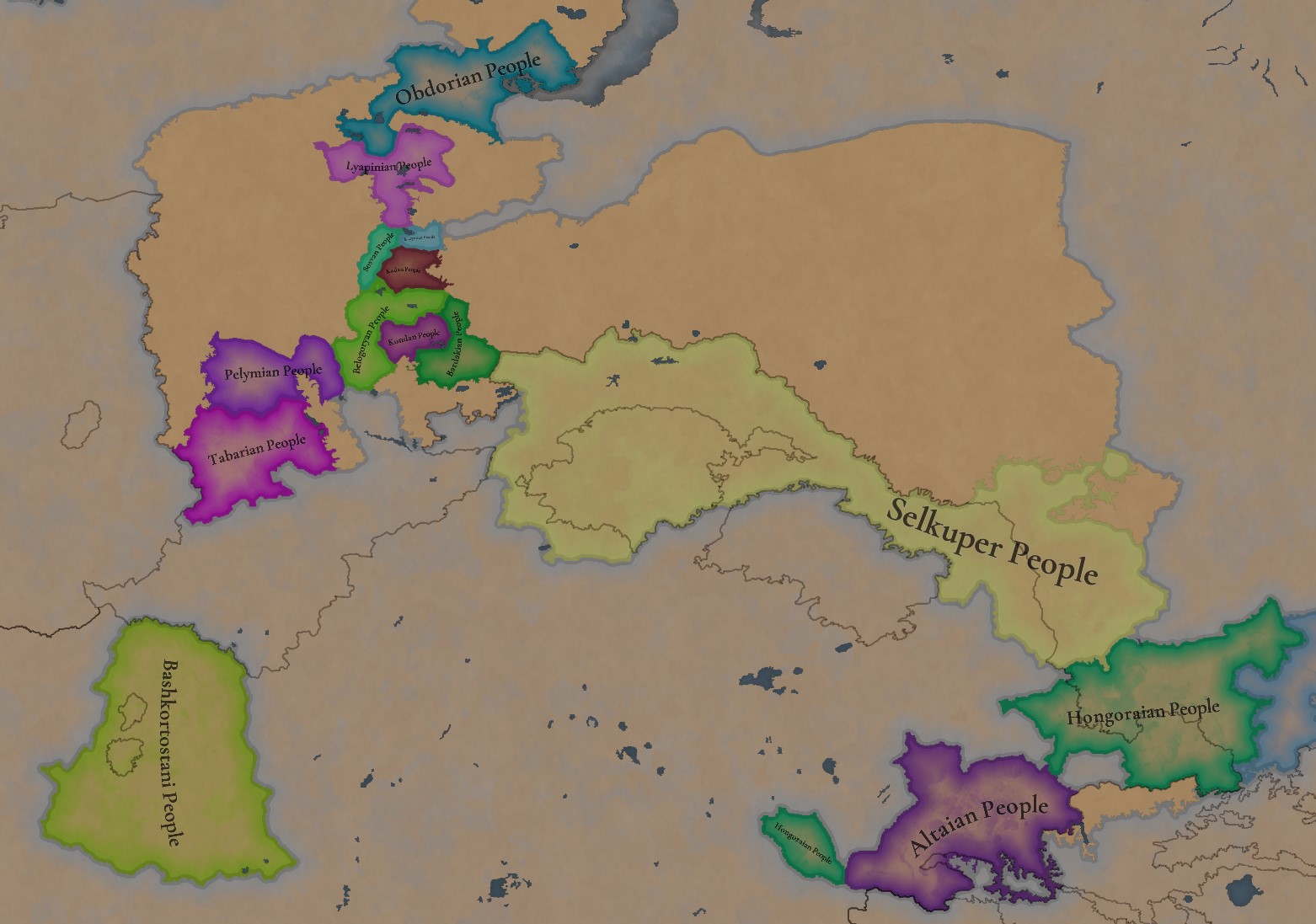
A bit up to the north, we have some Societies of Pops! This means that the territory of Western Siberia won’t be empty land, but will be populated by these people, which can be interacted with.

BTW, I’m not showing this week a dynasty map because, well, only the Borgijin dynasty rules over the lands of the Golden Horde, of course!


Locations:
Locations.jpg

Locations Western Siberia.jpg

Locations 3.jpg

Locations 4.jpg

Locations 5.jpg

Tons of locations today… You might notice that the density location is in a progression from west to east, from the most densely settled areas to the less settled ones. You may also notice that we’ve followed a design of ‘settler corridors’ in Western Siberia, setting those parts of the land that were habitable, usually on river valleys.

Provinces:
Provinces.jpg

Provinces 2.jpg


Areas:
Areas.jpg


Terrain:
Climate.jpg

Topography.jpg

Vegetation.jpg

The terrain is interesting here, as there are two main ecological areas. The first is the Steppes, Flatlands with Sparse and Grasslands vegetation, with either Cold Arid or Continental climates. And then we have the Siberian Arctics Forests, which are completely different, of course. On a note, the Urals were set as Hills, as they’re a quite settleable area, but we’ll probably make a review with your feedback, and add some mountains there.

Development:
Development.jpg

The whole region is not very developed, you might notice the difference with India, from last week’s Tinto Maps.

Harbors:
Harbors.jpg

There are some harbors in the Steppe region… In the Black Sea and Caspian Sea, of course! As usual, we’re open to feedback on this matter.

Cultures:
Cultures.jpg

Plenty of cultures! One note: Although we planned to work on the religious and cultural minorities of the region during the summer, we ended up not having enough time to add them. So what we’ll be doing today is showing the rough outline of ‘cultural spheres’, and then we’ll add the minorities during the review of the region. In that sense, feedback is very well received.

With that said the only note that needs to be made in terms of the cultural design is that we divided the Tatar cultural group into some differentiated regional cultures, being Crimean, Mishary, Kazani, and Astrakhani. We’re also aware that some of the cultures, as Mari and Chuvash, might be a bit displaced, as noted in the Russian Tinto Maps, so we’ll review and correct that with your feedback.


Religions:
Religions.jpg

Regarding Religions, the matter is a bit worse, as the big Sunni blob is just because the main religion of the Golden Horde is Islam, after the conversion of Uzbeg Khan, but that’s obviously incorrect. Also, as we have been able to forecast development time on how Pagan divisions will be during this autumn, we will make a comprehensive review of the region as well, to get a good distribution of ‘Shamanist’ Paganism, Tengrism, and Sunni Islam.

Raw Materials:
Raw Materials.jpg

Raw Materials 2.jpg

Raw Materials 3.jpg

Regarding the raw materials, the Steppes have plenty of Livestock and Horses, quite logically, although there are regions with some other goods. And up to the north, the main materials are Lumber and Fur. Apart from that, I want to mention the mineral hub in the Ural Mountains, with plenty of Copper, Iron, Gold, Lead, and Coal. That makes it a very mid and late-game interesting spot, and playing as Muscovy/Russia, I’ll tell you that you definitely want to expand into that region, as it will fulfill some of your material needs by that time.

Markets:
Markets.jpg

Markets! Big region, with lots of markets, although you may noticed that we changed the coloring of the locations that have 0% market access, which is the case in several areas. In any case, the market centers are Kaffa, Astrakhan, Saray-Jük, Kunya Urgench, Samarkand, Almaty, and Chimgi Tura. BTW, these names are much easier to notice in the game’s UI, as they’re beside the market centers:

Markets 2.jpg


Population:
Population.jpg

This week we’re showing only the country population mapmode, as there are some location numbers here and there which are failing, due to the already known issue with our pop editor (and which are on the way to be fixed). In any case, the whole population of the region is around 6.5-7M, of which around 6.3M are part of the Golden Horde. As I said, it’s a menacing country…

And that’s all for today! This is going to be my last Tinto Maps in a while, as I’ll be on vacation for 3 weeks during October (you might have noticed that I didn’t have any during summer), so one of the Content Designers in the team, @Roger Corominas , will step in and be in charge of the next 4 Tinto Maps. It’s in good hands, as Roger is an Experienced CD, who has been working and focused on Project Caesar for more than 3 years, at this point (this is why you might not know him from EU4, as other CDs in our team). In any case, he will be starting with the regions of Xinjiang, mostly ruled by the Chagatai Khanate, and Tibet.

I’ll keep reading and answering you during next week, and then I’ll be back in a month from now. See you!
 
  • 145Like
  • 48Love
  • 5
  • 3
  • 1Haha
Reactions:
So they are a single entity (ruled by one ruler and considered a single ulus), however, many sources put them to different hordes. And this is why you have decided to split it?

I believe it requires more study about whom it belonged to in 1337, not the creation of 4 separate nations. This is just unnecessary fragmentation
Bashkiria has always been divided. In fact, it should be divided into 7 parts. This is the number of tribes from which it was formed. I will return to Bashkiria to find the rest of the parts, but I will not display them as real countries.

https://ru.wikipedia.org/wiki/Башкирские_племена
 
Last edited:
So, the new version of the map so far is as follows:
View attachment 1257963

Why 1340? Because Uzbek Khan's reforms were completed after Mubarak Khoja Khan was defeated, who did not want to give up his own lands to create new hordes. And so he tried to become independent by starting to issue coins of his own production. He was defeated this year, and in the same year, some territories began to be considered uluses. In particular, the rulers of Sygnak began to be referred to as the khans of the Golden Horde. Before that, they were considered co-rulers of the Kok Horde (blue). Perhaps in 1337, there were no hordes at all in the east of the golden Horde, and the main border between the descendants of Shiban and Orda-Ezhen passed west of Jend, through the center of Desht-i-Kipchak Ulus (both parts directly belonged to the ulus of Shiban and Orda-Ezhen, respectively) and west of Ibir Ulus. But many sources have contradictions for this division.

Desht-i-Kipchak Ulus (Iuz Horde) is a special territory with its capital in Turgai or Tagatai, or maybe two at the same time. Historically, it has constantly changed its rulers and there have always been conflicts. It has never had its own historical rulers, but all the neighboring khans claimed and owned it. For what reason is unknown, perhaps this territory had a ceremonial status. Perhaps the border of this ulus passed to the north, in the areas of the modern borders of Kazakhstan.

Zher su is a domain with its capital in old Taras. Historically, it is mentioned as the place where Urus Khan ruled after his defeat to Tokhtamysh. Excavations were carried out in the area, it was supposed to find coins of Chagatai production, but to the surprise of scientists, coins produced in Orda Bazaar, the capital of Kok Orda (blue), were found there. The border runs roughly along the borders of modern Kazakhstan. There is a mention in the source that there was a border between old Talas and new Talas. In addition, wikipedia indicates that during the conquest of the Karakhid Khanate, it was divided between Jochi and Chagatai. But before that, it was not clear where this separation took place. I could not determine whether this territory belonged to the Kyzyl Horde (red) or the Kok Horde (blue), so its affiliation can be determined during the conflict between Uzbek Khan and Mubarak Khoja Khan.
Some sources:
Yangi Taraz XIII-XIV centuries. And the discovery of its geographical location according to numismatic data.
Karluk Khanate

Oirat-Kalmyk Confederation. During the search for the borders of the ulus, it became clear that the Golden Horde had not yet been controlled by the Ob. But there was already a Turkic population there. By way of exclusion, the Oirat-Kalmyks are the only cultures that could have been there.

Boz horde. I have already written that the lower reaches of the Irtysh River will be captured later than 1390. The area of Chingi-Tura in 1337 under the control of the horde is ambiguous. Even if it's under their control, it was captured in this century. The city is not yet the capital of the khanate, and it is not yet known where the capital should be. In the 14th century, the Korel ulus appeared, which, together with the Bashkir tribes, fought against the Ugrians (Magyars). Their boundaries are not fully known. In the course of finding out which rulers ruled where, it turned out that there were definitely four uluses in Boz Horde. Wikipedia may tell you that the lands north of these villages were captured by Genghis Khan himself and transferred to the legendary Taibuga. I hasten to upset you, there are at least 5 legends about Taibuga, and four others indicate that he lived in the 15th century. It was even possible to find out the exact dates when he could really rule – from 1428 to 1450. There are no other suitable dates, as they are occupied by other rulers. According to Maslyuzhenko, Taibuga arrived with the Burkut tribe to serve Abulkhair Khan and unexpectedly became a vassal in the northern lands. At the same time, the southern lands of the Boz Horde could come under the control of Abulkhair. It was at this time that Chingi-tura became a real center.

Markets. Since Chingi-tura is not a suitable market, I suggest making a market in Orda Bazaar, the capital of Kok Orda (blue) and in the place where Isker should be in the future. Now this province is called Vagai. According to legends, silver was mined there, but it seems that silver was brought there from Altai. In addition, the Ugrians (Magyars) fled there, and there was also the Rodan culture, so the place for the market is quite suitable.

And then we move on to 4 new Ugric tribes. The Sikhirtia is a mythical tribe that lived in the Tobolsk region. The Sipyr is the largest tribe in the area, when the Horde attacked it with an army of 2,100 people, they were defeated, losing 1,700 soldiers, and 400 people remained alive. The Zabolotny principality is a principality "beyond the swamp", so named because the Tatars, having mixed with this population, acquired a zabolotny dialect. I decided to name the last tribe Yugra, because it is similar to the chronicle Yugra. There are metals and Magyars in it, and it borders on the horde. And representatives of the Rodanov culture could be, so to speak, mercenaries, making sure that this principality was subordinate to Novgorod. However, these are just oral or semi-oral legends. We don't know what really happened. We can only localize 4 principalities in this place based on the fact that new Tatar dialect groups appeared in these places. So, I forgot to say that in the 15th century the population of this area should be about 31,000 people. And the army of each principality could not be less than 300 people.

Moving to the west. Pereyaslavl and Sharukan are the capitals of formations, but we do not know what they were called in the horde. West of the Dnieper, the Edisan Tatars were separated from the Budjak Tatars. Crimea Ulus, and Kyrk are named after themselves. In Crimea, the Kyrk will be conquered by the horde after 1342, but before 1363. The western location is called Kyrk-Or, the eastern location is called Kyrk–Er, and the population consists mainly of Alans, the topographic terrain is hills.
Source: In the land of the little Alans
Places of Genoese and Venetian possessions in the Black Sea – I'm not sure yet that I've found them all.
is Mangyshlak ruled by Toktamysh's father Tuy Kwaja?
GGGH.png

 
Moving to the west. Pereyaslavl and Sharukan are the capitals of formations, but we do not know what they were called in the horde. West of the Dnieper, the Edisan Tatars were separated from the Budjak Tatars. Crimea Ulus, and Kyrk are named after themselves. In Crimea, the Kyrk will be conquered by the horde after 1342, but before 1363. The western location is called Kyrk-Or, the eastern location is called Kyrk–Er, and the population consists mainly of Alans, the topographic terrain is hills.
Source: In the land of the little Alans
The only thing we know exactly about Pereiaslav and Sharukan is that they were completely destroyed 100 years before 1337.
Pereiaslav was later rebuilt in the XV century because the small surrounding settlements survived, but with 0 political significance. And Sharukan was never even rebuilt and no one knows there it was.

But you still suggest making them capitals of separate uluses... Really?
And a separate Pereiaslav ulus/Duchy or whatever after all mentions that it literally stopped to exist as a separate political unit after 1239?

Another thing we definitely know is that Putyvl was a part of Kyiv because Putyvl branch of Olgovychi ruled in Kyiv at the beginning of the XIV century.
This is one of the very few things known from the chronicle from that exact period:
Also Putyvl and Ovruch vere quite important centres of the Kyivan land in the first half of the XIV century according to 'Ukraine under the Tatars and Lithuania' (Rusyna O.V.,1998), (pages 32, 33 and 35) and should have higher development and population compared to others:
But you still include Putyvl in an imaginary 'Pereialslav Ulus' and the Golden Horde.

I really do not get the logic behind this 'we do not know anything about it, what it was and how was it called, so I draw another 5 uluses and hordes here'.

Also, the Yedisan Horde looks a bit odd for 1337 because the horde with this exact name appeared only in 1728.

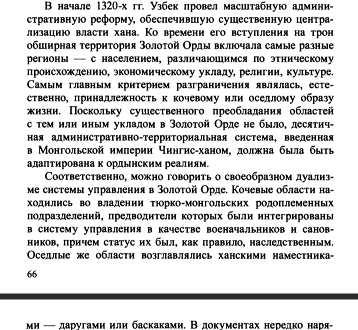
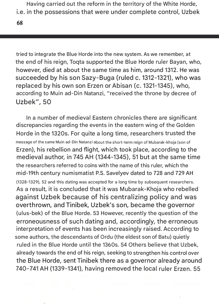
You may be right about the eastern parts, about the Blue Horde, Shiban ulus, Bashkirs etc., I never studied those parts in detail, but at least the White horde under Oz Beg was quite centralised because of administrative reforms carried out in the 1320s:
Oz Beg Admin RU.png
Oz Beg Admin EN.png
Oz Beg Admin RU1.png
Oz Beg Admin EN1.png
Oz Beg Admin RU1.5.png
Oz Beg Admin EN1.5.png

But it is unclear if it also happened in the Blue Horde and if Oz Beg had the same level of control over it:
Oz Beg Admin RU2.png
Oz Beg Admin EN2.png

The Tatar Encyclopedia depicts Oz Beg's White Horde this way:
Map.png
 
Last edited:
  • 6Like
  • 5
  • 1
Reactions:
The only thing we know exactly about Pereiaslav and Sharukan is that they were completely destroyed 100 years before 1337.
Pereiaslav was later rebuilt in the XV century because the small surrounding settlements survived, but with 0 political significance. And Sharukan was never even rebuilt and no one knows there it was.

But you still suggest making them capitals of separate uluses... Really?
And a separate Pereiaslav ulus/Duchy or whatever after all mentions that it literally stopped to exist as a separate political unit after 1239?

Another thing we definitely know is that Putyvl was a part of Kyiv because Putyvl branch of Olgovychi ruled in Kyiv at the beginning of the XIV century.
This is one of the very few things known from the chronicle from that exact period:

But you still include Putyvl in an imaginary 'Pereialslav Ulus' and the Golden Horde.

I really do not get the logic behind this 'we do not know anything about it, what it was and how was it called, so I draw another 5 uluses and hordes here'.

Also, the Yedisan Horde looks a bit odd for 1337 because the horde with this exact name appeared only in 1728.

You may be right about the eastern parts, about the Blue Horde, Shiban ulus, Bashkirs etc., I never studied those parts in detail, but at least the White horde under Oz Beg was quite centralised because of administrative reforms carried out in the 1320s:

But it is unclear if it also happened in the Blue Horde and if Oz Beg had the same level of control over it:

The Tatar Encyclopedia depicts Oz Beg's White Horde this way:
View attachment 1258459
Also, Desht-I-Kipchak on that map is located on the Dnieper.

Here is also one more example
1740473872467.jpeg


And it begs the question of why it is specifically in the middle of Kazakhstan - making It a real title. Perhaps if there is a lot of conflicting evidence, things should not be put on the map.
1740473735969.png
 
  • 9
Reactions:
So, for lovers of the fragmentation. How about this proposal

Currently, on the map, we have a lot of cultures which became separate entities during the game timeframe. Those cultures a roughly based around future hordes(Kazan, Nogay etc..) However, those divisions did not just become a thing, all of them were already existent divisions inside the Golden Horde.

What if instead of creating new vassals, we consider SoP nations over every migratory culture in the Golden Horde? Crimean Tatar SoP, Nogay Tatar SoP, Kazan Tatatr SoP and etc. Also, Mari Ulus will be a Mari SoP, Mordva Ulus can be a Mordva SoP, and Bashkir Ulus will remain an SoP!!! All of those SoPs can contain two cultures: One Turkic and one not (Bashkir and Chiyalick Magyar for example) with one assimilating another.

SoP is already created as a representation of some sort of a tribal organisation
Society of Pops
This is one of the most challenging types of countries in the game, as most of the mechanics are not available to them. They own no land, but instead are entirely based upon the pops associated with them. As they own no land, they do not interact with RGO’s nor can build most buildings. Almost all of them start without advances for taxation, codifying laws or constructing cities.

A lot of the world has different societies of pops, where larger groups of people live but are on the fringe of more organized and advanced states. In the New World there are a mixture of settled countries and society of pops.

These types of countries can migrate their pops from one province to another over time, and they can also force the allegiance of pops to change to them through warfare with another society.

The borders between different societies and even settled countries are extremely fluid, and they can be in the same location as either of them.

They can raise levies directly from their pops, and their armies can live off the land anywhere, gathering some small amount of food from any type of land. Their armies can always force any pop of their culture and religion to swear allegiance to their society.

Amongst the ways they can stop being colonized is forcing colonizers to the peace table, forcing them to cancel their colonial charters.

A settled country can in a war force a Society of Pops to abandon pops that they own, and if they no longer “own” any pops, that society will no longer be an existing country.

A society of pops can attempt to settle if they achieve certain advances, after which they will take control over all locations where they have pops and are the dominant culture and religion, and then become a Settled Country.

Currently though, the gameplay experience is not where we want it, and unless that is improved by beta, they are very likely to be AI only at release.
I think it meets all the requirements for the majority of the proposed Uluses.

There is also hope for even more fragmentation if really needed:
1. There might be more than one SoP per culture.

All of those Uluses that were proposed, are much closer to the SoP. We might lose some fragmentation (one ruler will represent 7 Bashkir families) but SoP also include that in their definition (for me at least)

SO in the result:
I can be one Golden Horde tag or 3-4 main Uluses (White, Blue, Shaibanid)
and other divisions will be represented as SoP, they will migrate with their people, assimilate cultures or do other stuff. However, when Troubles will begin those SoPs will get a chance to create their nation.

The base gameplay for the GH or its divisions of it will be to have them loyal in order to use troops.

It will be fun, It will be unique, and it won't be a complex border gore.

It can add multiple events when for example Nogai population want to migrate somewhere, and the border will dynamically change.

This proposal represents the dynamic, nomadic nature of Tatars, migrating with their people and titles back and forth. It will represent the complex structure of the Golden Horde, and it removes the majority of decisions "where specifically is the border in the middle of steppes"

And as a reminder. Bashkir people are already SoP. I propose to broaden it to all cultures making up Golden Horde. Perhaps there can be talks to create a settled Tatar/Mongol culture as a main pop for those nations.
 
Last edited:
  • 5
Reactions:
The only thing we know exactly about Pereiaslav and Sharukan is that they were completely destroyed 100 years before 1337.
Pereiaslav was later rebuilt in the XV century because the small surrounding settlements survived, but with 0 political significance. And Sharukan was never even rebuilt and no one knows there it was.

But you still suggest making them capitals of separate uluses... Really?
And a separate Pereiaslav ulus/Duchy or whatever after all mentions that it literally stopped to exist as a separate political unit after 1239?

Another thing we definitely know is that Putyvl was a part of Kyiv because Putyvl branch of Olgovychi ruled in Kyiv at the beginning of the XIV century.
This is one of the very few things known from the chronicle from that exact period:

But you still include Putyvl in an imaginary 'Pereialslav Ulus' and the Golden Horde.

I really do not get the logic behind this 'we do not know anything about it, what it was and how was it called, so I draw another 5 uluses and hordes here'.

Also, the Yedisan Horde looks a bit odd for 1337 because the horde with this exact name appeared only in 1728.

You may be right about the eastern parts, about the Blue Horde, Shiban ulus, Bashkirs etc., I never studied those parts in detail, but at least the White horde under Oz Beg was quite centralised because of administrative reforms carried out in the 1320s:

But it is unclear if it also happened in the Blue Horde and if Oz Beg had the same level of control over it:

The Tatar Encyclopedia depicts Oz Beg's White Horde this way:
View attachment 1258459
«But you still suggest making them capitals of separate uluses... Really?»

Wrong. I said that I don't know what should be there, but this territory definitely does not belong to Batu ulus.

«is that Putyvl was a part of Kyiv because Putyvl branch of Olgovychi ruled in Kyiv at the beginning of the XIV century»

According to this logic, Kazakhstan was a part of Kiev. The claim that Kiev owned Putivl is a lie. The claim that Putivl owned Kiev is true.

«But you still include Putyvl in an imaginary 'Pereialslav Ulus' and the Golden Horde»

I include Pereyaslavl in the Golden Horde, not Putivl. I warned you that it could take months to adjust the borders. I explore quickly, but not fast enough to adjust all the places on the map at once.

«I really do not get the logic behind this 'we do not know anything about it, what it was and how was it called, so I draw another 5 uluses and hordes here'.»

The basics of logic are taught in school, I won't explain the basics, I'll just say it again, more directly. We know that there was something else, and we are absolutely certain of this, based on indirect facts. In particular, the appearance of new dialects indicates contact with other cultures, that is, dialects may show processes of assimilation. But we don't know who the assimilation took place with. We don't need to know what it is to indicate it on the map.

«Also, the Yedisan Horde looks a bit odd for 1337 because the horde with this exact name appeared only in 1728.»

I didn't write the word "horde". I was referring to the geographical area. But studying the sources, it turned out that there could still be uluses. By the way, I found them thanks to your criticism. Reading about the Lithuanian Prince Olgerd, I found out that he fought against 3 rulers. Therefore, there should be at least 3 formations on the western bank of the Dnieper.

«but at least the White horde under Oz Beg was quite centralised because of administrative reforms carried out in the 1320s:»

It's true. However, Uzbek Khan will die. And the horde will become more decentralized. Anyway, these territories should eventually be political formations.

«But it is unclear if it also happened in the Blue Horde and if Oz Beg had the same level of control over it:»

The descendants of Orda-Ezhen really ruled quietly after that in their ulus. There are many contradictory points of view, but I believe that the main reason for the uprising was a change in the principles of supremacy in the dependent territories. For example, until 1340, Sygnak belonged to the Blue Horde, and after that, the rulers of Sygnak began to be called khans. That is, the title of the former vassal became equal to the Blue Horde. I saw a mention in one of the sources that they fought in the territory of Desht-i-Kipchak. At a later time, Desht-i-Kipchak became localized precisely in the central steppe. Since this territory changed hands and was constantly a place of conflict, taking into account its localization, I came to the conclusion that there was some kind of political formation here. Initially, I put Shiban ulus here because its description was the most appropriate, but now I realize that it was a mistake.

«The Tatar Encyclopedia depicts Oz Beg's White Horde this way:»

The problem of interpreting hordes has not yet been officially resolved and remains a controversial issue. The rulers of Sygnak began to be called khans since 1340. The rulers of the Blue Horde also bear the title of Khan. Why does one khan have a horde and the other doesn't? The point of view with two hordes is inconsistent, so I reject it and believe that there should not be less than 5 hordes.

Also, Desht-I-Kipchak on that map is located on the Dnieper.

Here is also one more example
View attachment 1258558


And it begs the question of why it is specifically in the middle of Kazakhstan - making It a real title. Perhaps if there is a lot of conflicting evidence, things should not be put on the map.
View attachment 1258555

«Also, Desht-I-Kipchak on that map is located on the Dnieper.»

It's not a mistake. Desht-i-Kipchak means a region of steppes, and there are steppes on the Dnieper too. As a European, you must have come across the fact that many names from other nations mean slightly different things.

«Perhaps if there is a lot of conflicting evidence, things should not be put on the map.»

This is a zone of constant conflict between the hordes, there just has to be something there to fight for it. If you have any other suggestions, please provide them to us! So far, we have options: "Shiban ulus", "Desht-i-Kipchak ulus" and "Uzbek ulus". How do you feel about Uzbek ulus? This name is ambiguous, because a couple of other uluses may equally be so named. But the option is acceptable.

So, for lovers of the fragmentation. How about this proposal

Currently, on the map, we have a lot of cultures which became separate entities during the game timeframe. Those cultures a roughly based around future hordes(Kazan, Nogay etc..) However, those divisions did not just become a thing, all of them were already existent divisions inside the Golden Horde.

What if instead of creating new vassals, we consider SoP nations over every migratory culture in the Golden Horde? Crimean Tatar SoP, Nogay Tatar SoP, Kazan Tatatr SoP and etc. Also, Mari Ulus will be a Mari SoP, Mordva Ulus can be a Mordva SoP, and Bashkir Ulus will remain an SoP!!! All of those SoPs can contain two cultures: One Turkic and one not (Bashkir and Chiyalick Magyar for example) with one assimilating another.

SoP is already created as a representation of some sort of a tribal organisation

I think it meets all the requirements for the majority of the proposed Uluses.

There is also hope for even more fragmentation if really needed:


All of those Uluses that were proposed, are much closer to the SoP. We might lose some fragmentation (one ruler will represent 7 Bashkir families) but SoP also include that in their definition (for me at least)

SO in the result:
I can be one Golden Horde tag or 3-4 main Uluses (White, Blue, Shaibanid)
and other divisions will be represented as SoP, they will migrate with their people, assimilate cultures or do other stuff. However, when Troubles will begin those SoPs will get a chance to create their nation.

The base gameplay for the GH or its divisions of it will be to have them loyal in order to use troops.

It will be fun, It will be unique, and it won't be a complex border gore.

It can add multiple events when for example Nogai population want to migrate somewhere, and the border will dynamically change.

This proposal represents the dynamic, nomadic nature of Tatars, migrating with their people and titles back and forth. It will represent the complex structure of the Golden Horde, and it removes the majority of decisions "where specifically is the border in the middle of steppes"

And as a reminder. Bashkir people are already SoP. I propose to broaden it to all cultures making up Golden Horde. Perhaps there can be talks to create a settled Tatar/Mongol culture as a main pop for those nations.

I am neutral to such a proposal. Everything will depend on the implementation. I do not know how tribal societies work, and it seems to me that the developers themselves do not yet know. They seemed to say that they would not be playable on release.

==================================================

So, @Kotyk-durkotyk. Have you already made an offer for Chernigov-Seversk land? Maybe you have already prepared sources? In 1337, Pereyaslavl belonged to the Novgorod-Seversky Principality, which seemed to be the suzerain of the Putivl Principality and a vassal of the Principality of Bryansk, which is a vassal of the Principality of Smolensk. And the principality of Pereyaslavl itself was divided between Kiev, Chernigov, Mankerman, and possibly the Principality of Moscow, but I haven't delved much into it yet and I can't say for sure.

If someone needs me to explain this or that formation on the map point by point, I can do it. Keep in mind that in my logic I usually adhere to the following principles: "If something is called differently, most likely they are different things", "any phrase is taken literally, even indirect indications of a political formation - this is a reason to add a new object to the map", "if there are no contradictions with different sources when adding new objects, then I add them regardless of the position of the author of the source on the situation", "in case of conflicting information, I do not take positions, but look for options to change the status of the object, if necessary, I will stop accepting the information literally."

Орда.png


These are the various borders that run inside the principality for the entire 14th century.
Переяславльская проблема.png
 
Last edited:
  • 6
Reactions:
Most likely, there will be no new political formations in this region. I will discuss the Russian population in the horde in the topic of Russia. I will be making additional adjustments to the horde. The issue of the distribution of rulers is in the process. You also need to indicate Tatar cities (including disputed ones) on the map. The situation with cultures is unclear, especially with minorities. There is a Greek majority not only in Crimea, but also in mainland Ukraine. In general, there are still a lot of things to do.
 
I cannot comment this madness with Smolenshina, Litovshina, Malaya Rus, Okraina seriously and what it is going to represent (lol, writing OU instead of just U in old Russian and Ruthenian texts was a copypaste from the Greek language, so Oukraina (Оукраина) was meant and pronounced as Ukraina regardless of its meaning).

And yes, I have made dozens of posts and local suggestions in the whole region where I saw obvious errors, but the main thing is that in general I agree with the setup proposed by the devs.

@Ispil you were a prophet, my respect:
Honestly mate I think with the road you're going down the only outcome you're gonna get is madness.
 
  • 3
  • 2Haha
Reactions:
Honestly, without proper bookkeeping of sources (how many of those borders are forward-dating something from the 13th century or backdating something from the 15th or 16th centuries into the 14th) and making it clear what is doing what and when, I'm not sure how useful that map even is. Like, some of it is stuff I agree with (Shiban being its own thing; Mangyshlak being its own thing; obviously Khwarazm being its own thing which is the one we really have the most evidence for, frankly), but the rest is like... again, I reiterate, the Steppe hordes in this period do not have written sources from within. Any and every bit of anything we've got going on for figuring them out, comes from the outside. Either that or the Secret History of the Mongols. That's it.

So again, if you're going to show me all of these really convoluted borders, I really want to know where, exactly, you're pulling them from.
 
  • 7
Reactions:
Kapets, okay, let's do it like with the little ones, point by point.
* A search engine with a neural network does not give the same answers for the same query. The above queries are simplified to show the information search methodology.

1) We open a search engine with a neural network and look for sources, something like this:
Request: A library dedicated to the Golden Horde.
Answer: There is a library of the Sh.Marjani Institute of History, Academy of Sciences of the Republic of Tatarstan. Scientific yearbook of the series "Medieval Turkic-Tatar states".
A source: http://татаровед.рф/libraries
Request: There are not enough books, where can I get them?
Answer: Enter the names of the books in the search to find them. Here's what I managed to find.
Sources:
Part 1: http://www.tataroved.ru/publicat/sttg_1.pdf
Part 2: http://www.tataroved.ru/publicat/sttg_2.pdf
Part 3: http://www.tataroved.ru/publicat/sttg_3.pdf
Part 4: http://www.tataroved.ru/publicat/sttg_4.pdf
Part 5: http://www.tataroved.ru/publicat/sttg_5.pdf
Part 6: http://www.tataroved.ru/publicat/sttg_6.pdf
Part 7: http://админ.татаровед.рф/uploads/libraries/original/f50d0b5895c38b4fe1f8d18c2c324224843fdc0c.pdf?1537866782
Part 8: http://админ.татаровед.рф/uploads/libraries/original/cd1a88c35fa80c94168e8a99316d214d22e0e3c6.pdf?1481634119
Part 9: http://админ.татаровед.рф/uploads/libraries/original/389580e8160c7345b27d0d9725d4a3e11b872f62.pdf?1515506405
Part 10: the link was not found
Part 11: http://админ.татаровед.рф/uploads/libraries/original/d270f4bb59b33c7a0216a1bf150959e780723827.pdf?1610528481
Part 12: the link was not found

2) We open the documents and look for the necessary information, so:
Press "Ctrl + F" and enter the word "Ulus" in the window that opens.Congratulations, you found them. There are even some dates listed. That's all, there's no need to be a genius! It seemed to me that this technique was obvious. The disadvantage of this method is that it is impossible to find something that is not a ulus, and the positive thing is that there was nothing special in the Golden Horde except uluses. For this reason, I cannot verify the validity and authenticity of those little guys in the uluses of Moldavia, Moksha and Bulgaria.

3) Information analysis.
Yes, it's not that simple. This is an important point, because not every ulus is a ulus and many ulus are named differently, being in the same place. You have to do the research.

4) Research.Excavation research. This is not the most accessible information, it takes a little work.
Request: How do I find information about the cities of the Golden Horde?
Answer: To find information about the cities of the Golden Horde, enter a request for ongoing excavations in certain areas. Here's what I managed to find.
A source: https://ru.wikipedia.org/wiki/Категория:Города_Золотой_Орды
Request: Is this information in the visual representation?
Answer: Couldn't find any information about this. But you might be interested in these sources, that's what I managed to find.
Sources:
https://www.klass39.ru/wp-content/uploads/2012/10/23d41bb89b8d.jpg
https://www.lifeofpeople.info/LibraryLoanData/MapsLoan/vkl_14.jpg
http://www.etomesto.com/map-atlas_russia-history_1264/
http://www.etomesto.com/map-atlas_russia-history_1328/
http://www.etomesto.com/map-atlas_russia-history_1389/
Request: How did you manage to localize many uluses?
Answer: The territory is indicated presumably based on oral traditions recorded in the Tatar chronicles. Here's what I managed to find.
Sources:
https://библиотека.сувары.рф/books/usmanov_m._a._tatarskiye_istorichyeskiye_istochniki_17-18_vv.pdf
https://goldhorde.ru/wp-content/uploads/2019/01/Хафиз-Абру.pdf
Request: What other studies are there?
Answer: Paleogenetics makes it possible to reconstruct ethnocultural areas and reveal the dynamics of population composition over time. Here's what I managed to find about the Tatar gene pool.
A source:
http://админ.татаровед.рф/uploads/libraries/original/60e56f340d1760812a2d37b873e802db24f8d0e4.pdf
About Kazakh tribes:
https://sun9-39.userapi.com/impg/Dw...9pP4LRyR-TDVIoXOOwXNLRfsTSDLJXZ0k8&type=album

5) Recording the results.If the information does not contradict the research, then it can be added.
Request: Were the rulers of Sygnak, Chingi-Tura, Horde-Bazaar, Saraychik, Sarai khans of the Golden Horde?
Answer: Yes; Yes; Yes; Yes; Yes.
Sources:
https://ru.wikipedia.org/wiki/Сырдарьинский_улус
https://ru.wikipedia.org/wiki/Чинги-Тура
http://rtk-atlantida.ru/site/123
https://ru.wikipedia.org/wiki/Сарайчик
https://translated.turbopages.org/p...6562/https/en.wikipedia.org/wiki/Sarai_(city)
Conclusion: There were 5 khans, so there were 5 hordes.

6) Lack of information and contradictions.
Request: What should I do if there is no information for a specific historical period due to its complete absence?
Answer: If there is no information for a specific historical period due to its complete absence, reconstruction of historical events may be based on subjective assessments and ideas of specific historians. They are often adapted to the existing historical model.

The rest of the books from my library that I used:
http://dspace.kgsu.ru/xmlui/bitstream/handle/123456789/3781/Маслюженко-ДН_2014_СБ.pdf?sequence=1&isAllowed=y
http://dspace.kgsu.ru/xmlui/bitstream/handle/123456789/5935/Маслюженко-ДН_2023_СБ.pdf?sequence=1&isAllowed=y
https://cyberleninka.ru/article/n/shibany-nesostoyavshiysya-etnonim/viewer
https://cyberleninka.ru/article/n/zheleznye-psy-batuidov-shiban-i-ego-potomki-v-voynah-xiii-v/viewer
https://goldhorde.ru/wp-content/uploads/2019/01/Костюков.pdf
http://www.cossackdom.com/doc/shinikov_chryar.pdf
https://book.ivran.ru/f/faizhanovskie-chteniya-13-m-2017.pdf

In total, there are more than 3,000 pages of useful information here. When you read all this, you will know absolutely everything about the Golden Horde! The problem is that this volume is too heavy.
 
Last edited:
  • 3
  • 1Like
  • 1Haha
  • 1
Reactions:
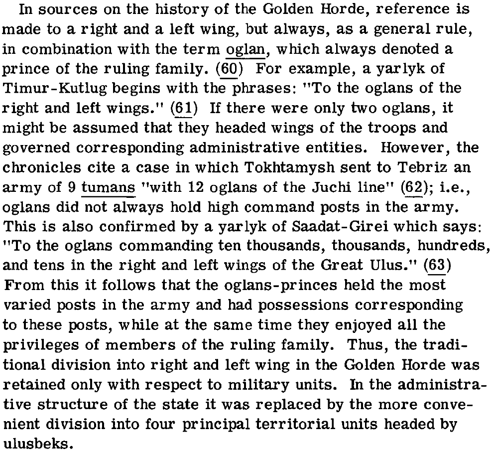
Yeah, I grabbed a copy of The Governmental and Administrative Organization of the Golden Horde and so far the only thing I can properly conclude from that is that you're never going to get anything useful with this approach of subdividing the Golden Horde in perpetuity. For context:

1740608017351.png

1740608030459.png

1740608046090.png

1740608101563.png

It seems quite evident to me, then, that what we're looking at is a feudal-administrative system where the individual noble families, while holding territory personally, were still heavily ingrained within the overall administrative and military apparatus of the state.

Given that the Kingdom of Serbia, which is doing something very similar in this time period, is not subdivided at all, I would say that the Golden Horde should not be subdivided. Chunks of their territory may break away depending on legitimacy (plus the "Great Troubles" as a disaster for them which increases this considerably), but representing that as being the case for every bit of their existence, even in 1337, is as nonsensical as doing so for any other polity in the world doing the same sorta thing at this time. This can be a broader mechanic, even, for other states ruled in this sorta fashion, where powerful noble families with land might try to break away and do their own thing. That's what happens to Serbia later on, for instance, after the death of their Emperor, though more fully.

This sorta division wasn't done for Serbia. It wasn't done for Naples. It wasn't done for Spain. It was only done for France because those individual counts and dukes and whatever were not within the French administrative apparatus; they very much ruled their own territories separately from the rest of the state. The only deviation was whether any given one of them was powerful enough to collect their own taxes, or whether the French king collected taxes in their realm instead. The Golden Horde did not work this way; those temniks are still very much existing within their state system and are still very much beholden to its systems. Did that remain the case when things were falling apart? Of course not, but that doesn't mean you have to represent it that way at the outset. Popping them in when things get rough is perfectly reasonable and does a far better job representing what was really going on than having the Golden Horde be cut into a million pieces.

Balkanization for balkanization's sake only makes outcomes nonsensical.
 
  • 8
  • 3Like
  • 2
Reactions:
Yeah, I grabbed a copy of The Governmental and Administrative Organization of the Golden Horde and so far the only thing I can properly conclude from that is that you're never going to get anything useful with this approach of subdividing the Golden Horde in perpetuity. For context:

View attachment 1259249
View attachment 1259250
View attachment 1259251
View attachment 1259252
It seems quite evident to me, then, that what we're looking at is a feudal-administrative system where the individual noble families, while holding territory personally, were still heavily ingrained within the overall administrative and military apparatus of the state.

Given that the Kingdom of Serbia, which is doing something very similar in this time period, is not subdivided at all, I would say that the Golden Horde should not be subdivided. Chunks of their territory may break away depending on legitimacy (plus the "Great Troubles" as a disaster for them which increases this considerably), but representing that as being the case for every bit of their existence, even in 1337, is as nonsensical as doing so for any other polity in the world doing the same sorta thing at this time. This can be a broader mechanic, even, for other states ruled in this sorta fashion, where powerful noble families with land might try to break away and do their own thing. That's what happens to Serbia later on, for instance, after the death of their Emperor, though more fully.

This sorta division wasn't done for Serbia. It wasn't done for Naples. It wasn't done for Spain. It was only done for France because those individual counts and dukes and whatever were not within the French administrative apparatus; they very much ruled their own territories separately from the rest of the state. The only deviation was whether any given one of them was powerful enough to collect their own taxes, or whether the French king collected taxes in their realm instead. The Golden Horde did not work this way; those temniks are still very much existing within their state system and are still very much beholden to its systems. Did that remain the case when things were falling apart? Of course not, but that doesn't mean you have to represent it that way at the outset. Popping them in when things get rough is perfectly reasonable and does a far better job representing what was really going on than having the Golden Horde be cut into a million pieces.

Balkanization for balkanization's sake only makes outcomes nonsensical.
That's a good criticism. You can agree with her. But you do realize that "The Great Troubles" in the Golden Horde is about to begin? Only certain uluses began to have influence. And they existed before "The Great Troubles". Why shouldn't I be able to play for them from the beginning of the game? We are discussing how to best represent the region in the game. In the game! Serbia and Naples did not break up a few years after the start of the game. Therefore, it makes no sense to divide them into parts. And the Golden Horde began to lose territories by uluses (the breakaway Khorezm, Lithuania gradually conquered several uluses in southern Ukraine). They need to be found and labeled. And what are you essentially offering in return? You suggest doing nothing and presenting the Golden Horde as a Chinese Ming from Europe 4. The Golden Horde will either fall apart in the first 50 years of the game from the events of the uprisings, or it will never fall apart. How often have you seen a Ming fall apart in the middle of a game? Did Min challenge you in the middle of the game when you were playing for him? I'm mapping the uluses that had influence and at some point became independent, or at least fought for it. This is a fact, which means that the division is justified from a gaming point of view.
 
  • 5
Reactions:
Yuan is also set to collapse 50 years into the game, but you don't see anyone proposing balkanizing it, either. The Golden Horde also wasn't necessarily doomed to its fate like what you're proposing would suggest.

If your motivation for your suggestion is "all these figures will be relevant in 30 years when the thing collapses", then you're baking the conclusion into the setup. Your entire premise is built on a shoddy foundation.

Serbia also collapsed even sooner after the start date than the Golden Horde, yet it isn't balkanized, either.
 
  • 7
Reactions:
Here, especially for you, I have found more easily digestible information about western uluses, which can be analyzed in an evening. Look, here's a map of the Grand Duchy of Lithuania. The former uluses are very clearly visible here:
1740690657050.png

Mankerman ulus was located on the eastern bank of the Dnieper River from 1242 to 1396. Here is the link:
https://uk.wikipedia.org/wiki/Улус_Манкерман

In Podillia, oh unexpectedly, Podolsky ulus! It existed in 1344. Since the Tatars did not call this ulus Podillia, I take the older name – the ulus of Burundai. Here is the link:
https://ru.wikipedia.org/wiki/История_Каменца-Подольского

Kuremsa ulus or Korentsa ulus is a ulus located from the east of the Southern Bug River to the Dnieper River in the area of the Lower Dnieper and Samara with the capital above the Dnieper rapids. About where I put it. In 1258, the ulus of Burundai appeared on Bolokhovskaya land, it is marked on the map of Russia in 1264.Here are the links:
rus-1264.jpg
https://ru.wikipedia.org/wiki/Куремса
https://infourok.ru/materiali-k-gia...toy-ordi-ulusi-mauciya-i-korenci-3609593.html

Kurmyshi ulus or Edisan is the remaining territory. His capital was in Odessa. At a later time, with the loss of Moldova, the capital will be on the territory of modern Ochakov, which was then called Kara-Kerman or Dziarcrimenda. This means that the capital was located to the west of the Southern Bug, so it is not a Kuremsa ulus. Here are the links:
https://proza.ru/2023/01/24/725
https://dzen.ru/a/Yktc3lhaDEFKsg9C

In the time of Plano Carpini, these three uluses were one, but those days are long gone, so my information does not relate to the 13th century, but in the 14th century they were conquered by the Lithuanians. By the way, Poles and Lithuanians, as well as Genoese and Venizians, were tributaries of the Golden Horde. Here are the links:
https://aquilaaquilonis.livejournal.com/1158405.html
https://cyberleninka.ru/article/n/v...otoy-ordy-novye-perspektivy-izucheniya/viewer

So what? Was it difficult for me to help provide this evidence? If you think I'm wrong, give me at least some normal arguments. And not just stupid: "I didn't read about it, so it didn't happen, eh." In the east, with the exception of the disputed central district (which has now been confirmed by an Ispil colleague in the message above), do you need to provide similar evidence? I am ready to find more easily digestible information for you.
 
  • 3
Reactions:
Yuan is also set to collapse 50 years into the game, but you don't see anyone proposing balkanizing it, either. The Golden Horde also wasn't necessarily doomed to its fate like what you're proposing would suggest.

If your motivation for your suggestion is "all these figures will be relevant in 30 years when the thing collapses", then you're baking the conclusion into the setup. Your entire premise is built on a shoddy foundation.

Serbia also collapsed even sooner after the start date than the Golden Horde, yet it isn't balkanized, either.

The Siberian ulus used coins of the Golden Horde until 1495. Until this year, it was legally part of the Golden Horde. Therefore, the Golden Horde should not collapse in 50 years. It should collapse in about 150 years.
 
  • 4
Reactions:
First link indicates that such a subdivision was done by appointment, not by succession. If it's done by appointment, it's an internal administrative division, not a vassal. Map is from 1392; worthless for 1337.

Second link doesn't mention any horde at all, just that it belonged to the Golden Horde.
Second map's latest date is 1264; worthless for 1337.

Third link is talking about something from the wrong century. Fourth link barely talks about it at all.
Fifth link is, again, mostly about the wrong century with only one or two passing mentions of anything relevant to the 14th. Sixth is a brief bit of fluff about the 14th century before getting into what it really meant to talk about in the 15th and 16th centuries, which is entirely useless for talking about the 14th.

The Siberian ulus used coins of the Golden Horde until 1495. Until this year, it was legally part of the Golden Horde. Therefore, the Golden Horde should not collapse in 50 years. It should collapse in about 150 years.
That's not how that works, and if that's the only thing you can pull out of that post, it's not even worth continuing this discussion.
 
Last edited:
  • 5
  • 1
Reactions:
First link indicates that such a subdivision was done by appointment, not by succession. If it's done by appointment, it's an internal administrative division, not a vassal. Map is from 1392; worthless for 1337.

Second link doesn't mention any horde at all, just that it belonged to the Golden Horde.
Second map's latest date is 1264; worthless for 1337.

Third link is talking about something from the wrong century. Fourth link barely talks about it at all.
Fifth link is, again, mostly about the wrong century with only one or two passing mentions of anything relevant to the 14th. Sixth is a brief bit of fluff about the 14th century before getting into what it really meant to talk about in the 15th and 16th centuries, which is entirely useless for talking about the 13th.


That's not how that works, and if that's the only thing you can pull out of that post, it's not even worth continuing this discussion.

You didn't like the fact that I'm not doing my research openly enough, okay, I met you halfway and brought my sources. You don't want to read scientific sources because they are too voluminous and difficult to read. Okay, I went to meet you halfway and picked up non-scientific articles. You don't like journalistic articles because they don't cover the topic. Okay, I'm starting to feel like I'm talking to someone who's not very... constructive. Maybe then you'd like to tell me WHAT YOU'RE TRYING TO ACHIEVE??? To have a dialogue, you need to say something. What exactly do you want from me? I'm ready to meet you halfway, but you're not offering anything. You're like a parrot saying that all this feedback is unnecessary, the region is already beautiful. If it's beautiful, then what's the point of you being here? I just really don't understand your intentions. You're a useless figure here.
 
Last edited:
  • 3Haha
Reactions: