• We have updated our Community Code of Conduct. Please read through the new rules for the forum that are an integral part of Paradox Interactive’s User Agreement.

Tinto Maps #24 - 25th of October - Japan and Korea

Hello and welcome once more to another week of Tinto Maps. This week we are going to the lands even further to the East and taking a look at Korea and Japan. So, without further ado, let’s get started.

Countries
Countries.png
Colored wastelands.png

Korea during the Goryeo dynasty was under the orbit of Yuán, and had very close ties with it, with the Yuán emperors taking Korean wives. The north, though, and also Tamna in the Jeju island wouldn’t be unified under Korea until the following Joseon dynasty, so they are still separated although all of them also under Yuán. On the other side, Japan starts in a very interesting situation. After a failed attempt to overthrow the shogunate and restore imperial power during the Kenmu restoration, one of the generals that contributed to such restoration, Ashikaga Takauji, in the end established his own shogunate in 1336 (just before the start of the game). The emperor had then to flee the capital and thus we start with the period of the Northern and Southern Courts, with two opposing Emperors and the shogun fighting for legitimacy. So, although it appears unified at first glance, Japan hides many internal divisions within (more on that later). Further South, the kingdom of Ryūkyū is not yet unified, so the three mountain kingdoms of Hokuzan, Chūzan and Nanzan vie for supremacy over the island.

Societies of pops
Societies of Pops.png

Basically already shown in the Manchuria Tinto Maps, but they need to be shown here too, especially the Ainu.

Dynasties
Dynasties.png

Dynasties zoom.png
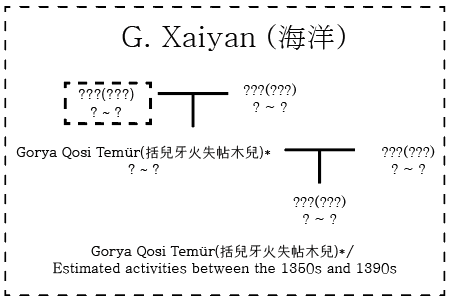
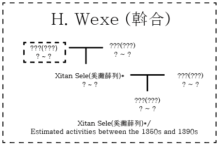
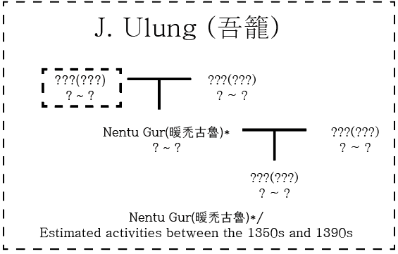
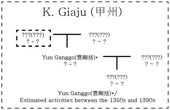
As it happens in China, the “Goryeo dynasty” name is actually not the name of the dynasty itself, which is actually the house of Wang.

Locations
Locations.png

Locations zoom 1.png
Locations zoom 2.png
Locations zoom 3.png
Locations zoom 4.png
Locations zoom 5.png
Locations zoom 6.png
Locations zoom 7.png
Locations zoom 8.png

Provinces
Provinces.png

Provinces zoom 1.png
Provinces zoom 2.png
Provinces zoom 3.png
Provinces zoom 4.png
Provinces zoom 5.png
Provinces zoom 6.png
Here (as well as with the areas next) we have tried to follow the administrative division of both countries in period, but we’ve had to make some adjustments. In Korea, we had to account for the fact that historically, almost immediately after the start of the game the Josen dynasty took over and the administrative divisions are somewhat different, so we’ve adjusted them together (and had to divide some of the bigger provinces for gameplay reasons). In Japan, the administrative divisions remained virtually unchanged since the establishment of the Ritsuryō system in the 7-8th century until after the Meiji restoration in 1868. However, we still had to make some adjustments, and the smaller ones had to unfortunately disappear.

Areas
Areas.png


Terrain
Topography.png
Vegetation.png
Climate.png

Very mountainous and forested areas both, so the few plains have to be taken the most advantage of.

Development
Development.png

Not bad developed areas, but obviously development decreases the further north it goes.

Natural Harbors
Natural Harbors.png


Cultures
Cultures.png

Korea is mainly Korean, and Japan has been divided into four main groups. Besides this, we also have Ainu in the north, Jeju in Jeju island and Ryūkyū in the Ryūkyū islands.

Religions
Religions.png

Korea has the same (name pending) religion as China while Japan is Shintō. I must say that this Shintō is not at all considered to be a Kami-exclusively-oriented Shintō nor the post-Meiji State Shintō in any shape or form. In all effects, it is considered under the Buddhism umbrella and it is treated as Buddhist Shintō, while of course including some different mechanics and references to the Kami too. The name Shintō was chosen basically because it’s more recognizable and identifiable with Japan. Besides this, there’s also the Ainu religion for the Ainu, and the Utaki religion for the Ryūkyū.

Raw Materials
Raw Materials.png

Raw Materials zoom 1.png
Raw Materials zoom 2.png
Raw Materials zoom 3.png
Raw Materials zoom 4.png
Raw Materials zoom 5.png
Not bad areas for resources, and plenty of rice and fish in Japan to get good sushi. The more observant of you will see that the resources of Hokkaido have already been adjusted thanks to feedback from the previous Manchuria Tinto Maps.

Markets
Markets.png

Some may find surprising the presence of Izumi as a Market in Japan, but it is the area that served as the main point of entrance for commerce into central Japan, where the merchant town of Sakai developed, until later Osaka developed under Toyotomi and basically took over that function.

Population
Population.png

Population zoom 1.png
Population zoom 2.png
Population zoom 3.png
Population zoom 4.png
Population zoom 5.png
Population zoom 6.png
Population zoom 7.png
Not much to say here, except that quite a bit of population waiting for some action.

Extraterritorial Countries
Extraterritorial Countries.png

Extraterritorial Countries zoom 1.png
Extraterritorial Countries zoom 2.png
Extraterritorial Countries zoom 3.png
I’m sure many of you were waiting for this. The samurai clans in Japan are represented as Extraterritorial Countries, and we have tried to be as close as possible to their distribution of territory in 1337. As you can imagine, that is not an easy task, and some more tweaking is needed, so if you have any feedback or extra info on that regard it would be much appreciated. Unfortunately, there’s some overlapping of some clans on the same territory and only one name can be shown at a time, so not all names are visible (the Oda clan is still there, I promise), but there are a total of 143 clans (not counting Ashikaga), plus two extra for each of the imperial courts that are present at start. Related to this, each clan will pledge its allegiance to either the northern or the southern court, mainly based on their historical allegiances but allowing a bit of leeway (and those allegiances don’t necessarily have to be permanent). So, as a bit of an extra tease, these are the allegiances of the clans at start (yellow are the north court supporters, blue are the southern court ones, and again keep in mind that only one color can be present even if there’s more than one clan with different allegiances in the same location)
Nanbokuchou.png

And that is all for today. Next week there will not be any Tinto Maps due to being a bank holiday, so next one will be in two weeks for a look further south into South East Asia. See you there.
 
  • 169Love
  • 118Like
  • 4
  • 4
  • 2Haha
Reactions:
In light of the newly-revealed language system, I will reitarate here what I said in the Tinto Talks thread.

If the liturgical language represents the language of scholarship, then Chinese should be the liturgical language of Korea, Japan, and Vietnam. Soon after the start of the game, it would also be adopted by Chuuzan on Okinawa. In all of these states, except perhaps the Ryukyus, Classical Chinese remained the language of formal writing and education until the 19th century. It was also the language employed by the Buddhist clergy, and through which Buddhist texts were disseminated throughout the area.
 
  • 5
  • 2Like
Reactions:
While I like what I see, why isn't there a large Mahayana minority in Japan? Yes, even though "Shinto" is syncretized in the game, there were clear influences of Confucianism and Taoist, as some at the time attempted to keep their distinction.
 
  • 2
  • 1Like
Reactions:
While I like what I see, why isn't there a large Mahayana minority in Japan? Yes, even though "Shinto" is syncretized in the game, there were clear influences of Confucianism and Taoist, as some at the time attempted to keep their distinction.
As far as I can tell, "Shinto" in the game is actually defined as "what it is that Japanese religion is" and therefore embodies both "actual" "Shintou", Buddhism, and every other longstanding religious tradition in Japan.
 
  • 3Like
Reactions:
Hachiro Lagoon in Akita Prefecture was a lake in this period.Reclamation began in the late Edo period, and it was only after World War II that it became what it is today.


Also, I don't think the east side of Kasumigaura in Ibaraki Prefecture is drawn.
 
Last edited:
  • 2Like
  • 1
Reactions:
Lets talk about islands
I want to talk about islands and since we've finally reached the first major archipelagic portion of the map i think its time i try to write my own proposals

I do want to make a very strong argument that i believe individual islands should get a MUCH lower bar for being portrayed than normal land locations. This is due to several reasons. One of the defining criteria and frameworks of having different locations is to portray the geographical consistency and composition of the known geographical world, like how it would be weird to include a mountainous and flat location in the same location like what happens quite often in EU4, with the highly enhanced granularity of Project Caesar you guys ahve clearly been able to improve this significantly. Which goes back to my main point that i would assume and think that one of the biggest criteria for location portrayal is the geographic consistency/continuity or lack thereof it which is why i think ISLANDS especially ones that are not within a strait crossing distance from the mainland should be portrayed even if they are very small and or inconsistent with the apparent minimum land area framework of how you guys give locations like Benevento and Andorra. Islands are probably the MOST DISTINCT geographical contrast you can add to a general area especially if you are portraying army based movements due to the disruptiveness of a massive body of water to army movement and spatial movement in general. It doesn't make sense for an island 100km away from the mainland being included in a mainland location like it is in most older paradox games. Now that i have my case/argument for the devs out of the way i will make some suggestions

Firstly i believe in the Kyushu general region some islands such as Iki Island should be portrayed, it is roughly the same size as the smallest island you guys have given representation too which is Miyakojima and seeing as how far away it is from the mainland it should be given its own separate location

Secondly the location of Minamimatsura or the Goto islands should also be split they are even individually if divided into 2 the eastern portion being renamed to Fukue Island they would still be individually bigger than Miyakojima so i believe this is a good justification.

Thirdly in the location of Nishimatsuura that area ive cordoned off has been incorrectly portrayed as a peninsula which atleast according to google maps is not the case it is a separate island, Its also roughly the same size as Miyakojima

Fourthly i think the island of Shodoshima in the Seto inland sea west of Awaji island should also be portrayed separately it is also similar in size to Miyakojima


View attachment 1208185

Moving onto another region of Japan

I believe the Izu islands should also be portrayed in that order specifically with the biggest island a 1 location and the string of smaller ones as another. They are definitely smaller than Miyakojima but they seem far away enough that i do feel they should be given a location, atleast 1
View attachment 1208190


Another area i do think its kind of strange to give a location to the two islands circled in blue but not the one in red, I also do find it perplexing that these islands in Hokkaido which is much more desolate and underdeveloped are given locations for their separate islands but not in the more populated areas in Honshu and Kyushu. HOWEVER do not mistake this as me advocating for their abolition for i am a location maximalist i merely just think that the areas South and honestly the entire world for that matter should get more granular depictions for islands due to my aforementioned argument about how geographically and spatially distinct they are from the mainland locations they usually get attached too

View attachment 1208198
Finally for the most radical of proposals i do think some of the islands in Ryuku specifically Yonaguni island and Tarama should be portrayed but they are like only around 50-80km so i guess it would definitely be difficult

View attachment 1208200

This also leads me to another proposal specifically for Korea
Firstly i do feel that Ulleung Do should be portrayed as well due to its history and how distinct and far away from the mainland it is its also very small but i do feel if Miyakojima can get portrayed i dont see why Ulleung Do should even if its a little bit smallerView attachment 1208201


And onto my final but also most important point which is the extremely bizarre contrast between the location density of what are probably the 2 most perfect pair of comparable islands which is Tsushima and Jeju island (Jeju island was also not properly shown in the post but from what i saw its only 1 location which is kinda horrendous). They are both islands in the same area with somewhat simmilar historys to their relation to the mainland, the only problem is Tsushima is HALF THE SIZE or even less of Jeju while having TWICE as many locations, that feels like a massive error in judgement, not to mention Tsushima is far more rugged and has less people. Tushima funnily enough has some of the highest location density with just around 300sqkm while Jeju has 1, MORE THAN 5X LOWER at 1500+. Again this is not an argument that Tsushima is over divided or that it should less locations i just believe Jeju should have just as much love as Tsushima due to how simmilar they are probably around 5-6 locations would be good or at the very least 3
Japan already has the highest province density in the world, far exceeding even HRE or North Italy
 
  • 3Like
Reactions:
A lot of the Koreans in Liaodong were Korean defectors who sided with the Yuan. The most famous of these were the Hong clan in Liaoyang, headed by Hong Pok-wŏn and his descendents, most infamously Hong Ta-gu.
View attachment 1207028
From Empire's Twilight: Northeast Asia under the Mongols by David M. Robinson
About Liaodong's ethnicity, it is rather complex.
View attachment 1220768
On Kingdom of Shenyang
As the map shows, we have Liaodong peninsula under Chinese army, Kingdom of Shenyang under a union with Goryeo and Liaoyang Province under Mongol-appointed Hong Pok-wŏn family, who known in Korean scripts "hated his motherland".

In 1266, Kublai Khan established Shenyang as a location for Goryeo POW. In 1308, Prince Wang Wŏn of Goryeo was awarded Kingdom of Shenyang for his military service, who inherited the Kingdom of Goryeo in the same year as Chungseon of Goryeo. After retirement, he transfered Shenyang to his niece Wang Ko, and Goryeo to his second son, Chungsuk of Goryeo. In 1345, Chungmok of Goryeo inherited Shenyang again.

On Chinese population in Liaodong
There are two possible sources of Chinese in Liaoyang Province. According to History of Yuan (HoY), the government issued new official regulation stating: "(For higher officers' promotions), Jurchen and Khitans are treated like Chinese; Jurchen born and raised in Chinese regions are to be treated like Chinese." Therefore, highly Sinicized Jurchens and Khitans living in the cities were considered Chinese under Yuan Dynasty.

Aslo from HoY, in 1284, 1289, and 1293, the government dispatched 1272 households, 1000 men, and 1360 households of newly surrended troops to build Tuntian ("military-agricultural colonies") in Jinzhou and Fuzhou, around south end of Liaodong Peninsula. A modern source (in Chinese) estimated about 18k Chinese migrated in Liaodong Peninsula. The same source also confirmed that 8 of 9 last Yuan military leaders stationed in Liaodong were Chinese, who later surrended to Ming Dynasty.
I have some claims about the Korean population in Liaoyang Province. I will detail the immigration situation of Koreans based on Cong (1993) (in Chinese) and Xu (2008) (in Chinese)
  1. Hong-led 1500 Korean households surrounded to Mongols in 1231. In 1232, the Mongol-Goryeo War resumed, and Hong's families were murdered by the King in 1233; thus, Hong led his remaining families and soldiers to retreat to Liaoyang City.
  2. Mongols used Liaoyang as a refuge for anti-royalists of Goryeo, among which Cho and Yi led 2000 people to join Hong in Liaoyang City.
  3. After Goryeo surrendered to the Mongols, the Duke of Yeongnyeong was sent to Liaoyang as a hostage and led another 1,300 households to reside in Shenyang.
In addition to Korean-led migration, Goryeo's POWs and refugees were relocated to Shenyang in 1297, Binzhou, Liaohe, Qingyuan, and Zhaozhou in 1316, and about 800 households back to Goryeo. Mongols ordered Goryeo to relocate a village with 200 households between Shenyang and Liaoyang and two villages with 100 households each on the southern bank of the Yalu River.

The total number of Koreans in Liaoyang Province amounted to more than 5,000 households and 30,000 people, comprising about 7% of the province's total population. Based on the History of Yuan data, in Shenyang, the 1300 households comprised 21% of 5183 total households, while in Liaoyang, the 2000-2700 Korean households comprised about 53%- 72% of 3708 total households. Most of the Korean population in Liaoyang Province lived in the Liaoyang-Shenyang region and the Korean Peninsula, with no clear evidence confirming other settlements. Although some records confirmed Koreans fled into Jurchen's land, their figure is complicate to estimate (could be more than 10k).

Outside Liaoyang Province, Khanbaliq/Beijing was a significant settlement for Koreans. The royal families of Goryeo sent many of the Korean population to Khanbaliq as their soldiers and servants. In 1354, Goryeo sent its 23,000-men-strong army from Khanbaliq to southern China for the battle of Gaoyou. The Korean population in Khanbaliq is estimated at least 30,000 people.
 
  • 4Like
  • 2
Reactions:
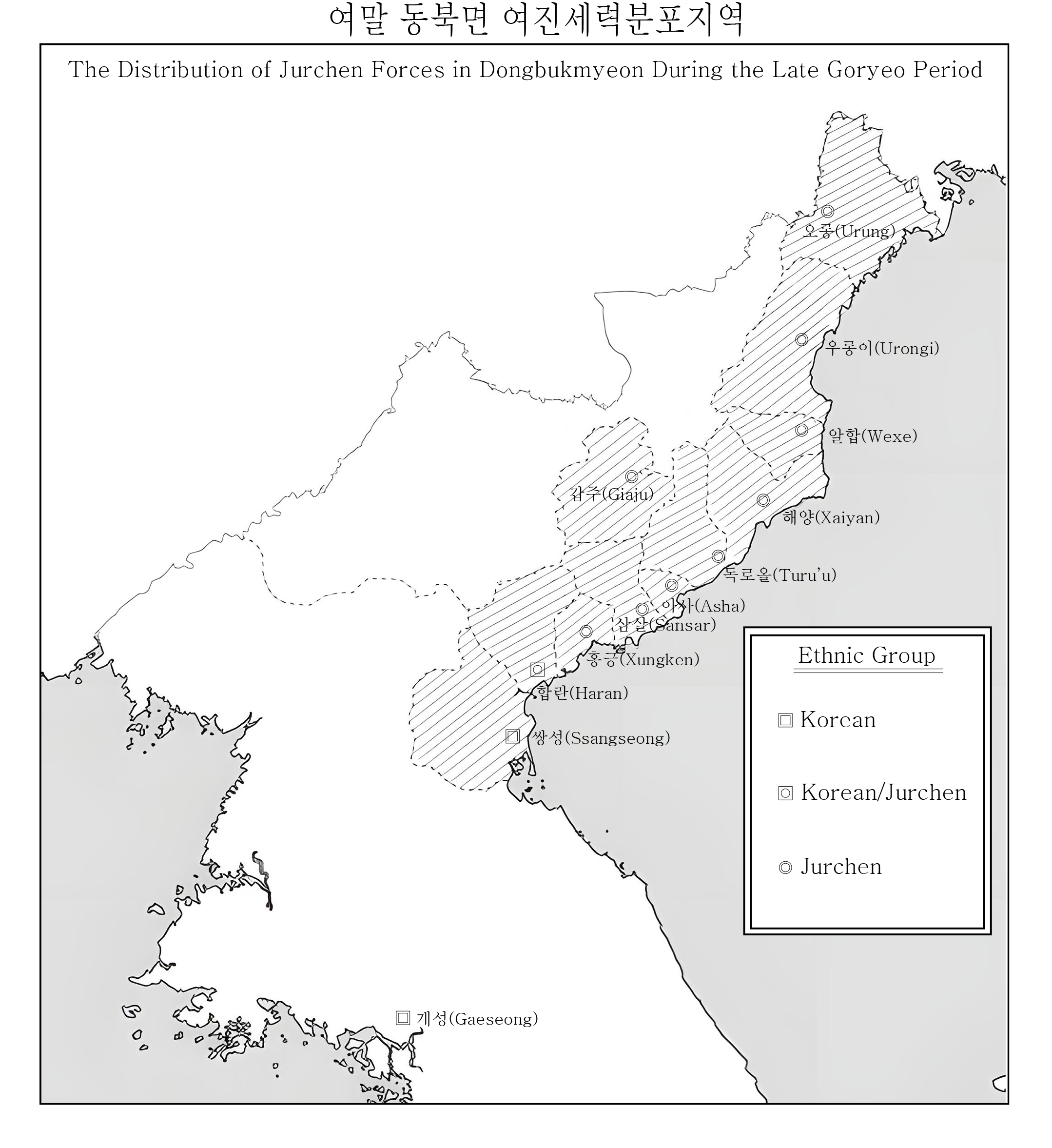
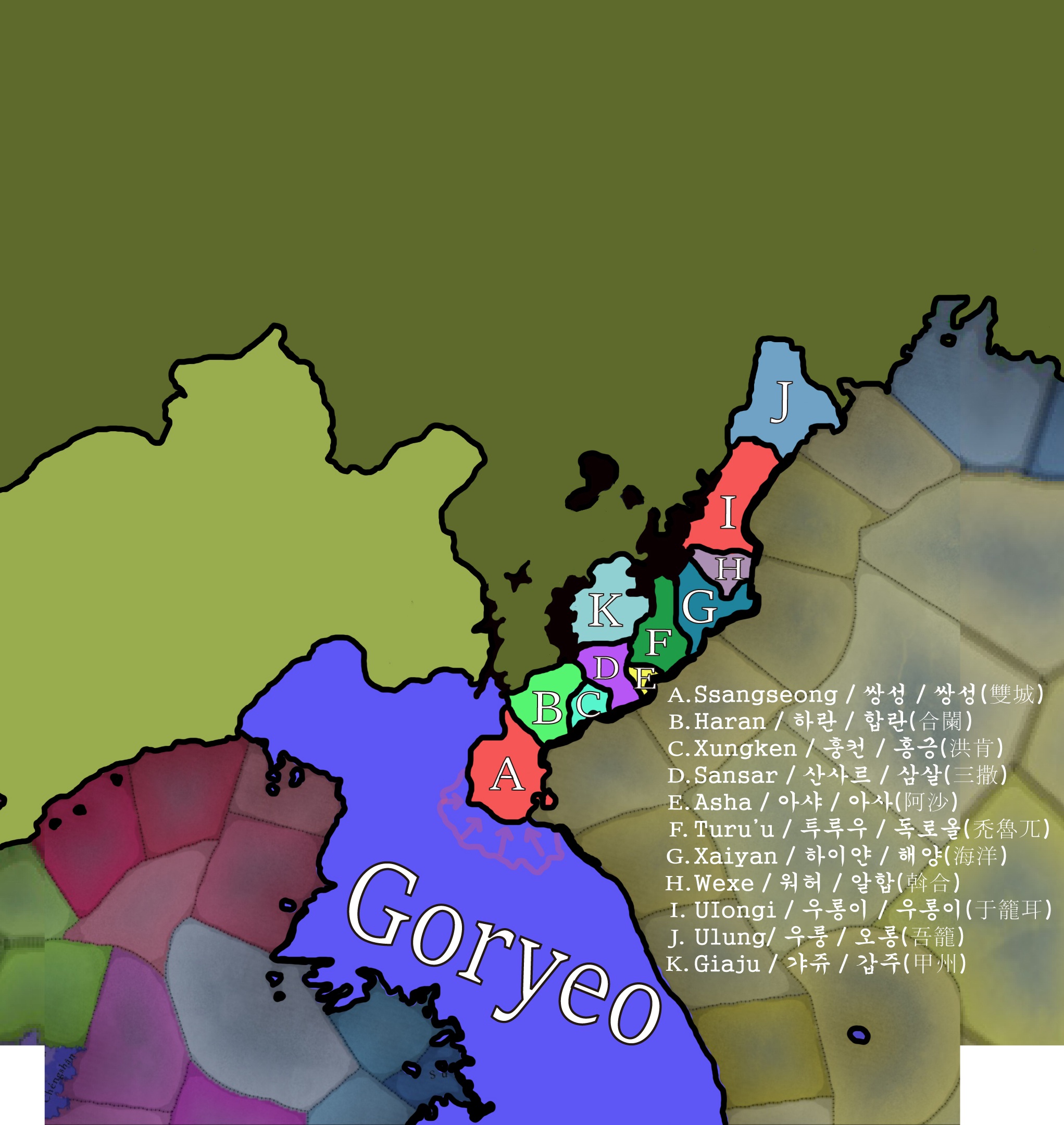
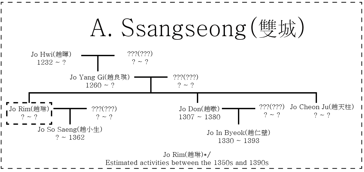
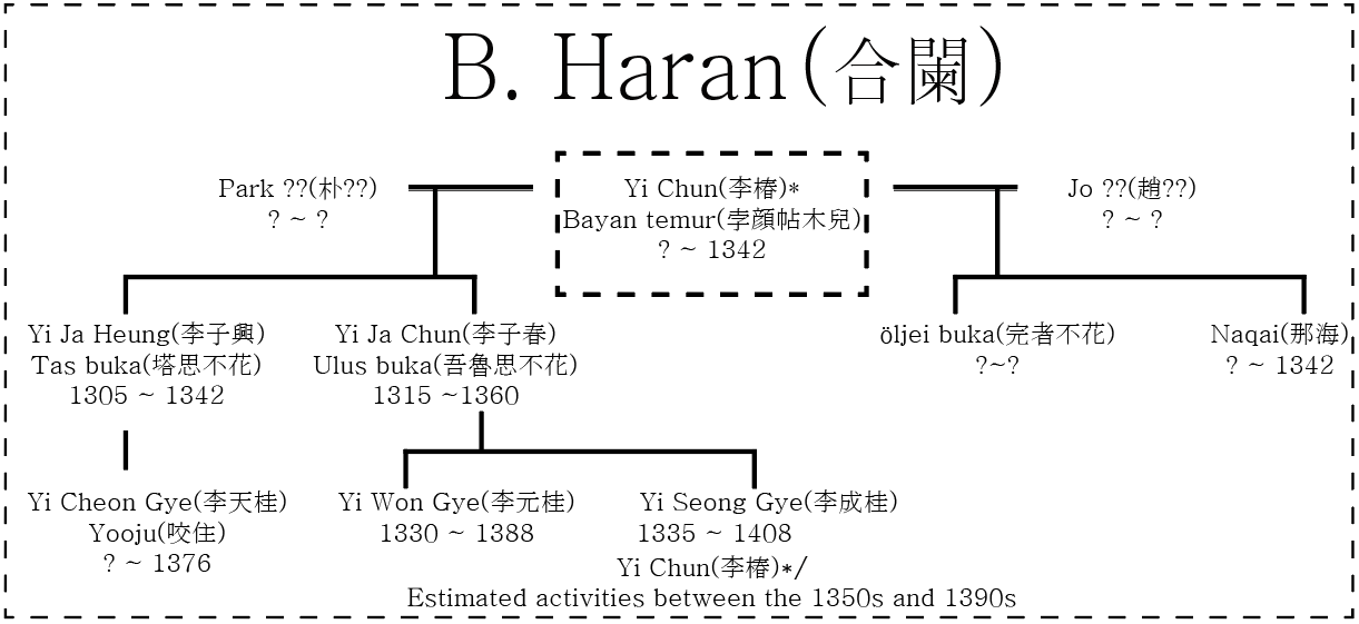
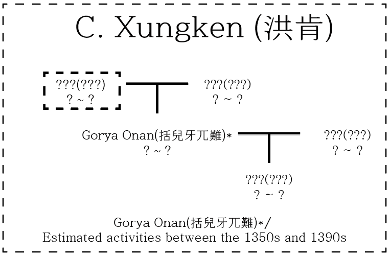
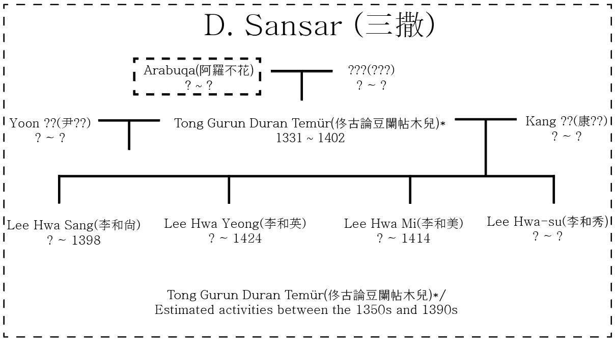
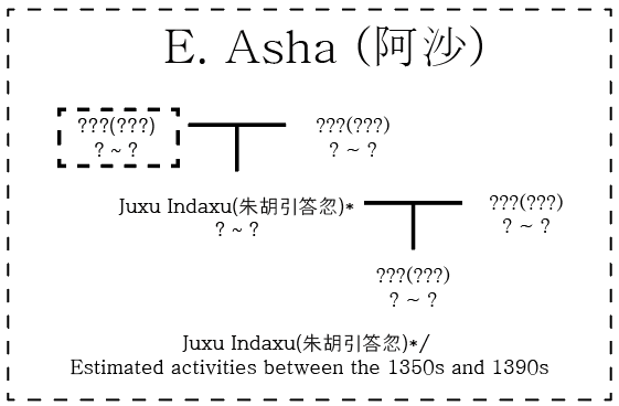
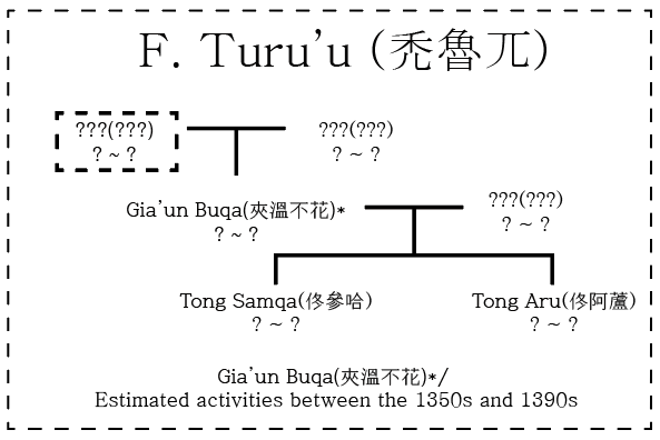
Feedback on the Northeastern Region of Goryeo (Jurchen Tribes)

Before I begin, I’d like to clarify that I personally believe the northeastern regions of Goryeo were more likely Societies of pops rather than fully settled states. However, I also understand the developers’ reasoning for portraying them as settled states.

Here is my feedback:

1735043701434.jpg

1735318260050.jpg

A. [Haran]

This region has long been referred to in Goryeo as “갈라전” (Galajeon) or “karran.” The term “karran” is believed to have originated from the Jurchens who lived in the area, as they called it “Haran.” Therefore, I believe “Haran” would be a fitting name for this region.

B. [Muragu]

This region was known as “경성-Gyeongseong” (mirror town) during the Joseon Dynasty. The Jurchens who inhabited the area reportedly called it “Murlango” or “Muragu.” Interestingly, the term “Muragu” is said to mean “mirror” in the Jurchen language, which is why the Joseon Dynasty later adopted the name “Gyeongseong” with the same meaning. Given this historical context, I believe “Muragu” would be a fitting name for this region.

C. [Pajeo]

This area was referred to as “파저 여진-Pajeo Jurchen” by Goryeo and Joseon for a long time. Unfortunately, it’s unclear what the Jurchens themselves called this place. One plausible explanation is that the land was harsh and sparsely populated, making it difficult to establish any distinct local name. Given this uncertainty, I think “Pajeo” would be the most appropriate name for this region.

D. [Uryangkhad]

I believe the name "Uryangkhad" would suit this area well. Goryeo and Joseon referred to this region as "올량합" (Uryangkhad) for many years. One important point to note is that, while it may sound similar to "Uriankhai" (referring to a branch of the Mongols), the two names are actually distinct, with "Uryangkhad" referring to a Jurchen group. Therefore, I think "Uryangkhad" is a fitting name for this region.

10038_2017_Article_BFjhg2016142_Fig1_HTML.jpg


E. [Odoli] or [Udege]

If the Jianzhou Jurchens moved to the Hunchun-Tumen area at the game’s starting point, then I think the name “오도리-Odoli” would be the most appropriate. However, if the Jianzhou Jurchens moved to Hetu Ala instead, then “우데게-Udege,” which reflects the region’s historically dominant group, would be a better fit.

F. [Naran]

I believe the name “Naran” would be appropriate for this region. Historical records from the Joseon Dynasty refer to this area as “나란” (Naran). The origin of the name “Naran” may have derived from a Jurchen tribal name or a Jurchen-style place name used by the local inhabitants at the time. Later, this area was renamed “Samsu” and “Gap-san” during the Joseon period. Therefore, I believe “Naran” would be a fitting name for this region.

G. [Dungru]

I think the name “Dungru” would be fitting for this region. During the Goryeo and Joseon periods, this area was referred to as “독로” (Dokro), which may have originated from the Jurchen word “Dung-ru” used to describe the region. Later, it was renamed “Ganggye” during the Goryeo and Joseon eras. Therefore, I believe “Dungru” would be a fitting name for this region.
 
Last edited:
  • 11Like
Reactions:
1. The Tohoku region was then called "Ōu" or "Ōshū" and not "Tōhoku".
一般に中世は「奥州」の名のもとに奥羽が一まとめに扱われることが多く,現東北地方が具体的に一つの地域として扱われるようになった時代といえよう。(中略)平安時代から江戸時代中期までの長い期間,地域を指すものとしての「東北」という語は,はとんど用いられていない。
In general, the medieval period often treated the Ōu region collectively under the name "Ōshū," and it can be said that the time when the present-day Tōhoku region began to be regarded as a single area has arrived. (Omitted) During the long period from the Heian period to the mid-Edo period, the term "Tōhoku," referring to a region, was hardly used.
Other examples in this pdf were given for Ou as well as Oshu.

12/25 edit
Oshu may refer to the country of Mutsu alone, so Ou seems to be a better choice.

2. The economic center would be Kyoto (Yamashiro Province) rather than Izumi.
列島の東西、南北の結節点にあったのは京都である。朝廷や大小寺院の所在に加え、守護の在京が原則とされたことや、奉公衆が組織化されたことなどによって、この時代の京都には大量の武士も集住していた。瀬戸内海水運とは淀川で、日本海水運とは琵琶湖でつながり、陸揚げ地点となる鳥羽・伏見や大津・坂本には問おまると呼ばれる倉庫・交易業者の店が開かれ、そのもとで馬借のような運輸業者が活動していた。
Kyoto was the nodal point of the archipelago, both east-west and north-south. In addition to the presence of the imperial court and various temples, the principle of having the shugo (military governors) residing in the capital and the organization of the vassals led to a large number of samurai gathering in Kyoto during this period. The Seto Inland Sea shipping was connected via the Yodo River, while the Japan Sea shipping was linked through Lake Biwa. At the landing points of Toba, Fushimi, Otsu, and Sakamoto, warehouses and trading shops known as tomonaru were established, under which transport businesses similar to horse-drawn carriers operated.
ebara, masaharu. 2016. 室町幕府と地方の社会. tokyo: 岩波新書
 
Last edited:
I think Toshima should be called Edo for this period, it is more recognizable.
And Miyazaki should be Jogasaki and placed where Naka is.
1735052410914.png
1735052446536.png
 
Last edited:
  • 1Like
Reactions:
Topography Review.

This is an intermediate stage review, as I feel the location shapes don't quite match the topographic features.
Especially Hokkaido has location shapes that completely ignore existing topography.
As a lot of people proposed changes to the locations, I'd definitely wait till the "Feedback thread" before thinking about integrating my specific topographic suggestions.

HOWEVER, I think there is room for shaping some more locations to the existing topography. While administrative borders like to include barren ground ("this side of the mountain is mine"), this results in a lot of topographic features to be nullified on the map. Also, a lot of locations need to be upgraded to hills (especially in Korea).


I will present my case the other way around: 'marginal sources' like modern pop distribution, soil fertility in relation to the existing topography.
  • The relation between topography, soil fertility and modern/historical population distribution is extremely clear for Korea and Japan.
  • Wetlands in Japan are very fertile (washed out nutrients from volcanic soils), and especially the Kanto plain benefits here. Imo there should be some wetland locations, although I'd let game balance decide where exactly.

  • Korea is very hilly, and due to its geology is very infertile in those hills.
    • This restricted the agricultural lifestyle to the coastal plains and broader valleys.


Terrain Ruggedness IndexSoil fertility (yellow & green = fertile)Modern population threshold;
black = 0 inhabitants/km²
Modern population (full range)HYDE's anthromes ca. 1300 more saturated colors = more land usage/pops
4_DEM-TRI.png
6_Soil.png
7_Pop_AllorNothing.png
7_PopModern.png
7_PopHYDE_1300.png

Repeat of TRIDEM - exaggerated colorsWetlands
4_DEM-TRI.png
4_DEM-Colorful.png
5_Wetlands_GLWD.png

Current topography TintoAttempt at making suggestionsAttempt at making suggestions 'changelog'
1_TopoCurrent.png
1_TopoSuggested.png
3_TopoChangelog.png
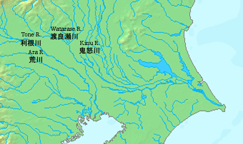
LATE EDIT: Blowout of Hi-res DEM of Kanto Plain (0-100 m). Note the Tone river was diverted towards the East in 1654LATE EDIT: Comparison to GLWD mapRiver courses in 16th century (pre-diversion). Modern Edo river was actually the original Tone river course.Modern river courses (Edo river disconnected from Tone river)
1735944090876.png
1735944020966.png
Tone_riverine_system_16century.png
Tone_riverine_system_20century.png
 
Last edited:
  • 14Like
  • 4
  • 2Love
  • 1
Reactions:
Map of significant Gold, Silver, and Copper deposits in early modern Japan (With some other minerals included such as lead, tin, and mercury) It's important to note though that the mining boom that took place in this period was only possible due to new technologies, so these locations would have either been less productive or non-existent in 1337


(Full article in pdf and website format)
 

Attachments

  • GoldSilverCopperDepositsEarlyModernJapan.jpg
    GoldSilverCopperDepositsEarlyModernJapan.jpg
    164,9 KB · Views: 0
Last edited:
  • 2Like
  • 1
Reactions:
I don't object to this, but we should also consider balance.
Japan has the highest location density in the world, their own religion and a whole game mechanic. As a country which was historically considered stronger than Japan(might not have been true in retrospect but perceptions don't come out of nowhere), I see no reason why this would be unbalancing.

Edit: if one recieved a bit more normal historical education, they will know that the two countries have existed way prior to the 1500s and not simplify it all with one recent event. Also, Korea actually did kinda invade Japan within the game's timeframe
 
Last edited:
  • 2Like
Reactions:
Japan has the highest location density in the world, their own religion and a whole game mechanic. As a country which was historically considered stronger than Japan(may or may not be true but perceptions don't come out of nowhere), I see no reason why this would be unbalancing.
What are you talking about??? Is Korea stronger than Japan??? No, absolutely not. If you have received normal historical education, you should know that in history, Korea was invaded by Japan, not Korea invaded Japan.

edit:
I just noticed someone made a minor update, so I’ve rewritten my response as well.

Serving as a vassal force under the Mongol Empire and invading Japan was hardly a glorious deed. If you believe that participating as a vassal in the invasion of Japan proves that Goryeo invaded Japan—and use this as evidence of Goryeo being stronger than Japan—then what does that make the Han Chinese troops, who formed the main force of the Mongol invasion? Were they reviving empire in stellaris?

You’re only focusing on the glory that Goryeo boasts about, while completely ignoring whose command they were acting under. You need to learn proper history.
 
Last edited:
  • 5Like
  • 5
Reactions:
Here's a list of missing natural harbors I think should be added to the map, with the caveat that it is not at all finished, I just decided it was best to go ahead and post it here for my own sanity. The Sea of Japan coastline definitely needs another look, but even outside that desolate wasteland there is still lots of gaps to fill in. Plan to add Maizuru, Hirado, Kochi, Moroyose, Yunotsu, Obama, and hopefully more. (I think they already covered Niigata, but I might add it anyways)


NanaoPortNoto.png

Nanao Port in Noto
  • A bay protected and mostly enclosed by Noto Island and the Sakiyama Peninsula
  • Nanao Castle, one of the largest medieval mountain castles in Japan, was built here by the Hatakeyama to better protect the port

IzuharaPortTsushima.jpg

Izuhara Port in Tsushima

  • The Tsushima Domain established its main shipyard/port here within a small inlet just inside the harbor in 1663
  • In modern times the port holds a festival to celebrate its role in the diplomatic missions sent by Joseon Korea to Edo
  • Tsushima was a major base for piracy and trade with Korea, and was eventually given a monopoly on the trade by the Tokugawa

FukuraPortAwaji.jpg

Fukura Port in Awaji

  • Has a sister harbor in Yura Port, protected by a lagoon, with a Meiji period fortress established there to protect Osaka
  • Major node of communication between Shikoku and Kansai (Kyoto, Osaka) since ancient times (7th century AD)


TsurguaPort.jpg
m.jpg

Tsuruga Port in Tsuruga

  • One of the major stops for the kitamaebune
  • Major link between Sea of Japan coastline and Kyoto/Osaka, goods unloaded in harbor and taken short distance by land to lake Biwa
  • Later superseded by the Shimonoseki route after the early Edo period, even then still considered one of the major Sea of Japan harbors
 
Last edited:
  • 4
Reactions:
Here's a list of missing natural harbors I think should be added to the map, with the caveat that it is not at all finished, I just decided it was best to go ahead and post it here for my own sanity. The Sea of Japan coastline definitely needs another look, but even outside that black wasteland there is still gaps all over the place. Plan to add Maizuru, Hirado, Kochi, Moroyose, Yunotsu, Obama, and hopefully more. (I think they already covered Niigata, but I might add it anyways)


View attachment 1241366
Nanao Port in Noto
  • A bay protected and mostly enclosed by Noto Island and the Sakiyama Peninsula
  • Nanao Castle, one of the largest medieval mountain castles in Japan, was built here by the Hatakeyama to better protect the port

View attachment 1241365
Izuhara Port in Tsushima

  • The Tsushima Domain established its main shipyard/port here within a small inlet just inside the harbor in 1663
  • In modern times the port holds a festival to celebrate its role in the diplomatic missions sent by Joseon Korea to Edo
  • Tsushima was a major base for piracy and trade with Korea, and was eventually given a monopoly on the trade by the Tokugawa

View attachment 1241367
Fukura Port in Awaji

  • Has a sister harbor in Yura Port, protected by a lagoon, with a Meiji period fortress established there to protect Osaka
  • Major node of communication between Shikoku and Kansai (Kyoto, Osaka) since ancient times (7th century AD)


View attachment 1241369View attachment 1241370
Tsuruga Port in Tsuruga

  • One of the major stops for the kitamaebune
  • Major link between Sea of Japan coastline and Kyoto/Osaka, goods unloaded in harbor and taken short distance by land to lake Biwa
  • Later superseded by the Shimonoseki route after the early Edo period, even then still considered one of the major Sea of Japan harbors
Some sources, a lot of them in Japanese, will add as I go along


  • 2Like
  • 1
Reactions:
I think all nations should have possibility for extraterritorial countries as it offers so much ease and depth in presenting medieval states.
Especially in case of Mongol hordes "Extraterritorial country" would make perfect tool for showing governance and disunity of Mongol khanates and hordes within Greater Khanate. We could model Golden horde existing while many other smaller hordes and tribes existing within it just like the Japanese daimyos. There could even be an event or disaster in which after the death of Uzbeg khan or accension of khan with weak legitimacy "Sengoku Jidai " of Golden horde occurs, with victorious side getting to enthrone their candidate for Khan
We could further use this model for other states across the world such as Delhi sultanate. When Delhi sultanate collapses in many places it happens by the emirs with already existing "fief" in local area depriving last of central government's authorities. Modeling those already existing "fiefs" as extraterritorial countries would make it perfectly fluid to transitioning into full on independence from Sultan.
Using this model we can make the varies tribes and cities in Chagatai khanate more easily presentable while making their eventual secession from khanate plausible. It would be prefect tool in case of Emir Timur. We could have Timur take control of extraterritorial state of Barlas "tribe" in western Chagatai khanate who in time gains increasing authority and power within the khanate until eventually usurping rulership entirely from Genghisisd khans.
I think even European kingdoms should have "Extraterritorial countries" to represent autonomies entities within the state such as weaker feudal vassals , free cities, bishoprics (temple lands) , and holy orders. I think having new countries for every sizable feudal county is getting out of hand when it could be mostly solved with implementing "Extraterritorial countries" as new kind of very low autonomy vassal with limited political capacity and diplomatic ability beyond the host "state".
Intertwining Estates with "Extraterritorial countries" would enrich game play massively while making governance far more fluid. For example in Christian kingdom with strong church influence and high church "land" , once locations/ or provinces grow highly autonomies (maybe at 90%) event could trigger for which church demands to create temple demesne (extraterritorial country ) there. I could even think of the event wording.
" Your majesty , news from the provinces. For years crowns control over the province of "XXX" has been growing weaker until at last local officials have even lost ability to tax. The local priests however have been using their influence and extensive land ownership in the region to run much of day to to day administration of the province. Local Bishop has sent petition to us hoping we could make this arrangement official by granting them administrative rights over the province by creating new bishopric. If accepted priests in our court would certainly be happy"
With limited diplomatic ability these new level of vassals would not change international stage while greatly influencing their host countries politics.
Overall introducing "Extraterritorial countries" new more integrated level of vassal would make great addition to gameplay and historical accuracy.
 
  • 2
  • 1Like
Reactions:
I found an interesting article about materials produced in Japan, so I will share it.
The system of economic life that depends on such estates is called the estate economy. Initially, the income of the estate owners came from the harvest of rice from their direct management fields (directly managed fields) or from land tax rice, but the estate lords who obtained the right of exemption gradually strengthened their collection from the peasants on behalf of the state. By the twelfth century, in addition to land tax, they began to collect public duties (which correspond to the system of rent and tax). The land tax was about three to five shō per段 until around the eleventh to twelfth centuries, but as the right of exemption became generalized, an amount equivalent to the rice from the land ancestor (seven shō and five go per段) was added, and it began to be called annual tribute. By the thirteenth century, the annual tribute was referred to as "tōdai," and it diversified to about one to one stone per段. Initially, public duties were mainly for procuring goods needed by the lords, in the plains estates, for example, melons, potatoes, gohō, lotus, beans, and ropes; in the mountainous estates, for example, horse chestnuts, chestnuts, walnuts, yam, persimmons, dry ginger, horsetail, and flat mushrooms; in coastal or island estates, salt, dried sea bream, oysters, and wild cloth; and in estates with many fields, wheat, soybeans, and sesame. Eventually, they began to impose duties such as daily laborers, annual tribute transport security, and treasure house security soldiers. The estate lords sought all the living resources and domestic labor from the estates throughout the year, allocating them monthly and daily to create a system of rotating vegetables. The completion of this system was around the twelfth century.
こうした荘園に依存して経済生活を行う仕組みを荘園経済という。荘園所有者は、初めは田地の収穫稲(直営田)か地子稲がその収入であったが、不輸権を得た荘園領主は、次第に国に代って荘民からの収取を強め、十二世紀になると、地子にほかに公事(令制の租庸調傜役にあたるもの)を取り立てるようになる。地子は、十一~二世紀ごろまでには段別三斗から五斗であったが、不輸権が一般化すると、これに田祖分(段別七升五合)相当が加えられて年貢と呼ばれるようになる。十三世紀には、年貢分は斗代とよばれ、段別一斗から一石前後に及ぶまで多様化する。公事も初めは、米以外に領主の必要とする物資の調達がおもで、例えば平野部の荘園では、瓜・芋・午房・蓮・豆・繩など、山間部の荘園では、栃・栗・胡桃・薯蕷・柿・干厥・土筆・平茸など、海辺や海島の荘園では塩・干鯛・蠣・荒布など、畑地の多い荘園では麦・大豆・胡麻などであったが、やがて日割り人夫や、年貢運送警備や宝蔵警備の兵士役まで課すようになる。荘園領主は、こうして一年中の生活資源と家内的な労働力をすべて荘園にもとめ、月割り日割りに荘園に割り当てて、廻御菜の仕組みを作り上げた。その仕組みの完成は、ほぼ十二世紀ごろである。
In short, the products other than rice were:
In the plains:
Melons (fruit), potatoes (potato), gohō, lotus (medicaments), beans (legumes), ropes (fiber crops)
In the mountains:
Horse chestnuts (fruit), chestnuts (fruit), walnuts (fruit), yam (potato), persimmons (fruit), dry ginger (medicaments), horsetail (medicaments), flat mushrooms (medicaments)
In coastal areas:
Salt (salt), dried sea bream (fish), oysters (fish), wild cloth
In fields:
Wheat (wheat, sturdy grains), soybeans (soybeans), sesame
It is said that these were produced, and although not included in the list of products, gohō, chestnuts, and walnuts can all be considered oil-producing plants.

Also, in another document:
In other words, the "timber" that was generating major economic profits at that time was later cut down from the Hata estate in the Shimoyama region and transported to Kyoto via Sakai in Izumi Province (now Sakai City in Osaka Prefecture) (from "Daijōin Jisha Zasshiki"). The "good wood" of Tosa had been attracting attention as a product early on.
つまり、当時主要な経済的利潤を生み出していた「材木」は、のちに幡多荘下山郷から伐採され、和泉国堺津(現在の大阪府堺市)を経由して京都に運ばれていた(『大乗院寺社雑事記』)。早くから土佐の「良木」が産物として注目されていたのである。
It is stated that the hata of Tosa should be lumber.

Also, not a product but a development:
The eastern part of Suruga Province, known as "Kawato," is a region blessed with production conditions due to the underground water from Mount Fuji. As mentioned earlier, every daimyō in the surrounding area wanted to control it as a directly governed territory, and therefore, it became an indirect zone among the daimyōs where no one could maintain stable control.
駿河国東部、いわゆる「河東」の地は、富士山の伏流水によって生産条件に恵まれた地域で、先述したとおり、周囲の大名の誰もが直轄領として手中に収めたいと考え、それゆえに誰も安定的には支配できないという、大名たちの間接地帯となっていた。
It is stated that the sunto and Fuji of Suruga should have a high level of development.

References
Takeuchi, Rizo.1975. 荘園分布図 上巻. Tokyo: 吉川弘文館
Kanda, Yuri. 2020. ここまでわかった戦国時代の天皇と公家衆たち. Tokyo: 文学通信
Higasijima, Makoto. 2023. 「幕府」とは何か. Tokyo?:NHK出版
 
  • 3
  • 1Like
Reactions:
Okay so I did some reading about Ryukyu and I've some important notes

Key Points are Bolded

Aji: Rulers of the gusuku (fortresses) in the archipelago, first independent kings, later then were made the noble class
Yukatchu: merchants

Population
Assuming that there were approximately one hundred fortresses on Okinawa by the fifteenth century, and using some reasonable assumptions to extrapolate the population backward in time from seventeenth-century records, there would have been an average of three hundred to five hundred people per fortress. Moreover, fortresses were overwhelmingly concentrated in the southern part of Okinawa.” (Gregory Smits, pg 36) So from 30,000 to 50,000 people in Okinawa, disproportionately in the south.
The total population of the Ryukyu kingdom was about 155,637 in 1800. Yaeyama’s population in 1803 was 15,858, which is very close to its population in 1798 (15,957) and 1810 (15,533). Therefore, as of approximately 1800, Yaeyama comprised 10 percent of Ryukyu’s population” (Gregory Smits, pg 238)
The population of Nanking alone probably exceeded that of the entire Chuzan kingdom in [1372].” (Kerr 69)

Possible Provinces and Tags
Before I said that Yaeyama, Mikyako and Yonaguni lived off of subsistence fishing until the Ryukyu kingdom, but I’ve since learned that isn’t true. After reading Gregory Smits’ 2019 book apparently they grew rice, millet, barley and wheat like the rest of the islands. Thus they should be regular tags (named after their respective islands).

Regarding Amami Smits states…
The appropriate starting place for early Ryukyuan history is the northernmost Ryukyu islands of Kikai, Amami-Ōshima, and Tokunoshima. These islands formed an economic unit and possibly, at times, a political unit.” (Gregory Smits, pg 18)
Until approximately the thirteenth century, however, there was a disproportionate concentration of wealth and advanced technology in the Northern Tier [the Amami islands], with Kikai [island] as its administrative center.” (Gregory Smits, pg 20)
the fourteenth century was when Okinawa surpassed the Northern Tier as the main center of gravity in the Ryukyu islands.” (Gregory Smits, pg 31)
According to the official histories, Shō Toku devoted considerable blood and treasure to pacifying Kikai, which resisted stubbornly. Other Ryukyuan rulers waged war in the Northern Tier.” (Gregory Smits, pg 24)
I think Kikai and Amami should be a polity called Kikai.

If you want to add a lot of potential fun you should also give Okinoerabu to a wokou pirate tag, “Okinoerabu served as a pasture for wakō horses, and it was the domain of the wakō leader Guraru Magohachi [~1400]” (Smits, 45)
[Okinoerabu] was the residence of wakō chieftain Guraru (Goran) Magohachi, who flourished during the first half of the fifteenth century. Magohachi had close ties with Okinawa.” (Smits, 71)

Kumejima should also be a tag
one plunderer is the powerful lord of Kumejima [ ] Kumejima…was the abode of powerful wakō groups…the position of the island itself, provide a commanding view of local sea-lanes…was perfectly situated to profit from, impose tolls on, or raid, commerce…Mount Ōtake and other peaks in Kumejima also provided ideal terrain for fortifications…A natural fortress, Kumejima was a strong power center, and it remained independent of Shuri’s control until Shō Shin’s reign…Kumejima had close ties with Miyako and Yaeyama.” (Gregory Smits, pg 100-101)

It’s important to keep in mind that except for Kikai, in 1337 all of the Ryukyuan islands were likely at similar levels of development and organization (From 1200 to 1400 they were gradually going from independent aji chiefdoms to increasingly centralized confederacies of ajis). All of them were aji confederations often ruled or influenced by Wokou. At best the islands and kingdoms were in reality loose confederations (suspiciously similar to Himiko’s Japan). So either they should all be tags or none of them. It is far more accurate for them to all be tags since they did everything tags do (diplomacy, war, taxes, estates, buildings, etc) and should be able to do those things as they certainly did historically. Also, they all developed external diplomatic relations in the first 100-200 years from 1337 at the very least and operated as political units despite common infighting and leadership disputes. Okinawa simply won out in the power struggle so gets more attention and has better documentation.

Here's the likely 1337, the likely 1400 map and my proposed 1337 map.
Real 1337.jpg
Real 1400.jpg
Proposed 1337.jpg

Red = many different aji polities
Green = confederacies of varied centralization (and Kikai, we have no idea how they were truly governed but I think it's reasonable to assume they were a kingdom of some sort)
Orange = Wokou pirate polities
Dashed = Kikai had waxing and waining control over the area
* = With all likelihood they weren't kingdoms at all by this point but they're conventionally called kingdoms despite this

Earlier I said that Okinawa should have Buddhist minorities and while that is true, I want to specify that it should be specifically Japanese Buddhist, so Shinto. Also, these Buddhists should mostly be not Hemin, they should be Yukatchu or Ajis.

Given what I’ve read I propose three new locations: Kumejima (and the surrounding islands), Kikai and Yonaguni.
Size does not equal historical importance. I’d argue that removing Amami off the map is better than removing Kikai based on historical importance.

Yonaguni
https://en.wikipedia.org/wiki/Yonaguni_language
Yonaguni fought wars with its neighbors and exported rice
in 1522, Nakasone Toyomiya invaded Yonaguni and destroyed its lord, Onitora.” (Smits, 170)
[The leader of Miyako] crossed over to Yonaguni Island beyond. There he overwhelmed the chieftain Untura and seized Untura' s daughter as a prize.
https://ja.wikipedia.org/wiki/サンアイイソバ

Kikai
In 999 Dazaifu reported that indeed Kikai had suppressed the raiders. Although we cannot verify these details, one point to note is the considerable power located in the Northern Tier. Archaeological evidence suggests that Kikai was both under Dazaifu jurisdiction during the tenth century and that the culture of its inhabitants differed from that of nearby AmamiŌshima. The political geography may have been even more complex, with Kikai and a small portion of Kasari peninsula on Amami-Ōshima forming a single political unit.” (Smits, 19)
In some medieval Japanese literary texts, the name “Kikai” transformed into boundary zones or lands far across the sea. It sometimes occurred attached to that of other countries, such as “Kikaikōrai” (Kikai + Korea), or as the first term in a list of distant places, as in “Kikai, Kōrai (Korea), Tenjiku (India), Shintan (China).” (Smits, 20)
...in Kikai…one hundred and fifty raised buildings, many burial pits, fifty hearths, and thirty ironworking hearths. Goods originating outside of Kikai account for about 70 percent of the total…The [iron] sand provided iron for metalworking. Iron products from Kikai eventually found their way to Okinawa.” (Smits, 20)
Kikai was outside of Japanese political control, and economic activity there diversified. Turbo-shell trade and trade in exotic products such as large conch shells and sea-turtle shells remained important, but Kikai also became the distribution center for local and regional manufactured items.” (Smits, 21)
Until approximately the thirteenth century, however, there was a disproportionate concentration of wealth and advanced technology in the Northern Tier, with Kikai as its administrative center.” (Smits, 20)
Kikai served as the chief distribution center for kamuiyaki. More generally, Kikai served as a major “exchange terminal” within the East China Sea network for a variety of products and people.” (Smits, 22)
After demand outstripped local turbo-shell production capabilities during the eleventh century, the Northern Tier began to export kamuiyaki to Okinawa and the southern Ryukyu islands in return for turbo shells. This process encouraged the development of powerful centers to the south, such as Katsuren in Okinawa and the island of Kumejima near Okinawa, which also traded extensively with China” (Smits, 22)
[Ryukyu] devoted considerable blood and treasure to pacifying Kikai” (Smits, 24)
After an invasion force he dispatched to conquer Kikai failed, Shō Toku personally led an army of two thousand to complete the task.” (Smits, 118)
Two household records from Kikai describe warfare and contact with Shuri prior to 1466, roughly sometime in the 1450s.” (Gregory Smits, pg 119)
He even has a whole section in the conclusion called ‘Ryukyu starts with Kikai’. (Smits, 246-7)

Kumejima
...Kumejima. Despite their small size, these three islands become significant points of analysis…” (Smits, 8)
the island of Kumejima near Okinawa, which also traded extensively with China” (Smits, 22)
This [shell trade] set the stage for development of power centers in Okinawa and nearby islands, especially Kumejima.” (Smits, 22)
only two physical objects (as opposed to people or deities) are modified by the term kikoe (resounding). They are a royal sword, Tsukushi-chara, and turbo shells (kurokariya) produced at Kumejima” (Smits, 22)
The next major development is the rise of large-scale gusuku at various locations in Okinawa, Kumejima” (Smits, 88)
one plunderer is the powerful lord of Kumejima [ ] Kumejima…was the abode of powerful wakō groups…the position of the island itself, provide a commanding view of local sea-lanes…was perfectly situated to profit from, impose tolls on, or raid, commerce…Mount Ōtake and other peaks in Kumejima also provided ideal terrain for fortifications…A natural fortress, Kumejima was a strong power center, and it remained independent of Shuri’s control until Shō Shin’s reign…Kumejima had close ties with Miyako and Yaeyama. For example, Kōntofushi-kawara, a deity worshipped in Taketomi, came from Kumejima. Moreover, a brother and sister deity from Kumejima came to be worshipped as the deity of Mount Omoto in Yaeyama..During the era of Shō Shin’s reign, the island’s thirteen furnaces specialized in different types of iron products, and they lit up the night sky with a red glow. Noting that Kumejima was known as “metal island” because of its abundant iron sand and ironworks, Iha Fuyū suggested that one reason Shō Shin invaded in 1506 was to gain control of its iron industry” (Gregory Smits, pg 100-101)
Kimihae in Kumejima was one of these elite territorial priestesses, the only one not a royal household relative. The term kimi referred to a high-ranking priestess.” (Smits, 165)
the Kimihae priestess of Kumejima led the force invading Yaeyama.” (Smits, 167)
Kumejima was a key point along the sea-lanes connecting the coast of China to the Ryukyu islands and points north. Kumejima was also home to a thriving iron industry. For all of these pragmatic reasons, Shō Shin would have wanted control over the island.” (Gregory Smits, pg 168)
Clearly the military campaign or campaigns in Kumejima had a large impact not only on that island but on the formation of Ryukyu’s empire, its officials, and its capital. In addition to economic and political reasons for invading Kumejima, Shō Shin also sought to conquer and appropriate the spiritual and symbolic power of the island.” (Smits, 177)
“[The ruler] planted mulberry trees on Kumejima to establish silk production there.” (Smits, 208)

Here I sketched out my proposed province map based on historical important and/or uniqueness rather than raw size.
Proposed Provinces 1337.jpg


Finally here are some more historical names for locations in the archipelago from the Omoro, “
Okishima [Ukishima] of Kikai
Moishima of Kikai From Okishima
To Biru [Beru village] in Kasari [northern Amami-Ōshima]
To the Nakasetouchi straits [southern Amami-Ōshima]
To Kanenoshima [metal island, i.e., Tokunoshima]
To Seriyosa [old name of Okinoerabu island]
To Kaifuta [Yoron island]
To Asumori [sacred site at the northern edge of Okinawa]
To Akamaru [Tōbaru in northern Okinawa]
To Sakigyamori [sacred site on Kouri island off northern Okinawa near Nakijin]
To Kanahiyabu [sacred site at Nakijin, northern Okinawa]
To Sakiyoda [Cape Zanpa near Yomitan, central Okinawa]
To Oyadomari [Naha harbor] To Shurimori [sacred grove inside Shuri castle].
” (Smits, pg 24-25)

Cultures
Gregory Smits gives some alternative cultural divisions that don’t follow linguistics. I understand it’s the standard you’ve set, but frankly, I prefer cultural boundaries that take more into account so I’m including them.
AD_4nXe1l-4bZdEJEtN8I2c39jClIFVMqXEubsvoC7Qm6NdKsnZzu9VgcJitIZnHG16__zIfy70NledLuC1l3ToYKbg39I6_qKytmFsrPNQl0D__lR1PIh9l5PZ1eCwwPQWlvqKPd8kd

I would combine Tokara and “Northern Tier” cultures. I would call them Amami (I could not for the life of me find a denonym for what Amami islanders call themselves, either Amami is also the denonym or it’s some hidden secret, I did find Amamibito (Amami people) but that’s Japanese) or Kikai as Kikai is the source of the culture not Hokuzan.
George Kerr even referenced the distinction
Even today the people of central Okinawa, who consider themselves more sophisticated, apply the term yawbara to the people of northern Okinawa, a name which has some of the belittling connotation of the term "hillbilly" in American slang. They continue to be marked off by strong local dialect variations and by a significant number of curious everyday customs, habits, and traditions, enough to suggest the possibility of a strong differentiation” (Kerr, 61)
Tokara mariners resided in Naha to help manage commerce and navigation” (Gregory Smits, pg 174)
Naha was a mixed port city in which people from various parts of Japan, the Tokara islands, and China lived” (Gregory Smits, pg 220)
There should be a few of them in southern Okinawa

Yakushima and Tangashima were possibly, but unlikely the location of a Ryukyuanish culture or at least a significantly divergent Japanese culture from around the end of Old Japanese. I can’t find much of anything between about 800-1500 (although there’s some de jure administrative reshuffling around 1200-1400, not sure if that means anything) so you could justify having this culture there in 1300 but it’s a black void from what I can find. It seems the islands were barely controlled by Japan, few to no taxes were collected and few to no soldiers were raised. If there is a culture it could be called Yaku as they were called in the 700s.
A point in favor of distinctness “[the Tokara cultural zone] may also include the islands of Yakushima and Tanegashima.” (Gregory Smits, pg 27)

One of the Smits’ big themes is how interconnected Ryukyu really was, there was a continuous trickle of Korean and especially Japanese people coming to the islands. This should be reflected by small minorities across entire archipelago, moreso the further north [in raw numbers not necessarily percentage] and especially in Naha. This should increase during Japan and Korea’s internal strife.

Here's my proposed culture map excluding foreign minorities
Proposed Cultures 1337.jpg


Harbors
Naha, “...three freshwater rivers emptied into Naha harbor. This inflow suppressed the growth of coral reefs and helped Naha became a prosperous international port.” (Gregory Smits, pg 23)

Government Types
Considering a lot of the previous information I brought up about the early polities of the Ryukyuan archipelago being confederacies of various ajis it might be better for them to be the tribal government type rather than a kingdom as they certainly weren’t kingdoms in the sense most people understand it. Also when you unite the archipelago you can form Ryukyu and become a kingdom. Also all polities should be able to form Ryukyu not just the ones on Okinawa.

Resources (tl;dr at bottom)
[Amami-]Ōshima (twenty ships): newly made tools, liquor, vegetables, and tax rice;
Miyako (eighteen ships): superior cloth, lesser cloth, coarse hemp, and rope for ships;
Yaeyama (ten ships): white rice, barley;
Kumejima (nine ships): cotton cloth, millet (awa), and millet (kibi);
Kikai (five ships): polished rice, millet (hie), and buckwheat.
” (Gregory Smits, pg 188)
Taxes received in Shuri in 1606

Amami Islands:
Iron: “Iron sand has been discovered at the Maehata and Ōufu sites within the group. The sand provided iron for metalworking. Iron products from Kikai eventually found their way to Okinawa.” (pg 20)
Yet Amami seems to still be a net importer, “People in the northern Ryukyu islands acquired iron and iron goods mainly via the shell trade.” (Gregory Smits, pg 22)
Shells: “Turbo-shell trade and trade in exotic products such as large conch shells and sea-turtle shells remained important” (Gregory Smits, pg 21), “Matsunoto in the Kasari peninsula of Amami-Ōshima was a major turbo shell processing site.” (Gregory Smits, pg 22)
Clay: “Especially significant was kamuiyaki stoneware, produced mainly in Tokunoshima and shipped throughout the Ryukyu islands and as far north as Kyushu;” “Kilns have been found elsewhere in the region, but Tokunoshima was the main manufacturing site, and Kikai served as the chief distribution center for kamuiyaki.” (Gregory Smits, pg 21-22) Even has its own wikipedia page (https://en.wikipedia.org/wiki/Kamuiyaki_ware)

Ryukyu often traded lumber for goods so there should be a lumber province on Okinawa (also the island is literally a tropical forest) [To Embrace and Protect: Managing Wind, Water, and Trees in the Ryukyu Kingdom by Byyun Chen, “Ryukyu, which lacked minerals but was rich in timber, had been able to sustain itself by importing metal from Satsuma in exchange for wood”)

The only legumes I could find were ‘possibly’ beans. Clearly, even if they were grown, they were not significant. The vast majority of their diet was rice, local foods (fish), and grains like wheat and millet. I think the legumes should be removed and replaced with more significant goods.

From what I’ve read tea trees were not present in Ryukyu until the 1600s, Tea should then be an import. Also even if there was tea it wasn’t a significant part of their domestic production and export economy, I still think it should be excluded.

Stone (specifically Ryukyu Limestone) is a possible resource, it was used a lot and mined in central/southern Okinawa. Unlike all the other goods (besides subsistence goods like rice) I can’t find much evidence of stone export.

Salt is a possible resource, Ryukyu was known for its high quality salt, especially that from Yaeyama.

More broadly, we know of roughly one hundred and fifty ironworking sites in villages unconnected with large gusuku. These sites produced “Weapons, armor, agricultural tools, fishing tools, building tools, knives, and iron cauldrons.” In 1376, Chinese Ministry of Justice Vice Minister Jì Hào returned from Ryukyu after purchasing forty horses and 5,000 jīn of sulfur. He reported a low demand there for luxury items such as silk, figured cloth, or gossamer fabric. Instead, Ryukyuans valued porcelain and metal axes. It makes sense, of course, that most Ryukyuans of the time would have prized items of practical utility” (Gregory Smits, pg 94) “Swords from Okinawa became popular export items during the fifteenth and sixteenth centuries.”(Gregory Smits, pg 99) If reasonable the Ryukyuan archipelago should be importing iron and producing various iron items for export.

Okinoerabushima’s wokou exported horses to China, “If an early Ming emperor needed several hundred head of military horses and was willing to pay a high price for them, wakō groups in…Okinoerabu island had the livestock and know-how to convey them to China.” (Smits, 40-1)
The main horse pasture in the Ryukyu islands was Okinoerabu, whose topography is mostly flatland atop a raised coral reef.” (Smits, pg 71)
The tribute goods delivered to China included Okinawan textiles, sulphur (from Tori-jima), and horses, which the Chinese appear to have valued highly.” (Kerr 66)

...turbo shells (kurokariya) produced at Kumejima.” (Smits 22)

Finally want to bump the sulfur guy (link:https://forum.paradoxplaza.com/foru...s-44-1st-of-january-2025.1724420/page-5#posts)

So my recommendations based off what I’ve read
Kikai: Iron or Fish
Amami: Shells or Rice
Tokunoshima: Clay
Okinerabushima: Horses
North Okinawa: Rice
Central Okinawa: Lumber
Southern Okinawa: Sturdy Grains
Kumejima: Shells or Iron
Miyako: Fish or stone
Yaeyama East: Pearls
Yaeyama West: Salt
Yonaguni (if there): Rice or Fish


Thank you for reading, may Amamikyu bless glorious Ryukyu

Sources:
Okinawa History of an Island People by George Kerr
Maritime Ryukyu 1050-1650 by Gregory Smits
 
Last edited:
  • 13Like
  • 3
  • 1Love
Reactions: