Hello everyone, and welcome to the fourth Tinto Maps! The feedback that we've received so far has been great, and there will be news soon regarding the map fixes that we've already done.
This week we are showing you Poland, Lithuania, Ruthenia, and the Baltic region. Let’s check it with no further ado:
Countries

A bigger picture of what’s going on in this region today, as we hadn’t shown it entirely before. To the west, the Kingdom of Poland is ruled by Casimir III of the House of Piast. It is not a completely unified kingdom, as there are several powerful vassals under him, most of them also Piasts themselves.
To the east, the Duchy of Lithuania is ruled by Gediminas, who has greatly expanded the influence of the country into Russian lands (side note: Gediminas entitled himself in his diplomatic correspondence ‘king’, but was considered by the Pope ‘king or duke’, and the title of Grand Duke wouldn’t be formally adopted until later [most likely replicating the Russian title ‘Grand Prince’]. That’s why Lithuania starts as a Duchy, although it will have an event that would make it possible to adopt the dynamic country name of ‘Grand Duchy’).
To the south, the principalities of Kyiv and Galicia-Volhynia have recently fallen under foreign influence, the first ruled by Theodor, brother of Gediminas of Lithuania; and the second by Yuri II, also from the Piast dynasty.
To the north, the Teutonic and Livonian Orders, which conquered the lands of Prussia and Livonia a century ago, are at war against Poland and Lithuania, after a long-established rivalry.
Also, a side note: we will talk about Moldavia in the Tinto Maps devoted to the Carpathian region, as it’s currently in a ‘placeholder’ spot.

A new map mode, the Diplomatic one! The game starts with an ongoing war between Poland, Lithuania, and their respective vassals, on one side, and the Teutonic and Livonian Orders, and Bohemia and its vassals, on the other.
Locations

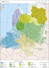
Here you have the locations of Poland, Lithuania, Ruthenia, and the Baltic region. Some issues that have already been reported by our Polish coworkers are the inconsistencies in the location naming in Polish (we’ll use proper Polish letters more thoroughly), and we’ve also started to review both the Polish and Baltic locations based on the early feedback you gave us. Oh, also, the Vistula and Curonian Lagoons missing is a bug, we’ll properly re-add them while doing the map review.
Provinces

Any suggestions for provincial naming are pretty welcome, as in the last DD!
Terrain


Cultures

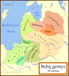
The Baltic lands have an interesting mix of different cultures. ‘Western Baltic’ culture represents the people speaking a West Baltic language (Old Prussians, Yotvingians, Curonians, etc.), while ‘Prussian’ is the culture of the German settlers of that area; on that style, we have a ‘Baltic German’ culture in the lands of Livonia and Estonia that also got settled by German-speaking people. The divide between Polish, Ruthenian, and Aukstaitian might be too deep, so we will most likely add a bit more mixed situation in the borders between these cultures.
Religions

A region with a more interesting religious setup! Apart from the Catholic-Orthodox divide, you can also see the Romuva religion, which was a hot topic in 1337 (shall the Dukes of Lithuania convert to Catholicism, or stay Pagan?). Red stripes to the north are other Animist populations. Also, disregard the Sunni region to the southeast, as we have to review all the pops of the Pontic Steppes, as well.
Raw Goods

From the distribution of the materials, maybe a couple of things might catch your eye. The first is that there’s an Amber good present on the shores of the Baltic Sea. The second is that the Tatra Mountains, in Slovakia, have a bunch of precious metals, which makes them a very interesting area to exploit and develop.
Population


The population of the region is divided into country and location views. Two notes: The total population of Estonia is not 711K people, that’s the total for its owner, Denmark. Second, we’ve read your feedback regarding the population map mode, and we’ll take a look at how to improve the visualization of the data, making it better for you.
EDIT: Markets

And that’s all for today! The region that we'll show next week is Italy! Cheers!
This week we are showing you Poland, Lithuania, Ruthenia, and the Baltic region. Let’s check it with no further ado:
Countries
A bigger picture of what’s going on in this region today, as we hadn’t shown it entirely before. To the west, the Kingdom of Poland is ruled by Casimir III of the House of Piast. It is not a completely unified kingdom, as there are several powerful vassals under him, most of them also Piasts themselves.
To the east, the Duchy of Lithuania is ruled by Gediminas, who has greatly expanded the influence of the country into Russian lands (side note: Gediminas entitled himself in his diplomatic correspondence ‘king’, but was considered by the Pope ‘king or duke’, and the title of Grand Duke wouldn’t be formally adopted until later [most likely replicating the Russian title ‘Grand Prince’]. That’s why Lithuania starts as a Duchy, although it will have an event that would make it possible to adopt the dynamic country name of ‘Grand Duchy’).
To the south, the principalities of Kyiv and Galicia-Volhynia have recently fallen under foreign influence, the first ruled by Theodor, brother of Gediminas of Lithuania; and the second by Yuri II, also from the Piast dynasty.
To the north, the Teutonic and Livonian Orders, which conquered the lands of Prussia and Livonia a century ago, are at war against Poland and Lithuania, after a long-established rivalry.
Also, a side note: we will talk about Moldavia in the Tinto Maps devoted to the Carpathian region, as it’s currently in a ‘placeholder’ spot.
A new map mode, the Diplomatic one! The game starts with an ongoing war between Poland, Lithuania, and their respective vassals, on one side, and the Teutonic and Livonian Orders, and Bohemia and its vassals, on the other.
Locations
Here you have the locations of Poland, Lithuania, Ruthenia, and the Baltic region. Some issues that have already been reported by our Polish coworkers are the inconsistencies in the location naming in Polish (we’ll use proper Polish letters more thoroughly), and we’ve also started to review both the Polish and Baltic locations based on the early feedback you gave us. Oh, also, the Vistula and Curonian Lagoons missing is a bug, we’ll properly re-add them while doing the map review.
Provinces
Any suggestions for provincial naming are pretty welcome, as in the last DD!
Terrain
Cultures
The Baltic lands have an interesting mix of different cultures. ‘Western Baltic’ culture represents the people speaking a West Baltic language (Old Prussians, Yotvingians, Curonians, etc.), while ‘Prussian’ is the culture of the German settlers of that area; on that style, we have a ‘Baltic German’ culture in the lands of Livonia and Estonia that also got settled by German-speaking people. The divide between Polish, Ruthenian, and Aukstaitian might be too deep, so we will most likely add a bit more mixed situation in the borders between these cultures.
Religions
A region with a more interesting religious setup! Apart from the Catholic-Orthodox divide, you can also see the Romuva religion, which was a hot topic in 1337 (shall the Dukes of Lithuania convert to Catholicism, or stay Pagan?). Red stripes to the north are other Animist populations. Also, disregard the Sunni region to the southeast, as we have to review all the pops of the Pontic Steppes, as well.
Raw Goods
From the distribution of the materials, maybe a couple of things might catch your eye. The first is that there’s an Amber good present on the shores of the Baltic Sea. The second is that the Tatra Mountains, in Slovakia, have a bunch of precious metals, which makes them a very interesting area to exploit and develop.
Population
The population of the region is divided into country and location views. Two notes: The total population of Estonia is not 711K people, that’s the total for its owner, Denmark. Second, we’ve read your feedback regarding the population map mode, and we’ll take a look at how to improve the visualization of the data, making it better for you.
EDIT: Markets
And that’s all for today! The region that we'll show next week is Italy! Cheers!