• We have updated our Community Code of Conduct. Please read through the new rules for the forum that are an integral part of Paradox Interactive’s User Agreement.

Tinto Maps #12 - 26th of July 2024 - Germany

Hello, and welcome to another new Tinto Maps! I’m back to duty, after the review of Italy that we posted last Thursday, and Johan taking care of Scandinavia last Friday. Today we will be taking a look at Germany! This region comprises the modern territories of Czechia, Austria, Switzerland, and Liechtenstein. However, for most of the timeline in Project Caesar, it was better known as the Holy Roman Empire. This organization once was a feudal empire elevated from the Kingdom of the Germans, but by 1337 was mostly disaggregated into a multitude of temporal and ecclesiastical jurisdictions, with only a tenuous feudal relationship with their Emperor.

Let’s start diving deep into this nightmare, then…

Countries:
Countries.png

I’m showing here a bit more of what the region is, so you can have a clear depiction of how it looks compared to the neighboring regions we’ve previously shown (and so that the Reddit guy who is patchworking the world map has an easier day ). What I can say about this when the map speaks for itself… The lands of Germany are highly fractured among different principalities, making for an extremely complex political situation. The Emperor in 1337 was Louis IV von Wittelsbach of Upper Bavaria… Because, yes, Bavaria is also divided. He is married to Margaret of Avesnes, daughter of Count William of Hainaut, Holland, and Zeleand, while his son Louis is the Margrave of Brandenburg. But probably the strongest power of the period is the Kingdom of Bohemia, whose king John also Duke Luxembourg and rules over both lands in a personal union, while also being overlord of the Margraviate of Moravia, ruler by his son Charles, and the Silesian principalities. The third contender probably is the Duchy of Austria, ruled by Albert II von Habsburg. He also rules over some lands in the formed Duchies of Swabia and Carinthia. There are also plenty of medium and small countries all over the region, with very different forms of government, which will probably make this HRE a very replayable experience…

Dynasties:
Dynasties.png

The dynastical map of the HRE gives a nice picture of the situation explained in the previous one. The von Wittelsbach, de Luxembourg (John of Bohemia is considered of French culture, therefore it uses the French toponymic article ‘de’; if he would change to the German culture, then it would be the ‘von Luxembourg’ dynasty), and von Habsburg cover much of the map; you may note that the Wittelsbach rule over five different countries (Upper Bavaria, Lower Bavaria, the Palatinate of the Rhine, and Brandenburg); while the House of Luxembourg also control the Archbishopric of Trier through Balduin, uncle of King John. Other important dynasties, although in a secondary position, are the Welfen, von Mecklenburg, and Gryf, present in multiple countries to the north; the Askanier, who happen to control half of Upper Saxony, while the rest is in the hands of the von Wettin; and the von Görz, who rule over the Duchy of Tirol and the County of Gorizia.

HRE:
HRE.png

We obviously have to repost the HRE IO map again here. The purple stripes mark the imperial territory, while the different types of members use different colors. We currently have these divisions in the IO: the Emperor (1, dark blue), Prince-Electors (4, light blue), Archbishop-Electors (3, medium blue), Free Imperial Cities (23, light green), Imperial Peasant Republics (2, orange), Imperial Prelates (44, white), and Regular Members (280, dark green). So, yeah, that make for a total of 357 countries that are part of the HRE. And before you ask: No, we won’t talk about its mechanics today, that will happen in future Tinto Talks.

Locations:
Locations.png

Locations 2.png

Locations 3.png

Locations 4.png

Locations 5.png
Germany has the highest density of locations in the world, as we wanted to portray the historical fragmentation of the HRE at the most detailed level of any Paradox GSG. There are a couple of things that we are aware of and we want to rework: the location connections (as in some places they are not obvious at all, and we want to make warfare in the HRE not impossible); and the transition between the German locations and those at their east, making it smoother (something that we will be doing in the review of Poland, Hungary and this region [e.g. for Bohemia]). A final comment: if you click on the spoiler button, you may be able to see 4 more detailed maps of the region.

Provinces:
Provinces.png

Map of provinces. As usual, suggestions are welcomed.

Areas:
Areas.png

Areas. We are currently not happy with the area borders (or at least, one of our German content designers isn't, and let me note it while preparing the DD... ;) ), as they reflect more modern areas so we will be looking into an alternative setup for them with your feedback. They also currently use their German names, which will change to English ones to be in line with other areas, as usual.

Terrain:
Climate.png

Topography.png

Vegetation.png

Terrain mapmodes. The region is quite forested, in comparison to other parts of Europe.

Culture:
Cultures.png

Let’s open the Pandora box and take a look at the cultures! The German cultures have come through a couple of reworks, until we’ve found a spot in which we’re kind of happy (or, at least, our German content designers do not complain!). The German cultures are very linguistically related, as we thought that it would be the best starting point for 1337. Please let us know about your thoughts on them.

Religion:
Religion.png

Boring religion map this week, as the region is overwhelmingly Catholic. There are Ashkenazi Jews in a bunch of places (a quick account: they’re present in 204 locations all over Central and Eastern Europe), and you may also see the Waldesians we added in the review of Italy last week.

Raw Materials:
Raw materials.png

Raw materials! Plenty of!

Markets:
Markets.png

The main market centers of the region are Cologne, Lúbeck, and Prague. We have reviewed them a couple of times, and this is the configuration that makes for a good setup historical and gameplay-wise. And you may also see Bruges, which has been reinstated as the main market of the Low Countries, after some tweaks.

Country and Location Population:
Population.png

Population 2.png

Population 3.png

Populations 4.png
The population of the HRE is… Fragmented. In that regard, Bohemia starts in a very strong position, with a strong competitor to its south (Austria) and north (Brandenburg).

And that’s it for today! I hope that we didn’t drive you into madness with this map… Next week we will take to a very different region, the Maghreb! See you then!
 
  • 175Love
  • 119Like
  • 4Haha
  • 4
  • 3
  • 2
Reactions:
View attachment 1169161
Another one of my masterpieces. After working on this the whole day I want to kill myself. Obviously alot left to do, especially the Tier locations are far from done but the freely available information is sparse to say the least.

1: Mainz, Mainz
2: Bingen, Mainz
3: Wiesbaden, Nassau
4: Usingen/Weilburg, Nassau
5: Dillenburg, Nassau
6: Altenkirchen, Sayn
7: Wied, Wied
8: Diez, Diez
9: Katzenellenbogen, Katzenellenbogen
10: Montabaur, Trier
11: Koblenz, Trier
12: ???, Trier
13: Daun, Trier
14: Prüm, Trier (Vassal?)
15: Trier, Trier
16: ???, Trier
17: Veldenz, Veldenz
18: Birkenfeld?, Sponheim
19: Starkenburg?, Sponheim
20: Simmern, Trier
21: Kreuznach, Sponheim
22: Alzey, Palatinate
23: Kaiserslautern, Trier or Bohemia
24: Worms/Leiningen, City of Worms or Bishopric of Worms, Leiningen
25: Mannheim/Neustadt, Palatinate
26: Speyer, City or Bishopric of Speyer
1722237385016.jpeg

A slightly fixed version.

1: Wied, Wied (Westerwald)
2: Montabaur, Trier (Westerwald)
3: Katzenellenbogen, Katzenellenbogen (Mittelrhein)
4: Wiesbaden, Nassau (Rheingau)
5: Bingen, Mainz (Rheingau)
6: Mainz, Mainz (Rheingau)
7: Alzey, Palatinate (???)
8: Kaiserslautern, Trier (???)
9: Leiningen, Leiningen (???)
10: Cochem/Mayen, Trier (Mosel)
11: Koblenz, Trier (Mittelrhein)
12: Wittlich, Trier (Mosel)
13: Trier, Trier (Mosel)
14: Saarburg/Merzig, Trier (Saargau)
15: Schaumburg/Tholey, Lorraine (???)
16: Birkenfeld, Sponheim (Nahegau)
17: Lichtenberg, Veldenz (???)
18: Kirburg/Grumbach, Wildgrafen (Nahegau)
19: Trarbach/Kastellaun/Kirchberg, Sponheim (Mosel/Nahegau)
20: Kreuznach, Sponheim (Nahegau)
21: Simmern, Trier (Mittelrhein)
 
Last edited:
  • 3Like
Reactions:
What's the point of these tiny impassable areas between locations that are connected anyway? It makes no difference for gameplay and just makes the map look weird.
There's only one like that, which I forgot to remove/
Impassable borders only make sense when there are only a small number of mountain passes in a region.

One of the biggest impassable areas you drew is exactly where the famous Goldene Steig salt route passed through:
goldenesteige_map.gif
Thanks for the feedback. But I'd argue that the Bohemian Forest is sufficiently a geographical barrier to be represented as a series of impassable zones. It ought to be represented as more than a line of hills that aren't distinguished from any other hills.
 
  • 2Like
Reactions:
Thanks for the feedback. But I'd argue that the Bohemian Forest is sufficiently a geographical barrier to be represented as a series of impassable zones. It ought to be represented as more than a line of hills that aren't distinguished from any other hills.
Well, there a simple argument I brought up in the Baltics thread: if Bohemia's mountains form such an obvious geographical barrier, why was Bohemia's entire border inhabited by Germans?
In the Alps, you can point to a handful of mountain passes that were historically used for movement of armies, while all other routes were mule tracks that were only used by local traders.
If you can point to the specific passes that were used to cross mountain ranges in Bohemia that were otherwise impassable, I think it would make sense to implement them.
 
  • 5Like
Reactions:
A lot of the German regions appear based on the modern federal states of Germany. "Rhineland-Westphalia" and "Rhineland-Palatinate" immediate stood out to me. Having a "Rhineland" area makes much more sense at this time than dividing it like this, especially when you factor in France's ambitions to conquer it during the Modern Era. "Styria" and "Carinthia" should also extend to the "Slovenia" area which probably shouldn't exist as a clearly defined region at this time.

View attachment 1168079

As stated in the Balkan Tinto Maps, making Moravian a separate culture is sensible, but in such a case "Czech" should be renamed to "Bohemian", the term was used all the time during the game's timeline.
Any reason Bavarian is split between Danube and South? Why not just "Bavarian"? Same with High vs. Rhine Allemanic, "High" is an entirely linguistic term, just name the culture "Allemanic", if you really want them to be separate rename Rhine Allemanic to "Alsatian". I also don't get the point in not just naming "Low Franconian" to "Dutch", are you afraid of offending Dutch-speaking Belgians? It's my understanding that if anything they take more issue with the name "Flemish" since that only refers to one region of the country while "Dutch" is the name of their language.
In general there is an overabundance of these linguistic terms that sound very awkward and modern, but I can't really tell you any other alternatives besides these ones.
I agree with you on this man, some of these cultures just aren't really necessary, they only make the gameplay too difficult for some minor tags, like Brandenburgish and markish which are basically the same, although I wouldn't mind having the Bavarian culture being split in 2 vertically(Bavarian and Austrian) makes more sense from a gameplay perspective even if the languages are the same being politically separated for centuries is what makes these 2 culturese similar but also different to this day, I'm also with you on the Dutch naming thing, it makes more sense to be called low Franconian in 1337 but the game ends in 1836 at a time where the dutch identity is more then well enstablished, Flemish is not even recognized as a proper language by the Belgian government, it's a Dutch dialect(also called Belgian Dutch) it became a thing because of the Flanders never became part of the Dutch republic(and later kingdom) for more than a few years, I think it would be fine if low franconian were to split in Dutch and Flemish after a while though. Regarding the Slovenian thing...considering how small some of these areas are Slovenia could easily be one but it should probably be renamed to Carniola and coincide with the one in the map you posted.
 
  • 3
  • 2Like
Reactions:
Hello everyone,


first of all, thank you very much for the beautiful map! Nevertheless, I think that some areas are not depicted correctly and should be edited. I have posted two maps (the first is Tinto's map and the second is the map of the Duchy of Saxony in the year 1000). I assume that you used this map as a basis for the creation of Provinces. (Derlingau, Bardengau, Harzgau etc.) In itself this is not completely wrong, but we are talking about the year 1337, which is 337 years later than the map of Saxony shows. A lot has happened in the region in these 300 years, so the basic Provences division is no longer correct.
I live in Braunschweig. Almost nobody knows the term Derlingau (where Braunschweig belongs according to the Tinto Map). This has to do with the development of Braunschweig in the time of Henry the Lion, Otto IV (Emperor in HRR) and Otto the Child (founder of the Duchy of Braunschweig-Lüneburg in 1235). In 1000 Braunschweig (or the three villages of Altewiek, Sack) is a village. After the death of Henry the Lion, Brunswick is the center of the region alongside Magdeburg. There is no longer any mention of Derlingau, but of the Braunschweigische Land.


1722244117619.png

1722244129424.png


Wolfenbüttel is more connected to Braunschweig than e.g. Gifhorn, so I would add Wolfenbüttel to Province of Braunschweig. You can even talk about Wolfenbüttel being a “little Brunswick” for the Dukes of Brunswick-Wolfenbüttel, because they moved their residence to Wolfenbüttel.


I also made a few suggestions as to how the regions should be divided:
1. province Braunschweig (capital in Braunschweig)
2. province Goslar/Hildesheim (capital in Goslar/Hildesheim)
3. province Hannover (capital in Hannover)
4. province Lüneburg (capital in Lüneburg).
5th Province Celle (capital in Celle)
6th Province Göttingen (capital in Göttingen)

Apart from the 2nd Province, all the other 5 core provinces were part of the Duchy of Brunswick-Lüneburg (see map next to it). The division proposed by me corresponds to the map showing the territorial unit of the Duchy of Brunswick-Lüneburg. I hope that this will somehow be represented in the game (event or something similar).

1722247480497.png
1722247287803.png


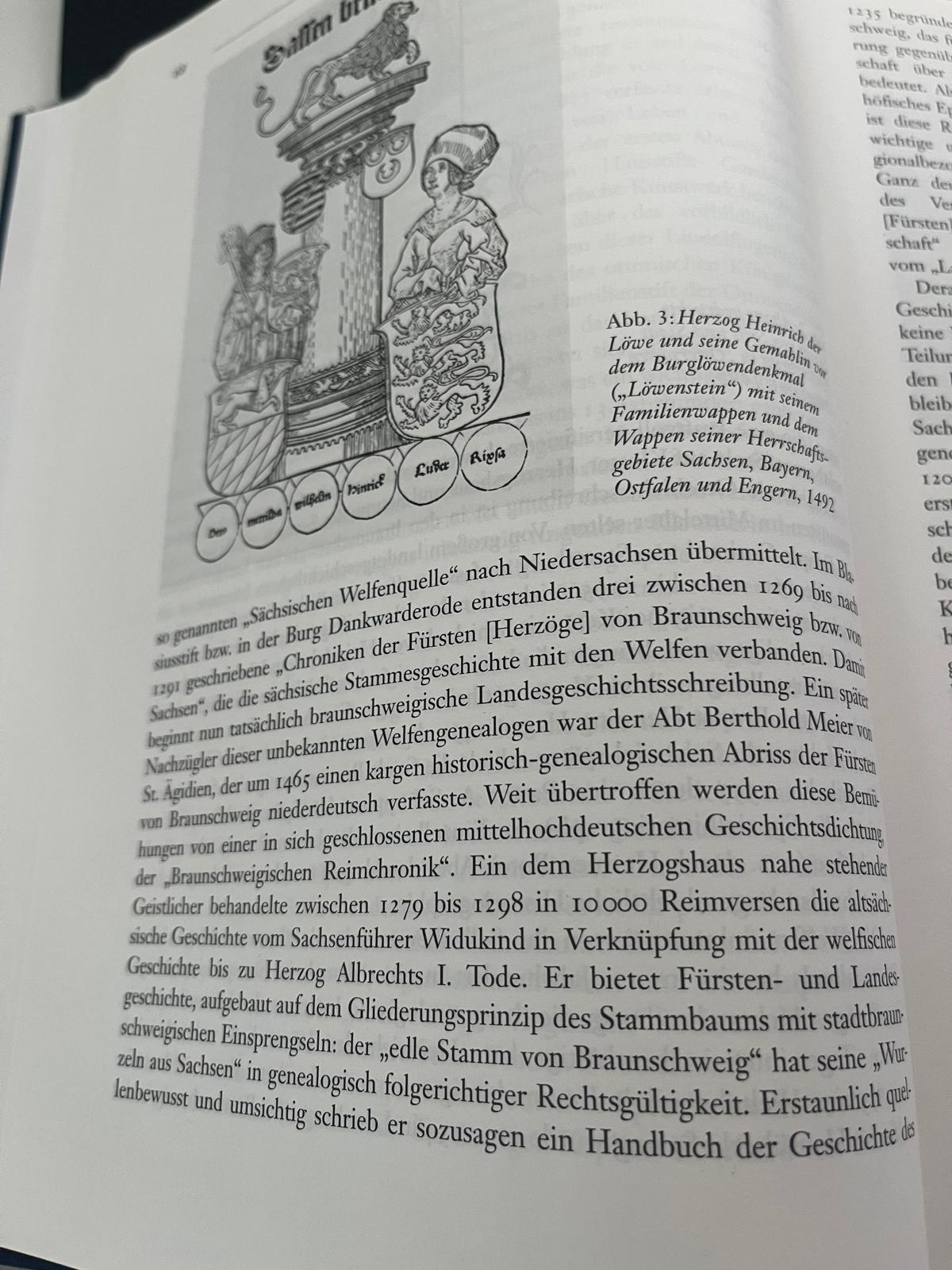
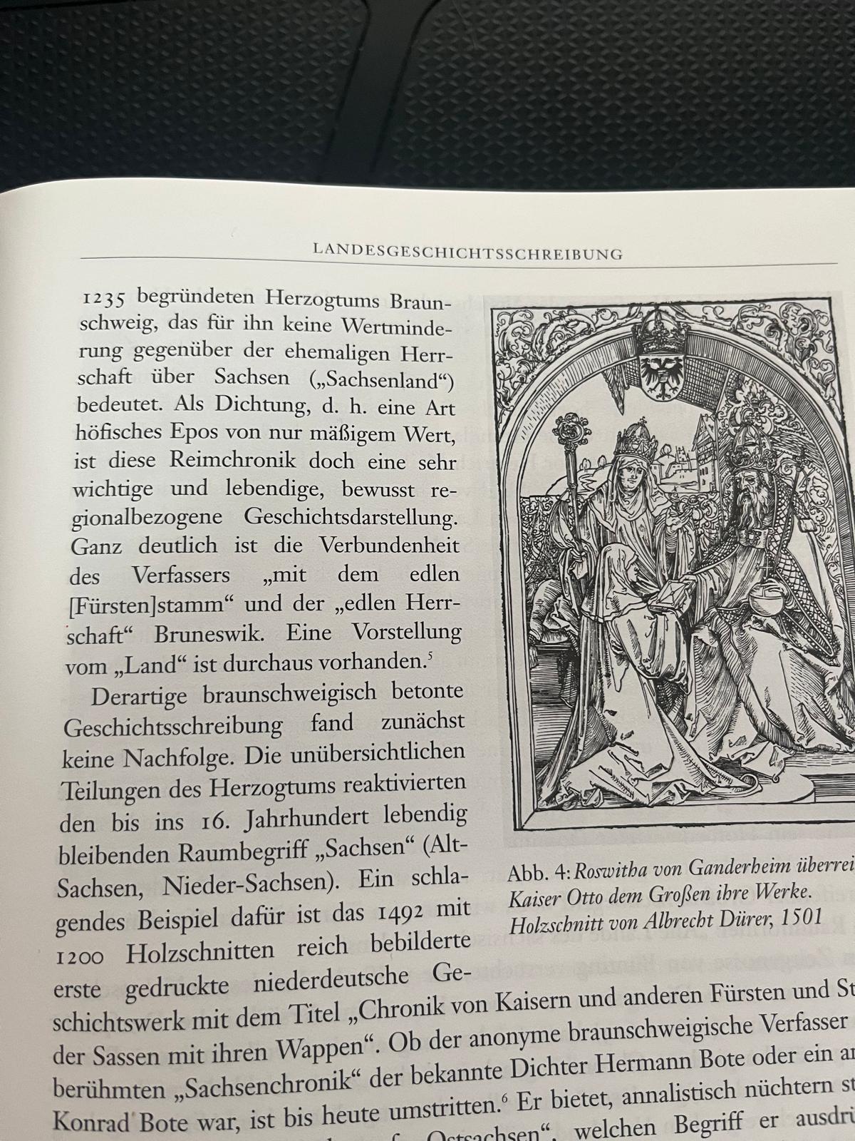
The fact that the connection between Braunschweig-Lüneburg was important for the region is shown by the names of the counties/duchies in the future: the Kurfürstentum Braunschweig-Lüneburg (created from the Principality of Calenberg in 1692) retained the name of BS-Lüneburg although the city of Braunschweig belonged to the Duchy of Braunschweig-Wolfenbüttel. After 1235 no one will speak of the county of Bardengau, but of the county of Lüneburg. No one speaks of Derlingauer Land, but of Braunschweiger Land (see the picture with the text below - from “Braunschweigische Landesgeschichte”, text by Dieter Lent). Here are a few works that prove that the reference is to Braunschweigische Land:
1. “Sächsiche Welfenquelle” (1194 by Henry the Lion)
2. “Chroniken der Fürsten von Braunschweig bzw. Sachsen” (1269 Blasiustift) - with this work the history of Brunswick actually begins. Nowhere else is there any mention of
3rd “Braunschweigische Remchronik” (1279-1298) describes the times from Widukind to Duke Albrecht I. According to Dieter Lent, the land is described as Braunschweig and in no other way.

These are works from the 13th century. The game is supposed to start 150 years later. The term Braunschweigische Land has long been established.


1722248728204.jpeg


1722248592745.jpeg


Areas

I also have something to say about Areas

Although this map (see below) is from the year 1512 and shows Maximilian's reforms, I would still be very much guided by what is shown here.


I don't get along with the term Saxony, where the federal state of Saxony is located today. Historically, today's Lower Saxony was the “real” Saxony (see the las Map). After Henry the Lion refused the help of Frederick I Barbarosa in his campaigns in Italy, the Duchy of Saxony was divided into three parts. The new Duke of Saxony took the eastern part of the duchy. After the Duchy of Brunswick-Lüneburg was founded by Otto the Child in 1235, the new Dukes of Saxony no longer had a territory in the former Duchy of Saxony.

I would make an analogy to the reform of Maximilian I: Lower Saxony (Duchy of Brunswick-Lünebug and the other territories) and Upper Saxony, for the territory that is shown as Saxony on your map.

1722249446739.png

1722249838768.png
 

Attachments

  • 1722246819960.png
    1722246819960.png
    389,7 KB · Views: 0
  • 1722245747862.jpeg
    1722245747862.jpeg
    288,1 KB · Views: 0
  • 5Like
  • 1
  • 1
Reactions:
Well, there a simple argument I brought up in the Baltics thread: if Bohemia's mountains form such an obvious geographical barrier, why was Bohemia's entire border inhabited by Germans?
In the Alps, you can point to a handful of mountain passes that were historically used for movement of armies, while all other routes were mule tracks that were only used by local traders.
If you can point to the specific passes that were used to cross mountain ranges in Bohemia that were otherwise impassable, I think it would make sense to implement them.
If the Lands of the Bohemian Crown are to have at least some impassable terrain it should be in Moravia. There were only 2 routes which were used by Hungarian armies to invade Moravia:
1) The southern route along the Danube and Morava rivers.
2) the Uherský Brod(Hungarian ford) Uherské Hradiště(Hungarian castle) route.

The same routes were also used by the Czech armies to invade Hungary.
Blue - impassable terrain
1722252631291.png
 
  • 5Like
Reactions:
Absolutely hyped!
A few things I noticed: Hamburg looks way too big. It looks like you somewhat went with the modern borders, which are the result of the 1937 Greater Hamburg Acts, where Hamburg received a few surrounding towns from the Prussian province of Schleswig-Holstein (most notably including Altona, the biggest city in SH at the time). As this happened relatively recently, the game should probably reflect the pre-1937 borders. Since Hamburg seems to be one of the bigger locations, shrinking it a little shouldn't be too dramatic of a change.

Is the tag in Eutin separate from Lübeck? Or are there two Lübecks?

Also, is "Brema" supposed to be Bremen?
1. Noted your input about Hamburg.
2. They're two different tags: Eutin belongs to the 'Bishopric of Lubeca', and Lübeck to the 'Free City of Lübeck'.
3. It's the 'Bishopric of Brema', which is different to the 'Free City of Bremen'.

I think I may give a longer explanation about the last two. We noticed after some time that we had an issue with some German tags: they were named the same, and only their government type differentiated them. Thus, the 'Bishopric of Lübeck' and the 'Free City of Lübeck', etc. The problem that it caused was that if for any gameplay reason, those two countries would become of the same type (let's say, monarchies), they could be named the same exact way in the UI; e.g., 'County of Lübeck' for both tags (which 'under the hood of the script', would be two different: LUB and LBB). One of our QAs came up with a kind of elegant solution to be able to keep all those 'duplicated tags', as it was kind of important to portray correctly the HRE: Why not rename the bishoprics to their Latin version, which was, after all, the 'official name' for the Church? Therefore, we have Bishoprics such as Lubeca, Brema, Riga Lettoniae, Augusta Vindelicorum, etc.

*This is something that only happens in the German world, as the collapse of the HRE as a functional state after the fall of the Hohenstaufen dynasty and the Great Interregnum led to the patchwork of jurisdictions that the HRE is in 1337, with the city council and the bishopric of a certain location having jurisdiction over different places; in the rest of Western Europe this usually doesn't happen (I'm tempted to say 'this doesn't happen at all', but it may be an obscure example here and there, so let's use a safer wording...), as either the city or the bishopric have won the 'jurisdictional race' over the other (as in, let's say, Italy), or they have a sovereign over them applying his own royal jurisdiction over their own lordly jurisdiction (as in France, England, the Iberian kingdoms, etc.).
 
  • 38Like
  • 10Love
  • 5
  • 3
Reactions:
isn't the black plague an IO as well?

also, don't temporary IO prop up from crusades / coalitions / etc etc?

also also, can't IO be a diplomatic version to form a country / federation? (like forming Northern and Southern Germany, Westphalia, so on so forth with a lot of other formables)

what about the Hansa? How will it be portrayed? A total unique different system? If I play eg as Lübeck and I manage to centralize the Hansa enough, do I get to form my own IO?

Like, the cool thing about IOs when they were first announced was that a country could have been in multiple of them at the same time, thus being a very powerful instrument to represent all the tomfoolery in this historical time. Will we see them just... being used less now? Or will many many IOs eventually prop out as the game progresses?
The Black Death is a Situation that spreads an epidemic disease called 'bubonic plague' through to different locations, nothing related to an IO.

There are temporary IOs such as crusades and coalitions. Those types of IOs are dynamic, so they appear as the game progresses; I was just referring to unique IOs scripted at the game start.

PS: Correction to myself... PUs are also IOs; so there are plenty of those at the start of the game, as well (I already mentioned in the TT the one between Bohemia and Luxembourg, for instance).
 
  • 17Like
  • 5
  • 1Love
Reactions:
What's the Leeuwardenstra dynasty in the Frisian Freedom? The name comes up with 0 results on google so feels odd if its just a fake dynastic name anyways, but is there a way to make the Frisian Freedom not have a dynasty since yeah, no nobility like that. A bunch of other states there seem to be lacking dynasties, is that just from not having put anything there yet or is that intentional?
A random dynasty, as we need to have a ruler for each tag of the game, which, in this case, is a 'Potestaat'.
 
  • 10Like
  • 2
Reactions:
I’m happy that modern-day Germany has been mapped in such detail, but the contrast in location and particularly province density with Bohemia is a little jarring. The difference versus Hungarian locations is even more severe.

It makes sense for the fragmented Germany areas to be denser, but would it be possible for locations be added/shuffled around at least smooth the transition to create a more visually appealing map?
It will be one of the objectives of the review of this region, yes.
 
  • 30Like
  • 1Love
Reactions:
1. Noted your input about Hamburg.
2. They're two different tags: Eutin belongs to the 'Bishopric of Lubeca', and Lübeck to the 'Free City of Lübeck'.
3. It's the 'Bishopric of Brema', which is different to the 'Free City of Bremen'.

I think I may give a longer explanation about the last two. We noticed after some time that we had an issue with some German tags: they were named the same, and only their government type differentiated them. Thus, the 'Bishopric of Lübeck' and the 'Free City of Lübeck', etc. The problem that it caused was that if for any gameplay reason, those two countries would become of the same type (let's say, monarchies), they could be named the same exact way in the UI; e.g., 'County of Lübeck' for both tags (which 'under the hood of the script', would be two different: LUB and LBB). One of our QAs came up with a kind of elegant solution to be able to keep all those 'duplicated tags', as it was kind of important to portray correctly the HRE: Why not rename the bishoprics to their Latin version, which was, after all, the 'official name' for the Church? Therefore, we have Bishoprics such as Lubeca, Brema, Riga Lettoniae, Augusta Vindelicorum, etc.

*This is something that only happens in the German world, as the collapse of the HRE as a functional state after the fall of the Hohenstaufen dynasty and the Great Interregnum led to the patchwork of jurisdictions that the HRE is in 1337, with the city council and the bishopric of a certain location having jurisdiction over different places; in the rest of Western Europe this usually doesn't happen (I'm tempted to say 'this doesn't happen at all', but it may be an obscure example here and there, so let's use a safer wording...), as either the city or the bishopric have won the 'jurisdictional race' over the other (as in, let's say, Italy), or they have a sovereign over them applying his own royal jurisdiction over their own lordly jurisdiction (as in France, England, the Iberian kingdoms, etc.).
Hey, since you're around, have you noted that there are two locations named Baden? One in Ortenau and one in Vienna.
 
  • 1Like
Reactions:
Why is Hainaut Picardian and not of Wallonian culture? The two cultures are very similar and they are in the Wallonia area, I think it makes more sense for them to be Wallonian
 
  • 1Like
Reactions:
Areas. We are currently not happy with the area borders (or at least, one of our German content designers isn't, and let me note it while preparing the DD... ;) ), as they reflect more modern areas so we will be looking into an alternative setup for them with your feedback.

Here is my proposal for the area maps. I based them on Reichskreise with some liberties. Dots symbolize other possibilities that I can see as possible. The second image is bad because of the projection.

try1.png
try2.png


try1.png
try2.png

Here @Karpi_ proposed to edit the division of the Electoral circle locations and follow the river in Saxon areas

1722264981977.png
1722264992203.png


1722264981977.png

1722264992203.png
 
Last edited:
  • 9Like
Reactions:
It still doesn't make sense to call it Baden, as that's a name it only ended up with because Baden managed to stay on top. If you want to split Swabia in general and not use geographical terms, then 'Rhenish Swabia' and '(Central) Swabia' would make the most sense for the whole time period. You could also just call it 'Schwarzwald' and 'Swabia' if you reshuffle the territories.
I agree, "Baden" wasn't a good call on my end.
It would be better to either follow a Reichskreis- ("Westschwaben" / "Ostschwaben") or a Language-based ("Alemannien" / "Schwaben") approach.

Still, the main point I wanna make is that in terms of the actual territorial boundaries, the western of the two areas making up that Swabian region should follow the geographical and linguistic borders we see in real life, meaning that (in the north) it should be confined to the western side of the Schwarzwald, following the flow of the Rhine down to the Bodensee, corresponding to the areas where the Alemannic varieties of Upper German are being spoken (which is roughly what my draft showed).
Alemannic-Dialects-Map-German.svg.png
Schwarzwald_-_Deutsche_Mittelgebirge,_Serie_A-de.png
 
  • 1
  • 1Like
Reactions:
I feel like the Bohemian massif should be more isolated of a geographical area than it is. This is a rough proposal for some impassable regions I think could be added. These areas are meant to represent places that are outside of main communication routes in and out of the region and probably wouldn't be traversed by an army, not that they're uninhabitable or can't be walked through. I'd appreciate feedback on whether people think these make sense.

View attachment 1169286

These maps were used as inspiration

View attachment 1169262

View attachment 1169261
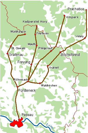
So I took a look at the mountain ridges around Bohemia. When I considered only the areas where there are high mountains (~1000m+ above sea level) and where there are presently no road connections, I was only left with two significant areas:
PC-Bohemian-mountains-2.png

One in the north, between the town of Harrachov and the mountain Sněžka, which doesn't even split any locations. The other one is in the southwest between the mountains of Plesná and Černá hora; this one would split the locations of Regen and Prácheň (and with the proposed changes Prácheň and Grafenau).
The mountains would end just west of the connection between Finsterau and Kašperské Hory.
 
  • 2
Reactions:
Here is my proposal for the area maps. I based them on Reichskreise with some liberties. Dots symbolize other possibilities that I can see as possible. The second image is bad because of the projection.

View attachment 1169390View attachment 1169391


Altmark can be added to Niedersächsisch regions, but I think it can anger a lot of people
Using the imperial circles as areas? That's a cool idea!
 
  • 5Like
Reactions: