• We have updated our Community Code of Conduct. Please read through the new rules for the forum that are an integral part of Paradox Interactive’s User Agreement.

Tinto Maps #20 - 27th of September 2024 - The Steppes

Hello, and welcome one more week to the weekly encounter for map lovers! This week it’s also directed at horse lovers because we will be looking at the Eurasian Steppes, plus the Urals! So let’s start with the maps without further ado.

Countries:
Countries.jpg

Colored Wastelands.jpg

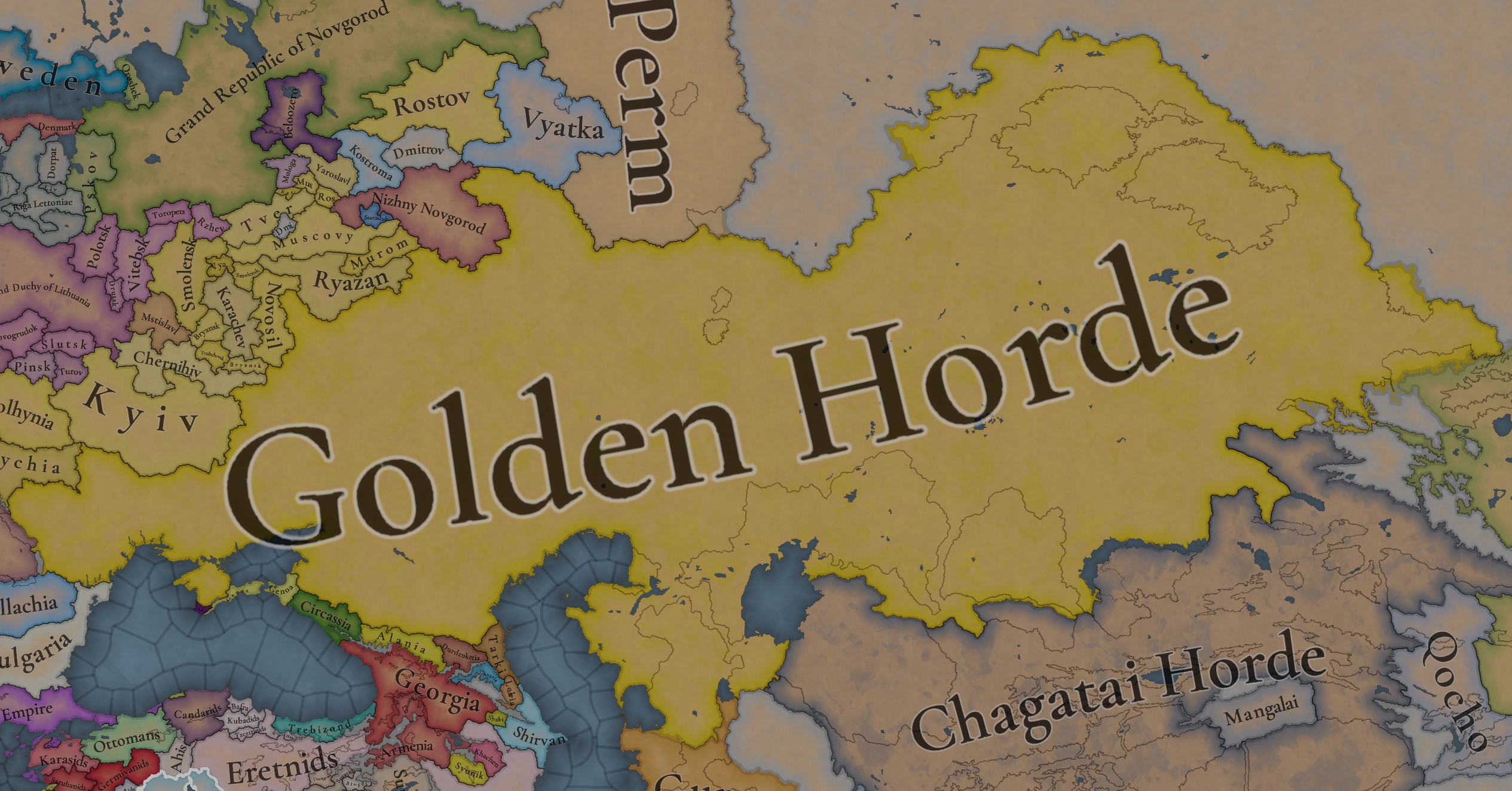
A glorious, Golden Horde! It is at its power peak, under the reign of Uzbeg Khan, so it's a much more menacing presence for its neighbors. However, it has its some internal issues that need to be managed, as you’ll notice in some of the maps, and in the future when we talk about the content for Hordes. The Golden Horde also heads its own IO, the Tatar Yoke, as shown in a previous Tinto Maps:

Tatar Yoke.jpg

We have already corrected the Ruthenian countries that are under the Horde’s Yoke, although we still have to correct the Russian principalities, which will be done in the corresponding Tinto Maps review. We’re also aware that we need to improve a bit the coloring of the IO, to mark not only the Golden Horde as the overlord of these countries, but also that Muscovy holds the title of the Grand Principality of Vladimir, which makes it the ‘enforcer’ of the Yoke. These fixes are also planned to be done in a few weeks.

Societies of Pops:
Societies of Pops.jpg

Societies of Pops 2.jpg .jpg

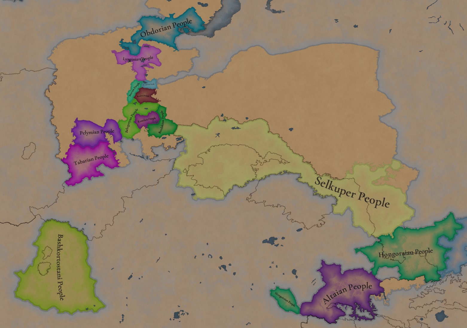
A bit up to the north, we have some Societies of Pops! This means that the territory of Western Siberia won’t be empty land, but will be populated by these people, which can be interacted with.

BTW, I’m not showing this week a dynasty map because, well, only the Borgijin dynasty rules over the lands of the Golden Horde, of course!


Locations:
Locations.jpg

Locations Western Siberia.jpg

Locations 3.jpg

Locations 4.jpg

Locations 5.jpg

Tons of locations today… You might notice that the density location is in a progression from west to east, from the most densely settled areas to the less settled ones. You may also notice that we’ve followed a design of ‘settler corridors’ in Western Siberia, setting those parts of the land that were habitable, usually on river valleys.

Provinces:
Provinces.jpg

Provinces 2.jpg


Areas:
Areas.jpg


Terrain:
Climate.jpg

Topography.jpg

Vegetation.jpg

The terrain is interesting here, as there are two main ecological areas. The first is the Steppes, Flatlands with Sparse and Grasslands vegetation, with either Cold Arid or Continental climates. And then we have the Siberian Arctics Forests, which are completely different, of course. On a note, the Urals were set as Hills, as they’re a quite settleable area, but we’ll probably make a review with your feedback, and add some mountains there.

Development:
Development.jpg

The whole region is not very developed, you might notice the difference with India, from last week’s Tinto Maps.

Harbors:
Harbors.jpg

There are some harbors in the Steppe region… In the Black Sea and Caspian Sea, of course! As usual, we’re open to feedback on this matter.

Cultures:
Cultures.jpg

Plenty of cultures! One note: Although we planned to work on the religious and cultural minorities of the region during the summer, we ended up not having enough time to add them. So what we’ll be doing today is showing the rough outline of ‘cultural spheres’, and then we’ll add the minorities during the review of the region. In that sense, feedback is very well received.

With that said the only note that needs to be made in terms of the cultural design is that we divided the Tatar cultural group into some differentiated regional cultures, being Crimean, Mishary, Kazani, and Astrakhani. We’re also aware that some of the cultures, as Mari and Chuvash, might be a bit displaced, as noted in the Russian Tinto Maps, so we’ll review and correct that with your feedback.


Religions:
Religions.jpg

Regarding Religions, the matter is a bit worse, as the big Sunni blob is just because the main religion of the Golden Horde is Islam, after the conversion of Uzbeg Khan, but that’s obviously incorrect. Also, as we have been able to forecast development time on how Pagan divisions will be during this autumn, we will make a comprehensive review of the region as well, to get a good distribution of ‘Shamanist’ Paganism, Tengrism, and Sunni Islam.

Raw Materials:
Raw Materials.jpg

Raw Materials 2.jpg

Raw Materials 3.jpg

Regarding the raw materials, the Steppes have plenty of Livestock and Horses, quite logically, although there are regions with some other goods. And up to the north, the main materials are Lumber and Fur. Apart from that, I want to mention the mineral hub in the Ural Mountains, with plenty of Copper, Iron, Gold, Lead, and Coal. That makes it a very mid and late-game interesting spot, and playing as Muscovy/Russia, I’ll tell you that you definitely want to expand into that region, as it will fulfill some of your material needs by that time.

Markets:
Markets.jpg

Markets! Big region, with lots of markets, although you may noticed that we changed the coloring of the locations that have 0% market access, which is the case in several areas. In any case, the market centers are Kaffa, Astrakhan, Saray-Jük, Kunya Urgench, Samarkand, Almaty, and Chimgi Tura. BTW, these names are much easier to notice in the game’s UI, as they’re beside the market centers:

Markets 2.jpg


Population:
Population.jpg

This week we’re showing only the country population mapmode, as there are some location numbers here and there which are failing, due to the already known issue with our pop editor (and which are on the way to be fixed). In any case, the whole population of the region is around 6.5-7M, of which around 6.3M are part of the Golden Horde. As I said, it’s a menacing country…

And that’s all for today! This is going to be my last Tinto Maps in a while, as I’ll be on vacation for 3 weeks during October (you might have noticed that I didn’t have any during summer), so one of the Content Designers in the team, @Roger Corominas , will step in and be in charge of the next 4 Tinto Maps. It’s in good hands, as Roger is an Experienced CD, who has been working and focused on Project Caesar for more than 3 years, at this point (this is why you might not know him from EU4, as other CDs in our team). In any case, he will be starting with the regions of Xinjiang, mostly ruled by the Chagatai Khanate, and Tibet.

I’ll keep reading and answering you during next week, and then I’ll be back in a month from now. See you!
 
  • 145Like
  • 48Love
  • 4
  • 3
  • 1Haha
Reactions:
svGQXJN1KS0.jpg


I found this map from 1263 on the Internet. The map is very far from the historical one, many uluses have been moved to neighboring places, and a couple of them are very far from their intended locations. The map shows: green - Berke's possessions; light green - Berkechar's possessions (Berke's brother); dark green - Tuka-Timur's possessions; blue - possessions of Orda-Ezhen's descendants (Kudaku in Orda-Yezhen's ulus and Abadzhi in Kuremsa ulus); red - possessions of Batuids led by Mengu-Timur. Orange - the possessions of the Buvalids, led by Mingqadar (son of Buval); turquoise - Tokuz-ogul (in the Mautsi ulus); The gray one belongs to the Shibanids (rulers: Kadak, Bainal, Akhadai-bahadur, Kutluk-Timur, Tama-Tokta, Bahadur); the rest belong to the sons of Jochi (rulers: Chimpai, Singkum, Shiramun, Karachar).

There are 13 uluses on this map in the territory I am exploring. The map does not show Burundai-noion (the son of a Burundai) in the Burundai ulus. Mankerman ulus should belong to one of Tuk-Timur's sons. We also know that before Taibugin, Ishima was ruled by 15 or 16 local rulers. Shiban ulus and Yangikent will be separated in the future. In the first half of the 14th century, the Korel and Desht-i-Kipchak ulus (Uzbek ulus in some sources) appeared. Therefore, 19 of the 19 uluses should exist in the studied area in 1340. At the moment, the question is not about their existence, but who ruled them, what they were called, and what their boundaries were.

"Zher su" is a bit of a separate story. I found it not as a ulus, but as a possession. I was looking for him purposefully, because he is fundamental for the future Kazakh statehood. I do not know to what extent it was embedded in the structure of the Golden Horde. All I know is that Urus Khan ruled this domain after his defeat to Tokhtamysh.
 
Last edited:
  • 1
Reactions:
View attachment 1260084

I found this map from 1263 on the Internet. The map is very far from the historical one, many uluses have been moved to neighboring places, and a couple of them are very far from their intended locations. Therefore, 19 of the 19 uluses should exist in the studied area in 1340.
Um, no. Therefore, the map is totally useless for Project Caesar because it's very far from the historical one.
 
  • 1
Reactions:
Um, no. Therefore, the map is totally useless for Project Caesar because it's very far from the historical one.
Yes, I literally wrote about it. This map is needed to make it easier to find the rulers of the uluses. Because uluses are mostly inherited. The Jochid uluses under Uzbek Khan was taken away from them and transferred to some other rulers.
 
It is not needed because it's ahistorical. You literally wrote that.
Only their location is unhistorical (because the rulers and uluses are described in sources around certain centers of settlement that we know about). The uluses did not change their borders, as evidenced by the data on the genetic diversity of the population. By conducting a comparative analysis of data from all time periods, we can determine the location of all the uluses and their rulers by year. I can't handle such a huge amount of work alone yet.
 
  • 2
Reactions:
Here's the current state of my feedback.
1741112849939.png

At first I attempted to categorize the stone kurgans geographically, but they seem pretty intermixed. So I ended up with a Mongol/Naiman/Kerait split. Argyns are there to break up the Kipchaks a little and they seem to have been there already, but anyone more knowledgeable may correct me on that. The Cuman Kipchak border goes on the Ural river which is pretty much the clearest delineation among the Cuman-Kipchaks at least during the pre-Mongol period. Kangly are Kangly and I made a suggestion on the Karluks in the Chagatai thread. Khwarezm I don't know so much about, perhaps it still had it's own identity at this time. Oghuz could be Turkmen at this time already.

1741113247988.png

1741112957435.png

In the article "Монголы в составе кочевников Улуса Джучи (Золотой Орды): по данным археологии" by V.A. Ivanov et al. 2019 6 types of stone burials are identified by their external characteristics.
1741050643007.png

Type I - a pile of stones over a grave - 7.7%2 (Fig. 2, 1);

Type II - a mound of earth mixed with stone - 26% (Fig. 2, 12);

Type III - round, oval or rectangular stone laying over the grave - 50.2% (Fig. 2, 4.6);

Type IV - stone ring around the grave - 19.3%3 (Fig. 2, 10);

Type V - stone “shell” (earth embankment covered with a layer of stone) - 15.9% (Fig. 2, 11);

Type VI - rectangular or oval stone fences - 8.7% (Fig. 2, 8).


1741050763070.png

I found something that may be type II from the preceding Kipchak period from Lisakovsky on the Tobol river, which may indicate that the burial type existed among the Kipchaks.
1741055139388.png


In an identical burial mound exists from this very site from the Golden Horde era as well.

Type VI is an elite Mongol burial, this is the exact same site and it is described as such. And it would make sense considering how much effort was put into them.
1741091353275.png


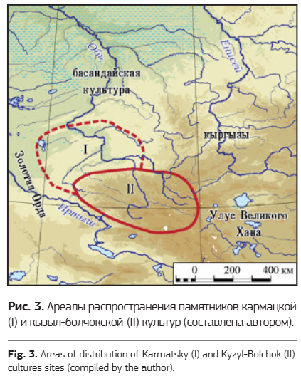
Type I seems to be connected to the Karmatsky and Kyzyl-Bolchok culture burial rite of burying people in birch bark coffins in rock piles. Collectively they used to be classified as Chasovennogorsk type but this didn't catch on due to internal differences it seems.

Type V seems to be connected to the Mongols as it is the type closest to the ones from Tien Shan for example. Type IV might have analogies among the Kimeks and Khakass, although I am not quite sure.
1741078263545.png

1741078378492.png

However this feature may be present among the other types as well.
https://archaeolog.ru/media/2017/vxxi_arch_conf/Tishkin_Gorbunov_Gorbunova_Atlas.pdf Page 106
https://www.academia.edu/40295497/The_Genoese_Gazaria_and_the_Golden_Horde_Vol_2_Генуэзская_Газария_и_Золотая_Орда_Том_2 Page Page 189
The Basandai culture up north didn't bury their dead in stone burials but still featured burying them in birch bark coffins. They're thought of as Turkicized Samoyeds, more specifically it seems to be an intrusion from the Srostki culture of the Kimeks to the local Ryolkin culture during the 10th century.
I think Kyzyl-Bolchok is the culture of the Telengit, Karmatskaya is the culture of the Teleut.

The author of this paper seems to connect burials of type I to the Naimans directly also connecting to the Chasovennogorsk type. One of the burials also seems to be of type III which is the most abundant type.

The Basandai culture might be related to the Eushta Tatars who are said to be Turkicized Samoyeds. This process happened with the migration of Kimek tribes to the area in the 9th to 10th centuries and funnily enough this description perfectly matches the formation of the Basandai culture.

Shandinskaya culture of the Kuznetsk basin seems to correlate best with the Shors

I expanded Khanty eastward to Kargat because the area was inhabited by Kyshtovskaya culture people who were the Ugric ancestors of Baraba Tatars.

The Nurataldy burial ground seems to have been left behind by a mixed community with ground and stone kurgans, and also Muslim burials.

Vyatkaland Russian setup is based on this map.
1741113447802.png


Mordvin and Cuman minorities in Volga Bulgaria are based on this map
1741113706222.png


Miscellaneous sources
Stone Kurgans
https://cyberleninka.ru/article/n/a...k-xiii-veka-v-lesostepnoy-zone-yuzhnogo-urala
Altai

Overall just good reading
 
  • 7
  • 3Like
  • 1
Reactions:
Here's the current state of my feedback.
View attachment 1261189
At first I attempted to categorize the stone kurgans geographically, but they seem pretty intermixed. So I ended up with a Mongol/Naiman/Kerait split. Argyns are there to break up the Kipchaks a little and they seem to have been there already, but anyone more knowledgeable may correct me on that. The Cuman Kipchak border goes on the Ural river which is pretty much the clearest delineation among the Cuman-Kipchaks at least during the pre-Mongol period. Kangly are Kangly and I made a suggestion on the Karluks in the Chagatai thread. Khwarezm I don't know so much about, perhaps it still had it's own identity at this time. Oghuz could be Turkmen at this time already.

View attachment 1261195
View attachment 1261192
In the article "Монголы в составе кочевников Улуса Джучи (Золотой Орды): по данным археологии" by V.A. Ivanov et al. 2019 6 types of stone burials are identified by their external characteristics.
View attachment 1260981


View attachment 1260982
I found something that may be type II from the preceding Kipchak period from Lisakovsky on the Tobol river, which may indicate that the burial type existed among the Kipchaks.
View attachment 1261003

In an identical burial mound exists from this very site from the Golden Horde era as well.

Type VI is an elite Mongol burial, this is the exact same site and it is described as such. And it would make sense considering how much effort was put into them.
View attachment 1261056

Type I seems to be connected to the Karmatsky and Kyzyl-Bolchok culture burial rite of burying people in birch bark coffins in rock piles. Collectively they used to be classified as Chasovennogorsk type but this didn't catch on due to internal differences it seems.

Type V seems to be connected to the Mongols as it is the type closest to the ones from Tien Shan for example. Type IV might have analogies among the Kimeks and Khakass, although I am not quite sure.
View attachment 1261029
View attachment 1261031
However this feature may be present among the other types as well.
https://archaeolog.ru/media/2017/vxxi_arch_conf/Tishkin_Gorbunov_Gorbunova_Atlas.pdf Page 106
https://www.academia.edu/40295497/The_Genoese_Gazaria_and_the_Golden_Horde_Vol_2_Генуэзская_Газария_и_Золотая_Орда_Том_2 Page Page 189
The Basandai culture up north didn't bury their dead in stone burials but still featured burying them in birch bark coffins. They're thought of as Turkicized Samoyeds, more specifically it seems to be an intrusion from the Srostki culture of the Kimeks to the local Ryolkin culture during the 10th century.
I think Kyzyl-Bolchok is the culture of the Telengit, Karmatskaya is the culture of the Teleut.

The author of this paper seems to connect burials of type I to the Naimans directly also connecting to the Chasovennogorsk type. One of the burials also seems to be of type III which is the most abundant type.

The Basandai culture might be related to the Eushta Tatars who are said to be Turkicized Samoyeds. This process happened with the migration of Kimek tribes to the area in the 9th to 10th centuries and funnily enough this description perfectly matches the formation of the Basandai culture.

Shandinskaya culture of the Kuznetsk basin seems to correlate best with the Shors

I expanded Khanty eastward to Kargat because the area was inhabited by Kyshtovskaya culture people who were the Ugric ancestors of Baraba Tatars.

The Nurataldy burial ground seems to have been left behind by a mixed community with ground and stone kurgans, and also Muslim burials.

Vyatkaland Russian setup is based on this map.
View attachment 1261199

Mordvin and Cuman minorities in Volga Bulgaria are based on this map
View attachment 1261201

Miscellaneous sources
Stone Kurgans
https://cyberleninka.ru/article/n/a...k-xiii-veka-v-lesostepnoy-zone-yuzhnogo-urala
Altai

Overall just good reading
Does Bolgar represent Oghuric(Bulgar/Bolgar) speakers or Kipchak speakers? Because modern Muslim tatars on Volga speak Kipchack, and Chuvash is the only Oghuric language.
 
Last edited:
  • 2Like
  • 1
Reactions:
Does Bolgar represent Oghuric(Bulgar/Bolgar) speakers or Kipchak speakers? Because modern Muslim tatars on Volga speak Kipchack, and Chuvash is the only Oghuric language.
The sedentary population would have still been Bulgar speaking at this time, evidenced by Bulgar epigraphy.
 
  • 2
  • 1Like
Reactions:
All this research and in the end I found this map with all the tribes labeled on it which basically agrees with my research anyways and in doing so gives a less ambiguous picture on the ethnic situation.
Great_Steppe_Early_14th_century_Atlas_Ta-1.png

1741307874027.png

Well at least corroboration is good to validate random maps off the internet. And it's not perfect or exact, but still a good guideline at least for the Golden Horde region.


This paper is excellent on the whole issue and I recommend to read it thoroughly if one is truly interested on the ethnic characteristics of the Shiban ulus in particular.

I also found some sources that indicate that Taibuga may have been a Kerait
 
Last edited:
  • 4Like
  • 1Love
  • 1
  • 1
Reactions:
I think this will be my final state of the feedback unless someone else chimes in (and please do, a comprehensive map is helpful for both the discussion and for the devs).
1741313047753.png

Decided to make the Naimans the majority instead of Mongols in the west since Naimans were historically attested as one of the most numerous tribes. They also are a standin for the Kuschi, a tribe with a dubious origin which may or may not have been Mongolic or Turkic. Adjusted the borders in Volga Bulgaria a bit too. Naimans are said to have remained in the Irtysh and they seem to have played a role in the Chagatai khanate too.

Added some Kipchak minorities based on ground burials from this map.
1741313296489.png
1741313311869.png


Jalair seem to have been on the Chu river at this time. Khongirad I am not so sure about, they seem to be more connected with Syr Darya than western Kazakhstan.
 
  • 4Like
  • 2Love
Reactions:
I think this will be my final state of the feedback unless someone else chimes in (and please do, a comprehensive map is helpful for both the discussion and for the devs).
View attachment 1262085
Decided to make the Naimans the majority instead of Mongols in the west since Naimans were historically attested as one of the most numerous tribes. They also are a standin for the Kuschi, a tribe with a dubious origin which may or may not have been Mongolic or Turkic. Adjusted the borders in Volga Bulgaria a bit too. Naimans are said to have remained in the Irtysh and they seem to have played a role in the Chagatai khanate too.

Added some Kipchak minorities based on ground burials from this map.
View attachment 1262087View attachment 1262089

Jalair seem to have been on the Chu river at this time. Khongirad I am not so sure about, they seem to be more connected with Syr Darya than western Kazakhstan.
The only thing I would argue against is representing the Jalairs as a culture, but only because at least within the Chaghatai Ulus, they're their own entire political entity (as detailed in this suggestion map). Creates a bit of an oddity where the Jalairs are two (Jalairs the Chaghatai Ulus and the Jalayirids over in the Ilkhanate) political entities and a culture.
 
  • 1
Reactions:
The only thing I would argue against is representing the Jalairs as a culture, but only because at least within the Chaghatai Ulus, they're their own entire political entity (as detailed in this suggestion map). Creates a bit of an oddity where the Jalairs are two (Jalairs the Chaghatai Ulus and the Jalayirids over in the Ilkhanate) political entities and a culture.
In that case they could be replaced by Mongols perhaps with a Kangly minority as they are also mentioned to have inhabited the Chu river.
 
I think this will be my final state of the feedback unless someone else chimes in (and please do, a comprehensive map is helpful for both the discussion and for the devs).
View attachment 1262085
Decided to make the Naimans the majority instead of Mongols in the west since Naimans were historically attested as one of the most numerous tribes. They also are a standin for the Kuschi, a tribe with a dubious origin which may or may not have been Mongolic or Turkic. Adjusted the borders in Volga Bulgaria a bit too. Naimans are said to have remained in the Irtysh and they seem to have played a role in the Chagatai khanate too.

Added some Kipchak minorities based on ground burials from this map.
View attachment 1262087View attachment 1262089

Jalair seem to have been on the Chu river at this time. Khongirad I am not so sure about, they seem to be more connected with Syr Darya than western Kazakhstan.


In the Mongolia & Manchuria thread, the devs stated that they will keep the different Mongol tribes as one large Mongolian culture, separating only the further out ones, such as Oirat, Tumed, Kharchin, Khorchin, etc.


Out of curiosity I checked Wikipedia again to see if the situation had improved regarding the White Horde versus Blue Horde nonsense.

1741319722355.png

1741319735481.png

It has not.
 
I think this will be my final state of the feedback unless someone else chimes in (and please do, a comprehensive map is helpful for both the discussion and for the devs).
View attachment 1262085
Decided to make the Naimans the majority instead of Mongols in the west since Naimans were historically attested as one of the most numerous tribes. They also are a standin for the Kuschi, a tribe with a dubious origin which may or may not have been Mongolic or Turkic. Adjusted the borders in Volga Bulgaria a bit too. Naimans are said to have remained in the Irtysh and they seem to have played a role in the Chagatai khanate too.

Added some Kipchak minorities based on ground burials from this map.
View attachment 1262087View attachment 1262089

Jalair seem to have been on the Chu river at this time. Khongirad I am not so sure about, they seem to be more connected with Syr Darya than western Kazakhstan.
I would comment on the Russian, Chuvash, Erzya and Mari border. I feel like it should be restructured

I did my feedback on it before
The additions I would like to suggest to the map

Chuvash: indicated by red dots
View attachment 1200641

Lyskovo existed since XII century as a Bulgar(Chuvash) fortress named Sundovit. but in 1410, it was named Lyskovo, so it probably can have a Muscovite minority already.

Erzya:
View attachment 1200642
Alatyr - was created in the place of Mordva (Erzya) people in the 13 century(debatable up to the 15th century). Named after Erzya hydronym Раторлей. Still has Erzya diaspora
Nizhnii Novgorod was built on Erzya village of Obran Osh
Kurmish uezd(contains Alikovo, Sechenovo(should be Tyoply Stan),) had both Erzya and Chuvash people (7%, 25%)
Shatki - in XVI century was Erzya settlements
Arzamas - legends that it was built on Erzya city, has remnants of Erzya hillfort
locations Ardatov and Ardatovo - named after a given name in Erzya.
Insar - Mordva hydronym, still has a lot of Mordva people living
Karsun - Karsunski uezd was 10% Erzya 85% Russian.


Bogdanovo MUST be renaimed Narovchat or Mokhshi! It was an important city in the Golden Horde. But it had and still has Moksha people there

Mishary:
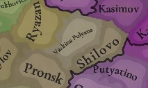
historically formed between rivers Tsna and Moksha (Shilovo, Tambov and Penza locations).

Kadom - was Mishary city! It was captured by conquests of Golden Horde
Ardatov - was a fortress used by the Golden Horde to collect yasak from Erzya people. That's why I think it should be majorly Mishary culture and have somewhat of a population.

Russians:
1728671032918.png

Vaskina Polyana MUST be renamed Isady. This city was founded in the 11th century, it should be present.
Pronsk - also was a Russian city. It was a center of Pronsk principality
Michurinsk should be named Kozlov
Usman - was a city built by settlers from Chernihiv in the 10th century
Kasimov - at that time was called Gorodets Meshersky (Meshera city) Was built before 1152 as a castle. In 1010, the region was converted to Christianity. Was never captured by the Golden Horde.


Final map:
Chuvash - white
Mishary - brown
Erzya - dark red
Moksha - pink

View attachment 1200645View attachment 1201559
Generally, Alatyr to Erzya

And I think Nizhnii Novgorod and Unzha should be Russian culture as they have already become cities
View attachment 1228714View attachment 1228715
Here is my proposal for the cultures of the East.

Let's start from the top to bottom:

I have put Nenets people at the top because the colonisation of those lands by Russians has not yet started.
Mezen city (not where location Mezen is located) was founded in the XVI century.
Locations Nes, Vizhas and Oma are currently populated by Nenets people. 7a on the map

Sloboda Lampozhnya was founded in 1545 by the Slavic population. However, when it was mentioned by Ivan the Terrible it was addressed to the Samoyedic people (Nenets) who lived near Kanin und Timan tundra

View attachment 1228683View attachment 1228684
The lands there are not highly populated even now, with Mezen the only big urban place

Komi-Zyrian
Pinega
The Pinega settlements were first mentioned in the charter, drawn up in Novgorod in 1137 by order of Prince Svyatoslav Olgovich. I think it had time to assimilate into the Novgorodian trade. This location should be a part of Novgorod.
However, the lower part of Mezen and near Pinega river were populated by Komi people
View attachment 1228690View attachment 1228691View attachment 1228696
location Koptyuga for example is still populated by Komi people even today

Chakola and Kevrola(Shardonem location, should be renamed!! ) are two cities mentioned in 1137 (from the Russian Wikipedia of those cities)
However, these are the deepest ones. This is why I think Komi people were pushed from Pinega River (as you can see they live near but not directly on)

Toyma was a Novgorodian city

Near modern Kotlas, there was a Finno-Ugric settlement of Pyras(as I understand Pyras location). In the XIX century publicism, it is indicated that Pyras was located at the mouth of the Vychegda at the place of Kotlas. Zyrian settlement Pyras in the mouth of Vychegda existed already in the XIV century.

It was here that St. Stephen of Perm began his preaching among the Komi-Zyrian in 1379.

In the Vychegodsko-Vymsk chronicle, there is the following record:

So it should have Komi culture

then I have assigned cultures based on this
View attachment 1228703
It shows Merya, Mari and Komi people areas. Kokshary are a debatable population this is why I have not relied on that from this map.
Light Green represents assimilated people, Green Merya, pink Mari and Kimo with purple

Here is an article about the population near Unzha

It shows a lot of Mari cities like Shanga, Yakshan, Yur and others
View attachment 1228706

Vetluga - in the 13th century was Mari city named Yur.
River Vetluga was fully controlled by the Mari people. In 1280 Mari kuguz(prince) Bai fortified Yur city. In the 14th century kuguz Osh Pandash won against Galich principality. It was conquered only in 1468 by Galich prince Semyon Romanovich Yaroslavsky. The City of Yur was fully burned and destroyed. And Only later was colonised by Russians.

The main thing to understand is that the Slavic population ran away from the Golden Horde, which is generally North. This is why it is too early for now to assign a lot of lands of Mari and Merya to Muscovite culture.

The final map changes I propose here are:

Perhaps additions to Chuvash can be a mixed Chuvash-Erzya lands, with Chuvash minority

I also tried to draw it on a newer map and found out Atrat isn't Chuvash City either. In the 17th century(quite late, but the first record) christianised Mordva lived there

1741344171353.png


Also on the maps you have shown I can’t see Mordvin minorities in Samara.
 
Last edited:
  • 2
  • 1Like
Reactions:
I think this will be my final state of the feedback unless someone else chimes in (and please do, a comprehensive map is helpful for both the discussion and for the devs).
View attachment 1262085
Decided to make the Naimans the majority instead of Mongols in the west since Naimans were historically attested as one of the most numerous tribes. They also are a standin for the Kuschi, a tribe with a dubious origin which may or may not have been Mongolic or Turkic. Adjusted the borders in Volga Bulgaria a bit too. Naimans are said to have remained in the Irtysh and they seem to have played a role in the Chagatai khanate too.

Added some Kipchak minorities based on ground burials from this map.
View attachment 1262087View attachment 1262089

Jalair seem to have been on the Chu river at this time. Khongirad I am not so sure about, they seem to be more connected with Syr Darya than western Kazakhstan.
And I believe there are more mixed urban cities, at least Sarāy al-Jadīd, Beljiman area and maybe Ukek. Also Yangi-Shehr had a lot of Bolgar people settled there by the Golden Horde
 
  • 2
Reactions:
I would comment on the Russian, Chuvash, Erzya and Mari border. I feel like it should be restructured

I did my feedback on it before

Generally, Alatyr to Erzya, but the river beach to Chuvash

And I think Nizhnii Novgorod and Unzha should be Russian culture as they have already become cities


The final map changes I propose here are:

Perhaps additions to Chuvash can be a mixed Chuvash-Erzya lands, with Chuvash minority

I also tried to draw it on a newer map and found out Atrat isn't Chuvash City either. In the 17th century(quite late, but the first record) christianised Mordva lived there

View attachment 1262212View attachment 1262226
The old locations weren't the best for that region so the feedback isn't exact. Do keep in mind that places like Atrat and Alyshevo were founded in the 17th century, and while there may have been Erzya there before that, the foundation of those specific settlements is due to further migration movements related to the activities of the Russian empire almost 300 years after the game start. So I would be cautious on assigning the culture based on that information alone.

This map illustrates the 16th century migrations of the Mordvins
1741349559136.png

https://dep_anatom.pnzgu.ru/files/dep_anatom.pnzgu.ru/conference/povolzhskie_finny_i_ih_sosedi_v_drevnosti_i_srednie_veka_2016.pdf
This is to my knowledge all the Mordovian burial grounds of the 13th to 14th centuries
1741345655574.png


However this map does show a Mordovian burial ground somewhere around Batyrevo. But I still wouldn't call it definitive that this area was majority Erzya, especially when in the preceding era it was part of the Volga Bulgar state and more importantly due to how little archaeological material there is from the Mordvins in this area.
1741345829229.png

In fact this area seems pretty sparsely populated overall at this time. I would make it Chuvash majority since it better aligns with the Sura border with Erzya, with maybe some Erzya minorities instead.

As for Nizhny Novgorod, I agree it should be pretty much just Russian, there was barely any Erzya activity there despite the Obran Osh legend archaeologically speaking. Perhaps it was a fort with no further settlement around it. However, on the first map Nizhny Novgorod is located west of where you place it, but ultimately the updated locations should be used so it doesn't really matter.
1741346564321.png


On the new map Nizhny Novgorod is placed where Gorodets is supposed to be and Meschersk is where Nizhny Novgorod is supposed to be, although this doesn't really change the borders that much. Gorodets and Unzha should be Russian majority, but with Mari minorities. Or going off of your map perhaps Merya minorities. Although Gorodets was said to have been established on Mari lands but this could well be a case of conflating the two which is not unheard of, or just the proximity of Mari people to the area.
1741346858710.png

On the mouth of Sura one can spot some Mari, which is substantiated by archaeological evidence.
1741346996000.png

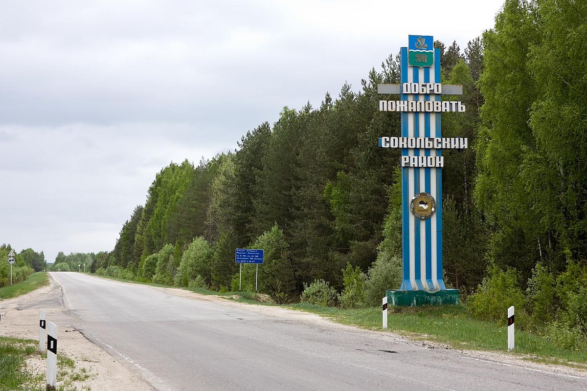
I think the location of Korenevo could still be Mari/Merya as the closest settlement Sokolsky wasn't founded until the 1400s

1741349067246.png

Summing all that up how about this?
 
Last edited:
  • 2
Reactions:
And I believe there are more mixed urban cities, at least Sarāy al-Jadīd, Beljiman area and maybe Ukek. Also Yangi-Shehr had a lot of Bolgar people settled there by the Golden Horde
Yes that is entirely true. Basically if there exists an urban center in the Golden horde, especially on the steppe, it was bound to have been mixed. There were Russians, Alans, Moksha, Mongols, Cumans, Turkmen and all sorts of other people brought over.
 
  • 1
Reactions:
I keep seeing people on here advocating for turbo-Balkanizing the Golden Horde... I'm not convinced that more tags, more balkanization = more historically accurate = better. Are you all sure that 1. we have enough sources for all the lesser hordes to justify their inclusion as sovereign states, and 2. it would benefit gameplay?