• We have updated our Community Code of Conduct. Please read through the new rules for the forum that are an integral part of Paradox Interactive’s User Agreement.
Semi-Lobster said:
I'm pretty sure that those are the modern age forts in CivIII. They're still good though.

Caught me. :D

Although it is modified.

nachinus said:
I would only add some water or beach in its base so it's more recognisable as a coastal fort. :)
Wouldn't that make it look funny in the middle of the land, though? Besides, the land-based pill box is so different that it should be easily distinguishable.
 
Colonel Kraken said:
Caught me. :D
Wouldn't that make it look funny in the middle of the land, though? Besides, the land-based pill box is so different that it should be easily distinguishable.

Yes, it's funny :) , but the other sprites for coastalforts currently available have that beach and sea, and i'm used to them, it's not that bad. :)
 
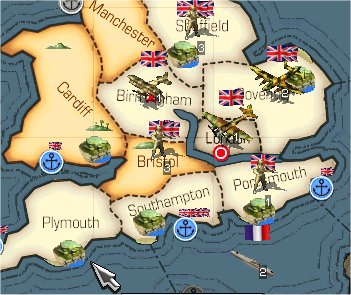
Alternate . . .

nachinus said:
Yes, it's funny :) , but the other sprites for coastalforts currently available have that beach and sea, and i'm used to them, it's not that bad. :)
How's this then?

HoIaltnewcoastalfortjpg.jpg

Complete with Atlantic Wall type barriers. :D
 
Might I ask for a cannon sticking out of that badboy? And a little more definition of the lines of the image (ie., the walls, the base, etc)? Just some constructive feedback. At any rate, I think it's great. :cool:
 
Phil K said:
Might I ask for a cannon sticking out of that badboy? And a little more definition of the lines of the image (ie., the walls, the base, etc)? Just some constructive feedback. At any rate, I think it's great. :cool:
I had thought about sticking a cannon out of it. I'll see what I can do. The images I used use a lot of . . . what is it called? . . . anti-aliasing? . . . that's why it's "fuzzy". I'll try to sharpen it a bit, though. Although the base is supposed to blend in with the beach. ;) It's buried in sand. :p Besides, that's a jpeg. It's going to be more fuzzy than in "real life".

Thanks for the feedback. :)

--CK
 
To everyone is involved on the new counters devlopement:

1-Any news? How far is it from being completed?

2-If you need airforce insignas for some country, just tell me what countries do you need and I sohuld be able to find an image! ;)
 
Col Kraken, with the .bmp that you sent me, you can see the fort outlined in purple when ingame, specially noticeable when contrasted with dark colors and with fog of war. Do you think you can fix it? :)

Btw, i won't be able to connect to the internet in the following week or so, (sorry :( ) could you send it to any other CORE team member (PhilK?) if you fix it?. :)

EDIT: the sprite doesn't go 'shaded' when it's in a prov with fog of war, it looks as bright as normally (but fog of war on and look at any prov with coastalfort, you'll know what i mean). I don't know what could cause this... maybe pallete? :confused:
 
Last edited:
Pkunzipper said:
To everyone is involved on the new counters devlopement:

1-Any news? How far is it from being completed?

2-If you need airforce insignas for some country, just tell me what countries do you need and I sohuld be able to find an image! ;)

As far as the world outside of Central-South America, most of Europe is done, and a fair amount of Asia. I would have to say that it will probably be a post 0.7 release (since I lost a few days of working on this with a fairly rotten cold).
 
nachinus said:
Col Kraken, with the .bmp that you sent me, you can see the fort outlined in purple when ingame, specially noticeable when contrasted with dark colors and with fog of war. Do you think you can fix it? :)

I'm not sure why this would be. It didn't occur in my game, but I can take a look at it.
Btw, i won't be able to connect to the internet in the following week or so, (sorry :( ) could you send it to any other CORE team member (PhilK?) if you fix it?. :)

No problem.

EDIT: the sprite doesn't go 'shaded' when it's in a prov with fog of war, it looks as bright as normally (but fog of war on and look at any prov with coastalfort, you'll know what i mean). I don't know what could cause this... maybe pallete? :confused:

I had noticed this too. I don't know what must be done in order for something to go shaded in FoW. I don't know how the game interprets the image to "fog it" out. Do you know how this is done? Do you know who I can talk to about that?

I used a 16 bit pallette because I noticed this is what was done for the other alternate (non-original) coastal fort that was being used for CORE mod. Does this one not shade out for FoW? Let me know.

By the way, what do you think of the version with the guns? Better or worse?

Thanks,

CK
 
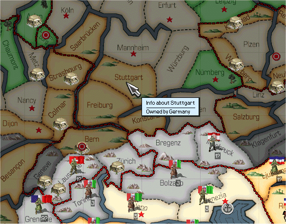
New Fort.

Ok, here's a new land fortification, complete with constantine wire around the base. Let me know what you think.

fort.gif


This one also does not go shaded in FoW, as you can see. Hopefully, I can get that straigtened out. Disregarding that, please let me know what you think.

Regards,

CK

EDIT: I found the "purple" you referred to on the coastal fort, and fixed it. I also touched it up a little. I've done some touch up on the land fort too. I'm waiting to here about making them "shade out" with FoW.
 
Last edited:
Ohhhh, sweeeeeeeet.

Listen, at some point some of you graphics-oriented guys - or should I say those more interested in the aesthetics of the gaming experience - might want to go in the province.csv file (choose the right one - the CORE one) and start fiddling with the placement of forts images on the map. As well as counter/sprite placement. Because it kind of stinks at the moment.

Get OpenOffice.exe (freeware) for a spreadsheet if you don't have MS Excel or some other app that makes the format of the province.csv file easily readable/tweakable.

I think PKZippuh is working on some aspects of this - ports and whatnot. So maybe he is the one to comment on it.
 
Phil, now that I have finished working on air models for 0.7 tech tree (ok, first I have to attend 2 exams :wacko: ), I will adress the fort/port/map placement on map.

However each map component port, VPstar/fort, unit counter, beach and every tree, sand, mountain sprite has two values (X and Y pos) in province.csv file. A spreadsheet editor is very usefull at the beginning, but after some hours of pratice it is possible to modify it with a normal text editor.

About fort/naval fort:
They are very nice! I like more the naval one without guns (maybe you can try doing only one longer frontal gun, instead of 2 smaller ones).
I like also the new land one!
 
I think now that we have a distinct land and coastal fort there is no need for a cannon for differentiation.

PKZIP, how on earth do you do it with a txt editor and not get aggravated? You have to scroll to the right, you have to figure out which value is which... Augh! Just too many things there for me - but then I haven't even altered one yet!

Hey, can you give some clues on what you've found? Like, how many ticks/clicks in one map pane? What is the value horizontally/vertically?
 
LOL, it is simply, when you get tired to scroll the Excel window everytime to read the header row, you begin to learn what the field means by the type of the number (high or low) and how many consecutive ';' there are before or after!!

To modify this file I used 2 computer on LAN, so I can easily see the map in one of them and edit the file on the other one and import the just modified file in a very short time.
Initially I went step by step, re-loading after each change. Then I began to use city/fort, port or beach position of near regions to the one I want to modify as reference to have a more precise pixel gap.
X position = 0 is near between Aleutian islands and Russia, and increasing X value you move the icon eastward.
Y position = 0 is the Northern border of the map, increasing it you move the icon southward.
A 50 step is about 1 cm on the max zoomed-in view.
One of the biggest noise is that by default all regions that in the Vanilla HOI had less than 5 VP have the position for the star/fort coincide with the counter position.

A lot of port position are wrong in Vanilla HOI, so I fixed it.
I suggest to anyone who want to work on that file to wait till 0.7 will be out, since they will find a much improved provinces.csv file.

I think to have said everything...
If you have still any question feel free to ask!
 
When I was doing the fixes for the map meta-thread in the bug forum I found it easiest to work with a split view in OpenOffice but nowadays I find that WordPad is just as easy. It's really down to personal preference and how much you know those files by heart.
 
Pkunzipper said:
About fort/naval fort:
They are very nice! I like more the naval one without guns (maybe you can try doing only one longer frontal gun, instead of 2 smaller ones).
I like also the new land one!
Phil K said:
I think now that we have a distinct land and coastal fort there is no need for a cannon for differentiation.

Thanks for your feedback. Personally, I like the coastal fort without guns also. I do have both versions. Whichever one the CORE team would like to use is available.

On the issue of shading out for FoW, I did notice that the CORE team's icons for the ports and the current coastal fort also do not shade out. I do not see this as a major issue. I actually kind of like it. It is much easier to notice these key map features which is "known" information by all, regardless of FoW.

Thanks,

CK
 
Last edited: