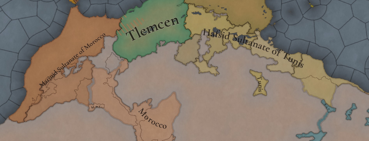
Wait, can someone tell me why does the tag of Djerid not own the namesake province?
- 2
And piggy backing off of this, and again, up to dev discretion for harbors, but Agadir and Safi (Tit?) could be considered bays as well as Oran (Wehran) and maybe Bijaya, Annabah, and Bizerte. Not great harbors, but it would flesh out the North Africa region quite a bit more.Where Algiers is should at least be a bay, and maybe Ceuta should be higher, but it depends on if you all see the geography there as favorable for a harbor. Otherwise, what a smooth coast, very few natural harbors!
Looking at the map of Arabia, one big inaccuracy I think was missed is that the Bani Yas tribal confederacy should not exist yet in 1337. In actuality this was not formed until the late 17th Century and these provinces should be empty.Not yet decided, nor the date.
Post it in the Arabian Tinto Maps, please.Looking at the map of Arabia, one big inaccuracy I think was missed is that the Bani Yas tribal confederacy should not exist yet in 1337. In actuality this was not formed until the late 17th Century and these provinces should be empty.
What today is the United Arab Emirates in 1337 was partly controlled by the Kingdom of Hormuz but otherwise was divided between smaller tribes. No large tribal confederacy existed here. The successor to the Jarwanids, the Jabrids would subjugate the region later on around the year 1450. Until then though it seems that there was no tribe with definitive control over the whole region.
Can we get a spoiler of which nation will be opening the TFs? Pretty please?Remember that this Friday we will start with our new series, Tinto Flavour! See you then!
Agreed, eastern Amazigh probably better name given that I can't find a consistent way to refer to the cultures and languages in question as anything other than Eastern Berber. It could theoretically be split into Ghadames, Awjilah, and Oasis Amazigh (Siwa & Sokna) and then have the rest be given to Zenati on a relatedness basis, but I feel as though that is not a sufficient solution as it ignores the aerial contact and the convergent evolution of the eastern Amazigh groups. So yeah, eastern Amazigh is better, especially for internal consistency.Now that Berber has been renamed shouldn't the eastern Berber culture get the same treatment?

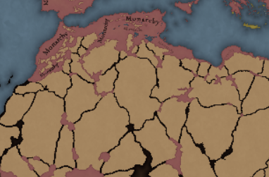
Theocracy under a Shaykh with the ability to become the imam. More beneathMonarchy... Which one would you suggest?
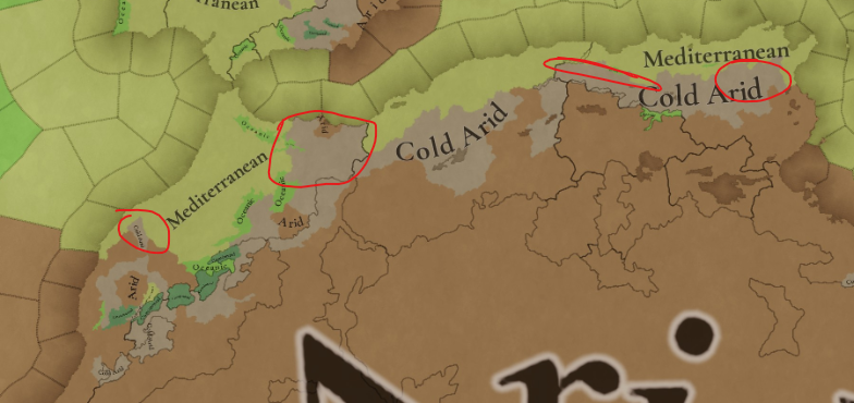
Cold Arid mostly identifies the Köppen-Trewartha BWK climate, 'Cold Desert climates': https://en.wikipedia.org/wiki/Desert_climate#Cold_desert_climatesThanks for yall's efforts!
Yet I'm very confused by the "cold arid"-assignment in the Maghreb region, since "cold arid" means icy cold, which definitely can only apply to the Sahara Dessert at night and cold months.
For example, the coldest region during winter time in Morocco is definitely the region around Tangier, Tetouan, Rabat and slighty Al Hoceima. But these times are by far not cold enough to be declared as "cold arid". I think we can agree on the fact that the region of The Great Horde is by far colder than the one in the Maghreb, yet both got declared as "cold arid"?
The Rif-Region is primarly declared as "cold arid", yet I think it should be, like in EU4, be Dryland with warm climate since this how it is literally in real life, so Mediterranean would be way more accurate, since only smaller regions within the Rif-Region are arid (characteristics of coastal regions).
Similar to Tunis, there is way too much "cold arid" environment.
In the northern bits of Morocco (especially Rif-Region --> north-east Morocco) should be more wheat distributed. Even people from French came to Morocco to buy out all fertile land because they knew how fertile these lands were, which made it very hard for local farmers to keep their sovereignty. Also, before the Rif-Wars (1921-1926) the lands were very fertile, but since then after the spanish used extremely toxic gases (highest amount used in a small area known in modern history) to enforce their demands the ground got contaminated and infertile.
The distribution is a minor aspect, but the "cold arid"-assignment should be definitely overthought since it really makes little sense to me. The temperature in these regions definitely do NOT fall below 0 and do not get nearly as cold as in The Great Horde. ESPECIALLY in the big northern-east region of Morocco. These are still warm regions, definitely.
This is my view on the Terrain assignment. I hope I was somehow a help and would love to talk more about this!
View attachment 1240710
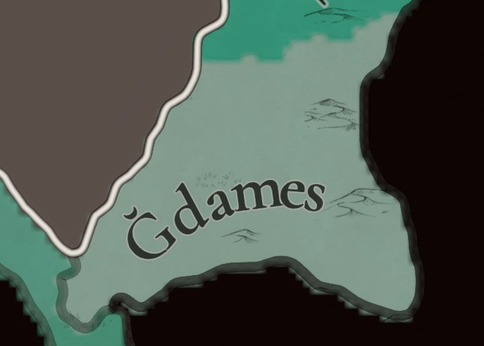
No, it is the IPA symbol for the voiced velar fricative, which is probably also the basis of the romanization of ⵖ, ⵗ (for most Tuareg languages in Niger and Mali), & ⵘ (for the Air language) of the Tifinagh scripts. It does not look good and most romanizations I've found use "gh" instead of "ɣ", which PC could do as well. The main one that uses ɣ is the Berber latin alphabet (its probably also why they use ɛ), but the aesthetics of it are just terrible when put within PC though I do get the appeal, but it does not look good. The 2022 romanization of Neo-Tifinagh would look much better but it isn't perfect either, relying off of the IPA too much for the labialized velar stops. So there really isn't a "good" option for aesthetics while maintaining a recognized and widely used romanization system, imo the best for this purpose would probably be IRCAM Neo-Tifinagh romanization (which while not widely used) will actually look decent, even if it uses o for ʕ and ignores labialization markings.Is this a Y?View attachment 1240718
Thanks for your explanation and source! I apologize, It seems like I knew a different definition of "cold arid"-climates.Cold Arid mostly identifies the Köppen-Trewartha BWK climate, 'Cold Desert climates': https://en.wikipedia.org/wiki/Desert_climate#Cold_desert_climates
We´re using the 1901-1925 dataset as a reference, as suggested when we started with Tinto Maps by @Sulphurologist , as apparently, it's the closer climate dataset to that of existing in 1337. This climate dataset is not the same as that we're experiencing nowadays.
Is this a Y?View attachment 1240718
Might be a diminutive. For instance "little Meknes" in Darija would become Mkines. Idk how diminutive works in Tamazight, but Amazigh often adopt the Darija form of proper nouns into Tamazight.Although interestingly, Arabic Wiki gives its name in Tifinagh as ⵖⴷⵉⵎⵙ "Ɣdims"/"Ghdims"
Yep in some of the more remote Saharan Tamazight dialects there is some confusion or switching between /ɣ/ and /ʕ/ iircand English Wiki gives it as ⵄⴰⴷⴻⵎⴻⵙ "Ɛademes"/"‘Ademes".


No, it's a letter of its own used in Tamazight languages: https://en.wikipedia.org/wiki/Voiced_velar_fricativeIs this a Y?View attachment 1240718

