• We have updated our Community Code of Conduct. Please read through the new rules for the forum that are an integral part of Paradox Interactive’s User Agreement.

Tinto Maps #23 - 18th of October 2024 - China

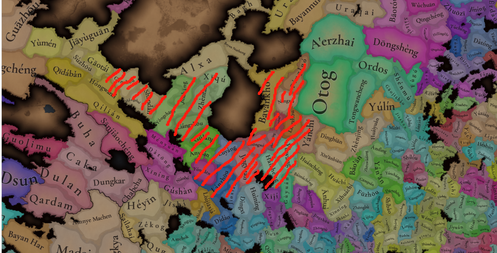
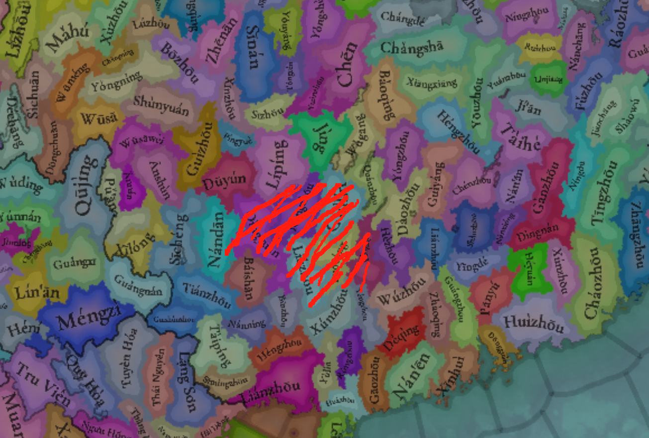
Hello, and welcome to another week of Tinto’s fun Maps. This week it will be a huge one, as we will take a look at the entirety of China. It is a really big area, but it didn’t make sense to split it into multiple parts to present it separately, so we are showing it all at once. So, without further ado, let’s get started.

Countries
Countries.png
Colored impassables.png

Obviously the territory is dominated by Yuán, with Dali as its vassal. They appear big, strong, and scary, but they will have their own fair share of problems for sure. I will not go into detail into the countries that can be seen further south, as we will talk about Southeast Asia in a future Tinto Maps.

Societies of Pops
SoP.png

Quite a variety of peoples in Southwest China, as you will see later in the culture maps.

Dynasties
Dynasties.png

Here we finally have managed to catch the full name of the Borjigin dynasty in all its glory.

Locations
Locations.png

Locations zoom 1.png

Locations zoom 2.png

Locations zoom 3.png

Locations zoom 4.png

Locations zoom 5.png

Locations zoom 6.png

Locations zoom 7.png

Locations zoom 8.png

Locations zoom 9.png
Before you ask, there are around 1800 locations in China proper, not counting impassables and barring possible counting errors.

Provinces
Provinces.png

Provinces zoom 1.png
Provinces zoom 2.png
Provinces zoom 3.png
Provinces zoom 4.png
Provinces zoom 5.png

Areas
Areas.png


Terrain
Topography.png
Climate.png
Vegetation.png

You will notice here that there are few locations assigned as "farmlands", that's because when we did this part of the map there was yet not a clear criteria on how we would be defining the farmlands and their placement here hasn't been reviewed yet.

Development
Development.png

As mentioned before, the harsh changes of development at the end of China proper is probably too strong right now and it’s something that will have to be reviewed, especially at the Liáodōng area.

Natural Harbors
Natural Harbors.png


Cultures
Cultures.png

Cultures zoom 1.png

Cultures graph.png

There is a lot of cultural variation in China, not only among the sinitic peoples (which have been divided according to their linguistical and dialectal differences) but also having many other types of non-sinitic peoples. The resulting pie chart for the cultures of the country is a wonder to see indeed. And even if Yuán itself is Mongolian, there are actually very few Mongolian people in the country, as only the ruling class would belong to it. That is one other source of further trouble for Yuán.

Religions
Religions.png

Religions zoom.png
Considering religion, there is also a lot of variation in the South West, and one thing you will notice is the clear lack of “Animism”. We have finally eliminated Animism as a religion from the game and have divided it into many multiple ones. Besides this, and some Muslim presence in some areas, there are other small pockets of religions that do not get to appear in the map, like Manichaeism, Nestorianism, Judaism and Zoroastrianism. And the elephant in the room is the Mahayana, that we have already mentioned that we have plans on dividing it, but more on it at the end.

Raw Materials
Raw materials.png

Raw materials zoom 1.png

Raw materials zoom 2.png
Raw materials zoom 3.png
Raw materials zoom 4.png
A very resource rich region, which makes it understandable that China was able to basically be self-sufficient in terms of resources for long periods in history, and with many sources of highly appreciated resources like silk, tea, and even soybeans. Another interesting thing is the division on the preference of grain cultivation, with rice being more prominent in the south while the north tends to favor wheat and sturdy grains (millet, basically).

Markets
Markets.png


Population
Population.png

Population zoom 1.png
Population zoom 2.png
Population zoom 3.png
Population zoom 4.png
Population zoom 5.png
Population zoom 6.png
Population zoom 7.png
Population zoom 8.png
Yes, there’s a lot of population in China, and with that many people and that many resources it obviously has a lot of potential. We have been following population census of 1351 and 1393, which allows us to have the most accurate values we can have.

Now, before closing off, let me turn back once again to the subject of religion, as it has already been pointed out that having a single Mahayana religion covering both China and Tibet (and parts of India) may not be the best both for accuracy and gameplay reasons, and we basically agree with it so we are planning on reworking a bit but it hasn’t been done in time for this Tinto Maps. However, as we are aware that you are not able to provide proper feedback unless we present you something, let me now share with you what are our plans with it. Please keep in mind that I will NOT go into details about their mechanics, and only talk about their distribution.

First of all, Tibetan Buddhism will be split and turned into its own religion. Although it “technically” is part of the Mahayana branch, it is true that its practices have distinguished it from Chinese Buddhism enough to represent it as its own religion, starting from the fact that they do not follow the same canon. The Mahayana that was present in India was already an outlier from start, so it will be made into its own religion.

That leaves out that the current “Mahayana” remaining in game will be Chinese Buddhism, that is, those following the Chinese Buddhist canon, and it will be present in China, Korea, and Vietnam. The question remains on what to call the religion, and several things have to be considered for that:

  1. The religion will already include blended into it Confucianism and Daoism besides Buddhism, so all three religions are included. That means it can’t be named either Confucianism or Daoism, as they have been bundled in. Buddhism was taken as the base name because, from the three, it was considered as the one mostly oriented towards the “religious” (Confucianism being more focused on administration and Daoism on rituals), and the most similar to what an organized religion would be outside of China.
    1. As a subpoint on that, and I can’t go into details for it yet, but there will also be options inside it to favor Buddhism over Confucianism or the opposite, so that is already covered too.
  2. As mentioned, it will be present not only in China but also in Korea and Vietnam (and any other country that may convert too, like for example Japan), so naming it something that’s too intrinsic to Chinese identity would not be ideal. That would mean that a term like Sānjiào, although good, would feel a bit out of place when playing for example as Korea (we know that the concept spread there too, but it was more prominent inside China and regardless having the name be directly in Chinese would be the main issue when playing outside China)

So, for now, the current name we are considering for the religion is directly “Chinese Buddhism”, or even leaving it as “Mahayana”, understanding that the main current of Mahayana is the version following the Chinese canon anyway. But feel free to suggest any alternative naming if you feel that there may be a better option we haven’t thought of, as long as it takes into consideration the previous points. And of course, let us know your feedback on the proposed representation and distribution too.

And that’s it for today, after a bit longer closing than usual. Next week we’ll be back a bit further east, taking a look at Korea and Japan. Hope to see you there!
 
  • 203Like
  • 66Love
  • 9
  • 6
  • 4
Reactions:
Why is Hangzhou a better port compared to the adjacent Zhoushan or Ningbo? Hangzhou was (and is) the estuary of the Qiantang River, coupled with the shallow but wide expanse of the Hangzhou Bay, meant that there was significant silt buildup in Hangzhou harbours, ultimately making Hangzhou a poor port, in particularly for seafaring ships. On the other hand, the Zhoushan-Ningbo area had multiple deep-sea ports and are shielded from Pacific winds, due to the Zhoushan archipelago. Historically, during the Ming dynasty, Zhoushan was one of the most significant centres of smugglers and pirates, and only remained undeveloped due Ming policies (islands are quite difficult to control, especially complex archipelagos). To this day, Zhoushan is one of the most major seaports in the entire world. Why is Zhoushan a much worse seaport than Hangzhou?
I agree that Hangzhou is not a port of good natural conditions. Instead, the port is located in the intersection of Qiantang River Basin, Hangzhou Bay, Beijing-Hangzhou Canal, Hangzhou-Ningbo Canal and both local economy and transportation infrastructure enable the port great siginficance.
 
  • 1
Reactions:
I am aware the status of the city was always complex. This wouldn't be a big issue if Hong Kong wasn't also clearly recreated in the game, despite the fact that it only became a colony in the same game "Victoria" game period that the Sino-Portuguese Unequal Treaty elevated Macau into an official Portuguese possession.

So I wouldn't mind Macau being out of Project Caesar. If Hong Kong was also out, that is. Just seems... unequal.
I feel it would be interesting if there is some mechanism to describe the trade system.
 
  • 1
Reactions:
I feel it would be interesting if there is some mechanism to describe the trade system.

Victoria 3's Treaty Port system does a pretty decent job, I'd say. They even use Macau as the example for their initial DD explaining it. It just doesn't make sense to have it in this game because it works on a location-level area of pixels, so it's redundant compared to owning the location in and of itself.

However, you also can't recreate historical strategic dynamics by just having it as a building on a separate province. The sieges on Macau by the Dutch, or on Diu by the Ottomans, don't work in the game's logic if the Portuguese possession in it isn't a location in and of itself, Treaty Port or not.

So there's really no ideal solution, not in the game's current technology. I empathise with the developers trying to abide by a consistent rule of what locations to include, but it also cuts off the potential in the game when you just outright exclude historically important locations because, as cities, they just weren't big enough to count as their own territories.
 
  • 1Like
Reactions:
Victoria 3's Treaty Port system does a pretty decent job, I'd say. They even use Macau as the example for their initial DD explaining it. It just doesn't make sense to have it in this game because it works on a location-level area of pixels, so it's redundant compared to owning the location in and of itself.

However, you also can't recreate historical strategic dynamics by just having it as a building on a separate province. The sieges on Macau by the Dutch, or on Diu by the Ottomans, don't work in the game's logic if the Portuguese possession in it isn't a location in and of itself, Treaty Port or not.

So there's really no ideal solution, not in the game's current technology. I empathise with the developers trying to abide by a consistent rule of what locations to include, but it also cuts off the potential in the game when you just outright exclude historically important locations because, as cities, they just weren't big enough to count as their own territories.
For me it's a matter of equality. Why does Hong Kong exist and Macau does not? Because of size. Ok then, why does Gibraltar exist? It's smaller than Macau, but it was a direct possession of UK. It seems to imply that both Hong Kong and Gibraltar are more important than Macau and it has nothing to do with size. This is quite an Anglo centric view of things.

I'm ok with Macau not being a location, so long as Gibraltar is not.
 
  • 3Like
  • 2
  • 1
Reactions:
For me it's a matter of equality. Why does Hong Kong exist and Macau does not? Because of size. Ok then, why does Gibraltar exist? It's smaller than Macau, but it was a direct possession of UK. It seems to imply that both Hong Kong and Gibraltar are more important than Macau and it has nothing to do with size. This is quite an Anglo centric view of things.

I'm ok with Macau not being a location, so long as Gibraltar is not.
Yes, Gibraltar really is the killer counter-argument, given it's approximately 1/4 the size of Macau.
 
  • 1
  • 1Like
Reactions:
For me it's a matter of equality. Why does Hong Kong exist and Macau does not? Because of size. Ok then, why does Gibraltar exist? It's smaller than Macau, but it was a direct possession of UK. It seems to imply that both Hong Kong and Gibraltar are more important than Macau and it has nothing to do with size. This is quite an Anglo centric view of things.

I'm ok with Macau not being a location, so long as Gibraltar is not.
To be noted, in game Gibraltar is significantly larger than the modern day British posesion of gibraltar (which given that for most of the game would be owned by either Granada or Castile is fine). That being said a similar logic could be aplied here as well.
 
Hello, and welcome to another week of Tinto’s fun Maps. This week it will be a huge one, as we will take a look at the entirety of China. It is a really big area, but it didn’t make sense to split it into multiple parts to present it separately, so we are showing it all at once. So, without further ado, let’s get started.

Countries
View attachment 1201429View attachment 1201430
Obviously the territory is dominated by Yuán, with Dali as its vassal. They appear big, strong, and scary, but they will have their own fair share of problems for sure. I will not go into detail into the countries that can be seen further south, as we will talk about Southeast Asia in a future Tinto Maps.

Societies of Pops
View attachment 1201431
Quite a variety of peoples in Southwest China, as you will see later in the culture maps.

Dynasties
View attachment 1201433
Here we finally have managed to catch the full name of the Borjigin dynasty in all its glory.

Locations
View attachment 1201434
Before you ask, there are around 1800 locations in China proper, not counting impassables and barring possible counting errors.

Provinces
View attachment 1201445

Areas
View attachment 1201453

Terrain
View attachment 1201454View attachment 1201455View attachment 1201456
You will notice here that there are few locations assigned as "farmlands", that's because when we did this part of the map there was yet not a clear criteria on how we would be defining the farmlands and their placement here hasn't been reviewed yet.

Development
View attachment 1201457
As mentioned before, the harsh changes of development at the end of China proper is probably too strong right now and it’s something that will have to be reviewed, especially at the Liáodōng area.

Natural Harbors
View attachment 1201459

Cultures
View attachment 1201460

View attachment 1201462
There is a lot of cultural variation in China, not only among the sinitic peoples (which have been divided according to their linguistical and dialectal differences) but also having many other types of non-sinitic peoples. The resulting pie chart for the cultures of the country is a wonder to see indeed. And even if Yuán itself is Mongolian, there are actually very few Mongolian people in the country, as only the ruling class would belong to it. That is one other source of further trouble for Yuán.

Religions
View attachment 1201463
Considering religion, there is also a lot of variation in the South West, and one thing you will notice is the clear lack of “Animism”. We have finally eliminated Animism as a religion from the game and have divided it into many multiple ones. Besides this, and some Muslim presence in some areas, there are other small pockets of religions that do not get to appear in the map, like Manichaeism, Nestorianism, Judaism and Zoroastrianism. And the elephant in the room is the Mahayana, that we have already mentioned that we have plans on dividing it, but more on it at the end.

Raw Materials
View attachment 1201465
A very resource rich region, which makes it understandable that China was able to basically be self-sufficient in terms of resources for long periods in history, and with many sources of highly appreciated resources like silk, tea, and even soybeans. Another interesting thing is the division on the preference of grain cultivation, with rice being more prominent in the south while the north tends to favor wheat and sturdy grains (millet, basically).

Markets
View attachment 1201470

Population
View attachment 1201471
Yes, there’s a lot of population in China, and with that many people and that many resources it obviously has a lot of potential. We have been following population census of 1351 and 1393, which allows us to have the most accurate values we can have.

Now, before closing off, let me turn back once again to the subject of religion, as it has already been pointed out that having a single Mahayana religion covering both China and Tibet (and parts of India) may not be the best both for accuracy and gameplay reasons, and we basically agree with it so we are planning on reworking a bit but it hasn’t been done in time for this Tinto Maps. However, as we are aware that you are not able to provide proper feedback unless we present you something, let me now share with you what are our plans with it. Please keep in mind that I will NOT go into details about their mechanics, and only talk about their distribution.

First of all, Tibetan Buddhism will be split and turned into its own religion. Although it “technically” is part of the Mahayana branch, it is true that its practices have distinguished it from Chinese Buddhism enough to represent it as its own religion, starting from the fact that they do not follow the same canon. The Mahayana that was present in India was already an outlier from start, so it will be made into its own religion.

That leaves out that the current “Mahayana” remaining in game will be Chinese Buddhism, that is, those following the Chinese Buddhist canon, and it will be present in China, Korea, and Vietnam. The question remains on what to call the religion, and several things have to be considered for that:

  1. The religion will already include blended into it Confucianism and Daoism besides Buddhism, so all three religions are included. That means it can’t be named either Confucianism or Daoism, as they have been bundled in. Buddhism was taken as the base name because, from the three, it was considered as the one mostly oriented towards the “religious” (Confucianism being more focused on administration and Daoism on rituals), and the most similar to what an organized religion would be outside of China.
    1. As a subpoint on that, and I can’t go into details for it yet, but there will also be options inside it to favor Buddhism over Confucianism or the opposite, so that is already covered too.
  2. As mentioned, it will be present not only in China but also in Korea and Vietnam (and any other country that may convert too, like for example Japan), so naming it something that’s too intrinsic to Chinese identity would not be ideal. That would mean that a term like Sānjiào, although good, would feel a bit out of place when playing for example as Korea (we know that the concept spread there too, but it was more prominent inside China and regardless having the name be directly in Chinese would be the main issue when playing outside China)

So, for now, the current name we are considering for the religion is directly “Chinese Buddhism”, or even leaving it as “Mahayana”, understanding that the main current of Mahayana is the version following the Chinese canon anyway. But feel free to suggest any alternative naming if you feel that there may be a better option we haven’t thought of, as long as it takes into consideration the previous points. And of course, let us know your feedback on the proposed representation and distribution too.

And that’s it for today, after a bit longer closing than usual. Next week we’ll be back a bit further east, taking a look at Korea and Japan. Hope to see you there!
Manahyana with Chinese characteristics
 
  • 2Haha
Reactions:
The area names Beizhili and Nanzhili mean the northern and southern direct territories. They are not names in the 14th century. In the Yuan Dynasty, Beizhili was called Fuli, and the northern half of Nanzhili belonged to Henanjiangbei together with Henan, and the southern half belonged to Jiangzhe together with Zhejiang. If the area names are not dynamic, I recommend calling Beizhili Hebei and Nanzhili Jiangnan, because they are names that are appropriate in any era, regardless of the location of the imperial capital.
 
  • 7
  • 1Like
Reactions:
Dear Roger.

I'm sorry I was busy before. Now I will answer your replies one by one. Except for the distribution of Muslims, I haven't made a detail map yet. I will add it later.

1. There should be a Hubei culture and it is better called Jing/荆 culture, because this culture actually also includes the southwestern Mandarin areas of Hunan. I personally think that this culture can be based on the provincial boundaries of Hubei today. There is no need for Jianghuai culture within the provincial boundaries of Hubei. At the same time, Changde in Hunan should also be Jing culture.

Bashu culture is mainly based on the scope of Greater Sichuan, including Hanzhong and Ankang south of the Qinling Mountains today, and Zunyi in Guizhou. Yungui culture should be on the Yunnan-Guizhou Plateau today, distributed in the river valleys of Yunnan, and other places in Guizhou except somewhere like Zunyi.

Here is what I think is the approximate distribution of Jing culture/Hubei culture, which needs to include provinces such as Shizhou/Lizhou/Changde/Huangzhou/Fangzhou
微信图片_20241026212231.png


微信图片_20241026212231.png

Here is what I think is the approximate distribution of Bashu culture, and yellow represents the mixed area with other cultures

微信图片_20241026212235.png

Here is what I think is the approximate distribution of Yungui culture. They do not need to have a large number of people or be the dominant population in every place. It is enough to have a slightly larger number of people in major cities such as Kunming. It mainly reflects a cultural form that is completely different from Bashu, and is also the population basis for the assimilation of the southwestern ethnic minorities by Han civilization.
微信图片_20241026212237.png


2. The Youyan culture is based on the dividing line between Liao and Song, and is distributed north of the dividing line, roughly including today's Beijing, Tianjin, Chengde, Tangshan and Qinhuangdao. After hundreds of years of division, the Youyan Han people have had different identities from other Han people. At the same time, if we look at some papers on the Liao Dynasty (I will supplement it later), there are also Youyan Han people in Chifeng. At the same time, Han people undoubtedly exist in the Liaodong Peninsula. Here is Laoqida/Nogeoldae, you can take a look.

“如今朝廷一统天下,世间用著的是汉儿言语。我这高丽言语,只是高丽地面里行的。过的义州汉儿地面来,都是汉儿言语。有人问著,一句话也说不得时,别人将咱们做甚么人看?”
“熙宗皇统五年,又罢辽东汉人、渤海猛安谋克承袭之制,侵移兵柄于国人。”

There are also some materials about Liaoyang in the Yuan Dynasty. From Jinzhou to Dandong, there is a considerable proportion of Han people.
Here is the distribution of Youyan culture in my opinion. Yellow represents the mixed area with other cultures.
微信图片_20241026212240.png
Here is the distribution of Liaodong culture in my opinion.
微信图片_20241026212242.png


3. Many people have already responded to the question of the culture of Zhongyuan and Qinlong, so I will not repeat it here.

4. I will add information about Muslims later.

5. Baima people are descendants of Di people, and they do have a relatively independent identity. They are roughly distributed in today's Mianyang Pingwu (Long'an), Jiuzhaigou, and Longnan, Gansu. Here is the distribution of Baima culture in my opinion.

6. Here is information about the migration of Miao people. It is true that Miao people did not reach the Sino-Vietnamese border at that time.

7. I later learned that this is not Kokang but other culture, so this is not important.

8. Jurchens are fishing and hunting people, mainly distributed in the forests of mountains. They did not go deep into the grassland area in western Liaoning. There was the Josutu area of Mongolia later, which should be dominated by Khorchin culture. There should be no Jurchens in these places.
Here should be Khorchin Mongol.
微信图片_20241026212250.png
9. Some Tangut people converted to Islam and I will add some informatio. In addition, You can look at the map of Western Xia for the areas ruled by the Dangxiang people.
This is where I think there are remaining Tangut people. Of course, they do not occupy the majority of the population.
微信图片_20241026212247.png


1729949837766.png


10. The Mongols became Tibetan Buddhists in the middle of the Ming Dynasty. Before that, their beliefs were diverse, and there were some Muslims. You can look at the information. In the Ming Dynasty, there was a Mongolian leader named Ismail who grazed in the Ordos area, and in the Yuan Dynasty, there was a prince named Suleiman.

11. In addition, it is recommended to add Guiliu/桂柳 culture, which represents the people who speak Southwestern Mandarin in Guangxi. They do have independent culture and identity.

Guiliu culture can be roughly distributed here. There are indeed Han people in the area.
微信图片_20241026212252.png
 
  • 11Like
  • 2
Reactions:
As for the distribution of Muslims, I will make a simple map.

I will add relevant information later
 

Attachments

  • 微信图片_20241026220423.png
    微信图片_20241026220423.png
    2,6 MB · Views: 0
  • 微信图片_20241026220430.png
    微信图片_20241026220430.png
    2,9 MB · Views: 0
  • 微信图片_20241026220432.png
    微信图片_20241026220432.png
    1,4 MB · Views: 0
  • 微信图片_20241026220435.png
    微信图片_20241026220435.png
    2,4 MB · Views: 0
  • 微信图片_20241026220438.png
    微信图片_20241026220438.png
    2,8 MB · Views: 0
  • 微信图片_20241026220440.png
    微信图片_20241026220440.png
    3,2 MB · Views: 0
  • 微信图片_20241026220442.png
    微信图片_20241026220442.png
    2,5 MB · Views: 0
  • 微信图片_20241026220444.png
    微信图片_20241026220444.png
    2,3 MB · Views: 0
  • 微信图片_20241026220447.png
    微信图片_20241026220447.png
    2,6 MB · Views: 0
  • 微信图片_20241026220449.png
    微信图片_20241026220449.png
    2,5 MB · Views: 0
  • 6Like
  • 1
  • 1
Reactions:
Dear Roger.

I'm sorry I was busy before. Now I will answer your replies one by one. Except for the distribution of Muslims, I haven't made a detail map yet. I will add it later.

1. There should be a Hubei culture and it is better called Jing/荆 culture, because this culture actually also includes the southwestern Mandarin areas of Hunan. I personally think that this culture can be based on the provincial boundaries of Hubei today. There is no need for Jianghuai culture within the provincial boundaries of Hubei. At the same time, Changde in Hunan should also be Jing culture.

Bashu culture is mainly based on the scope of Greater Sichuan, including Hanzhong and Ankang south of the Qinling Mountains today, and Zunyi in Guizhou. Yungui culture should be on the Yunnan-Guizhou Plateau today, distributed in the river valleys of Yunnan, and other places in Guizhou except somewhere like Zunyi.

Here is what I think is the approximate distribution of Jing culture/Hubei culture, which needs to include provinces such as Shizhou/Lizhou/Changde/Huangzhou/Fangzhou
View attachment 1207529

View attachment 1207530
Here is what I think is the approximate distribution of Bashu culture, and yellow represents the mixed area with other cultures

View attachment 1207531
Here is what I think is the approximate distribution of Yungui culture. They do not need to have a large number of people or be the dominant population in every place. It is enough to have a slightly larger number of people in major cities such as Kunming. It mainly reflects a cultural form that is completely different from Bashu, and is also the population basis for the assimilation of the southwestern ethnic minorities by Han civilization.
View attachment 1207534

2. The Youyan culture is based on the dividing line between Liao and Song, and is distributed north of the dividing line, roughly including today's Beijing, Tianjin, Chengde, Tangshan and Qinhuangdao. After hundreds of years of division, the Youyan Han people have had different identities from other Han people. At the same time, if we look at some papers on the Liao Dynasty (I will supplement it later), there are also Youyan Han people in Chifeng. At the same time, Han people undoubtedly exist in the Liaodong Peninsula. Here is Laoqida/Nogeoldae, you can take a look.

“如今朝廷一统天下,世间用著的是汉儿言语。我这高丽言语,只是高丽地面里行的。过的义州汉儿地面来,都是汉儿言语。有人问著,一句话也说不得时,别人将咱们做甚么人看?”
“熙宗皇统五年,又罢辽东汉人、渤海猛安谋克承袭之制,侵移兵柄于国人。”

There are also some materials about Liaoyang in the Yuan Dynasty. From Jinzhou to Dandong, there is a considerable proportion of Han people.
Here is the distribution of Youyan culture in my opinion. Yellow represents the mixed area with other cultures.
View attachment 1207535Here is the distribution of Liaodong culture in my opinion.
View attachment 1207536

3. Many people have already responded to the question of the culture of Zhongyuan and Qinlong, so I will not repeat it here.

4. I will add information about Muslims later.

5. Baima people are descendants of Di people, and they do have a relatively independent identity. They are roughly distributed in today's Mianyang Pingwu (Long'an), Jiuzhaigou, and Longnan, Gansu. Here is the distribution of Baima culture in my opinion.

6. Here is information about the migration of Miao people. It is true that Miao people did not reach the Sino-Vietnamese border at that time.

7. I later learned that this is not Kokang but other culture, so this is not important.

8. Jurchens are fishing and hunting people, mainly distributed in the forests of mountains. They did not go deep into the grassland area in western Liaoning. There was the Josutu area of Mongolia later, which should be dominated by Khorchin culture. There should be no Jurchens in these places.
Here should be Khorchin Mongol.
View attachment 12075409. Some Tangut people converted to Islam and I will add some informatio. In addition, You can look at the map of Western Xia for the areas ruled by the Dangxiang people.
This is where I think there are remaining Tangut people. Of course, they do not occupy the majority of the population.
View attachment 1207538

View attachment 1207541


10. The Mongols became Tibetan Buddhists in the middle of the Ming Dynasty. Before that, their beliefs were diverse, and there were some Muslims. You can look at the information. In the Ming Dynasty, there was a Mongolian leader named Ismail who grazed in the Ordos area, and in the Yuan Dynasty, there was a prince named Suleiman.

11. In addition, it is recommended to add Guiliu/桂柳 culture, which represents the people who speak Southwestern Mandarin in Guangxi. They do have independent culture and identity.

Guiliu culture can be roughly distributed here. There are indeed Han people in the area.
View attachment 1207537
It's my understanding that the Guiliu and Yungui cultures here did not exist until the Ming dynasty.
 
  • 1
  • 1Like
Reactions:
@Roger Corominas

As per developer comments, the use of exonyms for geographical and cultural entities was intentionally avoided.

Following this principle, Chinese Postal Romanization should be used for place as well as culture names, and Cantonese and Hokkien romanization for areas of Guangdong, Fujian, and parts of Guangxi.

E.g.: Yue > Cantonese
Guangdong > Kwangtung
Guangzhou > Canton
Dongguan > Tungkun
Xinhui > Shunwui
jiulong > Kowloon / Hong Kong

Pinyin disregards local linguistic variations and imposes the Beijing dialect on the entire region. The majority of people in Guangdong, Hong Kong, and Macau speak Cantonese and its related dialects since the Song dynasty, and it is unreasonable to expect them to embrace the Beijing dialectal representation of their heritage. This is a rather contentious subject for the local habitants.

As Lane Harris noted, 'postal romanization accommodated local dialects and regional pronunciations by recognizing local identity and language as vital to a true representation of the varieties of Chinese orthoepy as evinced by the Post Office's repeated desire to transcribe according to "local pronunciation" or "provincial sound-equivalents".'

Additionally, using Chinese Postal Romanization preserves existing transliterated spellings for important places, making it easier for non-Chinese users to understand.


Attachments

  • Areas.png
    Areas.png
    604,4 KB · Views: 0
  • Cultures.png
    Cultures.png
    361,7 KB · Views: 0
  • Markets.png
    Markets.png
    241,6 KB · Views: 0
  • 5
  • 3Like
Reactions:
@Roger Corominas

As per developer comments, the use of exonyms for geographical and cultural entities was intentionally avoided.

Following this principle, Chinese Postal Romanization should be used for place as well as culture names, and Cantonese and Hokkien romanization for areas of Guangdong, Fujian, and parts of Guangxi.

E.g.: Yue > Cantonese
Guangdong > Kwangtung
Guangzhou > Canton
Dongguan > Tungkun
Xinhui > Shunwui
jiulong > Kowloon / Hong Kong

Pinyin disregards local linguistic variations and imposes the Beijing dialect on the entire region. The majority of people in Guangdong, Hong Kong, and Macau speak Cantonese and its related dialects since the Song dynasty, and it is unreasonable to expect them to embrace the Beijing dialectal representation of their heritage. This is a rather contentious subject for the local habitants.

As Lane Harris noted, 'postal romanization accommodated local dialects and regional pronunciations by recognizing local identity and language as vital to a true representation of the varieties of Chinese orthoepy as evinced by the Post Office's repeated desire to transcribe according to "local pronunciation" or "provincial sound-equivalents".'

Additionally, using Chinese Postal Romanization preserves existing transliterated spellings for important places, making it easier for non-Chinese users to understand.

Of all the things you can suggest, postal is about the worst choice. It's completely unsystematic and done on ad-hoc basis, so place names that were not actually used in the postal system cannot be predicted. And even your examples just demonstrate how inconsistent it is:

Guangdong > Kwangtung
Both are Mandarin and represent the same sound. The vowel of the first character -wa- rules out any possibility of this name being based on local pronunciation

Guangzhou > Canton
"Canton" was a poorly recorded and Angelized version of "Guangdong" (It's not even Guangzhou), and similarly more likely to be based on Mandarin because the first vowel is recorded as an A instead of O or U

jiulong > Kowloon
Now this is definitely Cantonese, but the guy who wrote this down couldn't tell N and NG

Hong Kong
Both Mandarin and Cantonese has a medial -i- in the first character. This is either a bad transcription or some kind of Tanka (Boat People) accent that is not shared by the land-dwelling Cantonese
 
  • 5
  • 3Like
  • 1
Reactions:
@Roger Corominas

As per developer comments, the use of exonyms for geographical and cultural entities was intentionally avoided.

Following this principle, Chinese Postal Romanization should be used for place as well as culture names, and Cantonese and Hokkien romanization for areas of Guangdong, Fujian, and parts of Guangxi.

E.g.: Yue > Cantonese
Guangdong > Kwangtung
Guangzhou > Canton
Dongguan > Tungkun
Xinhui > Shunwui
jiulong > Kowloon / Hong Kong

Pinyin disregards local linguistic variations and imposes the Beijing dialect on the entire region. The majority of people in Guangdong, Hong Kong, and Macau speak Cantonese and its related dialects since the Song dynasty, and it is unreasonable to expect them to embrace the Beijing dialectal representation of their heritage. This is a rather contentious subject for the local habitants.

As Lane Harris noted, 'postal romanization accommodated local dialects and regional pronunciations by recognizing local identity and language as vital to a true representation of the varieties of Chinese orthoepy as evinced by the Post Office's repeated desire to transcribe according to "local pronunciation" or "provincial sound-equivalents".'

Additionally, using Chinese Postal Romanization preserves existing transliterated spellings for important places, making it easier for non-Chinese users to understand.


Pinyin (but without the diacritics) is the standard English form for most Chinese placenames and terms, so it should be that (unless the standard is meant to be the most common English form during the EU4 time period). Only arguable exception is Cantonese, but Yue is also generally used for the 'wider' culture/language and would definitely be more consistent with all the other cultures so is probably better. For locations using full Pinyin is correct as the locations are ruled by the Mandarin-dominated Yuan dynasty - but of course that doesn't preclude using local transliterations if they come under the rule of a state that uses a different Chinese language.
 
  • 5
  • 1Like
Reactions:
Let me bring up the issue of geography


1. Since the map shows lakes, it should also show the Yellow River, the Yangtze River, the Huaihe River, the the Pearl River, the Heilongjiang River, and the the Yarlung Zangbo River. As part of the map, they can block the army and affect regional production. We need the Yangtze River that can conduct naval warfare! In fact, many naval and defensive battles in Chinese history have occurred on the Yangtze River, which is an important part of China's internal wars


2. There are also regions such as Fujian, Sichuan, Yunnan Guizhou, Shaanxi, etc., which are all covered in high mountains, but there are no geographical barriers on this map, which is unreasonable. Some geographical barriers based on high mountain landforms should be implemented to prohibit the military from passing, so as to reflect the tactics of using troops and let the military wander between mountains, rivers, and forests to avoid pursuers, just like Sun Tzu's Art of War. However, I think it is not necessary to change these high mountain areas into desert areas to display them as impassable. This is not beautiful or practical. I believe that when the perspective is zoomed in, prominent line symbols will appear at the edges of these impassable plots to indicate that they are impassable
 
  • 2Like
  • 2
Reactions: