• We have updated our Community Code of Conduct. Please read through the new rules for the forum that are an integral part of Paradox Interactive’s User Agreement.

Tinto Maps #8 - 28th of June 2024 - Russia

Hello, and welcome one more week to Tinto Maps! This week we’ll be taking a look at Russia!

As an introductory note, we’re just considering today the ‘Russian core’, which in 1337 comprised the different Russian Principalities, as far as the White Sea to the north, and the Ural Mountains to the east. The lands that would later be incorporated into the Russian Empire will be covered in future Tinto Maps (otherwise, we would have to cover like… 1/8th? of the land mass in just one DD).

Countries
Countries.png

Russia is divided into several Principalities in 1337. The dominant one probably is Muscovy, as its Grand Prince, Ivan I Danilovich ‘Kalita’ (‘Moneybag’) is also Prince of Nizhny Novgorod and Kostroma, and of Novgorod (by election, in this case). He also holds the title of Grand Prince of Vladimir, bestowed by the Khan of the Golden Horde, which makes him the ruler enforcing the ‘Tatar Yoke’ over other Russian Principalities (which in our game is represented through an IO; the coloring of the different countries is different tones of yellow as they are tributaries of the Yoke). The other main power in the region is the Grand Republic of Novgorod, with a completely different institutional structure, that allows them to pick their rulers. Their power comes from being the main trading power between the Baltic Sea and the Russian region, and it’s the overlord of two border countries, the Principality of Pskov, and the County of Oreshek, a buffer country in Karelia, as agreed with Sweden after a recent war. Several lands to the north and east are not owned by any country. As a final note, you may also see that Lithuania is the overlord of some of the principalities, some of them directly through Gediminid rulers (Polotsk or Vitebsk), while other over Rurikovich rulers (Smolensk or Rzhev).

Muscovy.png

Tatar Yoke.png

The starting diplomatic of Muscovy and the Tatar Yoke IO, for the sake of clarity.

Dynasties
Dynasties.png

Several branches of the House of Rurik rule over the Russian lands. Fun fact: we have 18 different branches portrayed in the game. The exceptions are a few principalities, and the ruler of Karelia, Prince Narimantas of the Lithuanian Gediminids. Also, the 'Cherdyn' and 'Vyatka' are randomly assigned dynasties, as we haven't been able to get the data for those countries on 1337.

Locations
Locations.png

We’re showing a less detailed region this week because, well, Russia is big. Feel free to ask for more detailed screenshots of specific areas, and I’ll try to provide them. We’re also showing some parts of the Steppe, Finland, and Kola, because of the scale of the map; take them as ‘unavoidable spoilers’, as we’ll talk more in-depth about them in future Tinto Maps.

Provinces
Provinces.png

The provinces of Russia. As usual, suggestions are welcomed!

Terrain
Climate.png

Topography.png

Vegetation.png

Terrain map modes. As discussed in previous Tinto Maps, we’ll read carefully your feedback, as we have plenty of room to polish them!

Cultures
Cultures.png

Cultures! As in other regions, we decided to have three different cultures in the Russian region, Novgorodian, Muscovite, and Severian. The design here is different than in the Ruthenian region, because Russia was more politically divided in the High Middle Ages, and would later be more culturally unified later on, while in Ruthenia, the situation would be the opposite. In any case, the four of them are East Slavic cultures, and we're open to feedback, of course. Apart from that, there are a bunch of different cultures bordering the region: Karelian, Pomor, Komi, Udmurt, etc. We might add some more minorities of these cultures, in the feedback pass after this DD. Also, take into account that the minorities over the Tatar lands (currently under the Kazani and Mishary cultures) are not yet done.

Religions
Religion.png

Eastern Orthodoxy is dominant in the region, although there are other religions in the area, as well; take ‘Animist’, ‘Tengrist’, and ‘Shamanist’ as wide categories, as we’d like to add a bit more granularity for them (although that will come later this year, don’t expect them to be added in the coming Tinto Maps, but maybe on the later ones). We’ve already seen some posts asking about Slavic Paganism; up until now, we’ve considered the Russian people to be Christianized, even if it was a more or less superficial process. If you’d like us to add this religion and some percentage of the population adhering to it, then I’d ask you for specific sources that could help us portray it (so, isolated references to it being followed here or there won’t be helpful, while academic sources saying ‘up to X% of the population was following Slavic rites’ might very much be).

Raw Materials
Raw Materials.png

Quite different resources to other regions previously shown, with plenty of Lumber, Fur, and Wild Game in this region. I’ve also extended a bit the screenshot to the east, so you can see the mineral richnesses of the Ural Mountains, with plenty of locations with Copper, Iron, Gold, and Lead, making it quite juicy to colonize.

Markets
Markets.png

The counter to the richness of the natural resources of the region is its integration into the different markets, which at the start of the game are centered around Novgorod, Moscow, and Kazan. Fully exploiting the economic possibilities of Russia will therefore require effort and patience.

Country and Location population
Country Population.png

Location Population SW.png

Location Population SE.png


Location Population NE.png

Location Population NW.png

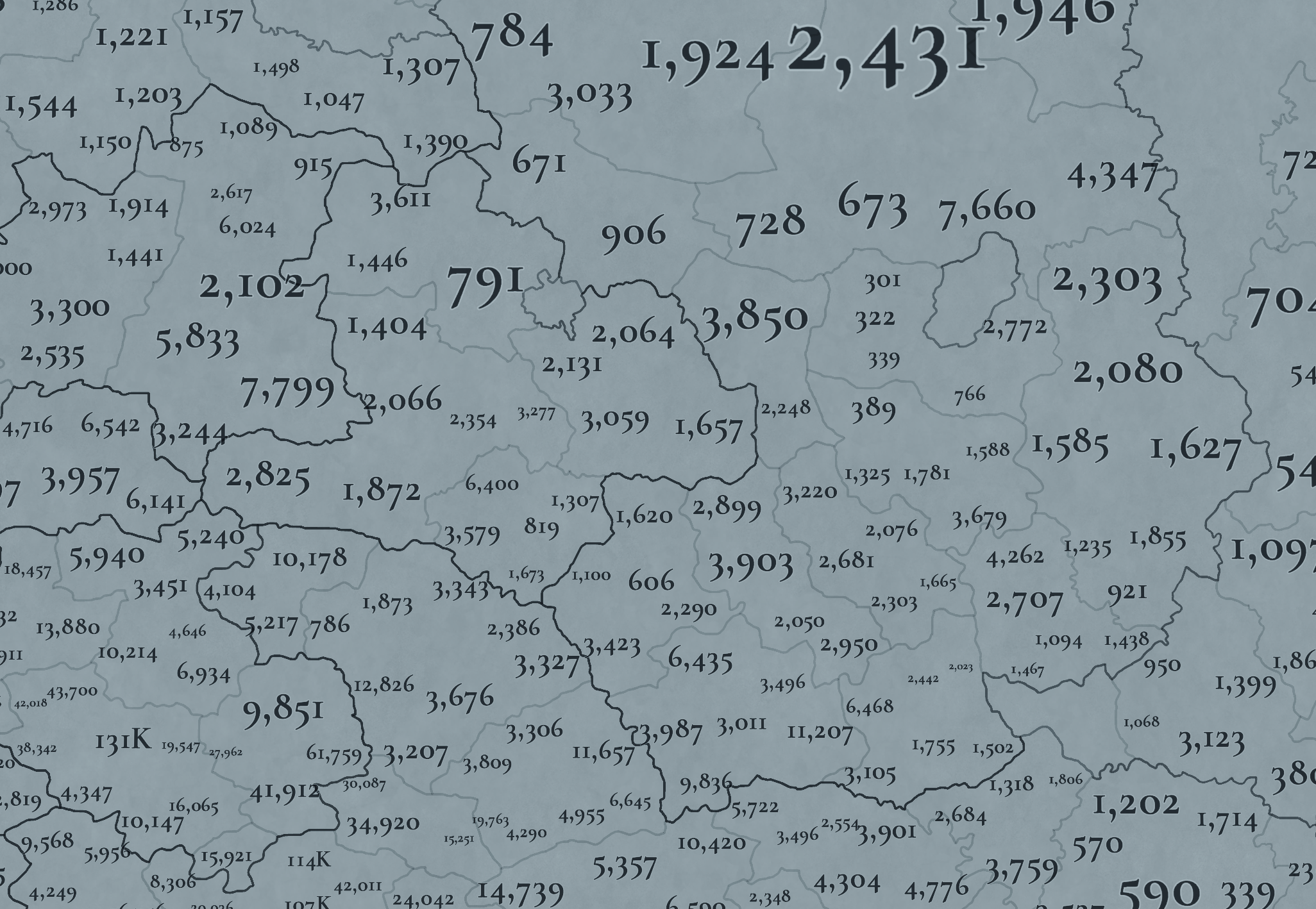
Not many people inhabit the Russian core, approximately 6M in total. This poses a series of challenges regarding the expansion of any Russian country. Also, we've divided into 4 different maps of the location population of the region, to make it possible to visualize. A side note: you might note that the population of NW Novgorod and Karelia is calculated a bit differently. That's because Johan took care of drawing the Scandinavian map in an early stage of development, and the Content Design team took over the rest of Russia at a later stage when we had already refined a bit more our population calculation methods. This means that when we do the feedback pass after this Tinto Maps, in a few weeks, we'll homogenize the style, as well.

And this is all for today! We hope that you’ll find it interesting, and give us great feedback! Next week we’re traveling to Carpathia and the Balkans! See you!
 
  • 158Like
  • 67Love
  • 6
  • 6
  • 5
Reactions:
Given the fact that both Sweden and Russia deployed warships on Lake Ladoga during their wars in the 17th and 18th centuries, I believe the lake should be divided into 2 or 3 locations, all in the inland sea category.

Lake Onega should probably get a similar treatment - perhaps a narrows location in the north and an inland sea location in the south. I don't think there's any history of naval action there, but there's no reason there can't be. Should any 2 rival powers come to occupy its shores, the lake is large enough to accommodate 2 fleets.
 
  • 5Like
  • 1
Reactions:
Arkhangelsk was established in 1584 around what had long been a monastery dedicated to the Archangel Michael, which the city was eventually named after. The location should be called Mikhalko-Arkhangel'skiy. I see on the Steppes map that there's also an Arkhangelsk area - that needs to be renamed as well, though I'm not sure what I'd call it. I also don't particularly like either the name or the shape of the Kola area.

Would it be possible to rework the provinces around the White Sea so that they're based off of the traditional Russian divisions of its coast?


Берега Белого моря имеют собственные названия и традиционно разделяются (в порядке перечисления против часовой стрелки от побережья Кольского полуострова) на Терский, Кандалакшский, Карельский, Поморский, Онежский, Летний, Зимний, Мезенский и Канинский; иногда Мезенский берег разделяют на Абрамовский и Конушинский берега, а часть Онежского берега называют Лямицким берегом.
 
  • 2Like
Reactions:
problem is - that this is too long and it is an adjective of a church name. Mikhalko-Arkhangel'skiy monastyr'
Monastery, not church. We have locations named after rivers - at least monasteries are inhabited. Call it Arkhangel Mikhail if that's more grammatically pleasing.
Arkhangelsk is an okay name as there are thousands of location names that are named by cities that will exist in starting 17 century
And I'm in favor of changing virtually all of them. If I'm colonizing the Hudson Valley as a Castilian, why would I possibly like having locations called New Amsterdam or Albany in my territory? Or imagine we were talking about St. Petersburg instead of Arkhangelsk.

And Paradox themselves seem to keep this in mind elsewhere. To give just one example, because it's the one I remember right now, Le Havre, founded 67 years before Arkhangelsk, is nowhere to be seen on the map of France. Or look at southern Africa - how many names from the Afrikaans or English languages do you see? It's with the map of Russia that they completely ignored this.
 
  • 2
Reactions:
To give just one example, because it's the one I remember right now, Le Havre, founded 67 years before Arkhangelsk, is nowhere to be seen on the map of France.
Even then, the monastery has been founded 50 years into the game and, by this logic, shouldn't give its name to the location.

However, its location is fairly clear and therefore the location might be named after the geographic feature: Pur-Navolok.
 
  • 3Like
Reactions:
Last edited:
  • 2Like
Reactions:
And the source for Russian Wikipedia says it was founded at a later date because the founding charter describes the local community accordingly.
I followed the sources that were available online, and 2 out of 3 (the older ones, admittedly) mention a founding date in the 12th century.

But whatever, Purnavolok is briefer and less controversial, so it works too.
 
Hello, and welcome one more week to Tinto Maps! This week we’ll be taking a look at Russia!

As an introductory note, we’re just considering today the ‘Russian core’, which in 1337 comprised the different Russian Principalities, as far as the White Sea to the north, and the Ural Mountains to the east. The lands that would later be incorporated into the Russian Empire will be covered in future Tinto Maps (otherwise, we would have to cover like… 1/8th? of the land mass in just one DD).

Countries
View attachment 1154677
Russia is divided into several Principalities in 1337. The dominant one probably is Muscovy, as its Grand Prince, Ivan I Danilovich ‘Kalita’ (‘Moneybag’) is also Prince of Nizhny Novgorod and Kostroma, and of Novgorod (by election, in this case). He also holds the title of Grand Prince of Vladimir, bestowed by the Khan of the Golden Horde, which makes him the ruler enforcing the ‘Tatar Yoke’ over other Russian Principalities (which in our game is represented through an IO; the coloring of the different countries is different tones of yellow as they are tributaries of the Yoke). The other main power in the region is the Grand Republic of Novgorod, with a completely different institutional structure, that allows them to pick their rulers. Their power comes from being the main trading power between the Baltic Sea and the Russian region, and it’s the overlord of two border countries, the Principality of Pskov, and the County of Oreshek, a buffer country in Karelia, as agreed with Sweden after a recent war. Several lands to the north and east are not owned by any country. As a final note, you may also see that Lithuania is the overlord of some of the principalities, some of them directly through Gediminid rulers (Polotsk or Vitebsk), while other over Rurikovich rulers (Smolensk or Rzhev).

View attachment 1154678
View attachment 1155164
The starting diplomatic of Muscovy and the Tatar Yoke IO, for the sake of clarity.

Dynasties
View attachment 1154695
Several branches of the House of Rurik rule over the Russian lands. Fun fact: we have 18 different branches portrayed in the game. The exceptions are a few principalities, and the ruler of Karelia, Prince Narimantas of the Lithuanian Gediminids. Also, the 'Cherdyn' and 'Vyatka' are randomly assigned dynasties, as we haven't been able to get the data for those countries on 1337.

Locations
View attachment 1154683
We’re showing a less detailed region this week because, well, Russia is big. Feel free to ask for more detailed screenshots of specific areas, and I’ll try to provide them. We’re also showing some parts of the Steppe, Finland, and Kola, because of the scale of the map; take them as ‘unavoidable spoilers’, as we’ll talk more in-depth about them in future Tinto Maps.

Provinces
View attachment 1154684
The provinces of Russia. As usual, suggestions are welcomed!

Terrain
View attachment 1154685
View attachment 1154686
View attachment 1154687
Terrain map modes. As discussed in previous Tinto Maps, we’ll read carefully your feedback, as we have plenty of room to polish them!

Cultures
View attachment 1154688
Cultures! As in other regions, we decided to have three different cultures in the Russian region, Novgorodian, Muscovite, and Severian. The design here is different than in the Ruthenian region, because Russia was more politically divided in the High Middle Ages, and would later be more culturally unified later on, while in Ruthenia, the situation would be the opposite. In any case, the four of them are East Slavic cultures, and we're open to feedback, of course. Apart from that, there are a bunch of different cultures bordering the region: Karelian, Pomor, Komi, Udmurt, etc. We might add some more minorities of these cultures, in the feedback pass after this DD. Also, take into account that the minorities over the Tatar lands (currently under the Kazani and Mishary cultures) are not yet done.

Religions
View attachment 1154689
Eastern Orthodoxy is dominant in the region, although there are other religions in the area, as well; take ‘Animist’, ‘Tengrist’, and ‘Shamanist’ as wide categories, as we’d like to add a bit more granularity for them (although that will come later this year, don’t expect them to be added in the coming Tinto Maps, but maybe on the later ones). We’ve already seen some posts asking about Slavic Paganism; up until now, we’ve considered the Russian people to be Christianized, even if it was a more or less superficial process. If you’d like us to add this religion and some percentage of the population adhering to it, then I’d ask you for specific sources that could help us portray it (so, isolated references to it being followed here or there won’t be helpful, while academic sources saying ‘up to X% of the population was following Slavic rites’ might very much be).

Raw Materials
View attachment 1155251
Quite different resources to other regions previously shown, with plenty of Lumber, Fur, and Wild Game in this region. I’ve also extended a bit the screenshot to the east, so you can see the mineral richnesses of the Ural Mountains, with plenty of locations with Copper, Iron, Gold, and Lead, making it quite juicy to colonize.

Markets
View attachment 1154965
The counter to the richness of the natural resources of the region is its integration into the different markets, which at the start of the game are centered around Novgorod, Moscow, and Kazan. Fully exploiting the economic possibilities of Russia will therefore require effort and patience.

Country and Location population
View attachment 1154693
View attachment 1154984
View attachment 1154985

View attachment 1154987
View attachment 1154990
Not many people inhabit the Russian core, approximately 6M in total. This poses a series of challenges regarding the expansion of any Russian country. Also, we've divided into 4 different maps of the location population of the region, to make it possible to visualize. A side note: you might note that the population of NW Novgorod and Karelia is calculated a bit differently. That's because Johan took care of drawing the Scandinavian map in an early stage of development, and the Content Design team took over the rest of Russia at a later stage when we had already refined a bit more our population calculation methods. This means that when we do the feedback pass after this Tinto Maps, in a few weeks, we'll homogenize the style, as well.

And this is all for today! We hope that you’ll find it interesting, and give us great feedback! Next week we’re traveling to Carpathia and the Balkans! See you!
1728654019912.png


There should be Principality of Tarusa. The first prince of Tarusa is considered to be Yury Mikhailovich, the youngest son of Mikhail Vsevolodovich of Chernihiv, who received Tarusa upon his father's death in 1246.
1728654403531.png
 
  • 6Like
Reactions:
View attachment 1156934

I've taken everyone's feedback and I've updated my cultural map. Hopefully this will be the final version, but if you have any feedback please tell me again, I do want to make this map perfect.


Thanks for the info on the Sámi, I've added them to the north of lake Onega and everywhere that they were present. I also had to change their colour because otherwise they would have been hard to distinguish from the Karelians, however I didn't change the Sámi colour in Murmansk because I don't think they should actually be Orange, I only did it for illustrative purposes.


Fair point, I've changed it now.


You are right that the Udmurts were concentrated in that region, but they also did reach further north, it's just that northern Vyatka is sparsely populated, but the few people who lived there were Udmurts. See the Vyatka principality for more details. As for the Bjarmians, I'm not touching them anymore, I know that I said that I wanted to make the map perfect, but I'm breaking that rule when it comes to the Bjarms. They're a nightmare to research and almost all of the evidence comes from a small amount of archaeological sites, also many of the sources are in Russian and impossible to track down. So I'm giving up on researching them, it's not worth it.

As for the Meshchera, yes they were definitely present in 1337, in fact the last accounts of their presence are from the 16th century. They survived for so long because the lived in the Meshchera lowlands, which were extremely swampy and never had much large scale Russian settlement. I actually underrepresented them originally as I misjudged the size of the Meshchera lowlands; I've also added a Severian minority to the Tuma location, as there were Russian settlements on the north bank of the Oka river, which is in the Tuma location.

Finally the Ungri, Fair point about the name, the term Ungri is only used in Eastern Roman, Arabic and Frankish sources. So I've instead changed the name to the old Magyarok word for Magyar, which is Mogyer; it's not a perfect name but it's the best I could think of. I also expanded Mogyer to include the region of Magna Hungaria, which was Mogyer in the 1230s according to the accounts of Friar Julian. To verify this, I read This Journal on the connections between many Uralic and Ob-Ugric peoples to the Hungarian conquerors. The Journal backs up the conclusion that the Chiyalik culture was related to the Kushnarenkovo and Karayakupovo cultures, which lived in the region of Magna Hungaria at the time of Friar Julians travels. The evidence points towards all 3 of these cultures being related to the Magyars, it also points towards the conclusion that these peoples lived in these regions as late as the early 14th century, although this link isn't as strong with the Kushnarenkovo and Karayakupovo cultures.

Finally I added a Kazani minority to the Kungur location, to represent the Gaina tribe. Who underwent Kipchakisation starting in the 13th century and are often regarded as a Volga Tatar people from the 14th century onwards.

That's all the changes I've made so far, I might make more later, but it depends on how much feedback I get on the map. I still could portray Arkhangelsk better, but it would take a long time to do the research. Even then, my portrayal of the Arkhangelsk area is still an improvement over the original Tinto map, so I hope it helps when the new cultural map for the Russia region is made, when the Russia feedback thread is made. Anyway, that's all for now, bye.
The additions I would like to suggest to the map

Chuvash:
Dots show where Chuvash people lived in Kazan Khanate
AD_4nXe40LP0zdOKqAs96QT38rs9K3PwvJbY8YGwgRLJMD6Th6qQK6xnTSLlKGt2eRQFaGUUf09YLzEUC-s0f0VJBWiWxPVgTvOVXfEe3BJeuNwsFBSZfGFMARtkwARJtyTnIEqyJxkLbDS3shg9gJPjjxUCku7n


Lyskovo existed since XII century as a Bulgar(Chuvash) fortress named Sundovit. but in 1410, it was named Lyskovo, so it probably can have a Muscovite minority already.

Erzya:

AD_4nXd_AYn87uso2JsBI97rblHS62_HQIkrAfjXzDe0QOiVtlZ1YX6WEN4Ks4xsoS9MIOoAyfNy3kfEBWXerXN-V9oKso8t73QbjrVIHIiJqlp9j40iAGff-QyQviUcBer0uveWN41KNiVJTgVGCZJoGBkni14


Alatyr - was created in the place of Mordva (Erzya) people in the 13 century(debatable up to the 15th century). Named after Erzya hydronym Раторлей. Still has Erzya diaspora
Nizhnii Novgorod was built on Erzya village of Obran Osh
Kurmish uezd(contains Alikovo, Sechenovo(should be Tyoply Stan),) had both erzya and Chuvash people (7%, 25%)
Shatki - in XVI century was Erzya settlements
Arzamas - legends that it was built on Erzya city, has remnants of Erzya hillfort
locations Ardatov and Ardatovo - named after a given name in Erzya.
Insar - Mordva hydronym, still has a lot of Mordva people living
Karsun - Karsunski uezd was 10% Erzya 85% Russian.


EXTRA - Bogdanovo MUST be renaimed Narovchat or Mokhshi! It was an important city in the Golden Horde. But it had and still has Moksha people there

Mishary:
historically formed between rivers Tsna and Moksha (Shilovo, Tambov and Penza locations).

Kadom - was Mishary city! It was captured by conquests of Golden Horde. In the city later formed unique tatar culture that predated Kasim tatars.
Ardatov - was a fortress used by the Golden Horde to collect yasak from Erzya people. That's why I think it should be majorly Mishary culture and have somewhat of a population.
Both must be transferred to Golden Horde

Russians:
1728671032918.png

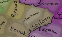
Vaskina Polyana MUST be renamed Isady. This city was founded in 11th century, it should be present.
Pronsk - also was a Russian city. It was a center of Pronsk principality
Michurinsk should be named Kozlov
Usman - was a city built by settlers from Chernihiv in the 10th century
Kasimov - at that time was called Gorodets Meshersky (Meshera city) Was built before 1152 as a castle. In 1010, the region was converted to Christianity. Was never captured by the Golden Horde.

Final map:
Chuvash - white
Mishary - brown
Erzya - dark red
Moksha - pink

1728659338409.png
1728829864189.png
 
Last edited:
  • 4
  • 2Like
  • 1Love
  • 1
Reactions:
The additions I would like to suggest to the map

Chuvash:
Dots show where Chuvash people lived in Kazan Khanate
AD_4nXe40LP0zdOKqAs96QT38rs9K3PwvJbY8YGwgRLJMD6Th6qQK6xnTSLlKGt2eRQFaGUUf09YLzEUC-s0f0VJBWiWxPVgTvOVXfEe3BJeuNwsFBSZfGFMARtkwARJtyTnIEqyJxkLbDS3shg9gJPjjxUCku7n


Erzya:

AD_4nXd_AYn87uso2JsBI97rblHS62_HQIkrAfjXzDe0QOiVtlZ1YX6WEN4Ks4xsoS9MIOoAyfNy3kfEBWXerXN-V9oKso8t73QbjrVIHIiJqlp9j40iAGff-QyQviUcBer0uveWN41KNiVJTgVGCZJoGBkni14


Alatyr - was created in the place of Mordva (Erzya) people in the 13 century(debatable up to the 15th century). Named after Erzya hydronym Раторлей. Still has Erzya diaspora
Nizhnii Novgorod was built on Erzya village of Obran Osh
Kurmish uezd(contains Alikovo, Sechenovo(should be Tyoply Stan),) had both erzya and Chuvash people (7%, 25%)
Shatki - in XVI century was Erzya settlements
Arzamas - legends that it was built on Erzya city, has remnants of Erzya hillfort
locations Ardatov and Ardatovo - named after a given name in Erzya.
Insar - Mordva hydronym, still has a lot of Mordva people living
Karsun - Karsunski uezd was 10% Erzya 85% Russian.


EXTRA - Bogdanovo MUST be renaimed Narovchat or Mokhshi! It was an important city in the Golden Horde. But it had and still has Moksha people there

Mishary:
historically formed between rivers Tsna and Moksha (Shilovo, Tambov and Penza locations). Moved south ONLY after the Russian conquest and colonisation. Other places that have Mishary culture currently should be changed.

Kadom - was Mishary city! It was captured by conquests of Golden Horde
Ardatov - was a fortress used by the Golden Horde to collect yasak from Erzya people. That's why I think it should be majorly Mishary culture and have somewhat of a population.

Russians:
View attachment 1200737
Vaskina Polyana MUST be renamed Isady. This city was founded in 11th century, it should be present.
Pronsk - also was a Russian city. It was a center of Pronsk principality
Michurinsk should be named Kozlov
Usman - was a city built by settlers from Chernihov in the 10th century
Kasimov - at that time was called Gorodets Meshersky (Meshera city) Was built before 1152 as a castle. In 1010, the region was converted to Christian. Was newer captured by the Golden horde.

Final map:
Chuvash - white
Mishary - brown
Erzya - dark red
Moksha - pink

View attachment 1200640View attachment 1201142
Added few chages on the Ryazan - Golden Horde border

Important note:
Kadom and Ardatov locations MUST be controlled by the Golden Horde. Ardatov was used by Golden Horde as a city for raids on Russian principalities, to collect yasak from Erzya and as a small fortress.
 
View attachment 1156934

I've taken everyone's feedback and I've updated my cultural map. Hopefully this will be the final version, but if you have any feedback please tell me again, I do want to make this map perfect.


Thanks for the info on the Sámi, I've added them to the north of lake Onega and everywhere that they were present. I also had to change their colour because otherwise they would have been hard to distinguish from the Karelians, however I didn't change the Sámi colour in Murmansk because I don't think they should actually be Orange, I only did it for illustrative purposes.


Fair point, I've changed it now.


You are right that the Udmurts were concentrated in that region, but they also did reach further north, it's just that northern Vyatka is sparsely populated, but the few people who lived there were Udmurts. See the Vyatka principality for more details. As for the Bjarmians, I'm not touching them anymore, I know that I said that I wanted to make the map perfect, but I'm breaking that rule when it comes to the Bjarms. They're a nightmare to research and almost all of the evidence comes from a small amount of archaeological sites, also many of the sources are in Russian and impossible to track down. So I'm giving up on researching them, it's not worth it.

As for the Meshchera, yes they were definitely present in 1337, in fact the last accounts of their presence are from the 16th century. They survived for so long because the lived in the Meshchera lowlands, which were extremely swampy and never had much large scale Russian settlement. I actually underrepresented them originally as I misjudged the size of the Meshchera lowlands; I've also added a Severian minority to the Tuma location, as there were Russian settlements on the north bank of the Oka river, which is in the Tuma location.

Finally the Ungri, Fair point about the name, the term Ungri is only used in Eastern Roman, Arabic and Frankish sources. So I've instead changed the name to the old Magyarok word for Magyar, which is Mogyer; it's not a perfect name but it's the best I could think of. I also expanded Mogyer to include the region of Magna Hungaria, which was Mogyer in the 1230s according to the accounts of Friar Julian. To verify this, I read This Journal on the connections between many Uralic and Ob-Ugric peoples to the Hungarian conquerors. The Journal backs up the conclusion that the Chiyalik culture was related to the Kushnarenkovo and Karayakupovo cultures, which lived in the region of Magna Hungaria at the time of Friar Julians travels. The evidence points towards all 3 of these cultures being related to the Magyars, it also points towards the conclusion that these peoples lived in these regions as late as the early 14th century, although this link isn't as strong with the Kushnarenkovo and Karayakupovo cultures.

Finally I added a Kazani minority to the Kungur location, to represent the Gaina tribe. Who underwent Kipchakisation starting in the 13th century and are often regarded as a Volga Tatar people from the 14th century onwards.

That's all the changes I've made so far, I might make more later, but it depends on how much feedback I get on the map. I still could portray Arkhangelsk better, but it would take a long time to do the research. Even then, my portrayal of the Arkhangelsk area is still an improvement over the original Tinto map, so I hope it helps when the new cultural map for the Russia region is made, when the Russia feedback thread is made. Anyway, that's all for now, bye.
Hello, and welcome one more week to Tinto Maps! This week we’ll be taking a look at Russia!

As an introductory note, we’re just considering today the ‘Russian core’, which in 1337 comprised the different Russian Principalities, as far as the White Sea to the north, and the Ural Mountains to the east. The lands that would later be incorporated into the Russian Empire will be covered in future Tinto Maps (otherwise, we would have to cover like… 1/8th? of the land mass in just one DD).

Countries
View attachment 1154677
Russia is divided into several Principalities in 1337. The dominant one probably is Muscovy, as its Grand Prince, Ivan I Danilovich ‘Kalita’ (‘Moneybag’) is also Prince of Nizhny Novgorod and Kostroma, and of Novgorod (by election, in this case). He also holds the title of Grand Prince of Vladimir, bestowed by the Khan of the Golden Horde, which makes him the ruler enforcing the ‘Tatar Yoke’ over other Russian Principalities (which in our game is represented through an IO; the coloring of the different countries is different tones of yellow as they are tributaries of the Yoke). The other main power in the region is the Grand Republic of Novgorod, with a completely different institutional structure, that allows them to pick their rulers. Their power comes from being the main trading power between the Baltic Sea and the Russian region, and it’s the overlord of two border countries, the Principality of Pskov, and the County of Oreshek, a buffer country in Karelia, as agreed with Sweden after a recent war. Several lands to the north and east are not owned by any country. As a final note, you may also see that Lithuania is the overlord of some of the principalities, some of them directly through Gediminid rulers (Polotsk or Vitebsk), while other over Rurikovich rulers (Smolensk or Rzhev).

View attachment 1154678
View attachment 1155164
The starting diplomatic of Muscovy and the Tatar Yoke IO, for the sake of clarity.

Dynasties
View attachment 1154695
Several branches of the House of Rurik rule over the Russian lands. Fun fact: we have 18 different branches portrayed in the game. The exceptions are a few principalities, and the ruler of Karelia, Prince Narimantas of the Lithuanian Gediminids. Also, the 'Cherdyn' and 'Vyatka' are randomly assigned dynasties, as we haven't been able to get the data for those countries on 1337.

Locations
View attachment 1154683
We’re showing a less detailed region this week because, well, Russia is big. Feel free to ask for more detailed screenshots of specific areas, and I’ll try to provide them. We’re also showing some parts of the Steppe, Finland, and Kola, because of the scale of the map; take them as ‘unavoidable spoilers’, as we’ll talk more in-depth about them in future Tinto Maps.

Provinces
View attachment 1154684
The provinces of Russia. As usual, suggestions are welcomed!

Terrain
View attachment 1154685
View attachment 1154686
View attachment 1154687
Terrain map modes. As discussed in previous Tinto Maps, we’ll read carefully your feedback, as we have plenty of room to polish them!

Cultures
View attachment 1154688
Cultures! As in other regions, we decided to have three different cultures in the Russian region, Novgorodian, Muscovite, and Severian. The design here is different than in the Ruthenian region, because Russia was more politically divided in the High Middle Ages, and would later be more culturally unified later on, while in Ruthenia, the situation would be the opposite. In any case, the four of them are East Slavic cultures, and we're open to feedback, of course. Apart from that, there are a bunch of different cultures bordering the region: Karelian, Pomor, Komi, Udmurt, etc. We might add some more minorities of these cultures, in the feedback pass after this DD. Also, take into account that the minorities over the Tatar lands (currently under the Kazani and Mishary cultures) are not yet done.

Religions
View attachment 1154689
Eastern Orthodoxy is dominant in the region, although there are other religions in the area, as well; take ‘Animist’, ‘Tengrist’, and ‘Shamanist’ as wide categories, as we’d like to add a bit more granularity for them (although that will come later this year, don’t expect them to be added in the coming Tinto Maps, but maybe on the later ones). We’ve already seen some posts asking about Slavic Paganism; up until now, we’ve considered the Russian people to be Christianized, even if it was a more or less superficial process. If you’d like us to add this religion and some percentage of the population adhering to it, then I’d ask you for specific sources that could help us portray it (so, isolated references to it being followed here or there won’t be helpful, while academic sources saying ‘up to X% of the population was following Slavic rites’ might very much be).

Raw Materials
View attachment 1155251
Quite different resources to other regions previously shown, with plenty of Lumber, Fur, and Wild Game in this region. I’ve also extended a bit the screenshot to the east, so you can see the mineral richnesses of the Ural Mountains, with plenty of locations with Copper, Iron, Gold, and Lead, making it quite juicy to colonize.

Markets
View attachment 1154965
The counter to the richness of the natural resources of the region is its integration into the different markets, which at the start of the game are centered around Novgorod, Moscow, and Kazan. Fully exploiting the economic possibilities of Russia will therefore require effort and patience.

Country and Location population
View attachment 1154693
View attachment 1154984
View attachment 1154985

View attachment 1154987
View attachment 1154990
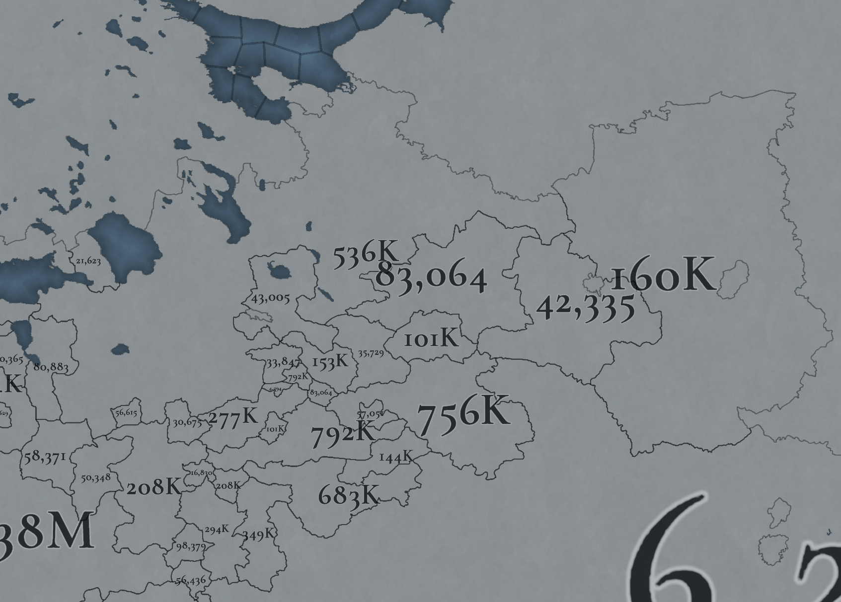
Not many people inhabit the Russian core, approximately 6M in total. This poses a series of challenges regarding the expansion of any Russian country. Also, we've divided into 4 different maps of the location population of the region, to make it possible to visualize. A side note: you might note that the population of NW Novgorod and Karelia is calculated a bit differently. That's because Johan took care of drawing the Scandinavian map in an early stage of development, and the Content Design team took over the rest of Russia at a later stage when we had already refined a bit more our population calculation methods. This means that when we do the feedback pass after this Tinto Maps, in a few weeks, we'll homogenize the style, as well.

And this is all for today! We hope that you’ll find it interesting, and give us great feedback! Next week we’re traveling to Carpathia and the Balkans! See you!

Few additions to the Komi and Mari people's representation.
1728828762601.png


First: Komi-permyak and Komi-zyryan should be split. K - Komi-zyryan(or just Zyryan) and P is Komi-permyak(or gust Permyak, Permian, Permich)
I based their divisions on tracing language maps
Izhma and Pechora locations also should have Komi-zyryan culture
1728828076421.png
1728827971922.png

Same with Udmurt people but to add to it
Mozhga - is populated by Udmurt people
Vyatka - Udmurt people populated the region, but it was a center of Russian migration and the Vyatka Republic. Perhaps it should have a Novgorodian majority.
Mari
AD_4nXcegynCLLRAPoNioil11ZTEQftzihHjp0wGQcIceRpgCM7PcUmxNHhqe7CjEUavc-l4Rr0V5qUXauIXp4PyYmqOIKAgV_0gVaOC4OdpP6AWqR-KMMYtuPpxSkQWtcq8pfCZvu1-IagWON5RhWiv6XFZrdya
AD_4nXcO0RaOMab45y85uMNyr-lKY36xPDfeCGoNxcGMDfWiKaDUP-LYq_565tn2w0clOYvY3UYWD51zh57EQ2Rj6ZDEqvkfjaD1MJj2n0nShpkVMPgFEHviy0gazJf7RgPjAWv-9TEoJokvE1HgecOetwGPcLXb

On the west Mari people bordered Gorodetskoye(Nizhniy Novgorod) and Galich principalities. Nizhny Novgorod did not control so many lands there. So the teritory should be reassigned like in the first picture.
Mararjev - should be named Unzha. It was the border fortification.
Vetluga - in the 13th century was Mari city named Yur. River Vetluga was fully controlled by Mari people. In 1280 Mari kuguz(prince) Bai fortified Yur city. In the 14th century kuguz Osh Pandash won against Galich principality. It was conquered only in 1468 by Galich prince Semyon Romanovich Yaroslavsky. The City of Yur was fully burned and destroyed. And Only later was colonised by Russians.
Sharanga - was built in the 17th century on Mari lands, and still is part of Mari culture.
Pyshchug and Vokhma were built in the 16th century. before that lands were not inhabited but they contain a lot of traces of Mari people and names of places.
In 1181 Novgorodian pirates conquered Mari city Koksharov, which became part of Vyatka land. I think it should still have Mari people around it but it is up to debate how many Novgorodians remained there and in Vyatka and Orlov cities.
The eastern border was aligned with the Vyatka River.
Kilmez - was settled by Mari only in the 16th century!
 
  • 4Like
  • 1
  • 1
Reactions:
Hello, and welcome one more week to Tinto Maps! This week we’ll be taking a look at Russia!

As an introductory note, we’re just considering today the ‘Russian core’, which in 1337 comprised the different Russian Principalities, as far as the White Sea to the north, and the Ural Mountains to the east. The lands that would later be incorporated into the Russian Empire will be covered in future Tinto Maps (otherwise, we would have to cover like… 1/8th? of the land mass in just one DD).

Countries
View attachment 1154677
Russia is divided into several Principalities in 1337. The dominant one probably is Muscovy, as its Grand Prince, Ivan I Danilovich ‘Kalita’ (‘Moneybag’) is also Prince of Nizhny Novgorod and Kostroma, and of Novgorod (by election, in this case). He also holds the title of Grand Prince of Vladimir, bestowed by the Khan of the Golden Horde, which makes him the ruler enforcing the ‘Tatar Yoke’ over other Russian Principalities (which in our game is represented through an IO; the coloring of the different countries is different tones of yellow as they are tributaries of the Yoke). The other main power in the region is the Grand Republic of Novgorod, with a completely different institutional structure, that allows them to pick their rulers. Their power comes from being the main trading power between the Baltic Sea and the Russian region, and it’s the overlord of two border countries, the Principality of Pskov, and the County of Oreshek, a buffer country in Karelia, as agreed with Sweden after a recent war. Several lands to the north and east are not owned by any country. As a final note, you may also see that Lithuania is the overlord of some of the principalities, some of them directly through Gediminid rulers (Polotsk or Vitebsk), while other over Rurikovich rulers (Smolensk or Rzhev).

View attachment 1154678
View attachment 1155164
The starting diplomatic of Muscovy and the Tatar Yoke IO, for the sake of clarity.

Dynasties
View attachment 1154695
Several branches of the House of Rurik rule over the Russian lands. Fun fact: we have 18 different branches portrayed in the game. The exceptions are a few principalities, and the ruler of Karelia, Prince Narimantas of the Lithuanian Gediminids. Also, the 'Cherdyn' and 'Vyatka' are randomly assigned dynasties, as we haven't been able to get the data for those countries on 1337.

Locations
View attachment 1154683
We’re showing a less detailed region this week because, well, Russia is big. Feel free to ask for more detailed screenshots of specific areas, and I’ll try to provide them. We’re also showing some parts of the Steppe, Finland, and Kola, because of the scale of the map; take them as ‘unavoidable spoilers’, as we’ll talk more in-depth about them in future Tinto Maps.

Provinces
View attachment 1154684
The provinces of Russia. As usual, suggestions are welcomed!

Terrain
View attachment 1154685
View attachment 1154686
View attachment 1154687
Terrain map modes. As discussed in previous Tinto Maps, we’ll read carefully your feedback, as we have plenty of room to polish them!

Cultures
View attachment 1154688
Cultures! As in other regions, we decided to have three different cultures in the Russian region, Novgorodian, Muscovite, and Severian. The design here is different than in the Ruthenian region, because Russia was more politically divided in the High Middle Ages, and would later be more culturally unified later on, while in Ruthenia, the situation would be the opposite. In any case, the four of them are East Slavic cultures, and we're open to feedback, of course. Apart from that, there are a bunch of different cultures bordering the region: Karelian, Pomor, Komi, Udmurt, etc. We might add some more minorities of these cultures, in the feedback pass after this DD. Also, take into account that the minorities over the Tatar lands (currently under the Kazani and Mishary cultures) are not yet done.

Religions
View attachment 1154689
Eastern Orthodoxy is dominant in the region, although there are other religions in the area, as well; take ‘Animist’, ‘Tengrist’, and ‘Shamanist’ as wide categories, as we’d like to add a bit more granularity for them (although that will come later this year, don’t expect them to be added in the coming Tinto Maps, but maybe on the later ones). We’ve already seen some posts asking about Slavic Paganism; up until now, we’ve considered the Russian people to be Christianized, even if it was a more or less superficial process. If you’d like us to add this religion and some percentage of the population adhering to it, then I’d ask you for specific sources that could help us portray it (so, isolated references to it being followed here or there won’t be helpful, while academic sources saying ‘up to X% of the population was following Slavic rites’ might very much be).

Raw Materials
View attachment 1155251
Quite different resources to other regions previously shown, with plenty of Lumber, Fur, and Wild Game in this region. I’ve also extended a bit the screenshot to the east, so you can see the mineral richnesses of the Ural Mountains, with plenty of locations with Copper, Iron, Gold, and Lead, making it quite juicy to colonize.

Markets
View attachment 1154965
The counter to the richness of the natural resources of the region is its integration into the different markets, which at the start of the game are centered around Novgorod, Moscow, and Kazan. Fully exploiting the economic possibilities of Russia will therefore require effort and patience.

Country and Location population
View attachment 1154693
View attachment 1154984
View attachment 1154985

View attachment 1154987
View attachment 1154990
Not many people inhabit the Russian core, approximately 6M in total. This poses a series of challenges regarding the expansion of any Russian country. Also, we've divided into 4 different maps of the location population of the region, to make it possible to visualize. A side note: you might note that the population of NW Novgorod and Karelia is calculated a bit differently. That's because Johan took care of drawing the Scandinavian map in an early stage of development, and the Content Design team took over the rest of Russia at a later stage when we had already refined a bit more our population calculation methods. This means that when we do the feedback pass after this Tinto Maps, in a few weeks, we'll homogenize the style, as well.

And this is all for today! We hope that you’ll find it interesting, and give us great feedback! Next week we’re traveling to Carpathia and the Balkans! See you!
The border between Slavic speakers and Mishary Tatars
1728830035956.png

Russians:
As I have outlined before
Pronsk - was a Russian city. It was a center of the Pronsk principality
Michurinsk should be named Kozlov
Usman - was a city built by settlers from Chernihiv in the 10th century
Kasimov - at that time was called Gorodets Meshersky (Meshera city) Was built before 1152 as a castle. In 1010, the region was converted to Christianity. Was never captured by the Golden Horde.
Oskol - had a Russian population before the Mongol conquest. Later became one of the Lithuanian cities.
Yelets - was a Russian city since 1060. In 1389 knyaz from Elsets Yury Ivanovich met the Metropolitan of Kiev Pimen.
Mishary:
historically formed between rivers Tsna and Moksha (Shilovo, Tambov and Penza locations).
Anna location - name comes from Tatar root


It is important to know that Christianity was not forbidden in the Golden Horde. There was a deligated Metropolit in Saray (Saray Eparchy). That can be one of the cases why so many Mishary Tatars have quickly assimilated as some could have been Orthodox. It is still debated that Cossacks were Christianized Tatars who accepted the Russian language as they became more involved with colonisers.
 
Last edited:
  • 1
  • 1Like
Reactions:
Yeah i agree wiht margustoo. Ingria can be formed i guess but there is no reason for it to exist in 1300s. Cause it was formed in 1600s when Sweden conquered these lands and if Ingremland is a thing then Karelians near Tver' should be also. Since they are settled there fleeing from Swedish folks
 
  • 1Like
Reactions:
I don't know if anyone has mentioned it, but an important source that should be looked at when making changes, is the list of Russian cities and towns that was published early 15th century and names most known towns, cities and other settlements that excisted during late 14th and early 15th century. This source could lead to better names for the locations.

Here is the map of all the settlements that were named there:
View attachment 1197460

I found another map about the same list of cities and villages. This one isn't without mistakes (for example South-Eastern Estonia is shown as part of Pskov and South-Eastern Latvia is shown as part of Lithuania, when in reality both were controlled by Livonian Order). But nevertheless it might be useful when determing where a town/city/fortification was/is.

1403302475.jpg

/edit - Made a map a spoiler, because following replies pointed out that it is even more controversial than what I originally thought. Borders are wrong in more places than just Baltics. Also ethnicities are wrong. And most crucially some city/town/fortress placements are wrong. Nevertheless I do think there is some use for it, because it might be way clearer where towns/cities are (than on the map I shared previously) because it is more high resolution.
 
Last edited:
  • 1
Reactions:
I found another map about the same list of cities and villages. This one isn't without mistakes (for example South-Eastern Estonia is shown as part of Pskov and South-Eastern Latvia is shown as part of Lithuania, when in reality both were controlled by Livonian Order). But nevertheless it might be useful when determing where a town/city/fortification was/is.

View attachment 1202243
It's a map of orthodox dioceses (that's what the title says). That's why bits of Estonia and Latvia under Livonian rule are coloured.
 
I found another map about the same list of cities and villages. This one isn't without mistakes (for example South-Eastern Estonia is shown as part of Pskov and South-Eastern Latvia is shown as part of Lithuania, when in reality both were controlled by Livonian Order). But nevertheless it might be useful when determing where a town/city/fortification was/is.

View attachment 1202243
It alarms me that this map has highly wrong culture/language markings. Moksha in Novgorod, Merya in Yaroslavl. That is not 1374. And the division of Slavic people into Baltorussian and Ukr (Ukrian?) is outlandish.
 
  • 1Like
Reactions: