• We have updated our Community Code of Conduct. Please read through the new rules for the forum that are an integral part of Paradox Interactive’s User Agreement.

Tinto Maps #9 - 5th of July 2024 - Carpathia and the Balkans

Greetings, and welcome to another Tinto Maps! This week we will be taking a look at Carpathia and the Balkans! It will most likely be an interesting region to take a look at, with a lot of passion involved… So I’ll just make an initial friendly reminder to keep a civil discussion, as in the latest Tinto Maps, as that’s the easiest way for us to read and gather your feedback, and improve the region in a future iteration. And now, let’s start with the maps!

Countries:
Countries.png

Carpathia and the Balkans start in a very interesting situation. The Kingdom of Hungary probably stands as the most powerful country in 1337, but that only happened after the recovery of the royal power enforced by Charles I Robert of the House of Anjou, who reined in the powerful Hungarian nobility. To the south, the power that is on the rise is the Kingdom of Serbia, ruled by Stefan Uroš IV Dušan, who has set his eyes on his neighbors to expand his power. The Byzantine Empire, meanwhile, is in a difficult position, as internal struggles ended in Andronikos III being crowned sole emperor, at the cost of dividing the realm; both Serbia and Bulgaria have in the past pressed over the bordering lands, while the Ottomans have very recently conquered Nicomedia. The control over the Southern Balkans is also very fractioned, with a branch of the Anjou ruling over Albania, the Despotate of Epirus under the nominal rule of Byzantium as a vassal, Athens, Neopatria and Salona as vassals of the Aragonese Kings of Sicily, Anjou protectorates over Achaia and Naxos, and only nominal Byzantine control over Southern Morea. It’s also noticeable the presence of the Republics of Venice and Genoa, which control several outposts over the Adriatic and Aegean Seas. A final note: in previous maps, Moldavia was shown in the map, but we’ve removed it from it, and it will most likely spawn through a chain of events in the 1340s.

Dynasties:
Dynasties.png

The House of Anjou rules over Naples, Hungary, Albania, Achaia, and Cephalonia; they’re truly invested in their push for supremacy over the region. Apart from that, each country is ruled by different dynasties, except for Athens and Neopatria, ruled by the House of Aragón-Barcelona.

Locations:
Locations 1.png

Locations 2.png

Locations 3.png

Locations 4.png
This week we’re posting the general map of the region, along with some more detailed maps, that can be seen if you click on the spoiler button. A starting comment is that the location density of Hungary is noticeably not very high; the reason is that it was one of the first European maps that we made, and we based it upon the historical counties. Therefore, I’m already saying in advance that this will be an area that we want to give more density when we do the review of the region; any help regarding that is welcome. Apart from that, you may notice on the more detailed maps that Crete appears in one, while not being present in the previous one; because of the zooming, the island will appear next week along with Cyprus, but I wanted to make an early sneak peek of the locations, given that is possible with this closer zoom level. Apart from that, I’m also saying in advance that we will make an important review of the Aegean Islands, so do not take them as a reference for anything, please.

Provinces:
Provinces.png

Provinces! Nothing outstanding to be commented on here; as usual, we’re open to any feedback regarding them.

Terrain:
Climate.png

Topography.png

Vegetation.png

Terrain! The climate of the region is mostly divided between Continental and Mediterranean, with some warmer and some colder regions. Regarding the topography, the Carpathian mountains are famously important and strategic, while the Balkans are a quite hilly and mountainous region, which is also greatly covered by woods and forests.

Cultures:
Cultures.png

Here comes the fun part of the DD: The cultural division of the Balkans! A few comments:
  1. Hungary is full of different minorities. Transylvania, especially, is an interesting place: there we have a mix of ‘Hungarians’, ‘Transylvanians’ (which are the Romanian-speaking inhabitants of the region), ‘Transylvanian Germans’, and ‘Szekely’ people.
  2. We have divided the Southern Slavic-speaking region into their dialectal families of Slovene, Croatian, Bosnian, and Serbian.
  3. The Southern Balkans are mostly divided among Bulgarian, Albanian, and Greek cultures.
  4. We’re also portraying plenty of other cultures, such as Dalmatians, Aromanians, Sclavenes, Arvanites, Cumans, Jasz, or Ashkenazi and Romanyoti Jews.

Religions:
Religion.png

This one is also interesting. Apart from the divide between Western Catholicism and Eastern Orthodoxy, we have the Krstjani in Bosnia, Bogomils (the pink stripes both in Bosnia and Macedonia), and Paulicians in Thrace. The Jewish populations do not pass the threshold percentage to appear on the map, but there are plenty of communities across the region.

Raw Materials:
Raw Materials.png

The materials of the region. Something very noticeable is the richness of minerals, with plenty of Iron, Copper, Tin, Lead, Gold, and Silver. Specifically, Slovakia is very rich, and you definitely want more settlers to migrate to the region, and exploit its resources. The region is also very rich in agricultural resources, as you can see.

Markets:
Markets.png

The region is mostly divided among four markets: Venice, Pest, Ragusa and Constantinople.

Country and Location population:
Population 1.png

Population 2.png

Population 3.png

Population 4.png
Country and location population (which I’ve also sub-divided, and is under the Spoiler button).

And that’s all of today! I hope that you find the region interesting; we certainly think that it is. Next week we will go further south, and we will take a look at the Syrian Levant and Egypt. Cheers!
 
  • 193Like
  • 69Love
  • 7
  • 4
  • 3
  • 1Haha
Reactions:
1. Ok, this one really confuses me, specifically the mention of Sclavenes. To my knowledge "Sclaveni" was the term the Byzantines Romans used to refer to all Slavs, and this term fell out of usage once the different Slavic groups started forming separate identities. So by the time there are separate Croat, Bosniak, Serb et cetera cultures the term would not be appropriate to use. It seems that the pops labeled as "Sclavene" here are represented on the map as the blue stipes in parts of Greece. So does this culture refer to a now extinct Slavic speaking culture located in Greece that I don't know of?

2. As everyone has already pointed out - the split between Wallachian and Transylvanian cultures is inconsistent. You either have three cultures - Wallachian, Transylvanian and Moldavian or you have one - Romanian. In my personal opinion the first option is better, since it would be on roughly the same level of granularity as France already is in the game

3. I feel like Transylvanian Germans should be renamed to Transylvanian Saxons, since that's what they call themselves irl.

4. This is probably more of a topic for a future Pontic Steppe TT but Moldavia should be much more ethnically diverse. In 1337 besides the main Wallachian Moldavian/Moldovan culture the region would also be home to steppe nomads - primarily Cumans and Tatars in the southern regions as well as Slavic (Ruthenian) people - descendants of the ancient Tivertsi and the not so ancient Berladnici, who would form a majority (or at least a plurality) in the region of Bukovina.

5. Finally, here are some suggestions for dynamic location names and better location names in the regions that I'm familiar with:
Transcarpathia:
- Prešov (Slovak) -> Priashiv (Ruthenian & Rusyn), Priashovo (alternative Rusyn), Eperjes (Hungarian), Eperies (German), Preszów (Polish), Pryashev (Russian)
- Leibitz (German), Ľubica (Slovak) -> Liubytsia (Ruthenian), Liubitsa (Rusyn), Leibic (Hungarian)
Not entirely sure why this particular village was chosen, since the town of Kežmarok is right there, just tweak the location borders a bit.
Then the names would be:
- Kežmarok (Slovak), Késmárk (Hungarian), Käsemark (German), Kezhmarok (Rusyn and Ruthenian), Kieżmark (Polish), Kezmark (Yiddish), Villa Saxonum apud Ecclesiam Sancte Elisabeth (Latin).
- Kassa (Hungarian), Košice (Slovak) -> Koshytsi (Ruthenian), Koshitsi (Rusyn), Cașovia (Romanian), Koszyce (Polish) Kaschau (German), Kashoy (Yiddish), Cassovia (Latin)
- Zemplén (Hungarian) -> Zemplín (Slavic languages)
- Ungvár (Hungarian) -> Ungvar (Every other language), the name "Uzhorod" and it's variants were invented in the mid 1800s.
- Beregovo (Russian) -> Berehovo (Slovak, Rusyn), Berehove (Ruthenian), Beregszász (Hungarian), Bereg (Romanian), Bereg Saski (Polish), Beregsaß (German), Beregsaz (Yiddish)
- Huszt (Hungarian) -> Khust (Ruthenian, Rusyn), Hust (Romanian, alternative Rusyn), Chust (Slovak, German), Khist (Yiddish)
- Yasine (???) -> Yasinia (Ruthenian), Yasinie (Rusyn), Kőrösmező (Hungarian), Frasin (Romanian), Jasiňa (Slovak) Jasin (Yiddish)
The only notable thing about the town of Yasinia is that it was the capital of the short-lived Hutsul repubic. A better choice for the name of the location would be the city of Rakhiv, which is bigger and older; or the town of Velykyi Bychkiv, which is the oldest in the region (first recorded mention - 1358)
So the naming for these two would be:
- Rakhiv (Ruthenian), Rakhovo (Rusyn), Rahó (Hungarian), Rahău (Romanian), Rachov (Slovak), Rakhov (Russian), Rachów (Polish), Rachiw (German), Rakhev (Yiddish)
- Velykyi Bychkiv (Ruthenian), Velykyi Bychkov (Rusyn), Nagybocskó (Hungarian), Bocicoiu Mare (Romanian), Veľký Bočkov (Slovak), Velikiy Bychkov (Russian)
Bukovina:
The province of Suceava should be renamed into Bukovina, obviously. Although it is a bit too big to match the historical borders of the region.
- Cernăuți (Romanian) -> Chernivtsi (Ruthenian), Czernowitz (German), Czerniowce (Polish), Csernovic (Hungarian), Chernovitsy (Russian), Çernivtsi or Çernovi (Turkish) Tshernovits (Yiddish)
The tiny unreadable province between Cernăuți and Hotin is "Cetatea Țețina" - a fortress on what is today the outskirts of Chernivtsi that fades out of the historical record in mid 15th century, which is a pretty weird choice for a separate location. The names for it would be:
- Cetatea Țețina (Romanian) -> Tsetsyn (Ruthenian), Cecyn (Polish)
I feel like this location needs a better name, but I can't think of one. The town of Kitsman probably corresponds best to the in-game location's boundries.
- Kitsman (Ruthenian), Cozmeni (Romanian), Kotzman (Yiddish)
It could also be renamed after the village of Shypyntsi, which was a prominent settlement in the XIV century and gave it's name to the region of Bukovina (at the time it was known as Shypyntsi land).
- Shypyntsi (Ruthenian), Șipeniț (Romanian)
- Hotin (Romanian and Turkish) -> Khotyn (Ruthenian), Chocim (Polish), Khetin (Yiddish)
Bessarabia
- Soroca (Romanian) -> Soroky (Ruthenian)
- Orhei (Romanian) -> Orhiiv (Ruthenian), Orgeev (Russian), Őrhely (Hungarian)
Budjak
- Tighina (Romanian) -> Bender (Turkish), Bendery (Ruthenian, Russian), Tyagyanyakyacha (Cuman)
- Cetatea Albă (Romanian) -> Akkerman (Turkish, Ruthenian, Russian), Aqkermen (Tatar), Weißenburg (German), Asprokastron (Greek), Moncastro (Italian), Album Castrum (Latin)
- Chilia Nouă (Romanian) -> Kiliia (Ruthenian, Russian), Kellia (Greek), Licostomo (Italian)
- Ismail (Romanian, Bulgarian) -> Izmail (Ruthenian, Russian), Ismailiye (Turkish), Licovrissi (Italian)
- Cahul (Romanian) -> Kagul (Russian), Kahul (Bulgarian, Ruthenian)
I am gonna be honest with you, those "Rusyn" names are nonsense. Rusyn uses latin script, which is based on Czech. So it would be Pr'ašovo, Kežmarok, Jasiňe, Rachovo and so on.
 
Last edited:
  • 1Like
  • 1
  • 1
Reactions:
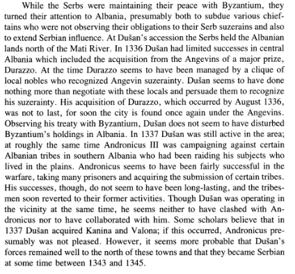
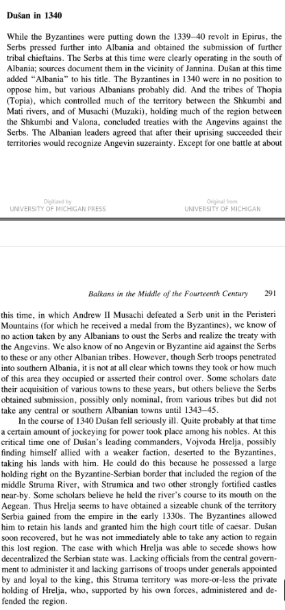
I have a suggestion for Albanian situation, I believe that there should be 2 more TAGs added which would be Thopia family (tag: Kruje) and Muzaka family (tag: Berat)
Current Albanian TAG would be historically depicted in Durres, Thopia dynasty could be depicted as a nominal vassal (or a ally) of Albania.
Muzaka TAG would be depicted as a Vassal state to Byzantium under rule of Andrea II Muzaka.
Byzantium would rule Valona and parts of Central Albania, as Thopia family historically (until Dusan's conquest) only owned territories between Mat and Shkumbin rivers, and Adronicos III (current Byz Emperor at the startdate) campaigned in central Albania in 1335.
Serbia should historically own area north of Mat river as well as Debar.

Now the another suggestion:

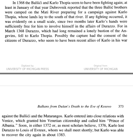
If Muzaka or Thopia states would become independent and annex Albanian TAG then either of those tags would inherit the Albanian state and form Albanian TAG (now under Albanian dynasty). This would reflect how Carl Thopia captured Durres in 1368 and after that he would be recognized as "Lord of Albania" in 1370s.


View attachment 1183102
Good suggestion! Do you happen to have a few sources on this subject, too? This would be the ideal setup, don't get me wrong, but the devs generally like to see a source or two, too.
 
I am gonna be honest with you, those "Rusyn" names are nonsense. Rusyn uses latin script, which is based on Czech. So it would be Priašovo, Kežmarok, Jasinie, Rachovo and so on.
Oh, I didn't actually know Rusyn had a standardized Latinization based on Czech, the names I found were in Cyrillic. Thanks for the correction!
 
  • 1Like
Reactions:
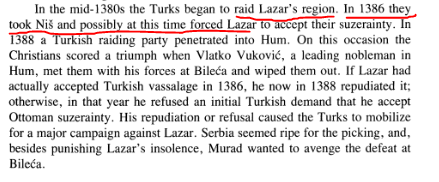
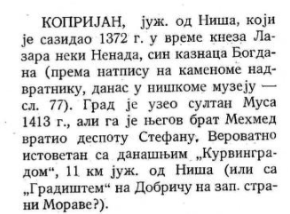
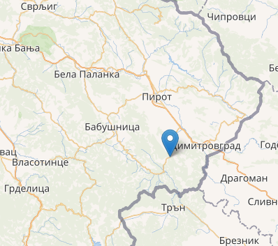
Nis,Svrljig,Pirot were recorded as Serbian after 1330. Since there was no wars between Serbia and Bulgaria border was most likely changed in 1330.
Also we know how border between Serbia and Vidin area looked like due to Ottomans keeping former borders and using them as internal ones.

I don’t see how this Wikipedia page proves that Pirot was under Serbian control in 1337. It’s not mentioned at all. Frankly, this article is poorly written. First, it claims “It was built in the 14th century by Serbian brigand and local ruler Momchil”. However, the two citations at the end sentence don’t seem to correspond to this statement. The first one is direct citation (in Bulgarian) saying “John Kantakouzenos explicitly emphasized: Momchil "...was descended from the Moesians [Bulgarians]"”. The second one points out p. 304 of Fine’s “The Late Medieval Balkans. A Critical Survey from the Late Twelfth Century to the Ottoman Conquest” where Momchil (Momcilo)’s actions in the Rhodope region were mentioned but nothing about Pirot fortress. Maybe the citations were meant for Momchil himself but still it is a lousy job. Thereafter the article describes places/regions, people and events but not explaining how they correlate to the Pirot Fortress.

I guess you fell for the “…Serbian brigand and local ruler Momchil” part of the sentence. Momchil changed sides many times over the years – during the Byzantine civil war he was first John Kantakouzenos’s ally, then Anna Savoy’s and Ivan Alexander’s, and finally Dusan’s. It’s highly unlikely or controversial to say the least to claim that Momchil commissioned the Pirot fortress building. He operated in the Rhodope region (Podvis and St. Irene fortresses), Thrace and Aegean coast (Xhanti). Check about this Fine’s “The Late Medieval Balkans. A Critical Survey from the Late Twelfth Century to the Ottoman Conquest”. My advice is not to trust everything you read on Wikipedia. Can you provide some other source (from the period), which claims that Momchil ruled over Pirot region, and he was a Serbian vassal?


Regarding the second material, it is hard for me to properly understand it (it is in Serbian after all). I gave it a try with Google Translator though. The things that bothers me the most is that in chapter “СРПСКА СРЕДЊОВЕКОВНА ЖУПА ТИМОК” (p. 47) I don’t see citations of authors from the period (13-14th century), only scholars from modern times. The other thing is that the work is some compilation of myths. Can you provide some other source concerning the topic?
 
Last edited:
  • 4
  • 1
Reactions:
I don’t see how this Wikipedia page proves that Pirot was under Serbian control in 1337. It’s not mentioned at all. Frankly, this article is poorly written. First, it claims “It was built in the 14th century by Serbian brigand and local ruler Momchil”. However, the two citations at the end sentence don’t seem to correspond to this statement. The first one is direct citation (in Bulgarian) saying “John Kantakouzenos explicitly emphasized: Momchil "...was descended from the Moesians [Bulgarians]"”. The second one points out p. 304 of Fine’s “The Late Medieval Balkans. A Critical Survey from the Late Twelfth Century to the Ottoman Conquest” where Momchil (Momcilo)’s actions in the Rhodope region were mentioned but nothing about Pirot fortress. Maybe the citations were meant for Momchil himself but still it is a lousy job. Thereafter the article describes places/regions, people and events but not explaining how they correlate to the Pirot Fortress.

I guess you fell for the “…Serbian brigand and local ruler Momchil” part of the sentence. Momchil changed sides many times over the years – during the Byzantine civil war he was first John Kantakouzenos’s ally, then Anna Savoy’s and Ivan Alexander’s, and finally Dusan’s. It’s highly unlikely or controversial to say the least to claim that Momchil commissioned the Pirot fortress building. He operated in the Rhodope region (Podvis and St. Irene fortresses), Thrace and Aegean coast (Xhanti). Check about this Fine’s “The Late Medieval Balkans. A Critical Survey from the Late Twelfth Century to the Ottoman Conquest”. My advice is not to trust everything you read on Wikipedia. Can you provide some other source (from the period), which claims that Momchil ruled over Pirot region, and he was a Serbian vassal?


Regarding the second material, it is hard for me to properly understand it (it is in Serbian after all). I gave it a try with Google Translator though. The things that bothers me the most is that in chapter “СРПСКА СРЕДЊОВЕКОВНА ЖУПА ТИМОК” (p. 47) I don’t see citations of authors from the period (13-14th century), only scholars from modern times. The other thing is that the work is some compilation of myths. Can you provide some other source concerning the topic?
If you have google translator or some other picture translator that you can check the other source,(since you probably got confused by name of the book, which would be Timok in history and myth, as the book has chapters about both actual history and political myths)
altho it is in Serbian it goes deeply into detail around the area of Timok in medieval ages (you have a chapter about Medieval Zupa).
First part is simply wrong as we undeniably have evidence that Pirot area (and Nis) was part during Lazar's rule. John A Fine also mentions this for Nis:
1725392960104.png
Late Medieval Balkans p.408

You can also check Medieval cities in Serbia, Montenegro and Macedonia by Alexander Deroko :
1725393466623.png
p.132
1725397113405.png
p.121


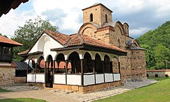
Also we have monastery of Poganovo that was built by Serbian noble Konstantine Dejanovic during the after the Serbian Empire :
1725393922455.png
1725393958872.png

which would also prove that area south of Pirot of was part of Serbia since 1330 (considering that there were no hostilities between Bulgarians and Serbs since 1330).
 

Attachments

  • 1725393940026.png
    1725393940026.png
    1,4 MB · Views: 0
Last edited:
  • 1
Reactions:
Bosnian culture is way to over represented, according to Paradox some cultures persist after hundreds of years after being conquered by a foreign power, but apparently if Bosnia holds a territory for 10-20 years before the start date of EU5, that region is automatically Bosnian culture.
 
  • 3Like
Reactions:
A few suggestion to the Hungarian map (1st part...):

LOCATIONS
Although the Hungarian locations are very good choices in general still I have some suggestions

Misspelled:

Not GYÖR but GYŐR (https://en.wikipedia.org/wiki/Győr)
not NAGYSZÖLLÖS but NAGYSZŐLŐS (https://en.wikipedia.org/wiki/Vynohradiv)
not KOROSBANYA but KÖRÖSBÁNYA (https://en.wikipedia.org/wiki/Baia_de_Criș)
not KOLOSZVÁR but KOLOZSVÁR (https://en.wikipedia.org/wiki/Cluj-Napoca)

A very unimportant location name is chosen instead of a more important one:

JAKEB_SZÁLLÁSA (proper Hungarian name is JAKABSZÁLLÁS) was a village while KECSKEMÉT is a much more important small market-place with a charter from 1368 (https://en.wikipedia.org/wiki/Kecskemét).
SAJÓGÖMÖR (https://hu.wikipedia.org/wiki/Sajógömör) was only a small village while JOLSVA (https://en.wikipedia.org/wiki/Jelšava) was a small but important town.
ORAVSKY PODZÁMOK is the Slovakian name of the village under the castle of ORAVA (its name means literally "the village under the castle"), so ORAVA (ÁRVA in Hungarian) could be a better choice (https://en.wikipedia.org/wiki/Orava_Castle).
CSÍKSOMLYÓ was an unimportant village in 1337 (https://en.wikipedia.org/wiki/Csíksomlyó_Pilgrimage) while CSÍKSZEREDA was the center of the district (https://en.wikipedia.org/wiki/Miercurea_Ciuc).
 
  • 2Like
Reactions:
  • 2Like
Reactions:
A few suggestion to the Hungarian map (3rd part...):

TERRAIN:

There should be much more locations with hills instead of flatlands.
I suggest the following locations with their hills:

Eger (Bükk) https://en.wikipedia.org/wiki/Bükk
Esztergom (Pilis) https://en.wikipedia.org/wiki/Pilis
Veszprém (Bakony) https://en.wikipedia.org/wiki/Bakony
Zemplén (Zemplén) https://en.wikipedia.org/wiki/Zemplén_Mountains
Kassa, Sajógömör and Torna (Gömör-Szepesi Érchegység) https://en.wikipedia.org/wiki/Slovak_Ore_Mountains
Buda (Budai-hegység) https://en.wikipedia.org/wiki/Pilis
Balassagyarmat (Börzsöny and Cserhát) https://en.wikipedia.org/wiki/Börzsöny
Hlohovec (Kis-Kárpátok) https://en.wikipedia.org/wiki/Little_Carpathians
Bihar, Beius and Korosbanya (Erdélyi-középhegység) https://en.wikipedia.org/wiki/Apuseni_Mountains

Detailed map in general:
 
  • 2Like
Reactions:
A few suggestion to the Hungarian map (4th part...):

CULTURES:

A suggest a strong German presence also in the northern part of Hungary (there were German settlers just like in Transylvania).
Levoca, Leibitz (both https://en.wikipedia.org/wiki/Zipser_Germans) and Banska Bystrica (https://en.wikipedia.org/wiki/Banská_Bystrica) have the same ethnic composition: German cities and towns with surrounding Slovakian villages.

Transylvanian Culture: Ist name is not the very best choice. The word Transylvanian is used for every inhabitants of Transylvania (including Romanians, Germans and Hungarians) not only for the those whom we call now Romanians. I suggest Transylvanian Vlachs (https://en.wikipedia.org/wiki/Vlachs) or Wallachians.


RELIGIONS:

As I see all Serbs, Rusyns and Transylvanian Vlachs are Orthodox. That's perfect!
 
  • 2Like
Reactions:
A few suggestion to the Hungarian map (5th part...):

RAW MATERIALS:

WINE!!!
I see only one location with wine in the map.
That must be corrected at least in the following locations:

Wine was a very important in medieval Hungary just think about Tokaji (https://en.wikipedia.org/wiki/Tokaji) which was produced in Zemplén and a dark red wine which was produced in Sremska Mitrovica (https://en.wikipedia.org/wiki/Fruška_Gora). Buda (https://winesofhungary.hu/wine-in-the-city/budapest-wine-history) and Eger (https://en.wikipedia.org/wiki/Eger) was also famous for its wine.

SALT
Salt-mining gave 10-20% of the income of the crown. There were far more salt mines than I see on the map.

I suggest Torda and Huszt for salt.

And one more thing I have taken as a personal offence:
Tolnavár (my place of birth) produces sand. Never-ever! Wine would be a much better choice (https://en.wikipedia.org/wiki/List_of_wine-producing_regions)
 
  • 2Like
Reactions:
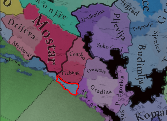
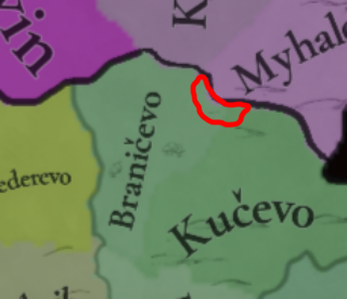
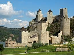
You should add locations of Konavle and Golubac


Konavle was a region (then part of Serbia) that is mising in the game, it's also the place where Stjepan II Kotromanic pilliged (1349) which latter provoked Stefan Dusan to invade Bosnia in 1350.
1725629924920.png


Golubac was a important fortification that was built in the early of 14th century, it was also quite hard to siege due to all towers being disconnected from each other.

1725630293179.png
1725630068628.png


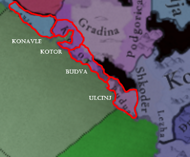
Also for Zeta coast : You should add Ulcinj location and move Budva closer to its real location.
1725632189431.png
 

Attachments

  • 1725629868834.png
    1725629868834.png
    246,8 KB · Views: 0
Last edited:
  • 4Like
Reactions:
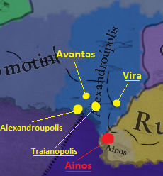
A month or two ago I quickly scanned for a good alternative for Alexandroupolis (which is itself the Greek name for an Ottoman Turkish village founded in the 19th century). I discarded the idea of renaming it to Traianopolis because I thought the city was gone already, but after a bit more research that doesn't seem to be the case. It still existed.

Someone in the Anatolian feedback-thread pointed out the castle of Avantas, which was used in the early 14th century as well. You'd think it could function as a substitute for Alexandroupolis, but a little bit of further digging yielded the following result: Avantas was built to not just protect the roads into the plains of Komotini/Thrace, but also to protect neighbouring cities/towns like Vira/Bera and Traianopolis from incursions made by Bulgarians or other hostile forces.

The map with the mentioned towns/castles:
Traianopolis.png


Some (translated) bits from the Greek Wikipedia (supported by a few other parts found on Google):
Traianopolis - Abandonment.PNG

I know, I know. It's Wikipedia again. But a quick Google doesn't yield other results than it still being in play for a decade or so after 1337.

And some bits about Vira/Bera, a neighbouring town with a fortified monastery. Also an option (but not my preferred one, that'd be Traianopolis itself).
On Vira.PNG

https://en.wikipedia.org/wiki/Theotokos_Kosmosoteira
Monastery.JPG

Neighbouring Ainos could get the Fish-tradegood, by the way, which would make more sense than Horses, if we look at the size of its hinterlands:
Ainos - Fish or Salt.PNG


So, in short:
- Rename Alexandroupolis to either Traianopolis or Vira (don't mind my spelling).
- Give the Fish tradegood to Ainos, instead of Horses.

EDIT: @DD0524 Why the disagree? Is it because of my earlier comment on Bulgarian culture in Macedonia? Or do you have other information which is unavailable to me?
 
Last edited:
  • 3
  • 1
Reactions:
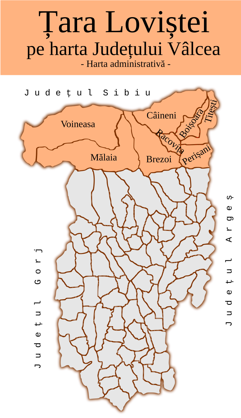
A Brezoi location should be split of off Râmnicu Vâlcea in the shape of the land of Loviștea, and made mountains instead; this location should also probably block the direct path from Szeben to Argeș, so that the road would take through Brezoi.

Câmpulung may also be mountains.

1725702084291.png

Edit: sorry fo the gigantic embed no idea why it looks like that
 
Last edited:
  • 1
Reactions:
If you have google translator or some other picture translator that you can check the other source,(since you probably got confused by name of the book, which would be Timok in history and myth, as the book has chapters about both actual history and political myths)
altho it is in Serbian it goes deeply into detail around the area of Timok in medieval ages (you have a chapter about Medieval Zupa).
First part is simply wrong as we undeniably have evidence that Pirot area (and Nis) was part during Lazar's rule. John A Fine also mentions this for Nis: View attachment 1183275 Late Medieval Balkans p.408

You can also check Medieval cities in Serbia, Montenegro and Macedonia by Alexander Deroko :
View attachment 1183282 p.132
View attachment 1183338 p.121


Also we have monastery of Poganovo that was built by Serbian noble Konstantine Dejanovic during the after the Serbian Empire :
View attachment 1183283View attachment 1183285
which would also prove that area south of Pirot of was part of Serbia since 1330 (considering that there were no hostilities between Bulgarians and Serbs since 1330).

The ownership of Nish is unclear in the 1330s. It might have been ceded to Serbia as a part of the peace treaty after the Battle of Velbazhd as some scholars suggest. But it might have been part of another deal we don’t know about in the later decades. I guess we would never know for sure unless some source resurface. It is clear that was part of the Lazar’s domain but it is some 50 years later.


Regarding Pirot, I have the feeling that you misinterpreted the text you posted. The text says that Lazar’s vojvoda Dimitrije captured Pirot after 1386. Check slightly different version of your text below. This page is from Colin Imber’s “The Ottoman Empire 1300–1481” book. Imber cited anonymous Ottoman source from 15th century, which was part of later compilation of sources gathered by Nesri. It seems that Lazar captured Pirot after the battle at Plochnik (1386 or 1387).
Imber, 1990 (p35).png


The starting date of Poganovo Monastery construction is contested. But let assume that starting date is in 1395 as some suggest, a bit before Konstantin Dragaš death. At this point this region was under Ottoman control. Konstantin Dragaš was Ottoman vassal since the very beginning of his reign in 1378. It is very plausible that Dragaš received the land around the monastery as a reward of being loyal vassal. It can hardly prove anything.
 
Last edited:
  • 4
  • 1
Reactions:
In the southern and central maps there are more people in the Athens location than in Byzantium? With the 3rd largest city at Megara just next door? Adding in the northern map shows Pecs as even larger?
 
  • 1Like
Reactions:
In the southern and central maps there are more people in the Athens location than in Byzantium? With the 3rd largest city at Megara just next door? Adding in the northern map shows Pecs as even larger?
A location has more than just the city, it also includes it agglomeration and overall a wider area. In the case of Pécs they ended up going with one massive location for the entirety of Baranya county, because of which the location has the population of the entire medieval county
 
  • 2Like
  • 1
Reactions: