• We have updated our Community Code of Conduct. Please read through the new rules for the forum that are an integral part of Paradox Interactive’s User Agreement.

Tinto Maps #9 - 5th of July 2024 - Carpathia and the Balkans

Greetings, and welcome to another Tinto Maps! This week we will be taking a look at Carpathia and the Balkans! It will most likely be an interesting region to take a look at, with a lot of passion involved… So I’ll just make an initial friendly reminder to keep a civil discussion, as in the latest Tinto Maps, as that’s the easiest way for us to read and gather your feedback, and improve the region in a future iteration. And now, let’s start with the maps!

Countries:
Countries.png

Carpathia and the Balkans start in a very interesting situation. The Kingdom of Hungary probably stands as the most powerful country in 1337, but that only happened after the recovery of the royal power enforced by Charles I Robert of the House of Anjou, who reined in the powerful Hungarian nobility. To the south, the power that is on the rise is the Kingdom of Serbia, ruled by Stefan Uroš IV Dušan, who has set his eyes on his neighbors to expand his power. The Byzantine Empire, meanwhile, is in a difficult position, as internal struggles ended in Andronikos III being crowned sole emperor, at the cost of dividing the realm; both Serbia and Bulgaria have in the past pressed over the bordering lands, while the Ottomans have very recently conquered Nicomedia. The control over the Southern Balkans is also very fractioned, with a branch of the Anjou ruling over Albania, the Despotate of Epirus under the nominal rule of Byzantium as a vassal, Athens, Neopatria and Salona as vassals of the Aragonese Kings of Sicily, Anjou protectorates over Achaia and Naxos, and only nominal Byzantine control over Southern Morea. It’s also noticeable the presence of the Republics of Venice and Genoa, which control several outposts over the Adriatic and Aegean Seas. A final note: in previous maps, Moldavia was shown in the map, but we’ve removed it from it, and it will most likely spawn through a chain of events in the 1340s.

Dynasties:
Dynasties.png

The House of Anjou rules over Naples, Hungary, Albania, Achaia, and Cephalonia; they’re truly invested in their push for supremacy over the region. Apart from that, each country is ruled by different dynasties, except for Athens and Neopatria, ruled by the House of Aragón-Barcelona.

Locations:
Locations 1.png

Locations 2.png

Locations 3.png

Locations 4.png
This week we’re posting the general map of the region, along with some more detailed maps, that can be seen if you click on the spoiler button. A starting comment is that the location density of Hungary is noticeably not very high; the reason is that it was one of the first European maps that we made, and we based it upon the historical counties. Therefore, I’m already saying in advance that this will be an area that we want to give more density when we do the review of the region; any help regarding that is welcome. Apart from that, you may notice on the more detailed maps that Crete appears in one, while not being present in the previous one; because of the zooming, the island will appear next week along with Cyprus, but I wanted to make an early sneak peek of the locations, given that is possible with this closer zoom level. Apart from that, I’m also saying in advance that we will make an important review of the Aegean Islands, so do not take them as a reference for anything, please.

Provinces:
Provinces.png

Provinces! Nothing outstanding to be commented on here; as usual, we’re open to any feedback regarding them.

Terrain:
Climate.png

Topography.png

Vegetation.png

Terrain! The climate of the region is mostly divided between Continental and Mediterranean, with some warmer and some colder regions. Regarding the topography, the Carpathian mountains are famously important and strategic, while the Balkans are a quite hilly and mountainous region, which is also greatly covered by woods and forests.

Cultures:
Cultures.png

Here comes the fun part of the DD: The cultural division of the Balkans! A few comments:
  1. Hungary is full of different minorities. Transylvania, especially, is an interesting place: there we have a mix of ‘Hungarians’, ‘Transylvanians’ (which are the Romanian-speaking inhabitants of the region), ‘Transylvanian Germans’, and ‘Szekely’ people.
  2. We have divided the Southern Slavic-speaking region into their dialectal families of Slovene, Croatian, Bosnian, and Serbian.
  3. The Southern Balkans are mostly divided among Bulgarian, Albanian, and Greek cultures.
  4. We’re also portraying plenty of other cultures, such as Dalmatians, Aromanians, Sclavenes, Arvanites, Cumans, Jasz, or Ashkenazi and Romanyoti Jews.

Religions:
Religion.png

This one is also interesting. Apart from the divide between Western Catholicism and Eastern Orthodoxy, we have the Krstjani in Bosnia, Bogomils (the pink stripes both in Bosnia and Macedonia), and Paulicians in Thrace. The Jewish populations do not pass the threshold percentage to appear on the map, but there are plenty of communities across the region.

Raw Materials:
Raw Materials.png

The materials of the region. Something very noticeable is the richness of minerals, with plenty of Iron, Copper, Tin, Lead, Gold, and Silver. Specifically, Slovakia is very rich, and you definitely want more settlers to migrate to the region, and exploit its resources. The region is also very rich in agricultural resources, as you can see.

Markets:
Markets.png

The region is mostly divided among four markets: Venice, Pest, Ragusa and Constantinople.

Country and Location population:
Population 1.png

Population 2.png

Population 3.png

Population 4.png
Country and location population (which I’ve also sub-divided, and is under the Spoiler button).

And that’s all of today! I hope that you find the region interesting; we certainly think that it is. Next week we will go further south, and we will take a look at the Syrian Levant and Egypt. Cheers!
 
  • 193Like
  • 69Love
  • 7
  • 4
  • 3
  • 1Haha
Reactions:
I just have one thing to add, the region you called "Toplica"in Serbia there was called "Zagrlata" in middle ages. Also Kosovo not a thing in that time, the near modern borders for that make no sense, the demographic also is kind of wrong, we started really migrating north when the turks hit us, the northern part of serbia should be nearly all be bulgarian and aromanian all the way to the velika morava-south morava rivers, the southern demographic should have much more serbs especially in the as you named it dardania region.
 
Last edited:
  • 2Like
  • 2
Reactions:
I honestly don't know, but my opinion is that the population in Usora and Soli is mostly krstjan but not mostly Bosnian in that area, I belive in a game sense the area is ripe to sway ether Serbian or Bosnian majority, and I'm basing this on next to nothing historicaly... Tho I disagree that we should call the Bosnian culture at that stage as being in its "adolescence", it would be hard to argue that considering it so easily converted to Islam when the Ottomans arrived, one would expect more resistance.
Well then you need to consider why this particular area and people with their specific cultural/religious experiences converted more readily compared to their neighbors. I don't think this means the culture was 'weak' but rather that the relationship and perception of Christian religions had deteriorated due to historical experiences. In your understanding, having a weak culture means you are more readily converted which doesn't make that much sense. If the culture is weak that just means it is not that distinct from some other culture (not that it is a super primitive culture), so why would this alone lead to such a large difference in conversion? Instead that should mean it should have experienced a religious path similar to its 'parent' culture. It would be more appropriate to say that the reason for conversion are the cultural and religious differences.
 
  • 1Like
  • 1
Reactions:
For better historical accuracy, the Jász and Cuman people in Hungary should be associated with horses or livestock as their primary raw resources. Rather than regions like Slovakia, Pécs, or even Transylvania. Please adjust the resources for Kiskunfélegyháza, Jakeb-Szállása (this name is incorrect in Hungarian and needs correction), and Karcag accordingly.
 
  • 3Like
Reactions:
I don't think Ravno is ill-suited. It is a very old settlement dating back to the V century BC.

Zaječar is a good canditate but had no control over central Pomoravlje.

WIth the rest i very much agree with. Kragujevac makes much more sense than Jagodina, as it is far older and larger.
Ravno was Horeum Margi in Roman times. Now it has Turkish name - Ćuprija, probably because in time of Ottoman conquest there was a bridge (ćuprija means bridge) built by Romans over Morava.
As for dilema Jagodina - Kragujevac, I think that Kragujevac is much newer than 14th century, but I'm not sure about Jagodina either. Trying to be non-biased here, being from Kragujevac myself. There was a fortress, however, which Ottomans would call Sivricehisar, to the southwest of Kragujevac, some 30km from it. It is now just a common village - Borač. In those days it was a significant settlement to the extent that it was included in Fra Mauro's world map as Borazo. https://mostre.museogalileo.it/framauro/en/interactive-exploration/explore.html
It's just south of Belgrade on the map, and one must zoom in heavily to spot it.
Maybe this picture together with (imagined) fortress added on top of it, which remainings can still be seen, can provide better information. Borač was mentioned in serbian sources from the times of emperor Dušan, so it wasn't out of time frame. Its fortress was destroyed by invading Ottoman army in 1438. Before that, it was target of Hungarian raid lead by king Sigismund of Luxembourg (or Zsigmond) himself in 1389, just months after the battle of Kosovo. Despot Stefan Lazarević signed a charter of free trade with Dubrovnik in early november of 1405 in this fortress. It's still kept in archives in the city of Dubrovnik and can be found online, since it's been digitalized.

As for province name of Šumadija, it's much newer than 14th century. It has been given after the second siege of Viena. This area was depopulated and was heavily forested (šuma = forest). After the Treaty of Passarowitz (Požarevački mir), Austria gained control of northern part of Serbia and conducted census, only to find that mere 30 thousand (if I can recall corectly, could be more) people lived there.
All that being said, I must admit that I don't know what was the name of this province in the 14th century.
EDIT:
Now I see that Nikicaga has already mentioned Borač, and gave much better link to it than I did.
 
Last edited:
The author thinks that Hungarian outright didn't border the German speaking region and that Slovakia and Croatia touched in the west? Or am I misunderstanding something? Like where exactly does the author claim Slovak majority ended and Hungarian majortiy started?

Edit: Looking at the maps made when googline the book it seem to me that Slovak nationalists really think the book is saying that the entire of Hungary was Slovak? What the fuck? Or is that before the Hungarians arrived? If so what does the book actually claim?
You speak about some uncertain nationalists about which I was not even speaking, so I really do not know what they claim or about what I would argue. First of all, as I said, the book consists of two volumes. It has about 650+650 pages, so it is difficult to talk about all of Hungary in a simple way. The first volume is divided into chapters by counties (vegyes) and talks about the time before and after the arrival of the Magyars. It deals with the linguistic changes of toponyms (and names connected with places) in the manuscripts and shows how many, originaly Old-Slovak language forms (word-forming bases of words, suffixes, sounds) of toponyms have been changed into Hungarian over time and distinguishes these toponyms from other languages (in this way it divides Slovak/Slovene/Croat/...) lands. But it does not claim that the Magyars did not live in these areas or that there were no Hungarian languages in these areas in certain centuries. It just tries to argue that there were Slavs (Slovaks/...) in certain time (12th/13th/14th/15th centuries). As for the whole of Hungary: with a bit of caution, I can say that the author claims that there were Slavs/Slovaks in almost the whole of the Kingdom of Hungary, but in some parts they disappeared quickly (11th/12th century), as Magyars became the majority in those parts (e.g. the south-eastern part of the Kingdom of Hungary). Well, I guess by the strength of these statements some might argue that before the Magyars arrived, there were large Slovak/Slavic areas in what is now Hungary (and do it via ostentatious maps, if they are nationalists...). In many ways, Stanislav agrees with the Hungarian scholars Moór Elemér or Kniezsa. They also claimed that there were Slovaks in many areas, although not always in the same areas and at the same times as Stanislav claimed. However, it must be said that Stanislav's research is more complete and deals with many more toponyms and arguments than these old works. For example: "According to Moór's research on place names, the old Slavic population in western Hungary was still preserved at the beginning of the 13th century, but through the 13th and 14th centuries it was completely lost, i.e. partly Germanized and partly Hungarianized. In the south of western Hungary, however, the Slovenes survived until the modern period. The territory first inhabited by the Slovaks eventually fell back into Slavic hands, because the Croats settled there before the Turkish invasion and occupied a fairly large part of the area (Moór ib. 322)." Stanislav's show on many examples, that Slavs / Slovaks lived there also in 13th/14th/15th centuries (= so he usually pushes Moors/Kniesza claims further for "pro-Slovak" settlement claims. Its really "ant work" what he has done. He judged thousands of names according to their etymology (what his predecessors did not do in this quantity and quality)... Of course there can be some mistakes, but when these judgments are connected (= there were many old Slovak etymologies nearby in certain time), he makes some kind of strongly argued claims.
 
  • 4Like
  • 3
  • 1
  • 1
Reactions:
Maybe bosnian/serbian/croatian should be tied to religion. If one of these pops becomes orthodox they would become serbian or if they become krstjani/muslim they would become bosniak etc etc. Isnt that how these identities formed?
 
  • 2
Reactions:
For example: "According to Moór's research on place names, the old Slavic population in western Hungary was still preserved at the beginning of the 13th century, but through the 13th and 14th centuries it was completely lost, i.e. partly Germanized and partly Hungarianized. In the south of western Hungary, however, the Slovenes survived until the modern period. The territory first inhabited by the Slovaks eventually fell back into Slavic hands, because the Croats settled there before the Turkish invasion and occupied a fairly large part of the area (Moór ib. 322)." Stanislav's show on many examples, that Slavs / Slovaks lived there also in 13th/14th/15th centuries (= so he usually pushes Moors/Kniesza claims further for "pro-Slovak" settlement claims. Its really "ant work" what he has done. He judged thousands of names according to their etymology (what his predecessors did not do in this quantity and quality)... Of course there can be some mistakes, but when these judgments are connected (= there were many old Slovak etymologies nearby in certain time), he makes some kind of strongly argued claims.
The thing is the suggestion you made doesn't connect with the evidence you brought up in large part, so I was questioning what the source was actually saying.
In fact so far the evidence you brought up doesn't contradict anything shown in the Tinto map, even your last quote outright says that the Slavs in Western Hungary disappeared around the 14th century completely, which makes me think they could easily be small enough in 1337 to not even be represented in a dashed manner.

I'm trying to really understand what your point is, but what you seem to want is not even supported by what you bring up, you should really make a more cogent argument and be more explicit about the areas you think should be X or Y and derive that directly from your source.
 
  • 5
  • 1Like
Reactions:
I asked something similar in Tinto Maps #7 for Anatolia about the population of Rhodos:
In TM7 my question was why the population of the country was higher than the population of the Location
(this was answered there by Pavia. if your curious my question is here the answer is here).

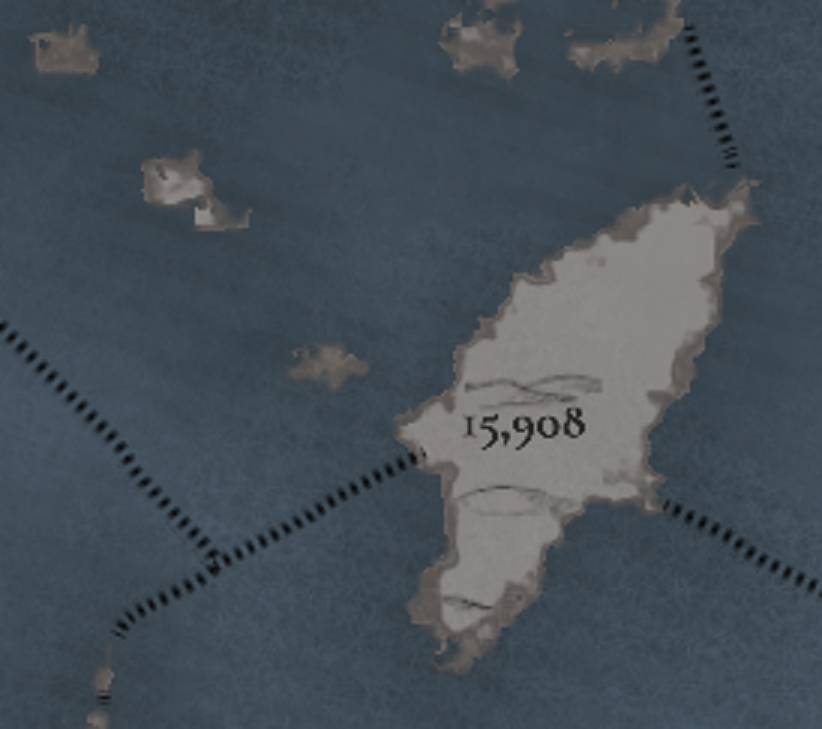
Well now I have the opposite problem, as the Location of Rhodos is cleraly 15,908
Population Location.png

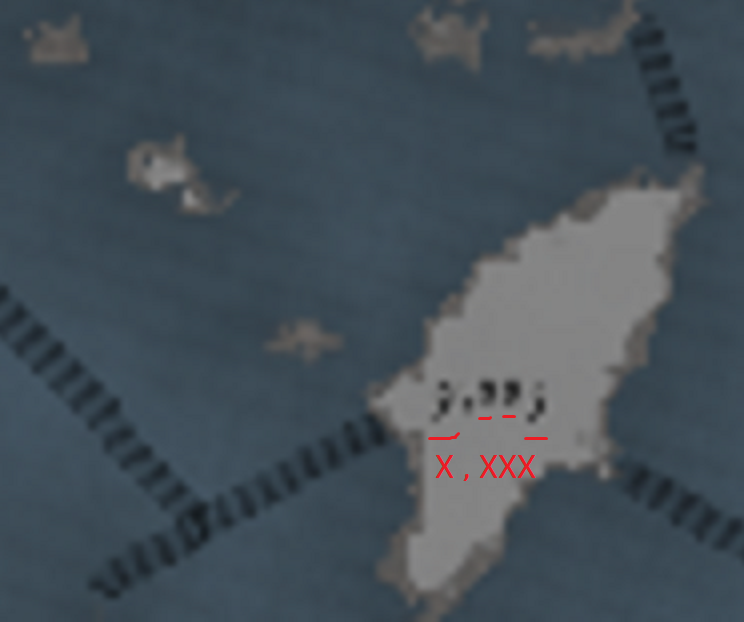
but the population of the Country seems to be just in the thousands
Population Country.png

Why?
 
  • 1
Reactions:
So excited to play in this region! I've got some feedback about Moldavia, but first a question - is there a good way to play as Moldavia from game start? Something like starting as the Golden Horde and releasing and playing as Moldavia, or via event? Maybe you start as Hungary and can invade the Golden Horde and release Moldavia as a march, and one of options is to switch to play as Moldavia (I guess that's technically possible via EU4 mechanics too, but it would be cool if it was part of the event chain)? If releasing from the Golden Horde is the only option, would the event chain still trigger to get Hungary to support your independence?

As for my feedback, for the cultures, I think people have already said everything I have to say, I think it should either be a single Romanian culture (strongly prefer this), or a separate Moldavian culture, or at the very least rename Wallachian to Vlach. The culture in the region should also be a lot more diverse, there were Slavic and Turkic people in the region as well.

I'll mostly give feedback on the location distribution, as the locations in Moldavia are way too big currently compared to its neighbors. First just some nitpicks, as other people have pointed out the diacritics for ă, ș, and ț are wrong. There's also a bunch of provinces that have the letter î in the middle of the name - this is communist era orthography. Nowadays the rule is to use î if it's the first/last letter, â otherwise. In Moldavia I see 3 provinces with this mistake, Cîmpulung Moldovenesc, Bîrlad, and Hîrlău, which should be Câmpulung Moldovenesc, Bârlad, and Hârlău respectively.

For my map changes, I've mostly based it off of this map (which I'll refer to further as the reference map), as well as English and Romanian Wikipedia. The map shows the biggest cities and the feudal lands partitions of the country in 1483. When creating the provinces, I made sure all settlements I've used have been historically attested before 1500, which should match the current locations: Soroca (1499), Iași (1408), Orhei (1470) etc.
https://upload.wikimedia.org/wikipedia/commons/9/92/Moldova_(1483)-en.png
Moldova_%281483%29-en.png


These are the changes that I really hope to see to the map:
View attachment 1159185
  • Split off Siret and Baia from Suceava. These cities were capitals of the principality during the 14th century: Baia (1343–1354), Siret (1354–1388). I also think Cernăuți should go further south, so that recreating historical Romanian borders / the historical split of Bukovina is possible. (source)
  • I am biased on this one as Chișinău is my hometown, but I really think it has to be included. It was first historically attested in 1436, and became the capital of the governogate of Bessarabia under Imperial Russian rule - granted this is in 1812 but that's still within the game's timespan. It'd be a shame not to include what is today the second largest Romanian city.
  • I think the Prut river should cleanly split the provinces. It was a very important split in the early 1800s, as Russia annexed the land between the Prut and the Dniester as an important strategic position, creating a separation that lasts until today between Russified-Romanians to the right and the other Romanians to the left. Without this split, it would be impossible to end the game with accurate Russian Empire borders. For this, I split off Ungheni and Tigheci. Ungheni was attested in 1462, however for Tigheci I couldn't find more information other than it being present in the reference map as a feudal land "capital". As an alternative, Târgu Sărății could work - it was attested as the old name of Leova in 1489, but it's existence is controversial. (source1, source2, source3, source4)
  • Finally, Cahul should be renamed to Șcheia, it was only named Cahul in 1835. (source)
Now for some of my other suggestions, here's the map I managed to cook up:
View attachment 1159189View attachment 1159190
  • Reshaped Șcheia, Tighina, Ismail, and Chilia to be able to recreate modern Moldova borders. Also added Lipcani for that purpose.
  • I could not find evidence of Tulnici, Tutova, or Cudalvi as settlements in medieval Moldavia, so I took them out. Cudalvi also seems to be a typo as someone else pointed out.
  • I used this list of fortresses in Moldavia: https://ro.wikipedia.org/wiki/Lista_cetăților_moldovenești
  • I only included settlement that mention being attested historically before 1500 in Romanian Wikipedia.
For the map above, I mostly tried to follow the current borders in game. I've also tried creating another map from scratch, only referencing the reference map and its feudal partitions. Thus this is what I'd ideally have in game if it were up to me:
View attachment 1159191
View attachment 1159192
  • In this version I also added the locations of Bugeac and Adâncita.
I probably got some things wrong, I'm by no means an expert on this, I'm sure I also skipped some possible settlements, but I hope I was able to help a little bit with increasing the province density. I will edit this post later with sources + thoughts for each new location, for now I have to catch some sleep.
Hi! I think that the design of the events for the creation of the Voivodeship of Moldavia will be a DHE that fires for Hungary after some triggers, creating it as a type of subject (probably a March), with one of the options allowing the player to switch and play with it. Ideally, we would have some follow-up events allowing the country to break free from Hungary, also after getting some triggers, so there's a feeling of progression in the gameplay (starting from scratch -> becoming independent from Hungary -> ????).

Regarding the cultures, I think that it doesn't make much sense to have Moldavian as a division from the start, as the polity wouldn't exist yet; however, I find it very reasonable to have it be created after one of these events, to portray the differentiated regional identity of Romanian-speaking people.

Also, thanks for your feedback! I think that we won't be able to have so much location density in the area, as we need some balance, but we'll most likely add some more.
 
  • 31Like
  • 5
  • 2Love
Reactions:
Were Bosnians really separate from Serbians or Croats at that point in time? Wasn't a Bosnian cultural identity only shaped later, during the ottoman times?

They were separate, due to melting of different South Slavic cultures and the spread of the Krstjani faith as it brought new traditions (and religious conflicts) which caused a cultural divide.

The Ottoman times would reshape them futher, and basically create yet another culture (Bosniak).
 
Now, let's get to what really matters: wine!

I'm not the first to suggest this, but Hungary should produce significantly more wine than it currently does. They were considered major rivals to Austrian vintners up until the Ottoman conquest. At least Eger and Sopron were major wine exporters and should have wine as a resource. Significant wine-producing regions also existed (and continue to exist) around Lake Balaton and much of the Alföld, so there is even more room to expand Hungary's wine production. For easy reference, the website Wines of Hungary isn't academically sourced, but it does provide detailed maps that give the history of individual wine-producing regions (I would just link to it directly, but the forum seems to register the link as spam). Finally, there is the famous Tokaj region, but that only really got going in the 16th century. If you add more granular locations to what is now Eger Province, whatever location ends up around Tokaj could have wine as a resource to represent the future development of the region.
 
  • 4
  • 1Like
  • 1Love
Reactions:
In general a feature I want is for the naming of locations to be based on the majority culture there, or possibly the majority culture of all of the non-peasant pops. Paradox should at least make this a game option that could be turned on or off. I think all of the towns in Burgundy getting renamed to Czech because I inherited Burgundy as Bohemia is weird and confusing.
In my opinion there are two imprtant factors, population and the "internationaly" used names. This is why I recommend using german names for Hungarian cities, because thy were german atleast til the 19th century. And I would not like to use location names that weren't even existed back that time. A great example is Bratislva, which word was invented in the19th century, by Pavel Jozef Šafárik.
 
@Zeprion I think that our workflow is kind of clear, but I'll explain it one more time.

Each week we post a Tinto Maps DD, for a region. We ask the community to post their feedback in these DDs, as it's the easier way for us to look at it, reply to it, and gather it in an organized way. Some time after (usually, some weeks), we put each Tinto Maps region into our development pipeline again, and we make the review of it. When we think that all the feedback has been gathered, analyzed, and implemented, we share the review with the community, to show the results of their feedback, and to also have an extra feedback/sanity pass.

Given this workflow, what is useful for us is:
- Posts in the Tinto Maps DDs with detailed feedback, if possible supported by sources.
- Links to specific posts in other threads open by the community, with the results of, maybe, months or weeks of discussion.

What is not useful for us is:
- Threads outside the Tinto Maps that are not linked in the Tinto Maps (we might be reading them, yes, but is way easier for us if you link us here the results of the discussion, again, as we can review the feedback way more faster, in an organized way).
- Repeating the same post several times in the same DD, as then you are making 'noise', that is making us more difficult to gather the different feedback.
- Complaints about previous PDX projects. This is Project Caesar, and I think that we're quite clear on what we are asking from the community for it, and the results we're giving in return (you can check any of the previous 3 Tinto Maps Review, for the Low Countries, Iberia, and France).

Three more things. Our maps will never be perfect, and will always have errors. However, we want to make them the best possible, as this is why we are taking so seriously the community feedback in this project. Let's put it this way: we have several Spanish content designers in the team (as Paradox Tinto is based on Sitges, Spain), who care a lot about our region, and we still had several errors to correct in the Iberian map, that we could tackle thanks to the community.

The second is about our care or carelessness about specific regions. We try to put the same care on each one, although sometimes it's easier, and sometimes it's harder. But, at the end of the day, we want a consistent result in all of them. We will devote to all of them the time we might need to, in due time. Because, for example, in the Polish/Baltic/Ruthenian Tinto Maps we have whooping 52 pages, with over 1,000 thousand posts to review. So we will continue following our working schedule, in order to make this possible.

Finally, we don't have anything against Romanians, or any other peoples or cultures, and we do care about all of them at the same level. We have a Romanian culture group (how that works, will be explained in a future Tinto Talks), that includes Wallachian, Transylvanian, Aromanian, Istroromanian (a culture that I didn't mention in the DD, but that is present in 3 locations, Buzet, Pazin, and Rovinj), and potentially Moldavian, if created by the events I just mentioned a couple of posts above. So we think that is quite a decent representation of the culture.
 
  • 89Like
  • 24Love
  • 8
  • 8
  • 1Haha
  • 1
Reactions:
The thing is the suggestion you made doesn't connect with the evidence you brought up in large part, so I was questioning what the source was actually saying.
In fact so far the evidence you brought up doesn't contradict anything shown in the Tinto map, even your last quote outright says that the Slavs in Western Hungary disappeared around the 14th century completely, which makes me think they could easily be small enough in 1337 to not even be represented in a dashed manner.

I'm trying to really understand what your point is, but what you seem to want is not even supported by what you bring up, you should really make a more cogent argument and be more explicit about the areas you think should be X or Y and derive that directly from your source.
In fact you miss what I quoted from Stanislav and as a good coin you take only older quotes which he overcame. I really can not translate and quote his 1200 p. work for each county here... I can only offer scan book to the developers of the game. But Stanislav e.g. wrote: (There are a bit inaccuracies in my translation/transcription as author use in some words linguistic signs for Old Slavic/Slovak sounds like yers, etc.)

We are now interested in whether Slovaks lived further south of the Moson County. From the eastern part of the Sopron County, Moór gave the name Potyond, which is Slovak. It is a settlement situated in the so-called Rábakôza or Medzirábí. And again, it is not the only name in this territory that would testify that ancient Slovaks lived here. Just next to it a little to the north is the village of Bogyoszló, from the old Slavic Buďislav. The palatality of the consonant ď (Hungarian gy) shows that it could not have been the southern Slavs who lived here, but only the western Slavs (Russians are not considered here; therefore, the Slovaks lived here). But first let us note that this name is also found elsewhere in the same County. This was also the name of today's Német-Keresztur, Germ. Deutsch-Kreuz, in the area of Ikva, below the south-western corner of Lake Neusiedl. The documents read as follows: Bujuslou, certainly instead of Buguslou, 1245, Buguslou 1288, Keresthur al. nom. Bogyzlow 1346, Bogyzlou 1368, Kysbudizlo 1429 (Cs. III, 592). Above all, these documents make it clear that the name Boleslav cannot originally have been here, as is sometimes claimed (Moór, WM 21; also in MESz I, 447-8: this dictionary derives from the name Budislav). This is refuted by the best forms with d. It seems to me that the document Kysbudizlo 1429 may reveal that in the XVth cent. Slavs were still preserved here. The ending of the name is already Hungarian, but'the first and then the second syllable are still Slavic; the first is more important - the second may have remained so due to the influence of the Slovak form' even for later times. There is a "u" in the first syllable, which is clearly attested by the other clues to this name. Nearby we have also a later proof of the existence of Slavs or Slovaks in this region. It is the record Prwnye 1402 (in the same year also Prunnye) for the name Pinnye, although the earliest is Puneu 1326, Pune 1331, Pynne 1335, etc. It is clear that this entry is made according to the living Slovak form of the name. This also confirms what we said for the name Kysbudizlo 1429. The name of the mountain near Csapod on the NW would also point to the Western Slavic Galic < *Golic, s "c" for Proto-Slavic *tj, if only there is no *Golica. Thus we get the Slovaks again a little further south of the Sopron-Fraknó line, which Moór supposed to be the boundary between Slovaks and Slovenes. Thus we have Slovaks west of Lake Neusiedl, further along it and in the south-west and then in the east of this stool. We also have links between these areas. In the neighbourhood is immediately Muzsaj, with evidence of Musey 1232, Mesey 1265, Musey1313, 1355, Musee 1349, Muse 1375, Musa 1422, etc., Germ. Mondschein. It is Mužaj, german name still preserved the nasal (vowel), i.e. here somewhere the Germans before the end of the 10th cent. German met the Slavs. The Hungarians had their form as early as 1265, but the Slavs continued to live here and so the Hungarians took the name again as Muzsa and again as Muzsaj. Thus, the Slavs lived here in the 15th century. And maybe even later. The Slovaks lived here, because there is u za Proto-Slavic ǫ versus Slovene o. (Vol. I., p. 30-31)
On the southern Slovak- South Slavic border we have the name Mereta, a solitude and a mill on Valicka, from Bánok-Szt.-György. The records are again twofold: Merethwa 1322, 1379, and then Merotha 1389, Merecza(?) 1410, Meretha 1524. We can see from them that the settlement was originally probably in *Měrotava. In the Slavs themselves, however, perhaps the suffix -ava was replaced by the suffix -a. We have an example of this in the name of Nitra, which before the arrival of the Hungarians was called both Nitrava and Nitra. Already at the beginning of the 14th century Hungarian had a form with an assimilated middle vowel and there is e instead of the Slavic o. But even after the change of suffixes the form with o was preserved in the Slavic population; hence the entry of Meroth 1389. Thus, even at the end of the 14th century we have here the existence of Slavs attested quite safely. A little to the south of this site is a village which is now called Csernyefôld, i.e. 'Čerňo's Land', *Čerňa. Historical evidence is for Chern(y}e- 1361 etc., but there is also Chernylfeulde 1381 < Černil. If this document really refers to this settlement and is correctly transcribed, we have here evidence that the suffix was changing and that therefore Slavs were living here at the end of the 14th century. From here, well to the north, from Zala-Egerszeg to the south, is the village of Milej. This was recorded as Miley 1178 (late copy), Mylee 1271, Milé 1335, 1338, and again Myley 1340, 1413-22, 1513. It is a Slav. Milej (Milějь)', such a personal name is known from Old Czech and Polish.* The Old Hungarian form is evidently Mile(e). The predominance of the Slavic element, however, imposed its form, and this has remained to this day. This shows that the Slavs in the 14th cent. and perhaps even later. The evidence might say that they were here in the 16th century, but it is not certain, because of the above mentioned new takeover of the Slavic form by the Hungarians. (Vol p. 51)
The mountains of Zilice (Zselicség) themselves were inhabited by Slavs also in the 15th century, because as early as 1425 there is a record of de Silisio (Cs. II, 644), although as early as 1228(?) there is Selýz, then Zelysio 1309, i.e. forms developed already in Hungarian with a change of i > e in the root syllable. In these mountains today there is a village Terecsény puszta (from Szigetvár on s.). The form of this name was originally Terecheufew 1183, Terechew 1466, 1468. 1492, 1542. It derives perhaps from Slavic *Trečev- (cf. pol. Trzek, Trzeczak, Koz. Bad. II, 422). The present name derives perhaps from the form *Trečin. Thus, there is a confusion of suffixes, which shows that the Slavs stayed here for a very long time, and what is more, they must have been here since the 15th & 16th centuries upwards, for in these centuries the original form of the name with the suffix -ev is still alive. In 15. cent. we have attested Slavs also in the village Rupol (Ropoly, Rapoly), which is referred to as Rupvl 1228?, 1357, 1443, Rwpol 1453, 1480, but in 1403 the form Rupolch, i.e. the Slavs extended the name with the new suffix -ьcь (-ci). Evidence of the existence of Slavs in the vicinity of Szigetvár as early as the 15th century. We have in the name of the village Molvány (from Szigetvár to the south). There is evidence of Milwan 1421, 1431, Miluan 1448, Nilwan 1455, but also Mylovan 1453, 1464, 1470. The form Mylowan is, of course, the exact and unchanged Slavic form Milovan (cf. Czech Mílovanicé). This form is certainly possible only in the mouth of Western Slavs. The abbreviated form Milvan is in Slov. Milovan is possible as Radovan and Radvan. The occurrence of the longer and more original form speaks of the presence of Slavs. In Hungarian the vocalic in the middle open syllable falls out. The form Milovan thus clearly indicates the existence of Slavs in the 15th century in this region. From the 16th cent. we have evidence of the existence of Slovaks in the record of the name of the village Csavonya, which is recorded as Chovonya 1406, but in 1536 Chawynya < Ščaviňa. Thus, we have seen that the Somod Coundy was inhabited by Slavs even before the arrival of the Hungarians and that the Slavic population was preserved there throughout the Middle Ages. (Vol. I. 60-61)
Today's Marócza< *Moravica in the 14th and 15th centuries. has the older Hungarian form Maroth 1339 etc. to 1487, but as early as 1424 etc. it is Marocz < *Moravc-. In a word, we have here as many as three forms. The first, the form best adapted to the Hungarian system, has been superseded by the Slavonic living form Moravc(i). Then the Slavs took another suffix to the original name, and instead of Moravc(i) used Moravica. This newer form was then adopted by the Hungarians, and from it is the present form Marócza. From this we can clearly see that the Slavs lived here (Komitat Baranya) for a long time and had a numerical majority, because they managed to displace the Hungarian name and impose their own form on the Hungarians. (Vol. I., p. 64)
In the northeastern part of the County (Baranya), the Slavs held out for quite a long time. In this part of the stool we have evidence of the existence of Slavs at the end of the 13th century. In the name *Nadojča. The exact Slavic version of the name is Nadoycha 1288, 1295, otherwise there are Nadayca 1015-1158, Nadaycha, Naydaycha 1259, Nodochya 1354, Nadýcha (sic!) 1400. True, Slavs lived here in other times as well. We can see this, for example, from the name Krakó, which is recorded in its Slavic form as early as the end of the 14th century. and in Hungarian in the 15th century. It has a newer form, although already in the middle of the 14 century. It was developed differently in Hungarian, i.e. in the 14th cent. It is Karakov's, but in the 15th cent. Krakó, but the Slavic form Krakov is at the end of the 14th cent. (Karakou 1347, 1352, Karakow 1348, Korkou 1347, but Crako'u 1371, Crakow 1373, Crakov 1376). For the 15th century we have evidence of the existence of Slavs somewhere near Baranyavar in the name *Rogač : Rogaach 1397, Rogach 1399, Rogath m. Rofjach1470, 1471, but Rogachewcz 1481, i.e. Rogachevc-. We can see that at the end of the 15th cent. A new suffix appears, which testifies that Slavs - southern (g !) - lived here then. (p. 65)

For the Slovakness of the south of the Tolna Country we have a significant proof in the name Boľata. The evidence is as follows: Balecha m. Baletha 1406, Boletha 1427, Balyatha 1430. This is originally the personal name Boleta. In Old Slovak we would have Boľäta, i.e. there would be an ä in the middle syllable. However, over time, in Slovak in most of the territory, the a in such a case has sprouted, i.e. it was then Boľata. This Slovak evolution is beautifully recorded in the documents for this name. It is impossible that the Balyatha document speaks of the presence of southern Slavs. The other documents (Baleta, Boleta) would have been attributed to the South Slavs if it were not for the Balyatha document. Hungarian vocal harmony is clearly not present here; rather, we would expect to find Hungarian vocal harmony in the Hungarian. syllables to be ö - é - e (cf. Dobréte < Dobrota). The Slovakness of this extinct settlement is confirmed, of course, by the fact that there are several names in the closest vicinity in Baranya County which are also guaranteed to be Slovak (Častá, Nebojsa, Trošfany, Hodáč). To the north of Boľata is the settlement of Csicsó (Chychou 1375, Chycho 1412). This is again - in connection with other testimonies - evidence for the Slovakness of the region. Slovak here is the form of the suffix -ov. In Croats (Serbs) this name would sound more like Cičev; in Hungarian, it would be Cičev. would then be the -ö form. Cf. also Serbian Cičevo, Cičevac (Imenik-Registar II, 1102). We have the same phenomenon further north in the name - perhaps today's Kocsoye, which is also recorded as Kechewd 1423, Kechow 1430, Kechew 1460, 1500. Here the form Kechow ~ Kechow is important for us, because -ov is West Slavic (it is rare among the South Slavs). The form Kechew may be a two-form, because in West Slavs the form on -ev is possible with possessives. Cf. in present-day Slovakia Kečovo, Hungarian. Kecsô (Tornaľa district), pol. Kieczoico. Such would also be the document Kaláznyó (Kalaznyow 1419, etc.), from Kalužňov. In the middle of the County, in its northern half, is the town of Miszla, i.e. Slav. Miszla. In this name, with a small exception, it is written in the ko reni y: Myzla 1324 etc. to 1480, only once is Misia 1418, i.e. when in our country the merging of y with i begins. This document could be a reflection of this process. In the South Slavs the fusion of y with i occurred long before that, i.e. from the beginning of the Serbian monuments. Thus, we have here again a document which, admittedly, rather only in connection with other important documents, testifies that Western Slavs, or Slovaks, used to live in this region. According to the records of this name they lived here still in the 15th century, which is in agreement with other cases. Cf. Slov. Myšia, Myslava, poľ. Myšia. Probably in the middle of the County was a village whose name is preserved only in the family name: Kusthan 1403, 1410, 1471, Kuscka, Kwstha 1453, 1454, 1469 (Cs. 111,439). They are probably Košt'an(i) or Košt'an(i), where in the Mag. The ending -n has dropped out, which is the case in the Hungarian. A well-known phenomenon. The form -sch- shows that we should read the notation -stli- as -Št-, because šč > Št; this change was made just not long before these notations, and we can see that there is still a fluctuation. The change šč>št is, admittedly, a Slovak phenomenon in this setting, since the Serbian št is older. The very change šč> št in this name shows that the Slavs sometime in the 14-15 cent. must have lived here. (p. 65-66)

And so on...
 
  • 1Like
Reactions:
By the way, I think this is the Tinto Maps with fewer negative reactions, and the feedback so far is great, even if the community was expecting some Balkanic mayhem. I'll be out for a few days from now, so expect less replies from my end, but we'll keep reading you. Cheers!
 
  • 66Like
  • 6Love
  • 5Haha
  • 4
  • 1
  • 1
Reactions:
Also regarding the location of Sighet, while stone is a pretty good representation of the zone and probably fitting for gameplay purposes, if balance allows it, salt could also take its place as it was the main traded good starting from around the 1400s with salt mines in the area and entire settlements centered around salt. Ocna Sugatag ("Ocna" meaning salt mine), I believe the biggest such settlement/mine is mentioned in documents in 1355 as "fodinae salium". At the end of the 14th century, there was a permanent exploitation of salt, in the framework of some smaller groups organized by the "Royal Chamber of Salt". From 1489, the existence of Paul Silvestru salt mine and the group of Ana-Iuliana and Elisabeta mines, which belonged to the royal domain, is attested.
Also, the town directly across the Tisa river from Sighet is called Slatina(RO), Aknaszlatina(HU), Solotvyno(UA) and Slatinské Doly(SK), named after the salt mine in the area. Salt would he a very reasonable trad
 
  • 1Like
  • 1
  • 1
Reactions:
Please fix the inaccuracy, hungarians were by far not the majority in transylvania. It was way too early for them to start staying there. Vlachs where the majority. Correctly you should make the transylvanian identity( which i do not understand why you didn't just call vlachs because that is what they were) majority in transylvania and western banat and hungarians and serbs minorities. I am really disappointed with this one
 
  • 12
  • 5Like
Reactions:
In fact you miss what I quoted from Stanislav and as a good coin you take only older quotes which he overcame. I really can not translate and quote his 1200 p. work for each county here... I can only offer scan book to the developers of the game. But Stanislav e.g. wrote: (There are a bit inaccuracies in my translation/transcription as author use in some words linguistic signs for Old Slavic/Slovak sounds like yers, etc.)

We are now interested in whether Slovaks lived further south of the Moson County. From the eastern part of the Sopron County, Moór gave the name Potyond, which is Slovak. It is a settlement situated in the so-called Rábakôza or Medzirábí. And again, it is not the only name in this territory that would testify that ancient Slovaks lived here. Just next to it a little to the north is the village of Bogyoszló, from the old Slavic Buďislav. The palatality of the consonant ď (Hungarian gy) shows that it could not have been the southern Slavs who lived here, but only the western Slavs (Russians are not considered here; therefore, the Slovaks lived here). But first let us note that this name is also found elsewhere in the same County. This was also the name of today's Német-Keresztur, Germ. Deutsch-Kreuz, in the area of Ikva, below the south-western corner of Lake Neusiedl. The documents read as follows: Bujuslou, certainly instead of Buguslou, 1245, Buguslou 1288, Keresthur al. nom. Bogyzlow 1346, Bogyzlou 1368, Kysbudizlo 1429 (Cs. III, 592). Above all, these documents make it clear that the name Boleslav cannot originally have been here, as is sometimes claimed (Moór, WM 21; also in MESz I, 447-8: this dictionary derives from the name Budislav). This is refuted by the best forms with d. It seems to me that the document Kysbudizlo 1429 may reveal that in the XVth cent. Slavs were still preserved here. The ending of the name is already Hungarian, but'the first and then the second syllable are still Slavic; the first is more important - the second may have remained so due to the influence of the Slovak form' even for later times. There is a "u" in the first syllable, which is clearly attested by the other clues to this name. Nearby we have also a later proof of the existence of Slavs or Slovaks in this region. It is the record Prwnye 1402 (in the same year also Prunnye) for the name Pinnye, although the earliest is Puneu 1326, Pune 1331, Pynne 1335, etc. It is clear that this entry is made according to the living Slovak form of the name. This also confirms what we said for the name Kysbudizlo 1429. The name of the mountain near Csapod on the NW would also point to the Western Slavic Galic < *Golic, s "c" for Proto-Slavic *tj, if only there is no *Golica. Thus we get the Slovaks again a little further south of the Sopron-Fraknó line, which Moór supposed to be the boundary between Slovaks and Slovenes. Thus we have Slovaks west of Lake Neusiedl, further along it and in the south-west and then in the east of this stool. We also have links between these areas. In the neighbourhood is immediately Muzsaj, with evidence of Musey 1232, Mesey 1265, Musey1313, 1355, Musee 1349, Muse 1375, Musa 1422, etc., Germ. Mondschein. It is Mužaj, german name still preserved the nasal (vowel), i.e. here somewhere the Germans before the end of the 10th cent. German met the Slavs. The Hungarians had their form as early as 1265, but the Slavs continued to live here and so the Hungarians took the name again as Muzsa and again as Muzsaj. Thus, the Slavs lived here in the 15th century. And maybe even later. The Slovaks lived here, because there is u za Proto-Slavic ǫ versus Slovene o. (Vol. I., p. 30-31)
On the southern Slovak- South Slavic border we have the name Mereta, a solitude and a mill on Valicka, from Bánok-Szt.-György. The records are again twofold: Merethwa 1322, 1379, and then Merotha 1389, Merecza(?) 1410, Meretha 1524. We can see from them that the settlement was originally probably in *Měrotava. In the Slavs themselves, however, perhaps the suffix -ava was replaced by the suffix -a. We have an example of this in the name of Nitra, which before the arrival of the Hungarians was called both Nitrava and Nitra. Already at the beginning of the 14th century Hungarian had a form with an assimilated middle vowel and there is e instead of the Slavic o. But even after the change of suffixes the form with o was preserved in the Slavic population; hence the entry of Meroth 1389. Thus, even at the end of the 14th century we have here the existence of Slavs attested quite safely. A little to the south of this site is a village which is now called Csernyefôld, i.e. 'Čerňo's Land', *Čerňa. Historical evidence is for Chern(y}e- 1361 etc., but there is also Chernylfeulde 1381 < Černil. If this document really refers to this settlement and is correctly transcribed, we have here evidence that the suffix was changing and that therefore Slavs were living here at the end of the 14th century. From here, well to the north, from Zala-Egerszeg to the south, is the village of Milej. This was recorded as Miley 1178 (late copy), Mylee 1271, Milé 1335, 1338, and again Myley 1340, 1413-22, 1513. It is a Slav. Milej (Milějь)', such a personal name is known from Old Czech and Polish.* The Old Hungarian form is evidently Mile(e). The predominance of the Slavic element, however, imposed its form, and this has remained to this day. This shows that the Slavs in the 14th cent. and perhaps even later. The evidence might say that they were here in the 16th century, but it is not certain, because of the above mentioned new takeover of the Slavic form by the Hungarians. (Vol p. 51)
The mountains of Zilice (Zselicség) themselves were inhabited by Slavs also in the 15th century, because as early as 1425 there is a record of de Silisio (Cs. II, 644), although as early as 1228(?) there is Selýz, then Zelysio 1309, i.e. forms developed already in Hungarian with a change of i > e in the root syllable. In these mountains today there is a village Terecsény puszta (from Szigetvár on s.). The form of this name was originally Terecheufew 1183, Terechew 1466, 1468. 1492, 1542. It derives perhaps from Slavic *Trečev- (cf. pol. Trzek, Trzeczak, Koz. Bad. II, 422). The present name derives perhaps from the form *Trečin. Thus, there is a confusion of suffixes, which shows that the Slavs stayed here for a very long time, and what is more, they must have been here since the 15th & 16th centuries upwards, for in these centuries the original form of the name with the suffix -ev is still alive. In 15. cent. we have attested Slavs also in the village Rupol (Ropoly, Rapoly), which is referred to as Rupvl 1228?, 1357, 1443, Rwpol 1453, 1480, but in 1403 the form Rupolch, i.e. the Slavs extended the name with the new suffix -ьcь (-ci). Evidence of the existence of Slavs in the vicinity of Szigetvár as early as the 15th century. We have in the name of the village Molvány (from Szigetvár to the south). There is evidence of Milwan 1421, 1431, Miluan 1448, Nilwan 1455, but also Mylovan 1453, 1464, 1470. The form Mylowan is, of course, the exact and unchanged Slavic form Milovan (cf. Czech Mílovanicé). This form is certainly possible only in the mouth of Western Slavs. The abbreviated form Milvan is in Slov. Milovan is possible as Radovan and Radvan. The occurrence of the longer and more original form speaks of the presence of Slavs. In Hungarian the vocalic in the middle open syllable falls out. The form Milovan thus clearly indicates the existence of Slavs in the 15th century in this region. From the 16th cent. we have evidence of the existence of Slovaks in the record of the name of the village Csavonya, which is recorded as Chovonya 1406, but in 1536 Chawynya < Ščaviňa. Thus, we have seen that the Somod Coundy was inhabited by Slavs even before the arrival of the Hungarians and that the Slavic population was preserved there throughout the Middle Ages. (Vol. I. 60-61)
Today's Marócza< *Moravica in the 14th and 15th centuries. has the older Hungarian form Maroth 1339 etc. to 1487, but as early as 1424 etc. it is Marocz < *Moravc-. In a word, we have here as many as three forms. The first, the form best adapted to the Hungarian system, has been superseded by the Slavonic living form Moravc(i). Then the Slavs took another suffix to the original name, and instead of Moravc(i) used Moravica. This newer form was then adopted by the Hungarians, and from it is the present form Marócza. From this we can clearly see that the Slavs lived here (Komitat Baranya) for a long time and had a numerical majority, because they managed to displace the Hungarian name and impose their own form on the Hungarians. (Vol. I., p. 64)
In the northeastern part of the County (Baranya), the Slavs held out for quite a long time. In this part of the stool we have evidence of the existence of Slavs at the end of the 13th century. In the name *Nadojča. The exact Slavic version of the name is Nadoycha 1288, 1295, otherwise there are Nadayca 1015-1158, Nadaycha, Naydaycha 1259, Nodochya 1354, Nadýcha (sic!) 1400. True, Slavs lived here in other times as well. We can see this, for example, from the name Krakó, which is recorded in its Slavic form as early as the end of the 14th century. and in Hungarian in the 15th century. It has a newer form, although already in the middle of the 14 century. It was developed differently in Hungarian, i.e. in the 14th cent. It is Karakov's, but in the 15th cent. Krakó, but the Slavic form Krakov is at the end of the 14th cent. (Karakou 1347, 1352, Karakow 1348, Korkou 1347, but Crako'u 1371, Crakow 1373, Crakov 1376). For the 15th century we have evidence of the existence of Slavs somewhere near Baranyavar in the name *Rogač : Rogaach 1397, Rogach 1399, Rogath m. Rofjach1470, 1471, but Rogachewcz 1481, i.e. Rogachevc-. We can see that at the end of the 15th cent. A new suffix appears, which testifies that Slavs - southern (g !) - lived here then. (p. 65)

For the Slovakness of the south of the Tolna Country we have a significant proof in the name Boľata. The evidence is as follows: Balecha m. Baletha 1406, Boletha 1427, Balyatha 1430. This is originally the personal name Boleta. In Old Slovak we would have Boľäta, i.e. there would be an ä in the middle syllable. However, over time, in Slovak in most of the territory, the a in such a case has sprouted, i.e. it was then Boľata. This Slovak evolution is beautifully recorded in the documents for this name. It is impossible that the Balyatha document speaks of the presence of southern Slavs. The other documents (Baleta, Boleta) would have been attributed to the South Slavs if it were not for the Balyatha document. Hungarian vocal harmony is clearly not present here; rather, we would expect to find Hungarian vocal harmony in the Hungarian. syllables to be ö - é - e (cf. Dobréte < Dobrota). The Slovakness of this extinct settlement is confirmed, of course, by the fact that there are several names in the closest vicinity in Baranya County which are also guaranteed to be Slovak (Častá, Nebojsa, Trošfany, Hodáč). To the north of Boľata is the settlement of Csicsó (Chychou 1375, Chycho 1412). This is again - in connection with other testimonies - evidence for the Slovakness of the region. Slovak here is the form of the suffix -ov. In Croats (Serbs) this name would sound more like Cičev; in Hungarian, it would be Cičev. would then be the -ö form. Cf. also Serbian Cičevo, Cičevac (Imenik-Registar II, 1102). We have the same phenomenon further north in the name - perhaps today's Kocsoye, which is also recorded as Kechewd 1423, Kechow 1430, Kechew 1460, 1500. Here the form Kechow ~ Kechow is important for us, because -ov is West Slavic (it is rare among the South Slavs). The form Kechew may be a two-form, because in West Slavs the form on -ev is possible with possessives. Cf. in present-day Slovakia Kečovo, Hungarian. Kecsô (Tornaľa district), pol. Kieczoico. Such would also be the document Kaláznyó (Kalaznyow 1419, etc.), from Kalužňov. In the middle of the County, in its northern half, is the town of Miszla, i.e. Slav. Miszla. In this name, with a small exception, it is written in the ko reni y: Myzla 1324 etc. to 1480, only once is Misia 1418, i.e. when in our country the merging of y with i begins. This document could be a reflection of this process. In the South Slavs the fusion of y with i occurred long before that, i.e. from the beginning of the Serbian monuments. Thus, we have here again a document which, admittedly, rather only in connection with other important documents, testifies that Western Slavs, or Slovaks, used to live in this region. According to the records of this name they lived here still in the 15th century, which is in agreement with other cases. Cf. Slov. Myšia, Myslava, poľ. Myšia. Probably in the middle of the County was a village whose name is preserved only in the family name: Kusthan 1403, 1410, 1471, Kuscka, Kwstha 1453, 1454, 1469 (Cs. 111,439). They are probably Košt'an(i) or Košt'an(i), where in the Mag. The ending -n has dropped out, which is the case in the Hungarian. A well-known phenomenon. The form -sch- shows that we should read the notation -stli- as -Št-, because šč > Št; this change was made just not long before these notations, and we can see that there is still a fluctuation. The change šč>št is, admittedly, a Slovak phenomenon in this setting, since the Serbian št is older. The very change šč> št in this name shows that the Slavs sometime in the 14-15 cent. must have lived here. (p. 65-66)

And so on...
But like how can you tell other than the Komitat Baranya example that Slavs/Slovaks were at least 25% of the population? That's the threshold for minorities to be shown.

The evidence you presented might reflect a 5% minority just as well as 30% one, it's not exactly clear
 
  • 1
  • 1
Reactions: