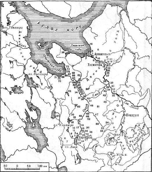
I was happily surprised when I noticed that the provinces of Novgorod were reworked to match the historical pyatinas. However, the provinces in Karelia and Kola could be improved a bit to have more historical borders and flavorful names.
First, I want to comment on the provinces belonging to the historical Obonezhskaya Pyatina:
View attachment 1228780View attachment 1228782
Currently, the in-game province borders follow the historical pyatina very closely, apart from the part in the northwest. Interestingly, the location borders here are still drawn according to the historical border of the pyatina, so there are probably reasons why the historical border wasn't followed. I still think that this should be fixed to match the historical accuracy of the rest of the provinces in Novgorod. This could maybe be done by expanding Pomorye to the west, as
the historical Pomor Coast reached all the way west to the Kem river. The Äänisniemi/Zaonezhye peninsula could be given to Aunus Karelia though, as its considered part of the Aunus region.
Relating to the Zaonezhye peninsula, the devs seem to have misinterpreted it as a region on the eastern coast of Lake Onega. In reality the name refers to
the peninsula on the northwestern part of the lake, with the Finnish name Äänisniemi literally meaning "Onega Peninsula".
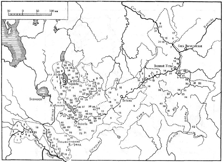
View attachment 1228802
This creates the question of what the current Zaonezhye province should be called. Unfortunately I don't know enough about this region to give a good answer, so take what I say next with a grain of salt. One option would be to name it Pudoga, after the
Pudozhsky Uyezd established in 1785. However, I also found a source according to which
this area was called Obonezhye, the same name which also refers to the entire Obonezhskaya Pyatina (Obonezhskaya apparently means "the area around Lake Onega").
If Zaonezhye were to be renamed to Obonezhye, then the current Obonezhkaya province should probably be renamed too. Similarly to the current Zaonezhye province, it could maybe be named Lodeynoye Pole after the
Lodeynopolsky Uyezd established also in 1785. A thing to also consider is that the border of
the two halves of Obonezhkaya Pyatina, the southern Nagornaya half and the northern Zaonezhskaya half (also known as
Zaonezhskie Pogosty), ran through this area, though the border was apparently a little unclear. Perhaps the province could just be divided between the surrounding provinces according to this border?
View attachment 1228830
On this map the halves of Obonezhkaya Pyatina are referred to in Finnish as "Ylämaan puoli" and "Äänisniemen pogosta(t)".
Returning to the northwest, the inner parts of East Karelia are currently rather plainly divided between "Inner Aunus Karelia" and "Inner White Karelia". While the provinces are fine, a more flavorful setup would be to have a province based on the historical
Lopskie Pogosty region (also known as "Leshaya Lop'", and, at least in Finnish historiography, "Novgorod Lapland" and "Forest Lapland"). The name means "Lapp Pogosts", referring to the Sámi inhabiting the region before it was colonized by the Karelians. The borders of Lopskie Pogosty can be seen on the map above (purple). Note that Suiku was separated from the province around the year 1600.
For Kola, I was able to find a way to divide it in a way very close to the current division. According to Wikipedia,
the Sámi dominated pogosts of the Kolsky Uyezd were categorized into three groups (according to
saami.su these divisions were known in the 17th and early 18th centuries). The groups were: Terskaya Lapps in the area closely corresponding to current North Kola, Konchanskaya Lapps in the area closely corresponding to the current Western Kola and Leshaya Lapps in the remaining small area west of Kantalahti. As far as I understood, these terms referred to actual geographic areas in addition to their inhabitants. In Russian these are "Terskaya Lop'", "Konchanskaya Lop'" and "Leshaya Lop'". While Leshaya Lop' would be too small to include, North and Western Kola could easily be renamed Terskaya and Konchanskaya Lop', with small border changes to match the historical areas better. More information about the areas can be found on their corresponding pages on saami.su (
Terskaya,
Konchanskaya,
Leshaya).
Another perhaps more intuitive option could be to name West and North Kola after the older two Novgorodian volosts:
Kolo and
Tre. They seemed to have similar borders to the Sámi groupings and Kolo/Kola would be a more recognizable name. Tre is a variant of Ter, which is the old name of the Kola Peninsula.
View attachment 1229499
View attachment 1228891
Historical map of the Kola Peninsula from
this page. Brown is Koncahnskaya Lop', orange is Terskaya Lop', yellow is Leshaya Lop' and red are the Russian and Karelian settlements. The black dots represent uyezd borders.
The situation in south Kola is slightly less clean. The southern coast of the Kola Peninsula is known as the
Tersky Coast ("Tersky Bereg" in Russian). According to Wikipedia it encompasses the coast between the mouth of the Varzuga river and Cape Svyatoy Nos. However, according to other sources, such as the map below depicting the historical coasts of the White Sea, the Tersky Coast would've reached all the way west to Umba (
Source for the map).
View attachment 1228881
Most importantly,
the Tersky Coast originally remained outside Kolsky Uyezd and was rather part of the Dvinsky Uyezd. This can be seen on old maps, such as this one from
Wikipedia:
View attachment 1228883
As such, Tersky Coast would make a lot of sense as a province. It would basically correspond to the current South Kola province, but without Raivke and Kantalahti.
This leaves us with the area between Kem and Kantalahti, for which I unfortunately wasn't able to find any matching administrative divisions from the time period of the game. There was the
Kemsky Uyezd established in 175, which (came to) encompass the area (including the northern parts of the Lopskie Pogosty). I'm saying came to because many older maps of it don't seem to show it with Kantalahti, instead Kantalahti was part of the Kolsky Uyezd at the time. One flavorful historical name for the southern part of the area was Karel'sky Bereg (in English "the Karelian Coast"). The coast near Kanatahti on the other hand was known as the Kantalahti Coast. Though I have no objectively good name for the area, I like Karel'sky Bereg.
Putting these ideas together, here's how an improved province setup could look like. It's not perfect, and I hope that people who possibly know more would give their input. My understanding of East Karelian administrative history isn't nearly as deep as Finnish administrative history.
View attachment 1229500
I drew the border according to existing location borders, but the borders of Lopskie Pogosty could be tweaked to match the historical ones. I also gave Alakurtti to Kemi Lappmark to match the Swedish-Russian border that eventually developed there. I also renamed Aunus Karelia to the Russian Olonets. Ideally Alakurtti and other Finnish Lapland locations should also be reworked to match historical Sámi siidas, like I suggested in my
Scandinavia feedback post, but that will hopefully be addressed in the Scandinavia feedback
")
.
Edit: I added the Obonezhkaya province back with the name Mezhozerye, which seemed to roughly refer to the territory of the province. (
Post where I explained it)
I also have a few small comments about Kola, which I said on
a post on the Scandinavia thread with better explanations:
- Prirechnyi is too recent and should be merged with Petsamo.
- I wasn't able to identify Koliskoj. It might refer to the siida of Kuolajärvi, but that would be on the Finnish side of the border. A better name would be Hirvasjärvi (Rus: Girvasozero, Akkala Sámi: Sââ´rvesjäu´rr).
- Mootka is misspelled and it should be Muotka.
- Kola should be Kuola in Finnish. (Assuming that all the location names in Kola are in Finnish. Hopefully they will be given Sámi names too when a Sámi language is added.)
- The area of Kiestinki used to have a Sámi siida, which in North Sámi was known as Oaivejávri (in another Sámi language its name is Bejauri, but I'm not sure which language). Perhaps this could be the used for the Sámi name of the location?
I also collected some sources for Sámi location names when working on Scandinavia feedback. Hopefully they'll be helpful: