• We have updated our Community Code of Conduct. Please read through the new rules for the forum that are an integral part of Paradox Interactive’s User Agreement.

Tinto Maps #4 - 31th of May 2024 - Poland, Ruthenia, Baltic

Hello everyone, and welcome to the fourth Tinto Maps! The feedback that we've received so far has been great, and there will be news soon regarding the map fixes that we've already done.

This week we are showing you Poland, Lithuania, Ruthenia, and the Baltic region. Let’s check it with no further ado:

Countries
Countries.jpg

A bigger picture of what’s going on in this region today, as we hadn’t shown it entirely before. To the west, the Kingdom of Poland is ruled by Casimir III of the House of Piast. It is not a completely unified kingdom, as there are several powerful vassals under him, most of them also Piasts themselves.

To the east, the Duchy of Lithuania is ruled by Gediminas, who has greatly expanded the influence of the country into Russian lands (side note: Gediminas entitled himself in his diplomatic correspondence ‘king’, but was considered by the Pope ‘king or duke’, and the title of Grand Duke wouldn’t be formally adopted until later [most likely replicating the Russian title ‘Grand Prince’]. That’s why Lithuania starts as a Duchy, although it will have an event that would make it possible to adopt the dynamic country name of ‘Grand Duchy’).

To the south, the principalities of Kyiv and Galicia-Volhynia have recently fallen under foreign influence, the first ruled by Theodor, brother of Gediminas of Lithuania; and the second by Yuri II, also from the Piast dynasty.

To the north, the Teutonic and Livonian Orders, which conquered the lands of Prussia and Livonia a century ago, are at war against Poland and Lithuania, after a long-established rivalry.

Also, a side note: we will talk about Moldavia in the Tinto Maps devoted to the Carpathian region, as it’s currently in a ‘placeholder’ spot.


Diplomacy.jpg

A new map mode, the Diplomatic one! The game starts with an ongoing war between Poland, Lithuania, and their respective vassals, on one side, and the Teutonic and Livonian Orders, and Bohemia and its vassals, on the other.

Locations
Locations.jpg

Here you have the locations of Poland, Lithuania, Ruthenia, and the Baltic region. Some issues that have already been reported by our Polish coworkers are the inconsistencies in the location naming in Polish (we’ll use proper Polish letters more thoroughly), and we’ve also started to review both the Polish and Baltic locations based on the early feedback you gave us. Oh, also, the Vistula and Curonian Lagoons missing is a bug, we’ll properly re-add them while doing the map review.

Provinces
Province.jpg

Any suggestions for provincial naming are pretty welcome, as in the last DD!

Terrain
Climate.jpg

Topography.jpg

Vegetation.jpg


Cultures
Cultures.jpg

The Baltic lands have an interesting mix of different cultures. ‘Western Baltic’ culture represents the people speaking a West Baltic language (Old Prussians, Yotvingians, Curonians, etc.), while ‘Prussian’ is the culture of the German settlers of that area; on that style, we have a ‘Baltic German’ culture in the lands of Livonia and Estonia that also got settled by German-speaking people. The divide between Polish, Ruthenian, and Aukstaitian might be too deep, so we will most likely add a bit more mixed situation in the borders between these cultures.

Religions
Religions.jpg

A region with a more interesting religious setup! Apart from the Catholic-Orthodox divide, you can also see the Romuva religion, which was a hot topic in 1337 (shall the Dukes of Lithuania convert to Catholicism, or stay Pagan?). Red stripes to the north are other Animist populations. Also, disregard the Sunni region to the southeast, as we have to review all the pops of the Pontic Steppes, as well.

Raw Goods
Raw Goods.jpg

From the distribution of the materials, maybe a couple of things might catch your eye. The first is that there’s an Amber good present on the shores of the Baltic Sea. The second is that the Tatra Mountains, in Slovakia, have a bunch of precious metals, which makes them a very interesting area to exploit and develop.

Population
Pops.jpg

Pops 2.png

The population of the region is divided into country and location views. Two notes: The total population of Estonia is not 711K people, that’s the total for its owner, Denmark. Second, we’ve read your feedback regarding the population map mode, and we’ll take a look at how to improve the visualization of the data, making it better for you.

EDIT: Markets
Markets.jpg

And that’s all for today! The region that we'll show next week is Italy! Cheers!
 
  • 212Love
  • 163Like
  • 10
  • 5
  • 4
  • 1Haha
Reactions:
We might have to add a few more Pagan pops there, aye.
in this thread about Tinto Talks #4 before it came out we also discussed this and one person quoted historians who proposed that "Pagans slaying christians" could have been German-Teutonic Order propaganda. And that there probably were not that many pagans. Also that the revolt was aimed at making Danish Denmark into Swedish Denmark.

I wonder if that Teutonic Order propaganda was made to cover up any atrocities or diplomatic incidents (killing of the 4 kings during negotiations)

Anyways, could look at sources like those two historians were referenced in the thread.
 
  • 1Like
Reactions:
Dzień dobry!

View attachment 1141170

As a Pole, I would like to praise the fact that the cultural situation (even Rusyn is there!!!) in this region is really well presented and that the density of locations and provinces does not differ from the rest of Europe. But I also have my comments and suggestions, which I will present below:

Provinces

View attachment 1141174

Locations names

View attachment 1141194

  1. Jelenia Góra (in Silesian: Jelyńo Gůra)
  2. Wałbrzych (in Silesian: Wałbrzich)
  3. Tarnowskie Góry (in Silesian: Tarnowske Gůry)
  4. Gliwice (in Silesian: Glywice)
  5. Racibórz (in Silesian: Racibōrz)
  6. Pszczyna (in Silesian: Psczina)
  7. Bielsko (in Silesian: Biylsko)
  8. Ostrawa (in Silesian: Uostrawa)
  9. Łomża
  10. Kolno

New locations names in Silesian and Kashubian (this is about dynamic names in these two languages - Silesian for Silesian culture and Kashubian for Kashubian culture):

Silesian
  1. Opole rename into Ôpole
  2. Brieg rename into Brzyg
  3. Opava rename into Uopawa
  4. Těšín rename into Ćeszyn
  5. Racibórz rename into Kluczbork (in Silesian: Kluczborek) BTW. THIS IS BAD LOCALISATION OF RACIBÓRZ
  6. Rybnik rename into Rybńik
  7. Bytom rename into Bytůń
  8. Wrocław rename into Brosłōw
  9. Jawor (without rename)
  10. Lubań (without rename)
  11. Zielona Góra rename into Zielōnŏ Gōra or Grinberg
  12. Wschowa (without rename)
  13. Wołów rename into Wołůw
  14. Legnica rename into Ligńica
  15. Głogów rename into Głogůw
  16. Żagań rename into Žahań
  17. Świdnica (without rename)
  18. Trzebnica rename into Trzebńica
  19. Oleśnica rename into Uoleśńica
  20. Oława (without rename)
  21. Grodków rename into Grodkōw
  22. Koźle (without rename)
  23. Lubliniec rename into Lublyńec
  24. Oświęcim rename into Uośwjyńćim
  25. Żywiec rename into Żywjec

Kashubian

  1. Szczecin rename into Szcecëno
  2. Wolin rename into Wòlëń
  3. Cedynia rename into Cediniô
  4. Kołobrzeg rename into Kòlbrzég
  5. Wałcz rename into Wôłcz
  6. Santok (without rename)
  7. Mecklenburg rename into Meczelbòr
  8. Wolgast rename into Wòłogòszcz
  9. Rügen rename into Arkóna
  10. Rostock rename into Roztok
  11. Werle (without rename)
  12. Danzig rename into Gdúnjsk
  13. Stolp rename into Stôłpskò
  14. Szczytno rename into Szczëtno
  15. Świecie rename into Swiecé
  16. Brandenburg rename into Branibòr
  17. Ruppin rename into Rypin
  18. Berlin rename into Kòpanica
  19. Havelberg rename into Hobolin
  20. Prenzlau rename into Przëbisłôw
  21. Köslin rename into Kòszalëno
SIlesian wasnt a thing back then, both Silesian and Polish were one langauge called Old Polish
 
  • 13
  • 5Like
  • 1
Reactions:
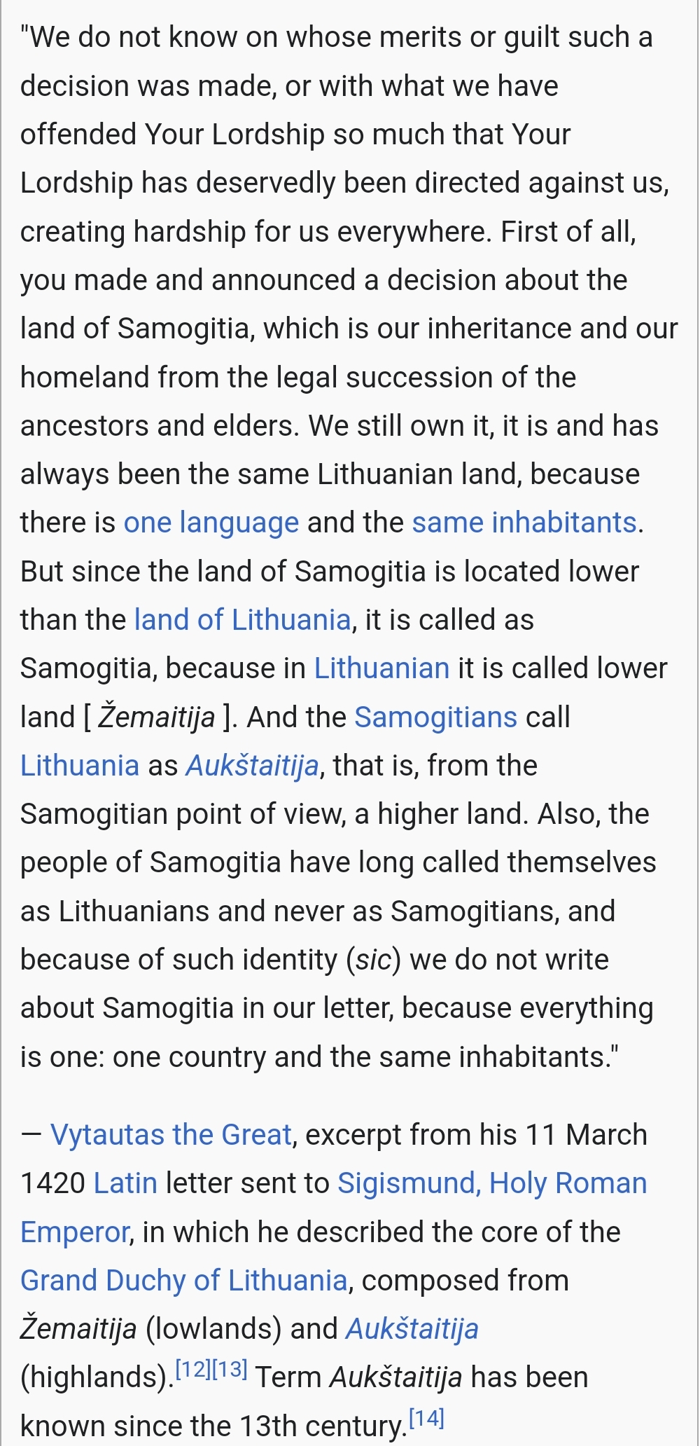
As a lithuanian I don't feel that separating lithuanians to samogitians and aukstaitians is really a good choice. As it basically means lower and higher lithuanians (as in terrain). But if you really need to separate them it should be samogitians and lithuanians, as Lithuania is formed from "lithuanian's" tribe, not aukstaitians

And it should be Lyda instead of Lida if there are lithuanians as it's name is from "slash-and-burn" agriculture.

I add a letter from The Grand Duke Vytautas in 1420 from Wikipedia (i know very scientific source). How samogitians calls themself lithuanians and never samogitians (letter is almost 80 years from the game start so you still might argue that you should keep them samogitians).

And note that only samogitians call Lithuania as Aukštaitija, as it's higher from them. Thus, I don't think that ruthenians or polish would call lithuanians as aukstaitians as it only makes sanse to differentiate between two parts of Lithuania for lithuanians (highlands and lowlands)

wiki/Samogitia
Screenshot_20240531_170205_Opera GX.jpg
 
  • 8Like
Reactions:
This! While the province should ofc not have the Russian name it should have a Ukranian name that is correct for the time period not a modern one.
The problem is that for the time period, a lot of the places (like Kryvyi Rih) were not that inhabited and might not have recorded contemporary names. Do the devs have a policy for how to name such places? I am going to guess that large parts of Siberia are going to have the same problem.
 
  • 3Like
  • 1
Reactions:
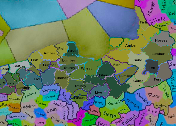
Suggestions for the raw goods of Prussia and East Pomerania:
prussiagoods.png

You cut off some of Eastern Pomerania (including Stettin) so this makes this a bit awkward... I couldn't include everything on the map.

Before posting what I've prepared, I have a few comments to make about the map that was posted.
It looks like you've shifted the wheat growing area from around the Vistula to the west of the Vistula?
I don't know what dyes in Danzig is supposed to represent. Did I miss an important woad growing area here?
No Fiber Crops at all is strange, considering how important Prussian canvas was. I also don't know why there's supposed to be iron in Pomerania.

Prussia:
This is a write-up based on German sources, one and two.

When it comes to both vegetation and goods that were produced, Prussia had pretty strong contrasts.
When the Order came to Western Prussia, they found cultivated land and a population that grew several different crops. This agricultural Western part continued being developed - forests were cleared and grain and hemp were grown on a scale that became ever larger. Prussia was a big producer of fiber crops which were made into canvas in Danzig and exported to the West, Prussian canvas was one of the major types of textiles traded in the Hansa.
As we get later into the time period and potatoes start to appear, Prussia becomes one of the most important food producers in the region (and eventually the breadbasket of the German Empire).
On the other hand, in the East and South of East Prussia, there was the “Great Wilderness” which was still contiguous, almost uninhabited forest in the 14th century. In the 16th century, forest cover there was down to 50%, in 1700 it was still 45%, in 1800 it was 32% and in 1900 17.4%, as more and more was cultivated as agricultural land.
The typical products exported from those forests were oak for ship building and cooperage, yew for crossbows, potash, tar and pitch. Customers were in the Netherlands, England, Scotland and even Portugal.
Potash isn’t in the game, but it was a big part of Prussia’s exports, 75% of income in some woodlands. It was used in glassmaking, pottery and dying of cloth. Maybe it could be represented by alum? (I have placed sand there now instead of alum)
The forests were also rich in berries, fruit, nuts and mushrooms, and of course hunting was very efficient in those thick forests, providing meat, leather and furs which were exported. Between 1612 and 1619, the Elector Johan Sigismund’s hunting journal lists the following kills in East Prussian forests: 4935 deer, 4008 boars, 112 moose, 52 bears, 15 wisent, 580 does and 1378 hares.
Fish was not only an important food source, but it was also salted and exported south all the way to Krakow and Lviv. In the 17th century, this became less important as cultivation of more land and control of rivers meant that fish lost spawning grounds and became less plentiful.
Beekeeping was a big part of the economy in the woodlands, export of beeswax was monopolized by the Teutonic Order. I suggested this as a trade good before, since honey/wax were very important as an export for wooded regions and wax was highly in demand, especially by Christian churches.
Livestock were cattle, horses, sheep and goats on woodland pastures. The Trakehner horse breed comes from the eastern boglands.
There was also bog iron which was produced throughout the period, although any bog iron is of rather low quality. The Order imported Hungarian metals through Krakow.
In terms of other production, glass was huge since they had plenty of access to raw materials (potash and fuel), and there was the aforementioned pitch and canvas production.
Due to the insatiable demand for fuel and clearing of forests, Prussia experienced wood shortages. The first regulations on forest use were documented in 1309 and by 1640 there was extensive forestry with man-made conifer forests.
Grain in Prussia was mostly rye, but wheat was grown in the fertile lands around the Vistula.
Prussia was a big importer and trader of salt - the cities of Danzig, Elbing and Thorn stored large amounts of salt which they exported to Scandinavian fish producers like Bornholm and Skane. There are many salt trade records from the time period - Setúbal had the cheapest salt, but shipping to Prussia was more expensive than the salt itself, so they imported mostly from the Low Countries and Germany.
When the Order arrived, they sourced salt from the Duchy of Dobrin (Dobrzyń) in the very south of their territory, but the lack of salt in Bohemia and Poland (except for mining around Krakow) is well known, and it looks like Prussia also had to import the majority of their salt, so I suggest not having much salt here, if any at all.
And finally - maybe most famously to some - Amber, which was plentiful on the coasts of Eastern Prussia. The Sambian Peninsula is believed to be responsible for the vast majority of the world’s amber production and the Roman Empire’s trade routes originating here are famous. In more appropriate times for this game, amber was chiefly exported through Königsberg. The Teutonic Order had the position of “Schäffer”, a person tasked with outside trade. While the Schäffer of Marienburg exported grain all over Western Europe, the Schäffer of Königsberg had the monopoly on amber exports. He would bring them to Brugge and come back with goods like cloth, sugar, salt, rice and spices. This system stopped around 1450.
In any case, if you’re going to have a modifier for amber production, Sambia should have it.


Eastern Pomerania:
Main Source, from the Federal Institute for the Culture and History of Germans in Eastern Europe
Germans started settling here in large numbers in the 13th century, leading to the founding of many cities with German law. While in 1337, the Eastern parts had just been settled, it was done at a high pace, so that Pomerania had plenty of settlements and lots of new cultivated land.
The main economic sectors in Pomerania were agriculture, brewing of beer and - you’ll never guess - pickled herring that they exported to Sweden. The source material doesn’t specify if it was stored in Luxembourg.
Pomerania was one of the most agricultural and conservative regions in Germany - with the exception of Stettin, one of the main harbors in the Baltic Sea.
Goods should mostly be sturdy grains, fish and lumber for the forests. There can also be some sand (they do have sandy beaches), amber, livestock and salt. Nothing exciting going on here to be honest.


Silesia is next!
 
Last edited:
  • 13Like
  • 2Love
  • 1
Reactions:
The divide between Polish, Ruthenian, and Aukstaitian might be too deep, so we will most likely add a bit more mixed situation in the borders between these cultures.

Ruthenian culture should be present in Red Ruthenia area (Chelm, Przemysl), as well as further north around Bialystok, with more Baltic (Yotvingians) in Grodno.
 
  • 12Like
  • 1
Reactions:
Am i forgoting something, but is it the first time (exepet the "alternate start date in EU4") that the game start and there is war ongoing ?

i don't think there is any of those in EU4 and we can maybe extend this to others games like Vic 3, CK3 or even HOI4 witch is insane when we talk of a game on the 2nd world war.

And with this info, i think we can expect other "wars on the start date" in the rest of the world ? am i right ?
It's never been impossible to script starting wars, AFAIK; Hoi4's 1936 start date has the 2nd Italian invasion of Ethiopia & the 1939 date has the 2nd Sino-Japanese war; Ck2 & 3's 1066 has the 3-way war for England. PDX content designers have just usually chosen not to include them, for whatever reason.
 
  • 3Like
  • 1
Reactions:
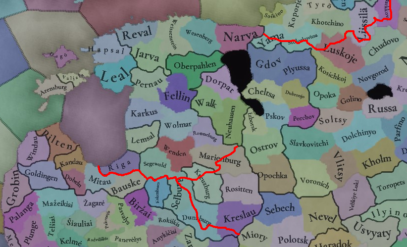
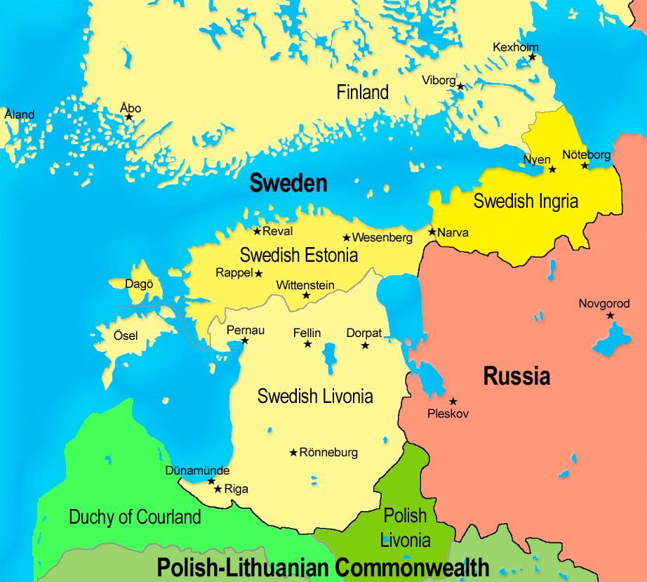
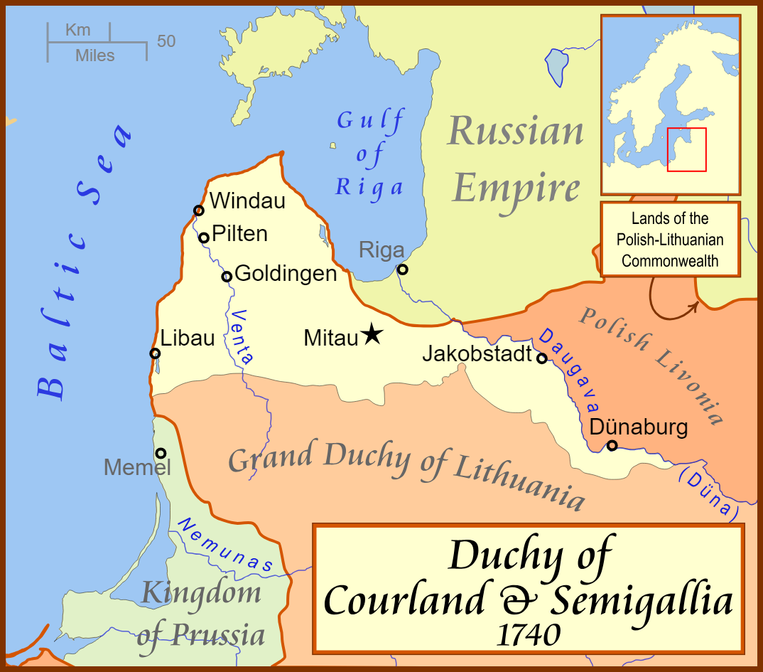
I think some of the borders in Livonia should be adjusted to better match the borders of future Duchy of Courland and Semigallia and Swedish Livonia, so that you could have accurate borders for 17th century Sweden and Poland-Lithuania. I'm aware this might slightly conflict with 14th century accuracy, but comparing the PC map to real maps of Livonian Order, the current PC map doesn't look completely accurate either. Imo the Courland-Semigallia border would be especially justified because the border followed a river, and being able to form a river border there would be very nice.

I also think the borders in Ingria could be tweaked for similar reasons. While this might not be the most accurate for 14th century internal divisions, people would probably prefer having historical international borders rather than historical internal borders.

1717165984158.png

1717165991033.png
1717165994722.png
 
  • 25Like
  • 1Love
  • 1
  • 1
Reactions:
Hey PDX Tinto, loving the Map updates and the totally unknown game that they relate to.

Thought that, as we are now in a region that would employ it, how flexible will place names be. By this I mean what encoding will be allowed? Will more of unicode be allowed in this game?

So using ç, ñ, the thorn, æ, and others for example, as well as other, non Latin base, alphabets in the base English encoding?

Looking forward to seeing Italy next week, keep on with your impressive work :).
 
  • 1Like
Reactions:
I understand that this is a question for another Tinto Maps, but what's that region between Ochakov and Iasi? O...

Odesa didn't have it's name up until 1794, but it most probably its name in game.

I suppose it should be named Hajibey at 1337, with Kotsiubiiv/Kochubeyev as dynamic names for Ruthenian and Russian cultures respectively.
And it can get name Odesa after an event, if owned by Russian Empire, which tries to play "3rd Rome card".
 
  • 4
  • 1Like
Reactions:
Another excellent map talk,

Regarding how to better show the player the population density of a region, could it be a mix of colour and numbers?

With the ability to turn off numbers and colour?

A method where a 'click' on the map / ui reveals the density in colour, another 'click' shows the numbers, and a final 'click' brings back both sets of information.
 
Based on my understanding Poland, Bohemia and the Teutonic Order are at peace in 1337, as they were able to temporarily settle border disputes at the Congress of Visegrád and come to a truce, but please correct me if I'm wrong.

I also have a question about location names, it looks like some of them are based on the majority culture of the location (west parts of Galicia-Volhynia, parts of Hungary), while others are based on the dominant culture of the country even when they are a minority in the specific location (Prussia, Baltics). Is there no consistent naming scheme for locations, or is this still a WIP thing and dynamic cultural names just haven't been applied to all of the locations?
 
  • 5Like
  • 2
  • 1
Reactions:
Is Kashubian separate culture from Polabian or have they been merged? If separate, I can send you list of Polabian localisation I did for some CK2 and CK3 mods few years ago.
Polabian is a different culture, yes.
 
  • 29Like
  • 14Love
  • 4
  • 2
Reactions:
As for Poland, I would definitely change a few names. I didn't look at all of them, but for sure instead of Zakopane, there should be Nowy Targ. At that time there was no Zakopane, and even later it was an ordinary mountain village. Similarly, over Lublin - Lubartów. It was founded in the 16th century - nearby Kamionka would be more appropriate (founded 100 years earlier - although not in the 14th century). This region in general is difficult when it comes to old cities.And I also think that Busko-Zdrój is better simply named Busko - which was signed that way even on an 18th century Austrian map.
From my perspective `Busko-Zdrój` should be replaced with `Nowe Miasto Korczyn`.

Nowe Miasto Korczyn (or `Korczyn` for simplification - but it's not historical accurate) was the main city of the region in that time (in fact there is hard to find english sources, but there are some in polish). Korczyn was a place of political conventions and noble gatherings. Korczyn was a royal city of the crown. The location at the crossroads of trade routes from Krakow to Ruthenia and from Hungarian Koszyce to Sandomierz contributed to the rapid development of the city. The proximity of the prince's court, which often stayed here, as well as the location near two navigable rivers (Nida and Wisła) meant that merchants and craftsmen settled here. Jagiełło received Teutonic envoys in Korczyn (14 sierpnia 1409), who handed him an act declaring war on the Kingdom of Poland (Polish–Lithuanian–Teutonic War, also known as the Great War). The general assemblies of the Lesser Poland Province were held in Nowe Miasto Korczyn.

At that time, Busko was a small town, much smaller than Korczyn and of much lower rank.
 

Attachments

  • Zrzut ekranu 2024-05-31 162419.png
    Zrzut ekranu 2024-05-31 162419.png
    45,7 KB · Views: 0
  • Polska_1333_-_1370.png
    Polska_1333_-_1370.png
    1,3 MB · Views: 0
  • Zrzut ekranu 2024-05-31 164609.png
    Zrzut ekranu 2024-05-31 164609.png
    28,8 KB · Views: 0
  • 6Like
  • 1
Reactions:
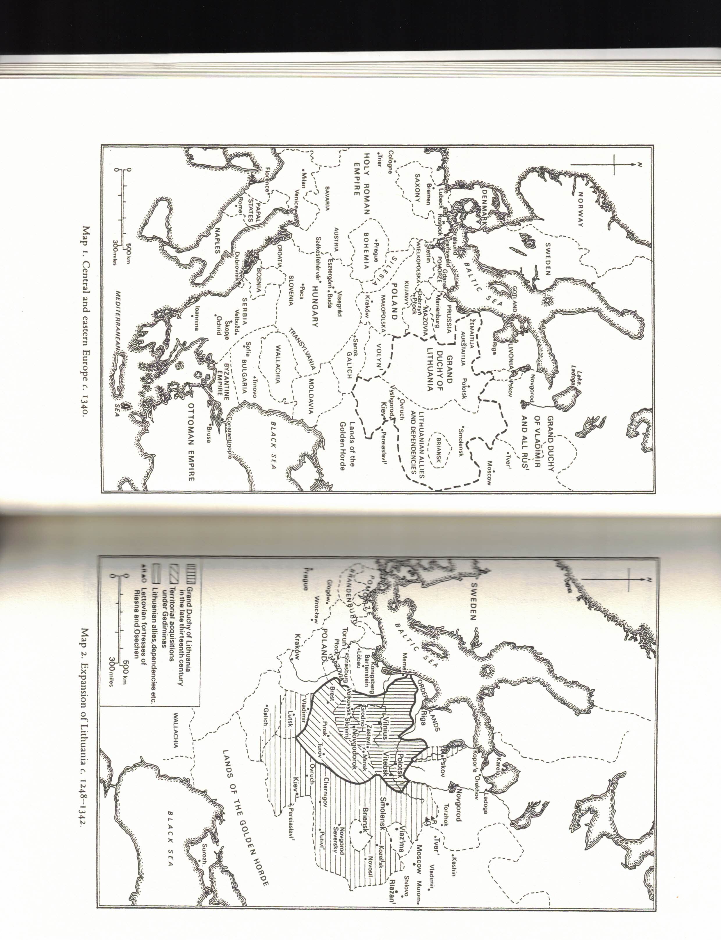
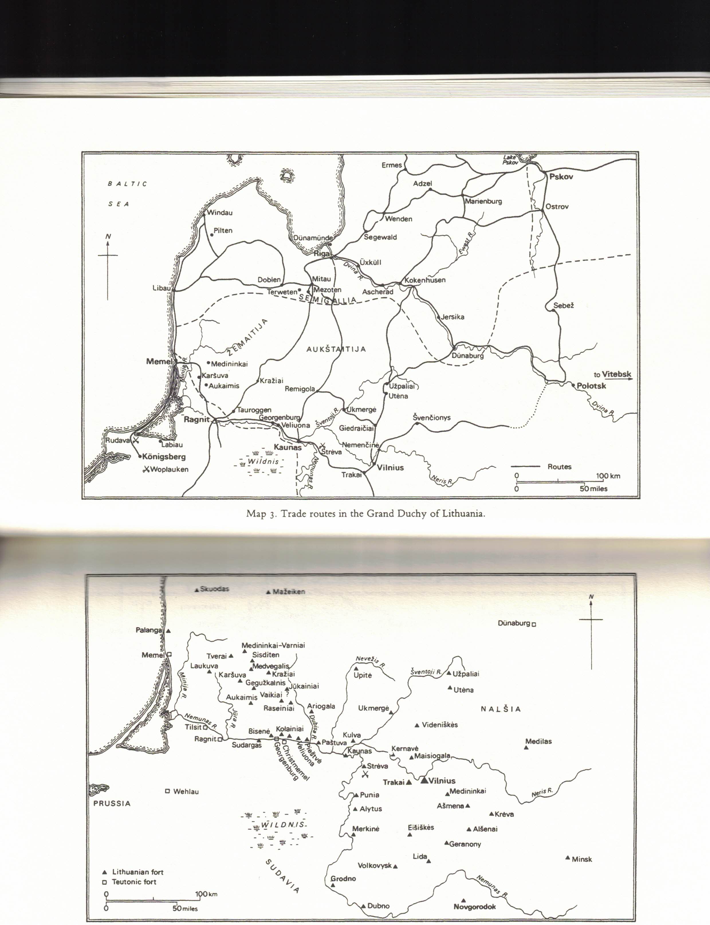
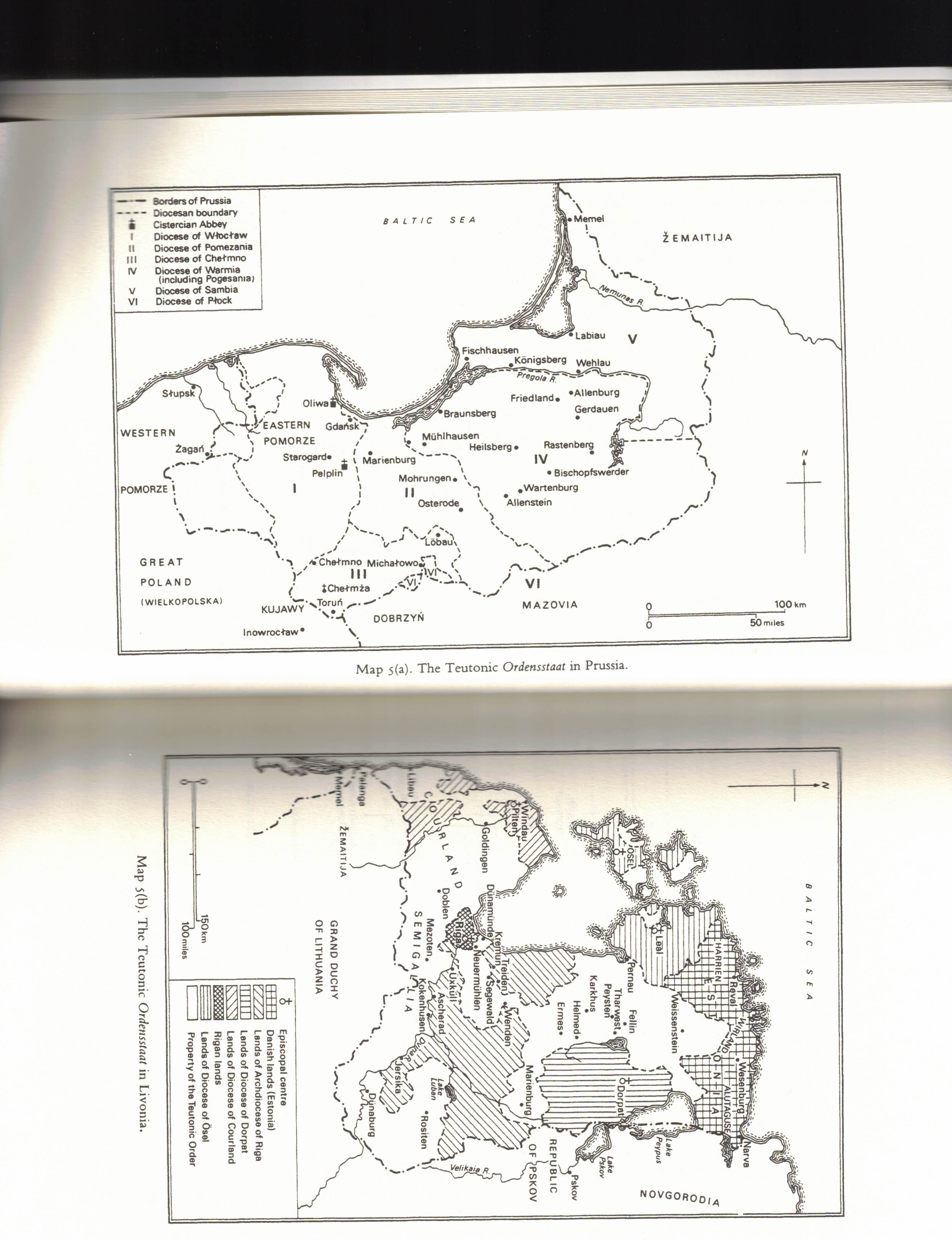
Some maps via Cambridge Studies in Medieval Life & Thought - "Lithuania Ascending" by SC Rowell
CCI_000002.jpg

CCI_000003.jpg

CCI_000004.jpg

So a couple items from the maps I've linked any game maps of the Grand Duchy of Lithuania
  1. Calling it "Duchy of Lithuania" vs Grand Duchy makes no sense. I am not aware of any document referring to either Lithuania nor referred to by Lithuanians themselves of them as a "Duchy".
  2. Lithuanian Kyiv controls too much territory south. The Golden Horde should have what you've labeled Bratslav and Vinnytsia
    1. Admitted these boarders especially around Vinnytsia are not static but hard to represent that in game so i'd err on giving them to the golden horde
  3. Kyiv is a modern spelling I don't much care for it in context though my knowledge of transliterating from cryllic isn't sufficient to offer a better choice
  4. Galicia-Volhynia controls territiory that should be alligned with lithuania
    1. Id say Dubno; Rivne; Ostoh; Korets and east ward should be part of Kyiv
    2. Ratne should be as well
  5. Pskov should be allied or dependent on Lithuania
    1. "Teutonic crusaders and the ravages of other Rus'ian princes. Pskov became a virtual client of the grand duke of Lithuania from 1322 until around 1400." (pg. 22)
  6. Location naming changes
    1. Lyakhavichy > Novogorodok
    2. Vawkavysk > Dubno
    3. Merkine > Alytus
    4. Ashmyany > Medininkai/Asmena - hard for me to place without rivers :(
    5. Hieraniony > Asmena/Kreva - same as above, hard to place without rivers
    6. Svencionys > Videniskes
  7. Trade Kyiv market should extend northwest-wards; perhaps as far as Grondno

edit - fixing quote year
 
Last edited:
  • 11Like
  • 3
  • 1Love
  • 1
  • 1
Reactions:
I think Rusyn is obsolete at the game start. Ruthenian should break up 100-200 years if one wants Byelorussian, Cossack, Ukrainian or Rusyn
 
  • 10Like
  • 3
  • 2
Reactions: