• We have updated our Community Code of Conduct. Please read through the new rules for the forum that are an integral part of Paradox Interactive’s User Agreement.

Tinto Maps #9 - 5th of July 2024 - Carpathia and the Balkans

Greetings, and welcome to another Tinto Maps! This week we will be taking a look at Carpathia and the Balkans! It will most likely be an interesting region to take a look at, with a lot of passion involved… So I’ll just make an initial friendly reminder to keep a civil discussion, as in the latest Tinto Maps, as that’s the easiest way for us to read and gather your feedback, and improve the region in a future iteration. And now, let’s start with the maps!

Countries:
Countries.png

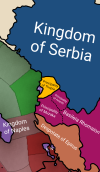
Carpathia and the Balkans start in a very interesting situation. The Kingdom of Hungary probably stands as the most powerful country in 1337, but that only happened after the recovery of the royal power enforced by Charles I Robert of the House of Anjou, who reined in the powerful Hungarian nobility. To the south, the power that is on the rise is the Kingdom of Serbia, ruled by Stefan Uroš IV Dušan, who has set his eyes on his neighbors to expand his power. The Byzantine Empire, meanwhile, is in a difficult position, as internal struggles ended in Andronikos III being crowned sole emperor, at the cost of dividing the realm; both Serbia and Bulgaria have in the past pressed over the bordering lands, while the Ottomans have very recently conquered Nicomedia. The control over the Southern Balkans is also very fractioned, with a branch of the Anjou ruling over Albania, the Despotate of Epirus under the nominal rule of Byzantium as a vassal, Athens, Neopatria and Salona as vassals of the Aragonese Kings of Sicily, Anjou protectorates over Achaia and Naxos, and only nominal Byzantine control over Southern Morea. It’s also noticeable the presence of the Republics of Venice and Genoa, which control several outposts over the Adriatic and Aegean Seas. A final note: in previous maps, Moldavia was shown in the map, but we’ve removed it from it, and it will most likely spawn through a chain of events in the 1340s.

Dynasties:
Dynasties.png

The House of Anjou rules over Naples, Hungary, Albania, Achaia, and Cephalonia; they’re truly invested in their push for supremacy over the region. Apart from that, each country is ruled by different dynasties, except for Athens and Neopatria, ruled by the House of Aragón-Barcelona.

Locations:
Locations 1.png

Locations 2.png

Locations 3.png

Locations 4.png
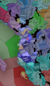
This week we’re posting the general map of the region, along with some more detailed maps, that can be seen if you click on the spoiler button. A starting comment is that the location density of Hungary is noticeably not very high; the reason is that it was one of the first European maps that we made, and we based it upon the historical counties. Therefore, I’m already saying in advance that this will be an area that we want to give more density when we do the review of the region; any help regarding that is welcome. Apart from that, you may notice on the more detailed maps that Crete appears in one, while not being present in the previous one; because of the zooming, the island will appear next week along with Cyprus, but I wanted to make an early sneak peek of the locations, given that is possible with this closer zoom level. Apart from that, I’m also saying in advance that we will make an important review of the Aegean Islands, so do not take them as a reference for anything, please.

Provinces:
Provinces.png

Provinces! Nothing outstanding to be commented on here; as usual, we’re open to any feedback regarding them.

Terrain:
Climate.png

Topography.png

Vegetation.png

Terrain! The climate of the region is mostly divided between Continental and Mediterranean, with some warmer and some colder regions. Regarding the topography, the Carpathian mountains are famously important and strategic, while the Balkans are a quite hilly and mountainous region, which is also greatly covered by woods and forests.

Cultures:
Cultures.png

Here comes the fun part of the DD: The cultural division of the Balkans! A few comments:
  1. Hungary is full of different minorities. Transylvania, especially, is an interesting place: there we have a mix of ‘Hungarians’, ‘Transylvanians’ (which are the Romanian-speaking inhabitants of the region), ‘Transylvanian Germans’, and ‘Szekely’ people.
  2. We have divided the Southern Slavic-speaking region into their dialectal families of Slovene, Croatian, Bosnian, and Serbian.
  3. The Southern Balkans are mostly divided among Bulgarian, Albanian, and Greek cultures.
  4. We’re also portraying plenty of other cultures, such as Dalmatians, Aromanians, Sclavenes, Arvanites, Cumans, Jasz, or Ashkenazi and Romanyoti Jews.

Religions:
Religion.png

This one is also interesting. Apart from the divide between Western Catholicism and Eastern Orthodoxy, we have the Krstjani in Bosnia, Bogomils (the pink stripes both in Bosnia and Macedonia), and Paulicians in Thrace. The Jewish populations do not pass the threshold percentage to appear on the map, but there are plenty of communities across the region.

Raw Materials:
Raw Materials.png

The materials of the region. Something very noticeable is the richness of minerals, with plenty of Iron, Copper, Tin, Lead, Gold, and Silver. Specifically, Slovakia is very rich, and you definitely want more settlers to migrate to the region, and exploit its resources. The region is also very rich in agricultural resources, as you can see.

Markets:
Markets.png

The region is mostly divided among four markets: Venice, Pest, Ragusa and Constantinople.

Country and Location population:
Population 1.png

Population 2.png

Population 3.png

Population 4.png
Country and location population (which I’ve also sub-divided, and is under the Spoiler button).

And that’s all of today! I hope that you find the region interesting; we certainly think that it is. Next week we will go further south, and we will take a look at the Syrian Levant and Egypt. Cheers!
 
  • 193Like
  • 69Love
  • 7
  • 4
  • 3
  • 1Haha
Reactions:
Honestly I do think that confusion with the modern term Felvidék should not really mean not using it, given that this was the name they were using for the area both officially and unofficially; it is sort of like not using the Roman Empire or Prussia because some people are weird about it, kind of. The only reason I think naming it after Upper Hungary might not work is because I don't really think Lower Hungary would work, but I don't have a strong opinion on the matter of naming.
Otherwise I'm of the opinion that Transylvania, Transdanubia and the Banat should be constant with their geographical boundaries, which are well-defined historically, and I think they should be as intact as possible, while the rest can have some freedom.
I don't however think that a Duna area makes much sense; it's not really a grouping a Hungarian would use, it feels a bit arbitrary to group Pest, Komárom-Esztergom and Nógrád together, I might prefer grouping Pest with the rest of the Danube-Tisza interfluve region instead. However I have no problem with one big "Alföld" area itself, stretching from Bodrog to Bihar and Szabolcs.


It was, I also mentioned it briefly, but I do think the name sounds confusing out of context (given that it doesn't look any Lower than the Upper one)
Upper and Lower Egypt are also not in the position some people think ;) just like Right-Bank and Left-Bank Ukraine, or Upper and Lower Austria.

Lower Hungary would be more than fine!
 
  • 3Like
Reactions:
Fun fact, that map even ignores the existence of székelys
The Székelys were not a separate ethnicity for most of history and some will say they still aren't.
Székelys were more like a social class than a culture, they were freemen tasked with guarding the border regions originally (not only in Transylvania but along all of the borders), so expecting them in a medieval ethnic map is a gross misunderstanding. As for it being an 11th century map, back then neither the Székely identity have formed yet, nor the system of the sedes that form the main backbone of Székely regionalism have formed or have been stabilized, so you wouldn't expect them if you knew their history
 
  • 4
  • 4
  • 1
Reactions:
Hello!

I have tried to illustrate in the attached image some colour changes that I think would improve readability.

This is also a personal preference - I think that the yellow / wheat colour for Romania / Wallachia from V2 / HoI4 / CK3 fits best, unlike the more recent blue, and in the context of the Project Caesar map it would certainly distinguish us from our neighbours.

I have also tried to implement the green that I have seen suggested for the Bulgarians, light blue for the Greeks and a vibrant red for the Turks.

I hope you like my suggestion, best regards!

View attachment 1164156
I agree, I think the colours are much better suited for the region/cultures!
 
  • 2Like
Reactions:
The Székelys were not a separate ethnicity for most of history and some will say they still aren't.
Székelys were more like a social class than a culture, they were freemen tasked with guarding the border regions originally (not only in Transylvania but along all of the borders), so expecting them in a medieval ethnic map is a gross misunderstanding. As for it being an 11th century map, back then neither the Székely identity have formed yet, nor the system of the sedes that form the main backbone of Székely regionalism have formed or have been stabilized, so you wouldn't expect them if you knew their history
What's the point of that argument, when i'm telling that instead of them we have trees on an ethnic map.
 
  • 3Like
  • 2
Reactions:
What's the point of that argument, when i'm telling that instead of them we have trees on an ethnic map.
Because those were unpopulated, forested areas during that period, the overall population was very low and even they lived in the valleys. Do you perhaps happen to be a researcher, perhaps an archeologist, hogy has conducted digs and research in those areas and have perhaps some archeological evidence of human settlements and villages in those areas?

Large swaths of land were pretty much uninhabited during the middle ages. In fact, the early Kingdom of Hungary (until the early 13th century or so) kept a deliberately uninhabited "no-man's-land" called the gyepűelve, along the Carpathians, only trespassed by scouts, and perhaps some herdsmen. Székelys, as I have mentioned, were guards of the inner gyepű ("march"), basically a border guard population along these borders. By the 13th century, the gyepű system was dismantled, the Székely sedes solidified into one defined region within Transylvania, and due to increasing population more areas of the Carpathians and the untrespassable marshes in the Plains were settled, though most of the mountains (like everywhere in the world) were still uninhabited.

The reason we have uninhabited forests and "trees" on an ethnic map is because, in fact, those areas (forested mountains, marshlands, etc.) seem to have really been unpopulated, as there are no settlements (villages, towns, farmstead) found in those areas from that period in the archeological record.

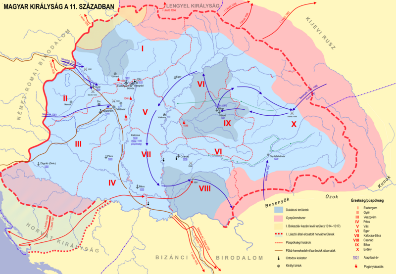
Hungary_11th_cent_hu.png


And yeah if you expect Székelys (as an ethnicity) in Székelyföld in the 11th century you have clearly no idea about the history of the area
 
  • 5
  • 4
  • 2
Reactions:
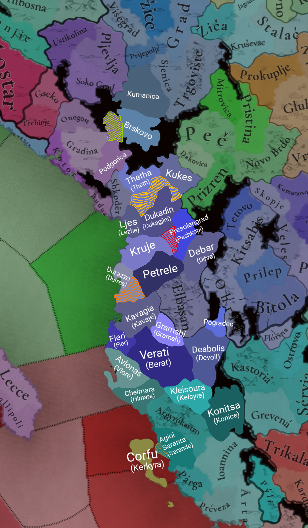
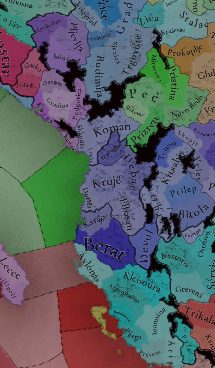
After many days I have finally finished with the Montenegrin, Epirus and (mostly) Albanian regions. All in all 9 locations have been split, five border changes have been made and I also added the names of the locations (the locations that I worked on) under the respective culture that they start in 1337.


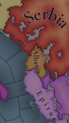
I will first start with the political map and it's changes (below are the official map from paradox and my map with the needed corrections).
IMG_20240717_122132.png

sketch-1721216045514.png

The changes:

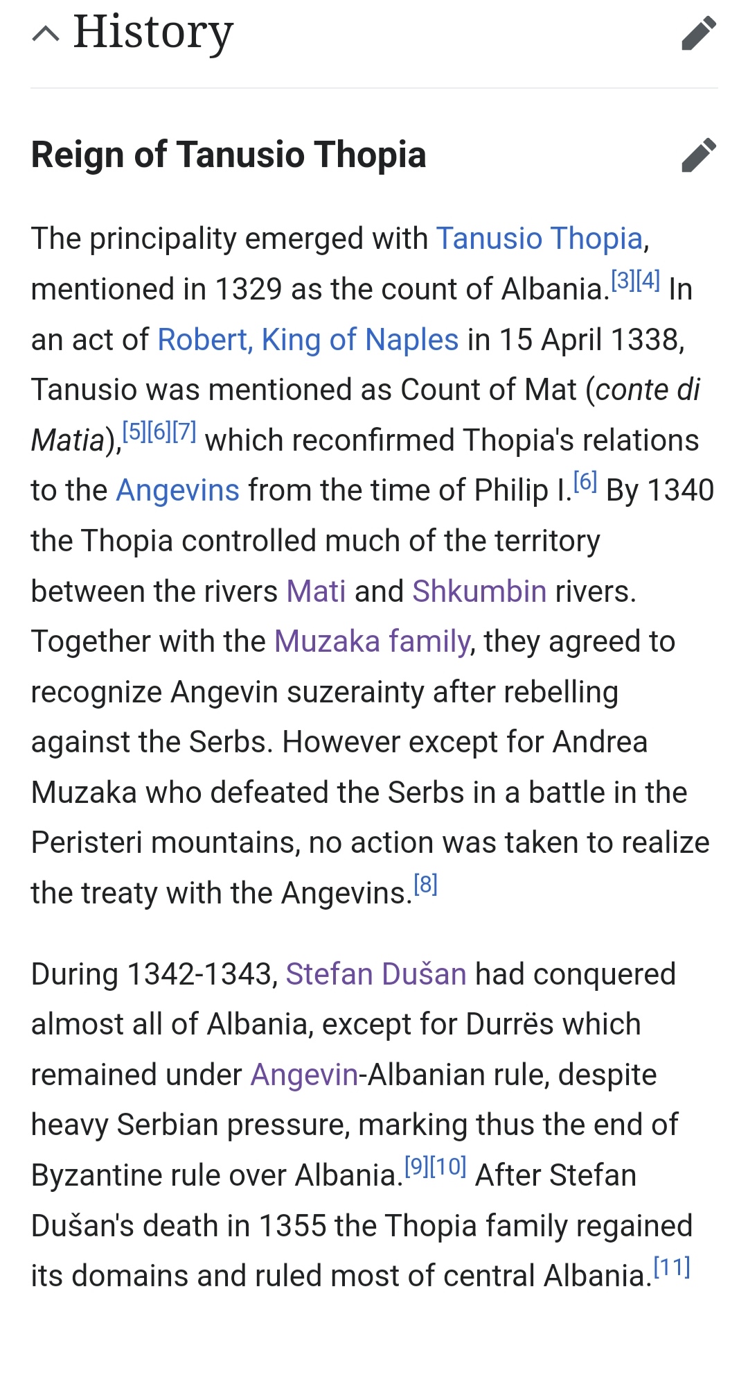
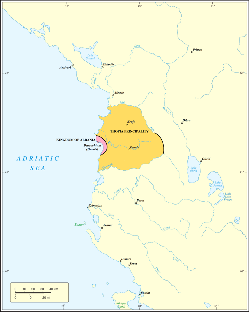
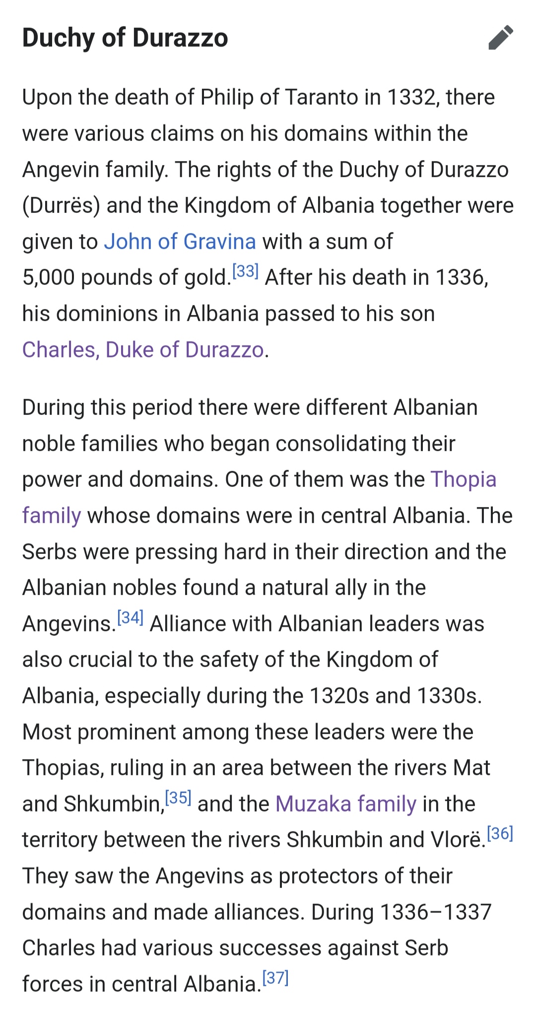
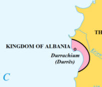
-Albania shouldn't start as a state (as they didn't exist at the time, although the Neapolitan Durres claimed themselves to be) but rather a formable nation to be able to form by the Albanian principalities of the region if they control certain locations for example (Kruje, Berat, Durres, Dukagjini and Lezhe).The Thopia principality should start in the place of Albania with some location changes, the location of Durres under Neapolitan control, Dukagjini under Serbian control and the Elbasan location under the Arianiti family who they in turn are under Byzantine suzerainty.

Thopia principality
IMG_20240717_125019.jpg

Kingdom_of_Albania_in_1368_AD.png

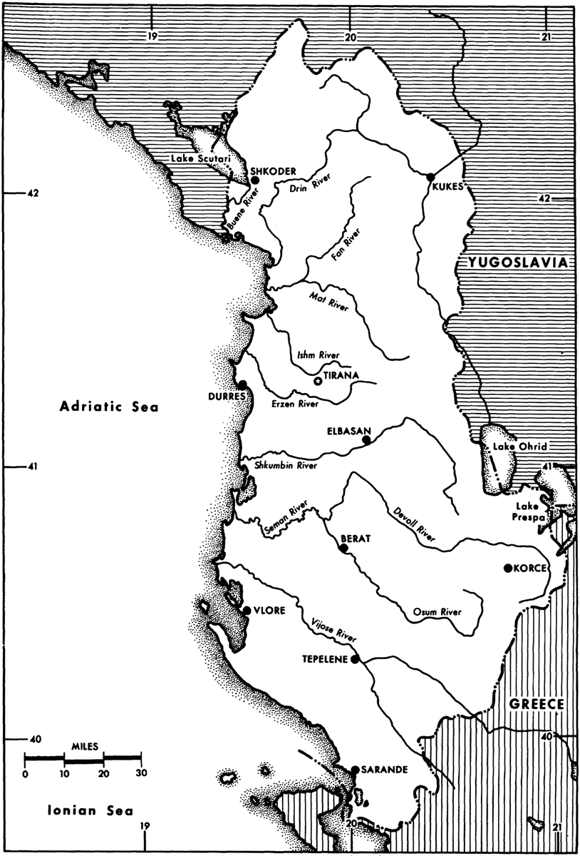
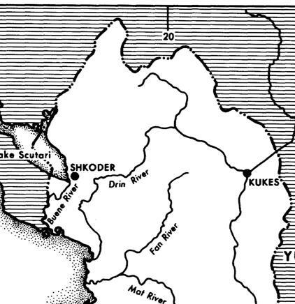
(I also added this map of the rivers in Albania, to better understand where the borders of the principalities and locations should be)
imagep038.png

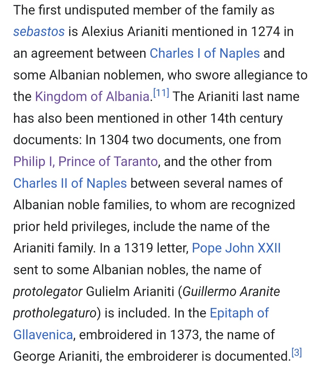
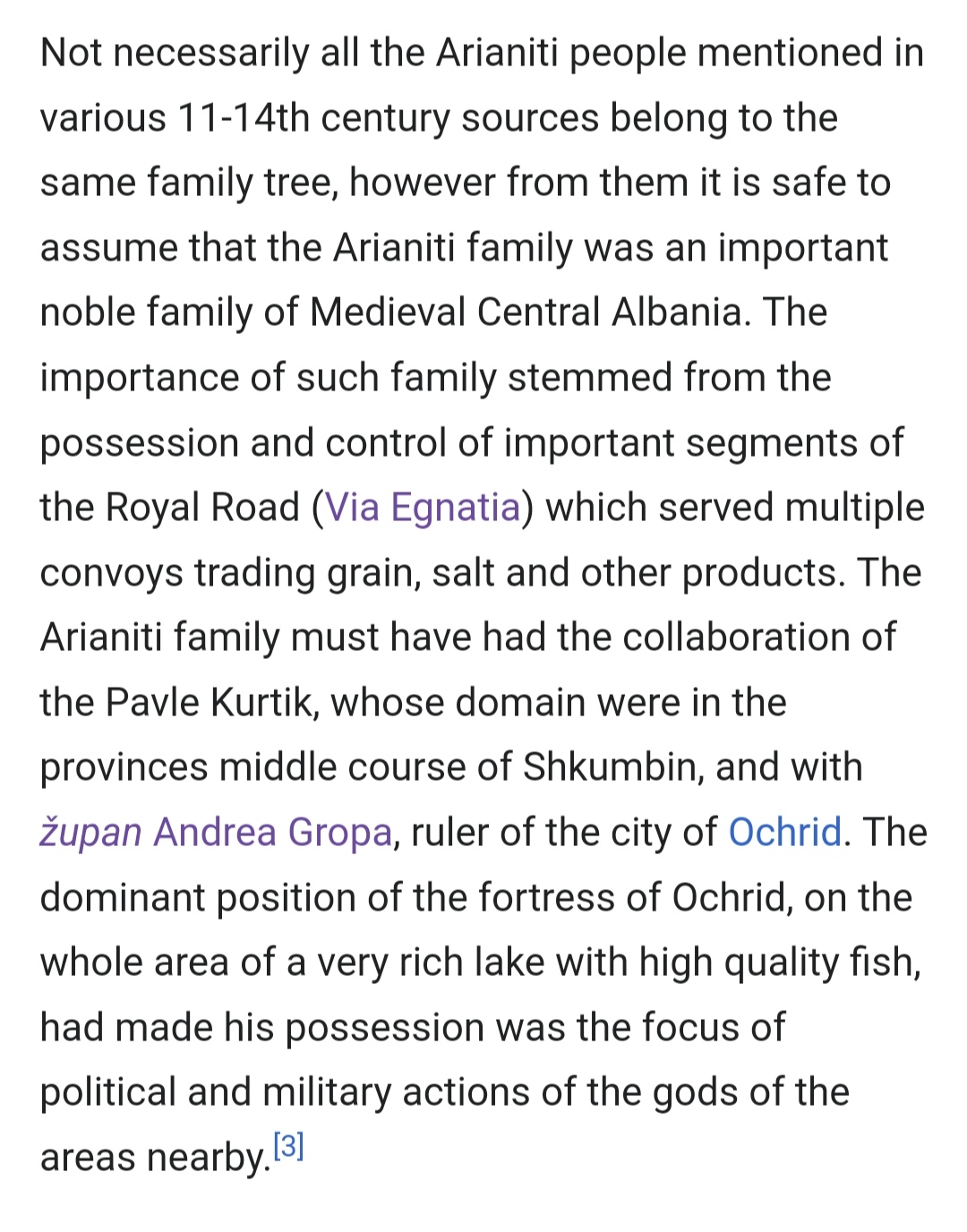
The Arianiti principality history before 1337 and it's rough borders around Elbasan.
IMG_20240717_125536.jpg

IMG_20240717_125522.jpg


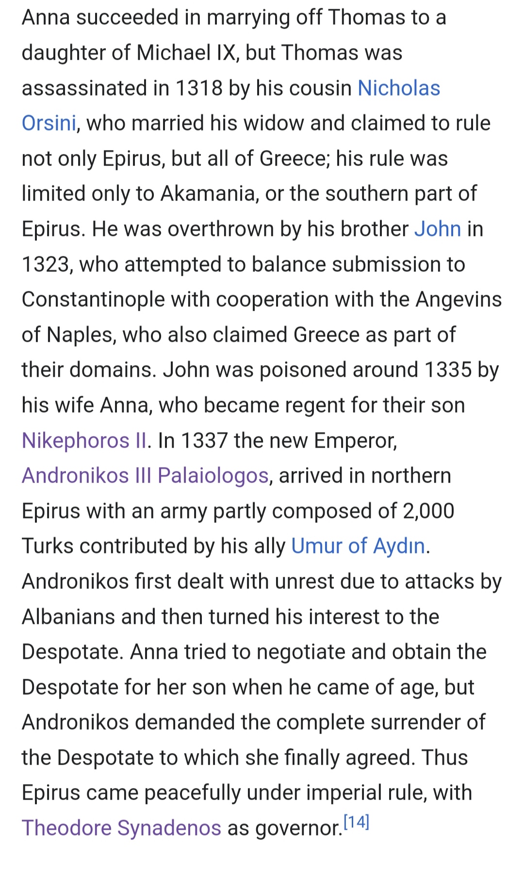
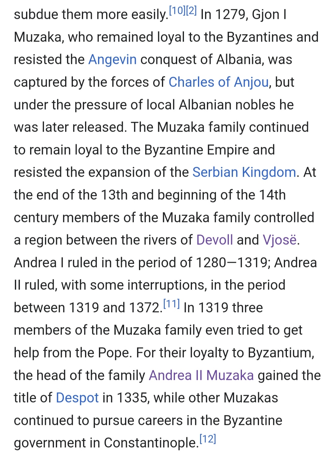
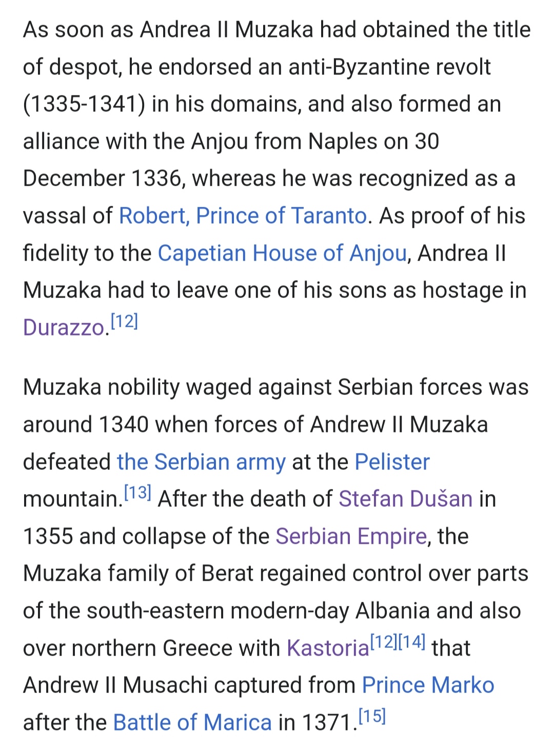
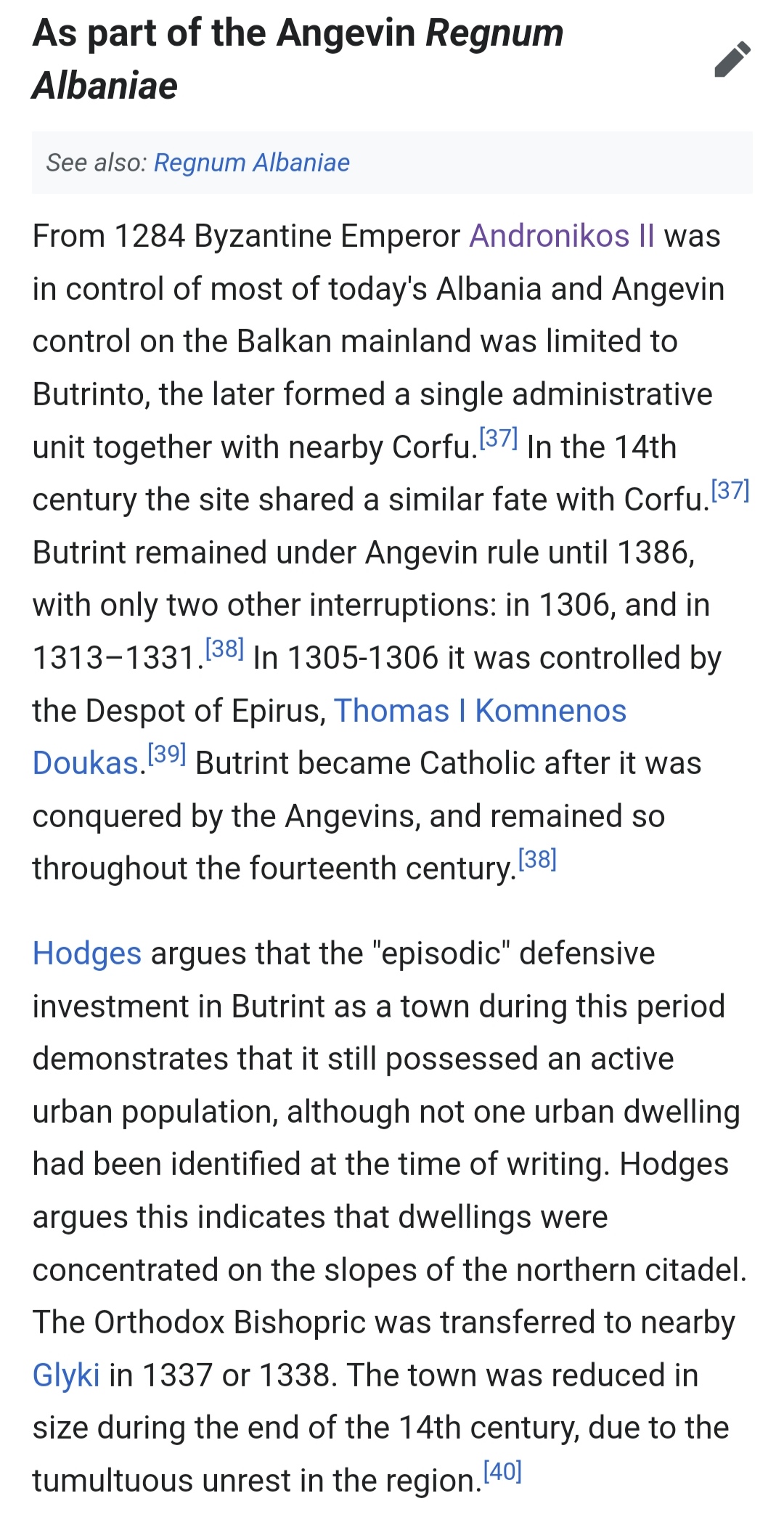
-The Despotate of Epirus (Who at the start date was in the process of becoming a province of Byzantium) northern border should be Avlona with the Berat and Kavaje locations instead be held by the Mazuka family who they too like the Arianiti were under nominal Byzantine control (as they styled themselves with Byzantine titles pursuing careers in the Byzantines state as well as Andronikos the third putting down a revolt in 1337 by Albanians in the area).

By late 1337 to 1338 the Despotate of Epirus was peacefully incorporated into The Byzantine Empire thanks to the efforts of Emperor Andronikos the third.
IMG_20240717_130432.jpg


The Mazuka family's history before 1337 and it's shifting loyalties.
IMG_20240717_130240.jpg

The failed revolt by Mazuka in 1337
IMG_20240717_130227.jpg


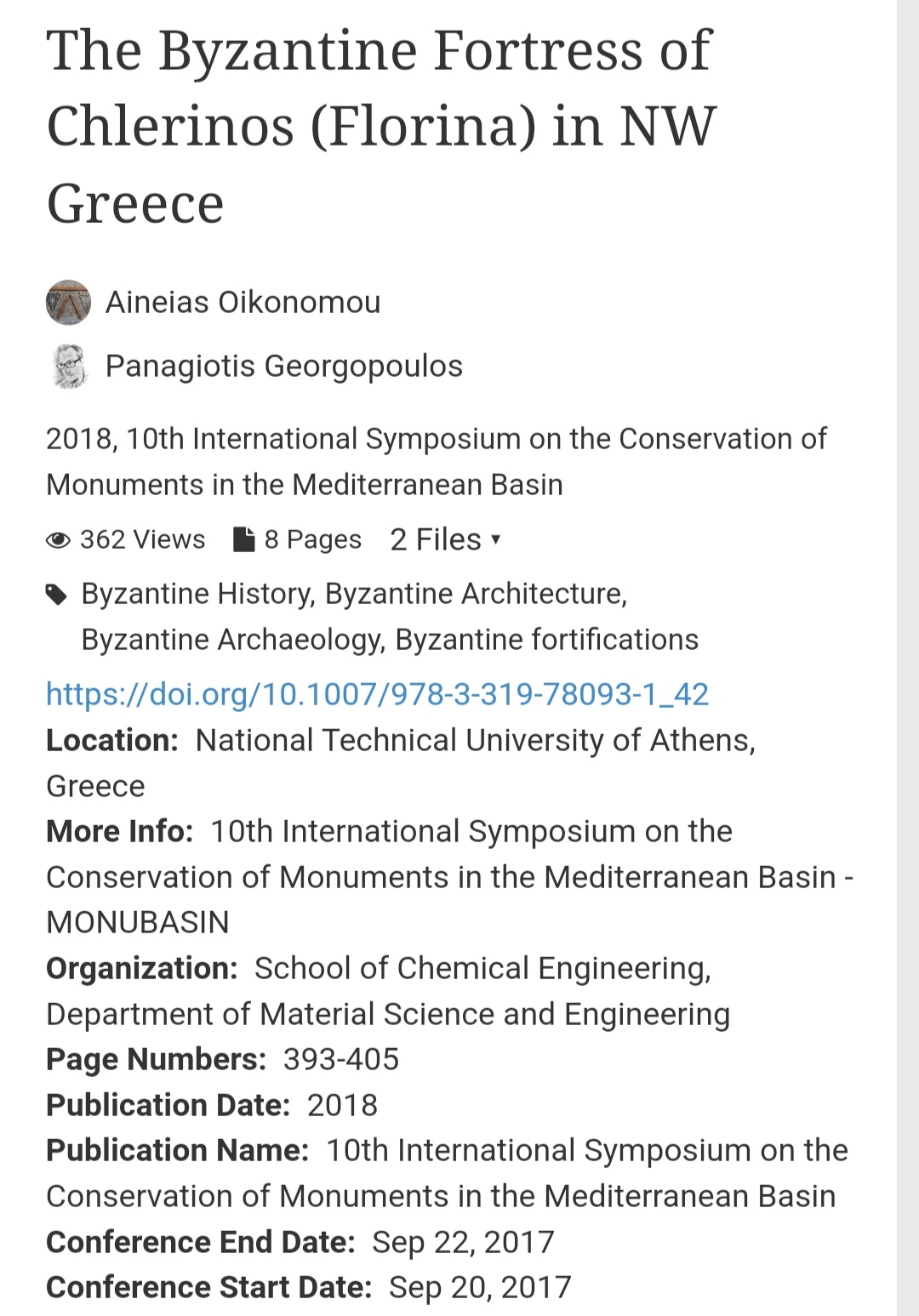
-The Kingdom of Serbia should also control the locations of Dukagjini, Pogradec, Pogradec is one of the new locations that I added (I would show later don't worry) and Florina.

IMG_20240717_094424.jpg

Source
IMG_20240717_094527.jpg


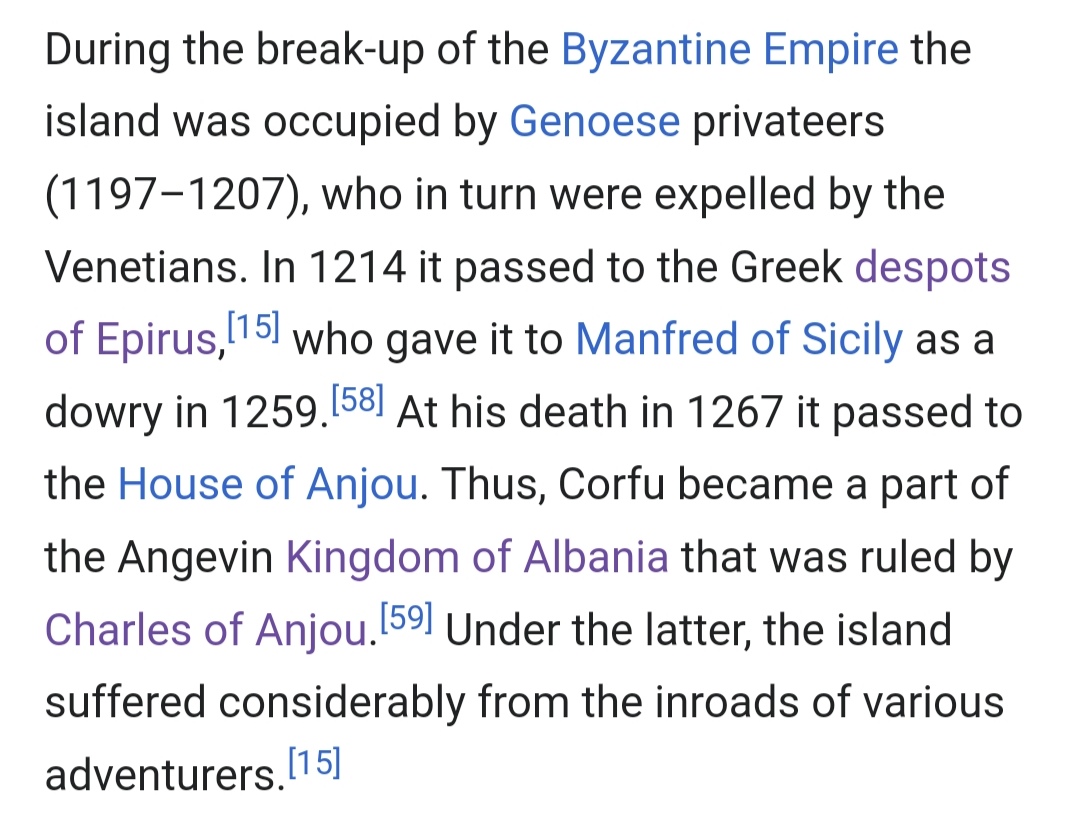
-The kingdom of Naples at 1337 should controll the port of Durres and it's immediate areas (I have taken away half of the location of Durres as it was very big and gave it to a new location Petrele). The island of Corfu with the Bouthroton fortress should be part of Naples as well, (Bouthroton as a location should be split, as Bouthroton itself was just a fortress with a small settlement that was slowly disappearing, its location is right across Corfu and it's purpose was to warn and protect the island from invading army's)

IMG_20240717_133013.jpg

Corfu
IMG_20240717_134557.jpg

Bouthroton (Butrint)
IMG_20240717_134726.jpg

This is it for the political spectrum of the region.


I would now focus on the changes in location borders and breakup of certain large locations, as you can see they are quite a few...
sketch-1721215898669.png

IMG_20240717_121009.png

(The original map side by side for comparing differences).

Alright from north to south.

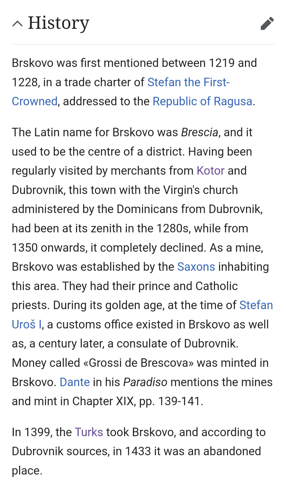
- The Budimlja location has changed to Brskovo as it was an already existing town in the 14th century while Budimlja wouldn't be mentioned until the 16th century
IMG_20240717_135800.jpg

I have also split the original Budimlja location in two as I believe it is quite big, the northern part is unfortunately quite devoid of written settlements in 1337 with the exception of the Kumanica monastery (if anyone knows of a better location name please inform me). While the light green stripes are to be taken of Podgorica location and be given to Brskovo as the town is right at the border between the two so in order to be more clear cutted I assigned that area to Brskovo.


-The koman location has been split in two new locations, while the yellow stripes are to be given to the Dukagjini location in order for the border to better reflect the drin river.
IMG_20240717_140605.png


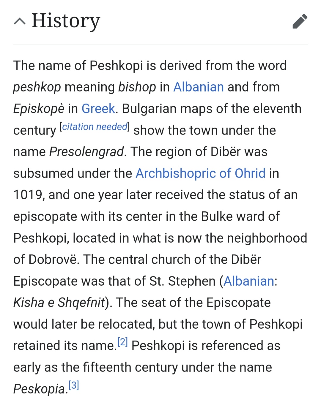
-The Dibra location has been split in two, since the new location Presolengrad was in written records from when Bulgaria controlled the region in the 11th century! (thus it's Slavic name).
IMG_20240717_141051.jpg

While the red striped area is to be taken of the Kruje location and be given to Presolengrad in order to better reflect Thopia's borders as they were between the Mat and Skhumbin rivers.
Kingdom_of_Albania_in_1368_AD.png


-The Kruje location too has been split with Petrele taking the southern part of the location as it was an fortified location in 1337. The orange area of stripes should be taken of Durres and given to Petrele as Durres an Angevin possession only controlled the city and immediate surroundings.
IMG_20240717_141852.jpg


-The Durres location as I said above should give half of it's southern area to Petrele as it certainly didn't control that much south and inlands.
IMG_20240717_142415.png

For reference (notice how even my reduced location is still big compared to what was actually controlled).


-The location of Berat has been split in three as there are a number of important settlements in the location area of Berat. Fier which was used for trade by the venetian merchants.
IMG_20240717_142700.jpg

While the Gramsh location seems to have been under the Arianiti family.
IMG_20240717_142943.jpg


-The Devol location has been split in two with the important Pogradec town being added.
IMG_20240717_143849.jpg


-The Vlore location has been split as well with the town of Himara being added in the south.
IMG_20240717_144142.jpg


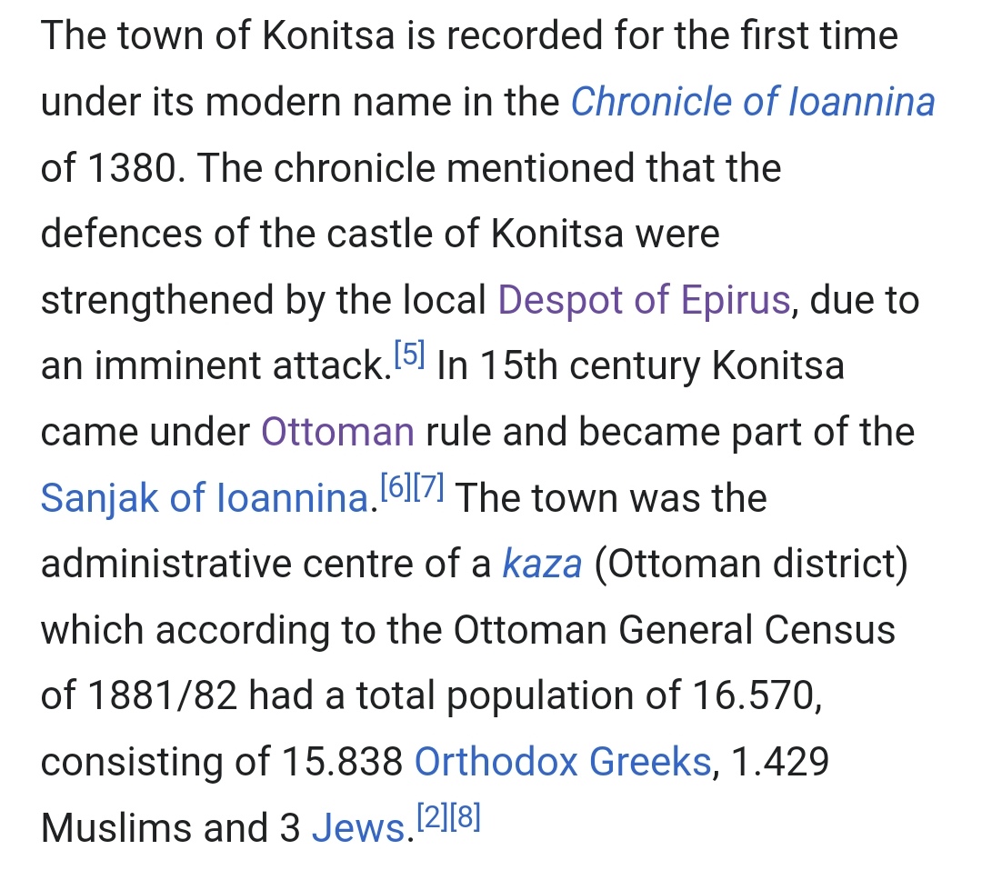
- I have decided to split the Kelcyre location as it seems quite big for only one location, adding Konitsa which it was first mentioned in 1380 as a fortified location so quite important and it probably existed in 1337.
IMG_20240717_144531.jpg


-And lastly the Bouthroton location which is shown to have a ridiculously big area. The Bouthroton fortress was built in order to keep the island of Corfu safe from raiders and invading army's (it's nicknamed the eyes and ears of Corfu for a reason after all).
Butrint_(Buthrotum,_Butrinto)._Venetian_enclave_facing_Corfu..jpg

What the Bouthroton really should be as a location.

However since it will be a very small location to add I think it will be best for Bouthroton to be included in the location of Corfu as one (the area of the light yellow stripes), for the fortress never truly fell until the end of the 18th century when french forces of Napoleon took the Corfu and the Albanians seized the opportunity and took Bouthroton (you can see how interconnected Corfu and Bouthroton were).
So instead of Bouthroton the location name should be Agioi Saranda as there was a local monastery in the area (even thought the town seems to be abandoned at the time).
IMG_20240717_145827.jpg


So that's it then, this took quite a while to make but I think in the end it was worth it!


Ps: my thanks to @Mingmung for inspiring me to finish it sooner rather than later.
 

Attachments

  • sketch-1721207286736.png
    sketch-1721207286736.png
    1,9 MB · Views: 0
  • sketch-1721207830047.png
    sketch-1721207830047.png
    714,4 KB · Views: 0
  • 6Like
  • 5
  • 2Love
  • 2
Reactions:
@DOURIOS nice suggestion, once again! I'm curious how far the devs will go with future splitting of locations in this area, but still!

I'm a bit puzzled about Dukadin, though. I didn't find anything of note on it. My suggestion dealt with it by merging it with a new Peshkopi location. Did you find anything on Dukadin?

I'm also not a fan of the current Montenegro setup (working on a post about it). It misses some future capitals, like Cetinje, the fortress of Gradina Martinic has been abandoned for a while, Podgorica is in the wrong location (it's actually slightly inside Gradina, I think) and Budua/Budva is not located within its location, at all. But should be split from Kotor. As Budua/Budva is currently in the location of the city of Bar (hence the confusion, I think).

The Kingdom of Albania was also controlled by a different Anjou, so it being a vassal/PU or something makes total sense. And I'd still keep Bouthroton as a separate location, just a bit bigger than your setup, but smaller than the current iteration.
 
Last edited:
  • 3Like
  • 1
  • 1
Reactions:
@DOURIOS nice suggestion, once again! I'm curious how far the devs will go with future splitting of locations in this area, but still!

I'm a bit puzzled about Dukadin, though. I didn't find anything of note on it. My suggestion dealt with it by merging it with a new Peshkopi location. Did you find anything on Dukadin?

I'm also not a fan of the current Montenegro setup (working on a post about it). It misses some future capitals, like Cetinje, the fortress of Gradina Martinic has been abandoned for a while, Podgorica is in the wrong location (you fixed it, too) and Budua/Budva is not located within its location, at all. But should be split from Kotor. As Budua/Budva is currently in the location of the city of Bar (hence the confusion, I think).

The Kingdom of Albania was also controlled by a different Anjou, so it being a vassal/PU or something makes total sense. And I'd still keep Bouthroton as a separate location, just a bit bigger than your setup, but smaller than the current iteration.

-Thank you :) And seeing that they gave 150 new locations for France alone... Well you can't blame me for being optimistic.

-Dukadin is simply the Slavic version of Dukagjini, unfortunately I haven't found anything about that location either I would take a look again and see if I can find some town or Castle in the region that existed at the time or close to it at the very least (I don't have high hopes though).

-Yeah Montenegro isn't really my area of expertise and seeing how long Albania itself took I decided not to work too much into it. I hope other people would look more into it (you seem familiar with it which is good)

-Yeah a vassal is probably more accurate


- Bouthroton either as its own location or part of Corfu I don't mind, but it must be scaled down from what it's original location was!
 
Last edited:
  • 1Like
Reactions:
Otherwise I'm of the opinion that Transylvania, Transdanubia and the Banat should be constant with their geographical boundaries, which are well-defined historically, and I think they should be as intact as possible, while the rest can have some freedom.
I don't however think that a Duna area makes much sense; it's not really a grouping a Hungarian would use, it feels a bit arbitrary to group Pest, Komárom-Esztergom and Nógrád together, I might prefer grouping Pest with the rest of the Danube-Tisza interfluve region instead. However I have no problem with one big "Alföld" area itself, stretching from Bodrog to Bihar and Szabolcs.
The issue that arises is that a Transdanubia following the well-defined boundary will cut straight across provinces and locations. In Pest and Fejer, this is easy to address by playing around with what county goes where, but upstream it becomes an issue when the boundary goes through Komarom, while the location of Esztergom is sliced clean in half. Hence my solution to split off the offending counties, along with Nograd which is a bit too hilly for the “plain” part of “Great Plain” and also sticks in a mildly bordergory manner, into a “Duna” area centered on Pest.
With Transylvania and Banat, I haven’t looked in detail, but I seem to remember them having some sort of issue that made me go “fuck it, I’ll just follow county borders instead and approximate the grouping”.
Edit: one of the issues was with Banat’s size, where following historical boundaries would leave it with two provinces and a small fraction of a third, which is a bit too small by PDX standards - hence including all of that third province (Arad), plus an optional fourth one (Hunyad).
 
Last edited:
  • 2
  • 1Like
  • 1
Reactions:
Because those were unpopulated, forested areas during that period, the overall population was very low and even they lived in the valleys. Do you perhaps happen to be a researcher, perhaps an archeologist, hogy has conducted digs and research in those areas and have perhaps some archeological evidence of human settlements and villages in those areas?

Large swaths of land were pretty much uninhabited during the middle ages. In fact, the early Kingdom of Hungary (until the early 13th century or so) kept a deliberately uninhabited "no-man's-land" called the gyepűelve, along the Carpathians, only trespassed by scouts, and perhaps some herdsmen. Székelys, as I have mentioned, were guards of the inner gyepű ("march"), basically a border guard population along these borders. By the 13th century, the gyepű system was dismantled, the Székely sedes solidified into one defined region within Transylvania, and due to increasing population more areas of the Carpathians and the untrespassable marshes in the Plains were settled, though most of the mountains (like everywhere in the world) were still uninhabited.

The reason we have uninhabited forests and "trees" on an ethnic map is because, in fact, those areas (forested mountains, marshlands, etc.) seem to have really been unpopulated, as there are no settlements (villages, towns, farmstead) found in those areas from that period in the archeological record.

View attachment 1164502

And yeah if you expect Székelys (as an ethnicity) in Székelyföld in the 11th century you have clearly no idea about the history of the area

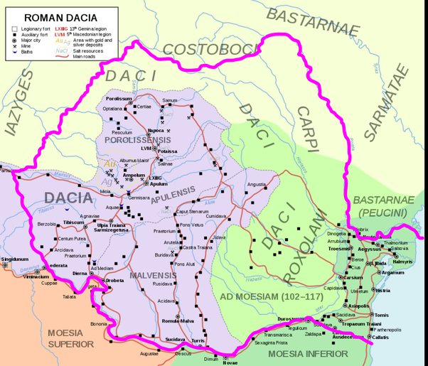
Before making such claims you better consult Dacia, Thracia, Roman fortifications maps and burial cites of Gothic and Huns tribes...
Sarmizegetuza, dacian capital, was literally in the mountains. Dense forrests and mountains are the locations where other nationalities lived after hungarians came. The shady way of depicting them as unpopulated areas is childish. And again, székelys consider themselves different from hungarians, I live there, and I know better.
1721225075418.png
 
Last edited:
  • 9
  • 3
Reactions:
Before making such claims you better consult Dacia, Thracia, Roman fortifications maps and burial cites of Gothic and Huns tribes...
Sarmizegetuza, dacian capital, was literally in the mountains
View attachment 1164556
From the period. Sarmizegetusa was razed a thousand years before the high middle ages. There are no such archeological finds from the middle ages lmao
 
  • 5
  • 5
Reactions:
Last edited:
  • 6
  • 3
Reactions:
The issue that arises is that a Transdanubia following the well-defined boundary will cut straight across provinces and locations. In Pest and Fejer, this is easy to address by playing around with what county goes where, but upstream it becomes an issue when the boundary goes through Komarom, while Esztergom is sliced clean in half. Hence my solution to split off the offending counties, along with Nograd which is a bit too hilly for the “plain” part of “Great Plain” and also sticks in a mildly bordergory manner, into a “Duna” area centered on Pest.
With Transylvania and Banat, I haven’t looked in detail, but I seem to remember them having some sort of issue that made me go “fuck it, I’ll just follow county borders instead and approximate the grouping”.
I'd personally probably move Nógrád to Western Slovakia/Lower Hungary/Nitra, or maybe to Upper Hungary, mostly because of its hilly terrain, because of its local dialect being in the Palóc group, and its relatively high Slovak influence. I do feel like it belongs to the North, to be fair
 
  • 1Like
  • 1
Reactions:
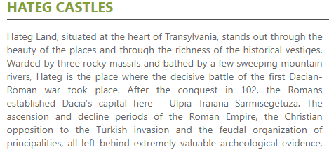
Yeah, check the dates. Neither of those castles were built prior to the 13th century, Deva was built after 1242, and the castle of Hațeg is from the late 13th century the earliest. Deva isn't really even a highland area, by the way, it is a small volcanic dome in the middle of a lowland valley, and isn't comparable to the forested highlands of the Carpathians or the Apuseni mountains.

This is quite literally in line with what I said earlier about highland areas starting to be permanently settled from the 13th century onward or so.
 
  • 4
  • 3Like
  • 3
  • 1
Reactions:
Modern-day Montenegro suggestions:

Hi everyone, this is my first post at the forum, I hope am not late for the review, because it took me a long time to make. I am from Montenegro and I know about the history and geography as I work as a tourist guide. I'll try to summarise my suggestions for the region here.

Locations/location names:
-Brskovo is omitted
. My suggestion would be splitting it from Budmilje and parts of Pljevlja (they seem lake large enough locations), otherwise Budimlje could be renamed.

Brskovo was extremely important as a mine (famous for its silver and minting coins), but also as a trading hotspot. Traders from Ragusa and Kotor relied on Brskovo because it was only possible for them to make huge profits if they could haul goods both ways when they go inland.
The pops should have include a large amount of chatolic saxon who had their own church, town "knez" (ruler) and made up the miner community.


It is true that after the game start it would decline in real history, as noted by other posters. Citation:
"У другој половини XIV в. почиње његово опадање, а 1433. га Дубровчани у једном тексту убрајају међу напуиггена мјеста, која не привлаче трговце." (During the second half of XIV century begins its decline, and 1433. Ragusans in one text note it as one of abandoned places, that do not attract traders.)

But considering the outsized importance at the game start and the fact that the decline lasted for several decades afterwards (also that even after the Ottoman capture in 1399 and the Ragusan claims of abandonment of trade in 1433 the location was far from depopulated, even if the mines and the town relying on it were)

-Bar is omitted. As someone already mentioned, Budva is put where Bar is geographically. During this era Bar is definitely more important so renaming the location to Bar and splitting Budva from parts of Kotor and Bar would be my sugggestion, depending on the desired location density.

-Gradina dilemma.
Gradina location is dominated by two geographic features. The flatlands of Bjelopavlići (where the remains of Gradina are and where the wast majority of the population at the game start would be living.). Other one would be the slopes of Lovćen. This is where, when the Ottomans come, the Crnojević dynasty runs to and Ivan founds Cetinje in 1482. From then on this is the capital of Montenegro (most importantly during the Petrović Njegoš dynasty when Montenegro was flipping in and out of de facto independence from the Ottomans (holding an even smaller area than the location depicted, but being able to hold it most of the time thanks to mountainous terrain.). They would win de jure independence only in 1878, though)

Therefore I am torn whether to suggest the location to be flatlands, or mountains (or hills if we pull the average) and what the name of the location should be. Gradina is today not a significant archaeological site and the XIV century character of the location would be rural, therefore a better name for it would be Gornja Zeta

I think there is a great opportunity for a flavourful event - Founding of Cetinje - If the Turks capture Podgorica (old capital of Žabljak Crnojevića was inside of this location) Gornja Zeta gets an influx of pops, a monastery buliding (or equivalent) and changes the name to Cetinje. The loaction gets a modifier if captured of extra separatism or sth (i don't know the mechanics of rebellions and separatism yet)


-Soko grad shoud be renamed to Komarnica/Piva - we are unsure of the date of construction of Soko grad, first mention is from 1419. and most estimates put the founding in the second half of XIV century. This location should be rural anyways and therefore it would be better represented by the name Komarnica, possibly Piva. These are two big and important "župa"s at the time.

I think there is a great opportunity for a flavourful event - Founding of Soko grad - If the location is owned by Kristjani or Bosnian ruler, the town can be founded, changing the name of the location.

-Morača location addition - Podgorica is mistakenly marked as a mountinous province and best way to solve this is to add a location of Morača in between the two wastelands of Sinjajevina and Prokletije. Morača was an important "župa" and Nemanjićs built one of the most important monasteries there -Morača monastery. Near the monastery is the remains of a fortress Morača but very little is know about it, but it is mentioned in 15th century. It should be rural and produce livestock.

-Podgorica name should be changed to Podlužje, Žabljak or Žabljak Crnojevića - Podgorica wasn't the urban centre that it is today. There was a trading post with this name at the game start but it's importance pales in comparison with the rural agricultural flatlands surrounding it. I propose a location encompasing these 3 "župa". Podlužje is the most important one at that time and should give the name to the location.
Alternatively if you want to name it after a town Žabljak Crnojevića is starting to rise at game start and will soon become the capital.

-Kotor location expanded to the west to encompass todays Herceg Novi and it's surroundings. Kotor should definitely represent whole of the Boka bay. From the map it looks like part of the bay where Herceg Novi would later be founded in 1382 (it would merit being a separate location but the location density would be too high) is drawn to be part of Ragusa (Dračevica was part of Nemanjić Serbia and churches on prevlaka were under Kotors jurisdiction)

Screenshot 2024-07-16 at 10.51.517.png
 
Last edited:
  • 3Like
  • 3
  • 1Love
  • 1
Reactions:
Yeah, check the dates. Neither of those castles were built prior to the 13th century, Deva was built after 1242, and the castle of Hațeg is from the late 13th century the earliest. Deva isn't really even a highland area, by the way, it is a small volcanic dome in the middle of a lowland valley, and isn't comparable to the forested highlands of the Carpathians or the Apuseni mountains.

This is quite literally in line with what I said earlier about highland areas starting to be permanently settled from the 13th century onward or so.
Not built, but reinforced already existing fortifications.
 
  • 2
  • 1
Reactions:
  • 3Like
Reactions:
Modern-day Montenegro suggestions pt II:

Sorry everyone, probably my response was to long so it got flagged for spam. I had to post it like this

Raw materials:
-Silver in Budimlje/Brskovo
-Olives in Bar
and maybe Budva also. These reagions produce olive oil and have been doing so from Roman times at least. In Bar there is a 2000yo olive tree and around Budva, Bar and in Valdanos there are olive grooves more than 1000yo
-If diversity of raw goods produced makes more gameplay sense then Budva could be producing fish (representing both fishing from the sea and from the lake because location on drawn on the map encompases Crmnica "župa")
-Salt in Kotor - Kotor was an important salt trading town salt for silver trade was their "bread and butter". Although Kotor was by XIV century trading more salt than it was producing (importing to meet the demand that was outpacing its production) it all started with the local production in Tivat Solila locality.
-Something other than wheat in Soko - Soko region was not known for wheat production
"Podgrađe je aktivno živjelo zahvaljujući trgovini i rudarstvu. Prema primorju su se izvozili raznovrsni proizvodi, uglavnom stoka, drvo i vosak. Takođe i metali, najvjerovatnije bakar, olovo i cink čijih ruda na ovom prostoru ima dosta. Oko rudnika su formirana rudarska naselja, karavanske stanice i trgovi. Osvajanjem Pive od strane Osmanlija 1466. godine, rudarstvo je zamrlo.
Skorijim arheološkim istraživanjima u Šćepan Polju otkriven je srednjovjekovni rudnik koji tek treba da nam otkrije tajne tadašnjeg rudarstva… "

Translates to: Surroundings of the town lived a bustling life thanks to trade and mining. Towards the seaside they exported diverse goods, mainly cattle, wood and vax. Also metals, most probably copper, lead and zink whose ores are plentiful. Around the mines there were mining settlements, caravan stations and trading squares. After the Ottoman conquest of Piva in 1466 the mining died out. Recent archeological investigations in Šćepan Polje (where Soko is situated) discovered a medieval mine that is yet to reveal the secrets of contemporary mining.

Unfortunately I don't have a better source right now. Considering that there is already a lead mine to the north and livestock to the south, lumber or copper would make sense.

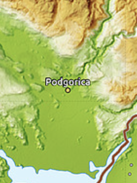
-Not livestok in Podgorica. My suggestion would be wheat, but wine, cotton or fish would also be options

Topography:
-Podgorica should be flatlands.

This is the biggest flatlands of the whole country it was very fertile and extremely important for agriculture of the region.
Topological map shows this without a doubt.
Screenshot 2024-07-17 at 14.17.52.png

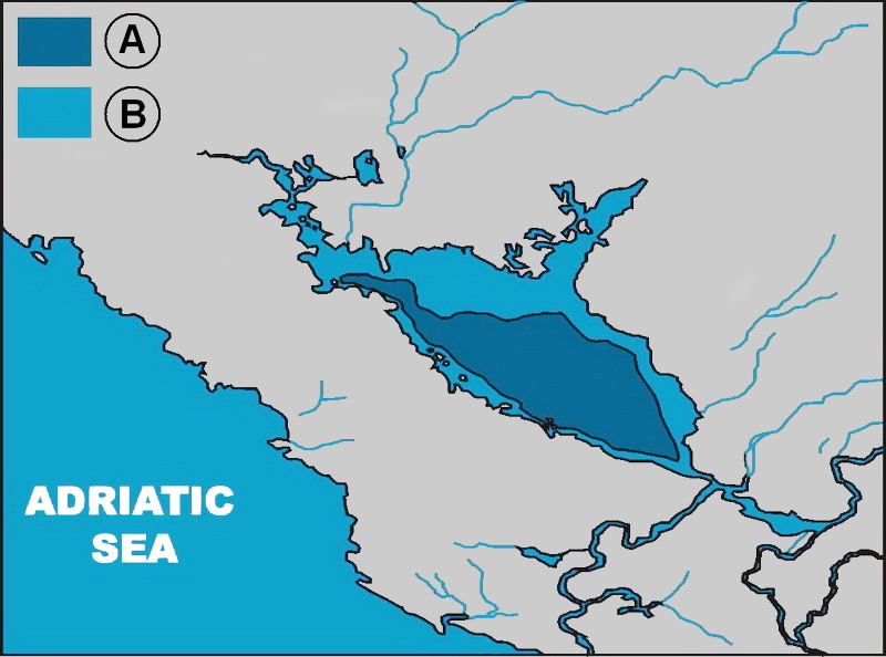
-Skadar lake should look different.
At the time Skadar lake used to be conisderably smaller (also it seems to be drawn to far south). It used to be called Diokletian lake or Veliko blato (big mud). It was only 4-5m deep and had a lot of marshy surroundings. Also a lot of the now underwater areas used to be big producers of cotton and wheat.
Dioclian_lake_XI_c.AD.jpg

-Onogošt should definitely stay as plateau. Today it is called plateau of Nikšić and settled areas definitely have plateau surroundings.

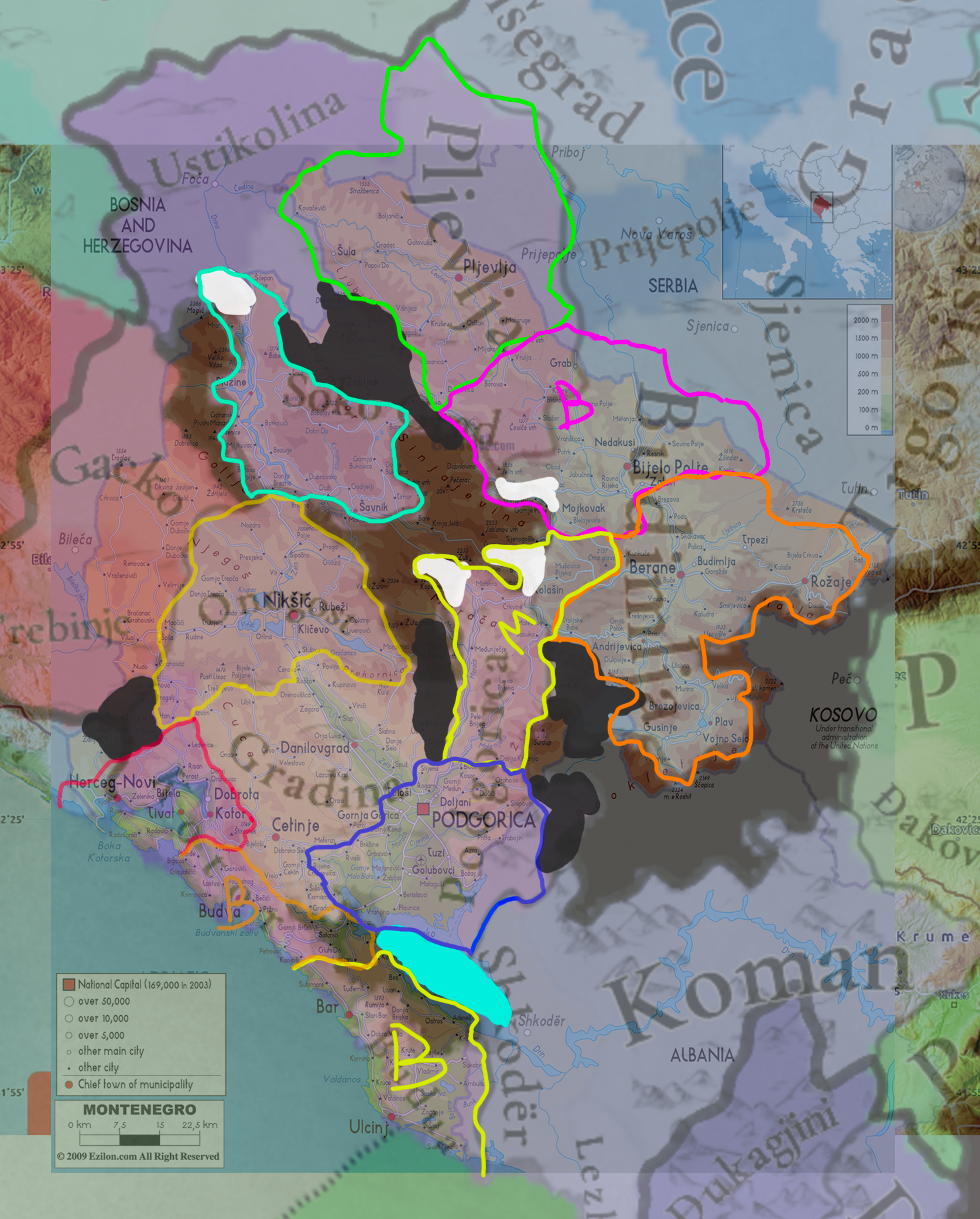
-Soko should be mountains. Inside this location are two big canyons and second highest peak of Montenegro. The old fortress of Soko is very hard to reach with a big army exept maybe from northwest.

-Wasteland for Tara Canyon. It's the deepest canyon in Europe and remote even today. I cannot see a big army traversing it, especially in the XIV century. This would make it impossible to go directly from Soko to Pljevlja, which could be interesting from gameplay reasons too.

-Orijen mountain added as wasteland.
Orijen has 6 peaks over 1800m and it's slopes descend all the way to 0m and the seaside. Kotor bay is very, very, very hard to access and this would make it at least not connected to Trebinje. Connection to Onogost shoud remain as there is an important road at the time through the passes, over Dragalj and Grahovo that Kotorans and Ragusans used for trade.

-Reduced size of the middle wasteland from the eastern side. Gornja Morača, Lipovo and Polja marked in white as it should not be a wasteland. Also on the southern side the wasteland should be expanded because it is the upper slopes of the Morača canyon 1000m deep at some points. Going along the river is possible, but crossing from one side of the canyon to the other is an ordeal.
-Added Komovi to the eastern wasteland. Prokletije wasteland should be expanded to further to the south and Komovi should be added to the western side.

Culture/Religion:
This is a can of worm I might not want to open, so I will be brief.

-More Dalmatian, more catolic in the costal towns.
At this point old walled towns of Kotor, Bar and Budva were predominately catholic (Bar was an archbishopric), while the surrounding rural settlements would have a larger proportion of orthodox. Kotor should definitely be the other way around than shown on the map (Dalmatian and catholic should be a majority and Serbian orthodox should be a minority). The same case could be made for Bar and Budva, but I could see it also the other way around if we consider the rural population to outnumber the townspeople (But inside the towns the catholics should make up 80-95%, Dalmatians maybe a bit less if you want to model that the customs are starting to merge and even though the priesthood is subject to the pope they are marrying and adopting other orthodox customs).

Also throughout Zeta province there should be scattered some catholics. Helene of Anjou was ruling Zeta only decades before the game start and she is remembered for showing religious tolerance throughout the province (implying the community wasn't fully orthodox)

Also a small Serbian minority in Ragusa should be present as there are families from Kotor present there, even being adopted into nobility and the council, forcing Ragusans several times to forbid marrying from Kotor.

-Possibly more Albanian and Vlach in the north and northeast.

-Catholic Saxon pops should be present in Brskovo/Budimlje

-Too early for Bosnian and Kristijani in Soko.


Screenshot 2024-07-16 at 10.51.57.png
 
  • 8Like
  • 2Love
  • 1
Reactions:
@petarsc My man, that's an awesome suggestion! I was busy with my own correction/research of Montenegro, but you did it even better. The developers might already be pretty happy with the density of the Balkans, so that's something we should keep in mind (your suggestions are still solid, though). The Italy region only got 5 more locations, for example.

Here are my general comments on Montenegro:
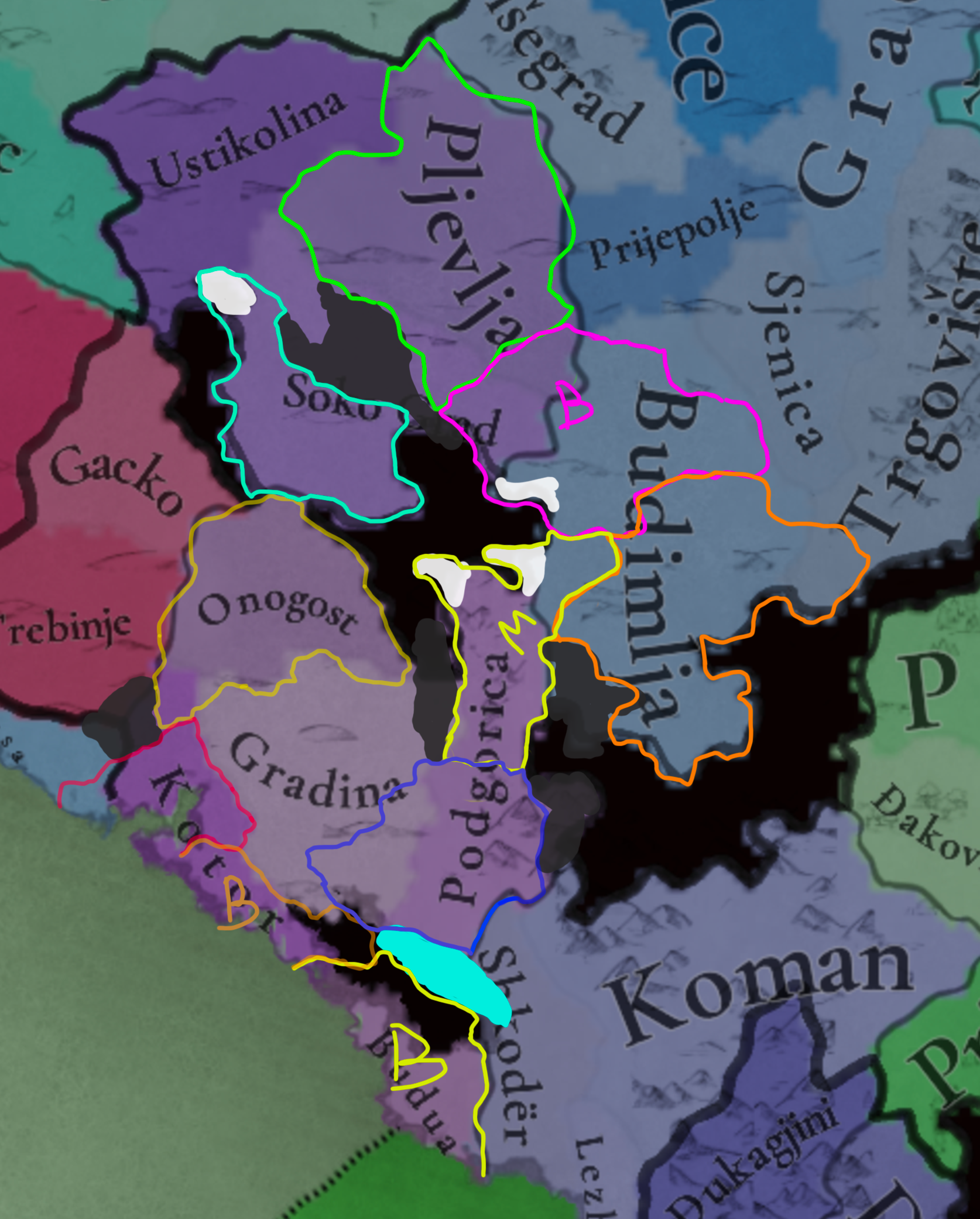
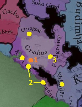
Montenegro.png

1: As you said so yourself, Gradina Martinic was already a ruin and not in use. The location was sparsely populated, but renaming it to Gornja Zeta would be a mistake, in my opinion. The developers aim to name locations after villages, towns, fortresses or cities, Gornja Zeta is neither of those. This may sound a bit odd, but I'd name it Cetinje already. I know that it's basically 150 years before its foundation, but some anachronisms aren't unheard of on the map. They're unavoidable, sometimes. And I doubt the developers want to create DHE's for every town that sprang up into existence during the game's timeframe.
2: Budua either gets renamed into Bar, or a new Budua location is carved out of Kotor and both Bar and Budua come into existence. That would be very nice for Venice, though. Depends on location-density, but with Lake Skadar being in the wrong location some space could be created for both of them.
3: Podgorica is located on the border between current Gradina and Podgorica, but I agree with your suggestion of renaming the location into either Podluzje or Zabljak Crnojevica (the latter has my preference) and redrawing the borders to indeed encompass all of these towns.

In short; I almost 100% agree with your suggestion, but I'd rename Gradina into Cetinje from the get-go, and Podgorica into Zabljak Crnojevica, with some rewritten borders to encompass the towns of Podgorica, Zabljak and Podluzje. Some slight anachronisms aren't odd to have in the Balkans, as long as they aren't 16th/17th/18th century towns. Your suggestions for other locations and some name-changes to the north are also very good!

Cheers!
 
Last edited:
  • 2Like
  • 1Love
Reactions: